INTRODUCTION
As a native of the Twin Cities, the Arrowhead region of Minnesota has been my sanctuary for most of my life. This has included trips to the Boundary Waters Canoe Area Wilderness, mellow drives along the North Shore, and section hikes along the Superior Hiking Trail (SHT). In the last five years, my interest in trail running has taken off, and I’ve enjoyed becoming part of the community and participating in races such as the Voyageur 50 miler, Superior Spring and Fall trail races, and the Arrowhead 135. I was drawn to attempting this FKT because it was a natural part of my progression up in distance and that it presented a high probability of failure and therefore an opportunity to test my limits. I went with the unsupported mode for two reasons. First, if I’m going to do something dumb, I might as well do it the dumbest possible way. And second (with joking aside), I felt it was the purest way to experience the trail, relying only on myself and what the trail allows. I had the idea that this would be the type of adventure and challenge that would transform me on a cellular level. I envisioned beginning as a caterpillar, entering my chrysalis, disintegrating into a goo, and being rebuilt one step at a time into a butterfly. This experience proved to be such a metamorphosis. Let me tell you about it!
TRIP REPORT
*Day 1: August 14th, 2023. Northern Terminus (270 degree overlook) to North Bally Creek Pond - 59.7 watch miles (58.5 official trail miles), 8,645’ vertical
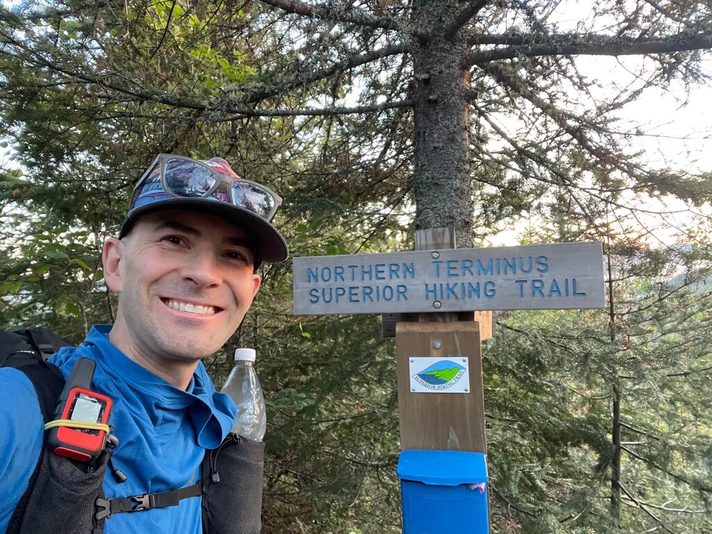
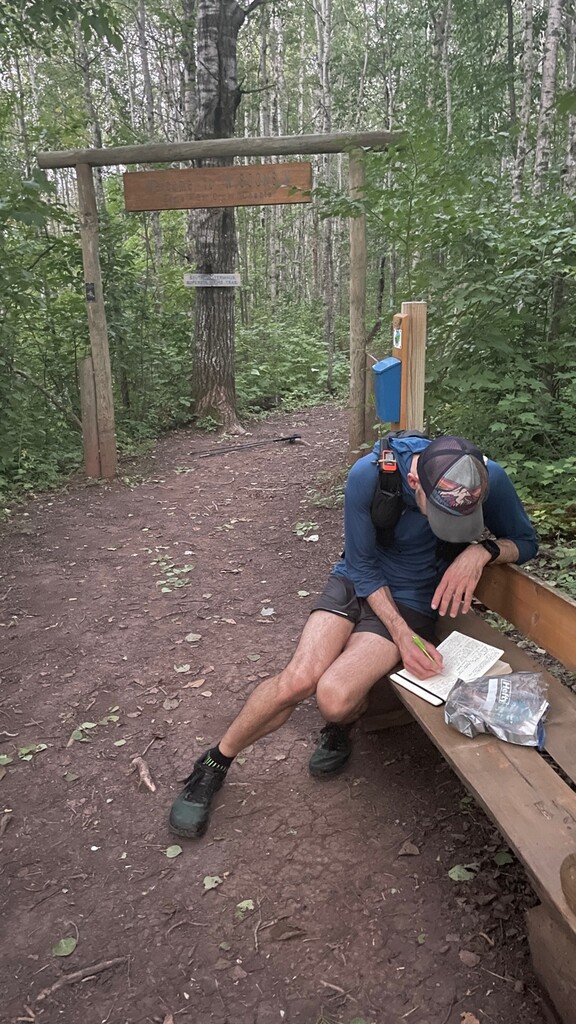
Woke up two minutes before my 4 am alarm at the Hungry Hippie Hostel outside of Grand Marais. My partner Kelly, 12-year-old son Gabriel, and I packed up and headed north on Highway 61 with a sky full of stars. After a 45-minute drive, we geared up and began the ~1 mile hike from Otter Lake Road to the 270-degree overlook, the Northern Terminus of the SHT. We arrived at 6 am, in time for a magical sunrise and view across the Pigeon River and into Ontario. I nervously signed the register, shouldered my 28 lb pack, said goodbye to Kelly and Gabriel, started my watch, and tapped the Northern Terminus sign. The adventure had begun!
I descended back down to where our minivan was parked on freshly tapered legs and full of stoke. This 13-minute mile would be the fastest split of the entire journey. By the time I’d reached the trail’s high point (1,829’ on Rosebush Ridge) ~6 miles in, I felt like the nerves had subsided and I’d hit a good groove. I continued in this flow state until beginning to hear the roar of the Brule River as I approached C.R. Magney State Park. Passing the iconic Devil’s Kettle Falls ~27 miles in, I hit my first dip in energy. I gave myself my first sit down break, taking 10 minutes to eat some Skittles and filter water. I pretty quickly came out of this mini bonk and flowed down to the trail’s low point (Lake Superior) for a ~1.5 mile lake walk.
The lake walk is appropriately named, as the trail parallels the shore of Lake Superior for this stretch, along a mixed cobblestone/rock outcrop beach. It is impossible to run along this stretch; if you do prepare to put 90% of your energy into the beach. While this stretch is beautiful, I was happy to filter some of Lake Superior’s tasty water and head back into the woods. To this point, water had been frequent enough, though many of the sources were ponds with significant scum.
Remaining daylight hours were uneventful; I reached for my headlamp along the eastern edge of the Devils Track gorge, mile 48 or so. Travel became more difficult as darkness set in. Furthermore, I had never experienced the section west of Pincushion Mountain and the climb west of the Gunflint Trail was burly. For the final six miles of the day, I fixated on how ready I was to be done for the day, which took me out of the present and into a dark place. About a mile prior to reaching camp, I started my dehydrated dinner (corn chowder) cold soaking. I arrived at camp shortly after midnight, quickly set up, ate dinner in my bag, didn’t brush my teeth (which would become a recurring theme for the remainder), and passed out.
*Day 2: August 15th, 2023. North Bally Creek Pond to South Cross River (197.5) - 45.5 watch miles (44 official trail miles), 7,838’ vertical
My alarm sounded at 5 am though I continued to lie there for 15 minutes. Upon rising I was surprised and delighted that I could still move. I packed up, gathered some pond water, and took off on trail, eating a 700 calorie bar for breakfast as I moved. The pace began slow but quickened as my body warmed up. I was excited to experience this section to Lutsen for the first time! I cruised for a couple miles until I reached a section of the Cascade River that stair steps progressively downward in a series of waterfalls. I was psyched until I saw a white blaze, signifying that I was on a spur trail and had been for a half mile. Aargh - wasted energy! I backtracked to where the trail split and was annoyed to find that the spur trail was mislabeled as the main trail at the split. Once back on course I tried to shake off the negativity, but it took the better part of an hour until my attitude had improved.
I gathered water and took a 10-minute sit-down rest at Cascade River State Park. I had a conversation with myself that yes, this is indeed an all-out effort, but it should be enjoyed at least a little and doesn’t need to be inhumane (in fact pushing to that level would be unsustainable over the FKT attempt). With renewed mental clarity, I pushed on, gaining a ridge with nice views and later traversing inland to Agnes Lake. This lake is stunning and its beauty and mellow terrain translated to some flowy miles. The “vista” one mile beyond the west end of Agnes Lake (trail mile 221) featured the cutest meandering stream I’ve ever seen.
Upon reaching Ski Hill Road at Lutsen, I had officially been on all sections of the SHT, making me an “end-to-ender” in Superior Hiking Trail Association lingo. Feeling proud, I continued southwest over a section I’d completed many times before in Superior Spring and Fall trail races (John Storkamp’s beautiful Rocksteady Running events), bracing myself for the most relentlessly brutal 100 miles of the SHT.
Went up and over two legendary climbs, Mystery and Moose mountains. Here, water became less abundant, requiring my standards to be lowered. It was at this point that the flow rate on my filter began to slow noticably. Also mosquitoes and biting flies joined the party, requiring I don my headnet for the first time on the trip and anoint any exposed skin with Picaridin lotion. My mood once again soured as I thought of the enormity of the task I faced and some of the first thoughts of quitting began to enter my mind. I’d have at least one hour worth of quitting-related thoughts per day for the remainder of the trip. Most of the time such thoughts closely tracked with thinking about how much was left to do. This will come as no surprise to most athletes out there, but I was at my strongest and happiest when I was working toward small goals - reaching the next water, vista point, camp, etc. - big efforts must be chunked into digestible pieces!
The remainder of the day was super scenic, involving ascending the flank of Carlton Peak and run/walking along the Temperance River. Visions of past experiences at Superior Fall 100 danced in my head as I moved through this area, filling up water and cold soaking my future bibimbap dinner at the location of the Temperance River aid station. I also reached for a podcast (Backpacker Radio) in this section as I found myself craving human voices. I switched on the headlamp on the west bank of the Temperance and made the tough climb up to the Cross River. Reaching this campground shortly after 10 pm I saw a couple tents and found a flat spot about 100 feet from each, though I still felt bad about potentially waking up my fellow campers. Like yesterday I ate dinner under my quilt and fell asleep immediately after swallowing the last spoonful.
Today was way harder than yesterday. Indeed, I’d say today was the hardest of the entire trip. I think this was due to my body settling into the task at hand, finding my trail legs, ramping up metabolism, etc. In retrospect it was the crux. I’m not sure where the wisdom came from but I am so glad I called it early, setting up camp not long after dark so I could get 6 hours of recovery in. I think it proved to be essential.
*Day 3: August 16th, 2023. South Cross River to Tettegouche - 51.8 watch miles (49 official trail miles), 8,999’ vertical
Woke up with everything hurting, with thoughts of quitting on my mind. I cursed myself for passing Tofte, where I could have gotten a hotel, but was also proud to have continued without being sucked into that trap. Quitting now would be just as hard as continuing, so might as well continue, right? Also, no bones were sticking out, nor had I sustained any injuries (aside from walloping my dome and seeing stars on a tree limb that overhung the trail on day 1). I was just tired, so it was still worth getting up and seeing what movement felt like, right? Plus my bag was observably lighter than day one so that was an improvement!
Within about one mile of starting my pace once again quickened as the soreness dissipated. My head remained out of it, however, and the fun I was having was 100% type 2. Biting flies, mosquitoes who wanted me for breakfast, and high humidity made it difficult to enjoy my surroundings as thoughts of quitting continued. I reflected that the weakest link in my chain is almost never physical and almost always mental. This extends to other areas of my life such as work, as well. While I didn’t reach any sort of profound conclusion or have any revelations on how I might troubleshoot mental adversity in the future, I decided that my ability to recognize when I’m in a dark place is improving, and that having such awareness is important.
The rollercoaster continued with an inexplicable high, perhaps brought on by increasingly abundant thimbleberries, raspberries, blueberries, and serviceberries. A stop at the Caribou River involving sampling the best water of the whole trip, some foot care (including taping my heels which were rubbing), and a sit-down break was awesome. Another quick down and up to the rollercoaster followed, involving leaving my phone (and with it my main navigational tool, photo/video documentation abilities, and podcast entertainment) at the Caribou River, thinking this effort was finished, only to backtrack and be reunited. It was definitely frustrating to have to tack on additional miles to the day but having the phone back was reinvigorating.
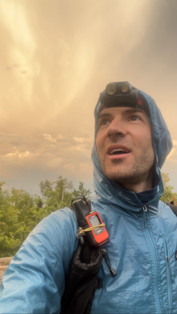
After three hours of trucking along, I began craving a break and ended up finding a nice flat rock close to Egge Lake where I took my first dirt nap of the trip, taking 10 minutes to close my eyes and rest my feet before continuing. Feeling recharged in the hour post-dirt nap, I continued as clouds built for the only storm forecasted during this FKT attempt window. The storm totally blasted me. At least an inch of rain fell from 6-7 pm, and with it came lightning, thunder, and intense wind (snapping trees around me). I welcomed the rain initially, eager for a cool down, but the storm overshot my desired temperature and instead I became chilled, putting on my rain jacket and shivering mildly.
I continued through section 13, a notoriously punchy section, which offered stunning views of the sunset beneath the deck of the departing rain clouds. The violence of the storm was counterbalanced by a serenity that I’ve never experienced before. The only noises I heard were my footfalls, a light breeze, and my breath (which I could see).
Approaching Tettegouche State Park, where I was planning to quit for the evening, I passed through the “Lime Squeezer,” an outcrop of basalt with a shoulder-wide fracture running through it. Emerging on the other side, I slipped on a slippery rock and landed without physically harming my body, but snapped the tip off of one of my trekking poles. I did a quick repair, affixing a shelter stake to the pole and securing it with duct tape. Miraculously the fix held for the remainder of the trip, functioning as well as the non-broken pole. The final two hours of the day seemed to last forever, but I got my Thai curry cold soaking (and was so hungry I ate it on the go). I finally arrived shortly before 1 am, set up quick and crashed.
*Day 4: August 17th, 2023. Tettegouche to Silver Creek - 49.0 watch miles (48 official trail miles), 8,599’ vertical
Woke up on the late side, around 5:45 am, quickly packed up, made some instant coffee, and hit the trail while breakfasting on a meal replacement bar. When I went to sleep the night prior I thought I’d never move again but a few hours of sleep can be miraculous, in terms of recovery. My clothes were still pretty wet from the rain the day before. With that in mind I had foot care prominently on my mind. I got into a routine of changing socks every 5 hours or so and slathering my feet with Aquaphor, which kept maceration at bay.
Made it to Bear Lake vista by 8:30 am and took in the beautiful view. It was blustery up on top, which gave a welcome break from the bugs.
I took a long late morning break at the Beaver River to fill up on water, refuel, and sit. I’d heard before beginning that the stretch from here to the Split Rock River was pretty dry so I carried one liter more than usual. My mouth was getting a bit tender from aggressively crunchy, salty, and sweet food so I started experimenting with cold soaking chips in a bag. It was gross. Ultimately I discovered (many of you I’m sure already do this) that combining a handful of chips, Oreos, bars, etc. with a swig of water really reduces the chewing time and food abrasiveness.
Arrived at the ruins of the bridge that used to cross the Split Rock River mid-afternoon, took a nice dirt nap, and continued on. Similarly, collected some water from the Gooseberry River late afternoon, and proceeded. The next few miles were easy running and walking and I got into a funny groove, singing to myself a very catchy melody timed to my steps. From the Crow Valley campsite onward, the trail was super technical, which in the dark and on shaky legs wasn’t my favorite part of the day. I broke up the gnarly nighttime technical trail session with some delicious cold-soaked Cuban beans and rice around 11 pm.
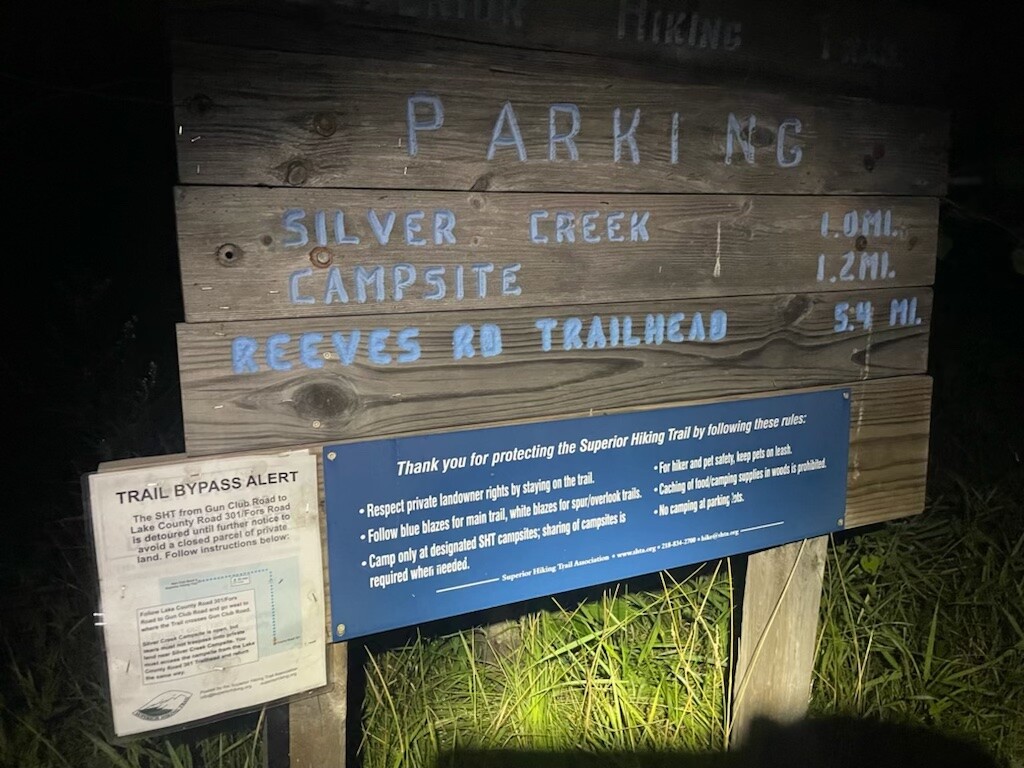
After what seemed like one million years, I made it to the trail junction with Fors Road/Lake County 301 around midnight. The trail is currently inaccessible west of the Silver Creek campsite and is bypassed via a road walk around private land. When Jeff Rauenhorst set the SHT FKT in 2020, he ran the 1.2 miles in to the Silver Creek campsite, ran back to Fors Road, and completed the reroute. This approach tacks on an extra 2.3 miles. I agree with Jeff that this extra mileage keeps one true to the spirit of the trail and is respectful of past FKT efforts. Tonight, I’d be doing the 1.2 miles in, and tomorrow morning I’d complete the remainder of the reroute (camping at Silver Creek). At 12:30 am I arrived at camp, which was closer to Lake Superior and therefore chillier than I was used to, and shivered my way through the night. I would find out in the morning that my bivy had been inside out; the added condensation probably didn’t do me any favors (doh!)
*Day 5: August 18th, 2023. Silver Creek to Lester River snowmobile shelter - 47.6 watch miles (47 official trail miles), 5,184’ vertical
Prior to breaking camp, I did an inventory of available calories. I was down to 10,000, which needed to last me 100 miles over two days. I was a little alarmed given that I’d been taking in between 6,000-6,500 per day and still being hungry at the end of each day and not excited at the idea of rationing. I exchanged some texts with Joe McConaughy, who recommended front-loading calories, then doing 100 calories per hour for the final 12 hours of the effort. Great - plan established - let’s get going!
I exited Silver Creek and completed the remainder of the reroute, moving inland and entering the Two Harbors section of the trail. Being cold was a great motivator to move quickly! Also the pavement felt so gentile on my feet! Speaking of feet, upon arriving at Reeves Road trailhead I replaced the tape on my heels, added some over a hot spot under the ball of my left foot, lanced blisters separating big and second toes on each foot, and smothered my feet in Aquaphor. This treatment instantly improved the state of my feet.
The next noteworthy stop was the Stewart River, which had excellent water and the cutest little water vortex swirling between a couple rocks. The rate of water filtration at this point was probably 10x slower than day 1, now taking about 5 minutes to process 1 L, but I didn’t mind too much as any time I was filtering I was also sitting down and resting. That said, I rested as little as possible at this stop, since mosquitoes and flies were horrendous, and continued to be until I entered Duluth.
En route to Duluth, the SHT shares sporadic miles with the North Shore State Trail, a multi-purpose trail used primarily for snowmobiling in winter and hiking in warm months, though swampy areas can make travel difficult. On a scouting trip in mid-July, I experienced these shared trail sections by wading through dew-covered (i.e. I got soaked) shoulder-high grass and weeds that obscured mud and puddles at foot level. It was awful and I was dreading these sections greatly. However, many sections of it had received a mow and/or weed wack, which made passage much more pleasant and my mood enjoyed a boost.
I had been strategizing how to approach the final push through Duluth for the entire day, with options ranging from sleeping for 3 hours at a campsite to taking a 20 minute trailside nap before tackling the final 60 miles. My fatigue level was high, but not immense (today was relatively easy with only a vertical mile of climbing and less technical trail) so at 10 pm I targeted the Lester River snowmobile shelter at mile 55 where I ate my final cold soaked dinner (another round of rice and beans), set my watch and in reach up of a quick charge, laid down on the bench inside the shelter, and slept for 30 minutes.
*Day 6: August 19th, 2023. Lester River snowmobile shelter to Southern Terminus - 56.6 watch miles (55 official trail miles), 8,645’ vertical
I packed up quickly and departed the snowmobile shelter at 11 pm on the 18th. Shortly after beginning I was joined by a porcupine, who abruptly entered the trail and paced me for about 30 seconds before diving back off trail. I hope this doesn’t count as support :)
The hours wore on and sleep pressure became intense, necessitating my first of several dirt naps at Downer Park on a nice flat rock slab overlook at 1:45 am. I fell asleep immediately and woke up with 5 seconds left on my 10-minute alarm. I continued on, entering a residential area of Duluth (Hunters Park), where I didn’t need a headlamp due to streetlights. I anticipated this section being eerie at night, especially passing by a large graveyard, but instead felt a calmness and a sense that everyone was sleeping peacefully.
Navigation-wise the Duluth section is the toughest of the entire trail. Trail markers on stop signs are less obvious than blue blazes on cedar trees and I found myself consulting my phone every 10 minutes or so. The trail hops from park to park (Hartley Nature Center, Bagley Nature Area, and Chester Park), traversing developed areas, including the University of Minnesota - Duluth, before reaching the shore of Lake Superior. Seeing a handful of people returning home from Friday night revelry made me think about how divergent our evenings had been.
I reached the section of trail that parallels the lake shore and mostly walked (though I ran a little!) from Leif Erickson Park through Canal Park. At Canal Park there is a pedestrian lift bridge that the trail uses to cross a harbor. The bridge was up for the evening, making pedestrian travel across impossible, so I needed to walk an extra half mile around the SS William A. Irvin (a historic lake freighter). This, in addition to a public restroom locked for the evening, and encampments pushed to the margin of Interstate-35, were sad reminders of anti-homeless measures that cities often enact.
Twilight set in around 5 am and the sun rose around 6 am, which were very welcome developments! That said, no amount of light or caffeine seemed to counter the effects of sleep deprivation. I was weaving all over the trail and had vivid hallucinations, first of branches growing in real-time from trees and adorable trailside piglets that under closer inspection turned out to be logs. Climbing out of Duluth, one passes through several small parks that look very similar (Enger, Lincoln, Lyman) and their similarity brought Deja Vu on strong, to the point that I was worried I was going in circles. I also confused myself into thinking I was in the Barkley Marathons and needed to be completing tasks, like ripping pages out of a book, as I went. It was obviously time for a nap. At 7:30 am I found a beautiful basaltic slab bed in Lyman Park and had the best dirt nap ever. After 10 minutes my brain function felt semi-normal, to the point that I could do math again (I enjoy passing time by calculating real-time splits and projected ETAs, etc.), which was comforting.
I continued west to the vicinity of Spirit Mountain ski area. I was just thinking about how every time I head out on the SHT I get stung by at least one hornet and it was miraculous that I hadn’t yet after five days! Perhaps my luck had turned! Nope. I look down and see a monster hornet repeatedly jabbing my right ankle while also looking up at me as if savoring my reaction. I rode the adrenaline high for a few miles on that one, using it to grind up the climb to Magney-Snively Natural Area.
Today was the hottest day by far, with temperatures soaring to 90 degrees with high humidity. I started acutely feeling these effects near the rugged Ely’s Peak area, with the dark grey-black basaltic rock radiating heat at me while I also struggled with the trail technicality. The trail became less technical beyond Ely’s Peak and entering Jay Cooke State Park, but I was dragging at that point due to the heat, bugs, and the overall ruined state of my mind and body. Fortunately, I got stung by another hornet, this time on the back of the head, which got me moving quicker again!
I crossed the beautiful swinging bridge over the St. Louis River and into trails at Jay Cooke that I’ve run a bunch. It was wonderful to be on such a familiar stretch of trail. I exited Jay Cooke State Park around 7:45 pm, headed for the Wild Valley Road trailhead. Upon arriving to the trailhead I saw our minivan, which I saw last at the Northern Terminus. I started down this final 2 mile stretch, knowing that the finish was within reach and that the 1” section of salami I had remaining would get me there. I turned a corner and was face-to-face with the Southern Terminus and was greeted by my fan club (my partner), a sandwich, a ginger ale, and a cannoli. I touched the sign at 8:20 pm, made a quick entry into the trial log, and began the 2-mile walk back to the trailhead. We drove back to my father-in-law’s place, conveniently located in Mahtowa, where I fell asleep in the bathtub while eating pizza.
ACKNOWLEDGEMENTS
This was an “unsupported” FKT attempt, though it would not have been possible without the assistance from many. First, many thanks go to my partner Kelly, for transporting me to and from the terminuses (termini?) of the trail, but more importantly, for providing space for training leading up to this effort, for always knowing what to say when I was doubting myself on trail and off, and for doing family-related heavy lifting during and prior to this event. I love you so much. To my kiddos Gabriel (it was so amazing experiencing sunrise at the Northern Terminus with you!) and Jake (who read me many a Garfield comic in the lead-up to this attempt, calming my nerves). To my parents for instilling a hunger for adventure in me via remote wilderness trips growing up and to my brothers for being partners in crime. To my father-in-law for providing a home base and looking after kiddos throughout the effort. To Annie Nelson and the remainder of the Superior Hiking Trail Association for partnering with me and building a community around this effort. (The SHTA is a fantastic nonprofit organization devoted to trail construction, maintenance, management, and promotion - if you enjoy the SHT please consider joining the community!) To my coach Joe McConaughy, who assembled an amazing training plan, demystified many of the gear decisions, aided with on-the-fly sleep and nutrition needs, all while being one of my most vocal cheerleaders. To my friends Joseph Altendahl, Jared VanderHook, and Alex Elisabeth for planting the seed for this idea. And finally to my trail running and Nordic skiing friends for your stoke level for this effort and for pushing me over the years - much love to you all.
Comments
Alan - thank you so much for sharing your experience! I've done the Superior 100 and Wild Duluth 100K a number of times. Your descriptions of the trail and your thoughts brought me so many memories of those races, the trail sections, the vistas, the hallucinations - I loved it! Just reading this brought me to tears. We should all be so lucky to have someone bring us a cannoli when we finish audacious goals! Bravo!
Thanks Mike! Hopefully we can share some time on trail during, or outside of, one of those awesome events soon!!
AMENDMENT
A few folks have been interested in the training and gear involved in this undertaking. Here ya go!
In the months leading up to this, my coach Joe McConaughy prescribed 10-12 hours of running (60-80 miles) with 5,000-10,000 feet of climbing per week. It was pretty standard, consisting of weekend long runs (sometimes 2x/weekend and sometimes with speed sprinkled in), lots of easy runs, and one faster (mainly tempo or hill repeats) run per week. Usually there were 1-2 strength workouts per week in there, as well. I did a couple of races as I built for this, including the Superior Spring 50k (a fabulous event on the SHT) and the Kettle Moraine 100 miler (a fabulous event in our fine neighboring state).
In the month before the attempt, I spent an increasing number of runs with my pack on, weighing 10-30 pounds. This proved to be extremely useful as I experienced very little shoulder or back chafing/discomfort during the attempt. A four-day fastpacking trip on the SHT the month before the FKT attempt proved extremely useful. During this trip, the trail let me know what I had signed up for (e.g. rocks, roots, bugs, and a nighttime thunderstorm that soaked all my gear). Emerging from this experience in one piece gave me the confidence that this massive goal was indeed achievable. It was also an excellent test of my gear, most of which I also used for the FKT attempt.
Speaking of gear, I had Topo Ultraventure Pros (sized up one size to permit foot swelling, which I would definitely do again!), worn over Xotoes (toe socks like Injinji, except far more durable) on the feet. Most of the time, my legs were covered by tights (yes, despite temperatures above 60˚F for most of the time out there - I hate the sensation of plants brushing by my legs), underlain by Saxx undies. I had an OR sun hoodie on top, a Garmin Fenix 6x on my wrist, a pair of Black Diamond Distance Carbon Z poles in my hands, and a trucker hat (and occasional bug net) on my head. My pack was a Pa’lante Joey. The first thing in was a Nylofume pack liner stuffed with a Hammock Gear 40˚F quilt, two extra pairs of socks, and long underwear for sleeping. Next was shelter - a Mountain Laurel Designs super light solo bivy and a Gossamer Gear solo tarp with stakes. A bag with electronics followed, with 25,000 mAh of charge (three Nitecores), a Fenix headlamp with extra battery, and all necessary cables. A stripped-down first aid kit was always accessible in one of the outside pouches (the MVPs in the kit: Aquaphor, Picaridin lotion, Ibuprofen, and Caffeine). I carried one 1L plastic bottle, one 500 mL soft flask fitted with a Katadyn water filter, and another 500 mL bladder for dry spots on the trail. Aside from that, I had my Garmin Inreach Mini shock-corded to the strap of my pack and was loaded up with 18 pounds of junk food, for a total beginning pack weight of 28 pounds.
Hope this helps and feel free to reach out with any other questions!
Congratulations Alan! Brilliant write up. Don’t know how you did it in peak mosquito season!!!