Where/how to start with this FKT? This is the same question I asked myself when planning my attempt. While this Oak Leaf Trail segment can easily be made into a loop using Howell Ave, I wanted all my effort to go into the segment itself. (I was quite successful at that, but we’re not there yet.) I opted to connect the ends by biking, locking my bike up in the shopping district around Drexel and Howell, then driving to the other end of the trail. The goal was to start with as fresh of legs as possible and have a super easy ride back to my car after the run. While I would do this again, I would scope out bike racks before the day and do the route in reverse.
For the record, Meijer was the only place I found with a bike rack (and the building shields it from the elements); otherwise, the railing outside Mod would probably work well too. Conversely, with the right lock(s), you could lock a bike to the OLT sign marking the southern terminus of the trail and easily park a car on Manitoba Ave at the northern terminus. Otherwise, at the southern end of the Oak Creek Line, you can park on the side of the road, possibly around the businesses across the street (I didn’t see any “No Parking” signs), or on the residential streets a couple blocks north. (Should you choose to ride between the north and south ends, please read the final paragraph.) Now moving on to the sweaty part.
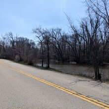
It was easily the hottest day of the year when I did my attempt; the temperature when I started late-morning was already above 70F with highs around 86F when I finally finished. At the trailhead, I slathered sunscreen all over my exposed arms, neck, chest, shoulders, shoulder blades, upper legs, and even the backs of my hands. I knew from riding sections of the Oak Creek Line that my first two-three miles would be entirely exposed. Later in the season, my first mile is lined by cornfields, but in April, those are still empty. The second mile is along County Line Road with (empty) fields on one side and the Root River on the other. It’s quite peaceful and extremely rural feeling.
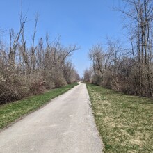
The third and fourth miles are along the old North Shore Right of Way (RoW), a bygone train line that included bridges over many of the streets it crossed in Oak Creek. (This will become relevant in the closing miles. Less relevant, you can see the remnants of this line through Racine and Kenosha Counties as it turns into County Bike Trail.) While RoW still has fields lining these miles, there is usually some tree coverage by summer. I ran this much too early for such respite. As a result, the heat and exposure in these first miles was significantly more draining than I anticipated, and I could barely push through to the shade of the tunnel under Highway 100, approximately halfway.
The shade and cooler temperature were such a relief I considered stopping there and calling it quits. I walked slowly through this tunnel and reminded myself of why I was doing this: I want a women’s time on this route, even if it’s a slow time. As a result, I decided I was okay jeffing this route. I couldn’t have made this decision at a better time as the wind had started to pick up and running through such a headwind was spiking my heart rate.
It’s hard to believe that Ryan Road was the fifth mile. This quiet road section was all exposed and nothing but headwind trying to blow me over. I jogged when I could, but this was a brutal slog. I don’t remember much from it, which probably means I should have eaten and drank more during this mile. Shortly after returning to the paved trail, I made a wrong turn. This also supports that I should have eaten and drank more during that mile because I had turn-by-turn directions from Komoot in my ear. I did start the sixth mile with a gel, water, and some walking. Heading northbound, this is a right turn to go along and behind a middle school where the trail will reconnect to North Shore RoW.
This section is where my run got really challenging. Near the end of the sixth mile is where the train had bridges over the roads, but like the train line, these bridges are gone. Instead, you run down to the street and back up the other side, at all three road crossings. With 65-70 minutes of under-fueled, semi-hydrated, and overheated running in me, these dips were dreadful. I walked up all of them. There was no way I could run them. Mentally, I knew I was in the final two miles, but my legs needed to be done now. I kept looking for shade to run/walk through and there was none because there was no foliage on the trees. I’ve biked these two miles before and remember them being more pleasant.
I wanted to put my full effort into this attempt, and I can confidently say I was shattered at the end of it. Most of that was from the heat and 90 minutes of direct sunlight burning me. Because all that sunscreen I covered myself in, it had expired and offered me no protection. I walked away from this run crispy and red like a freshly boiled lobster.
While my running journey had finished for the day, I still had to walk half a mile to my bike and ride four miles back to my car. I only mention this again because courtesy of the abysmal sidewalk just south of Ryan Road, I had to walk my bike the last mile and a half. Should anyone decide to ride between the north and south ends of this route, if the sidewalk is broken up and missing, go around it, not through it!
So many ways to improve for a faster time...


