

Note: I fully expect this to be beaten, i think 5-6hours is doable with someone who is experienced at ultra distances.
I used a Komoot on my Garmin watch as Nav, with a paper map/ compass as backup. https://www.komoot.com/tour/239015300?ref=wtd
https://glenntait.co.uk/2020/08/19/scotland-coast-to-coast/
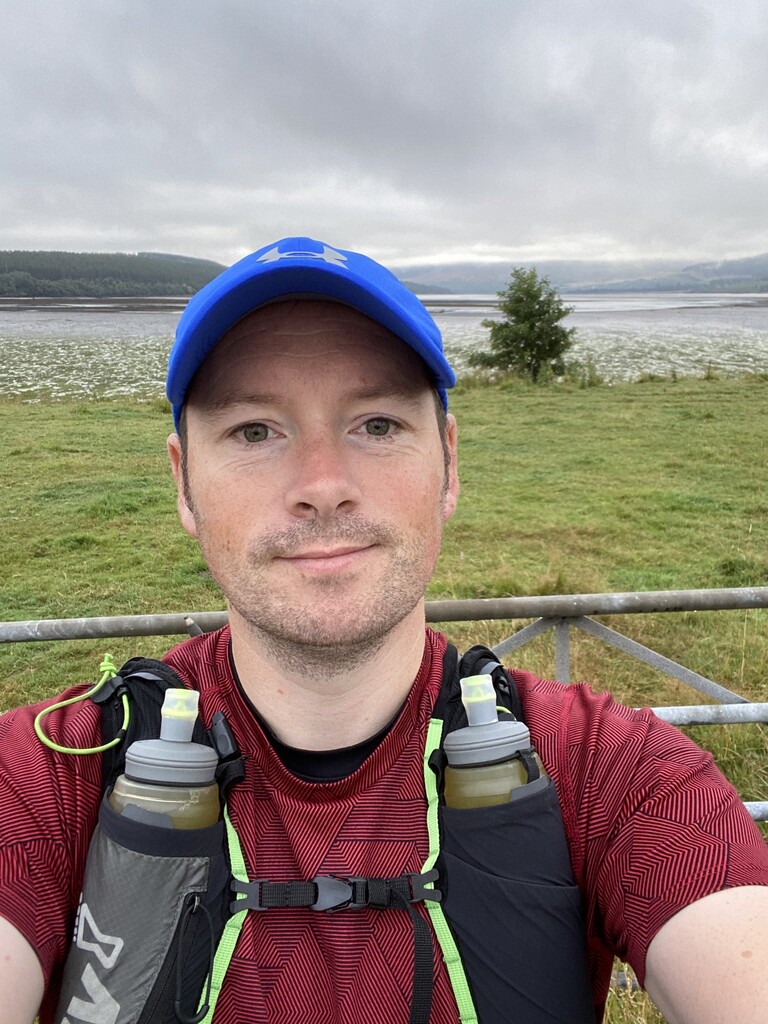
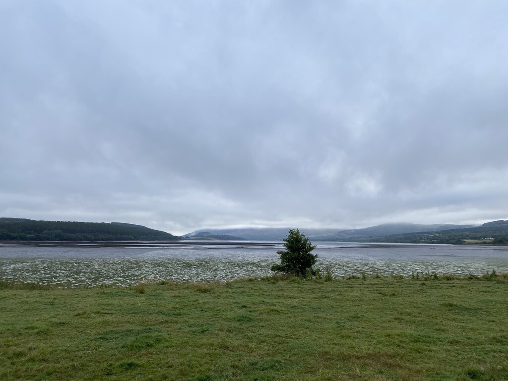
The forecast was for mist in the morning and cloudy at lunchtime with a Yellow weather warning for heavy rain from 1pm. It’s 8am on 18th August and I’m at Ardgay on the Dornoch Firth. The tide is out so the mudflats are all to be seen of the tide. This tidal Firth stretches miles inland from the North Sea, on the East Coast of Scotland, but it is the coast nonetheless and it makes for a rather short crossing to the West coast of Scotland.
Dornoch Firth behind me, Ardgay
After a bit of faffing trying to attach my poles, I bid Andy a goodbye. The next time I’d see him would be in Ullapool on the West. My watch starts and I’m off, with 16kms of single track road the going at the start is good. I was careful not to get carried away and made sure my HR was kept in zone 3 and below.
Looking toward Croick
Croick marks the end of the tarmac for now. I paused to look around the old church here. Built by Thomas Telford, it was a place of sanctuary as the clearances cleared the Glen. Those who fled stayed here and inscribed their names on the Church’s east window.
I left Croick with a sense of sadness that the glens i was about to traverse would have been more inhabited and less wild. But I was also glad to leave tarmac behind.
My pace to this point had been steady and I was already down to one water bottle. It was warm out with pockets of sun and little breeze. Planning this run I was hopeful of grabbing water en route. The water here is typically good to drink as long as it’s flowing and there’s no dead sheep upstream, you’re good to drink it.
The track was wide and hard, heavy machinery must use this and I was able to keep a steady pace. The streams coming down from the hillside were channeled underneath through large tubes, however there was no water, not even a trickle to be heard. I was concerned but I did have the river that flows nearby if I got stuck.
After a few kms the track turned rougher and narrower. The kind I was expecting. Still good going the ground was solid with little vegetation. I’d been passing sheep all up this Glen and ahead was a massive heard of deer. There must have been at least 100. Startled by my presence they started to disperse up the hills. Some even running toward me to go up the hill. They’re destined to be stalked and shot soon I expect.
I heard a trickle, a sound of water. The small stream had flowing cool water. I checked up the hill and with no sign of any sheep I decided to take some. It was cold and there were some small floaters. But it tasted good. I made a rookie mistake. Instead of having a few gulps and then filling it up, I didn’t go back for more. I should have replenished fully. However at this point I’d convinced myself that further up the Glen there’d be more water.
The route is fairly tame in terms of height. With only 740m total of climbing, compared with some 2000m in Cape Wrath days. The hills climbed were also relatively short and weren’t steep. I left the track and the Glen which turned south to head North to get over to the other side. There, halfway up, a bridge crossed a stream and I filled up again.
The track rounded the hill and in view came Suliven and Stac Pollaidh. An awesome sight. Their black and dark sides like pillars coming out of the land are a feature. Beneath was Glen Einig where I descended on a track that had seen better days. Note: there are other options further down which would be better for biking and maybe running.
There’s a bothy here, the Old Schoolhouse which has been kept with old desks and chalk board too. I couldn’t resist declaring I was there but chose to use proper English to avoid getting lines.
From here I was on familiar territory as the Cape Wrath Trail comes this way. I remembered this vaguely as I ran in the opposite direction. I had lunch here and kept my water levels high. The route is not obvious from here with lots of options to various glens but my trusty gps track kept me right. And right it was up a hill, the 2nd of the main inclines. This brings you up to a river crossing. The only main one on the route without a bridge. I remembered this from Cape Wrath and needing to wade it. The cool waters soothed my feet. Though it was only ankle deep, it could be quite high if there’d have been rain.
I was starting to get tired, the slow progress over these hills were expected but I wasn’t running much on the downs as my head was starting to get sore with dehydration. I forgot to fill up at the river so backtracked to fill up and take some gulps. I was worried about this next section where the chance for water might be low. The section climbs up to loch an Damph and past Knockdamph bothy. The track is rough, large rocks make running smooth hard. I was using my poles now to propel me up the hill.
The head was banging, and the sun was coming out. It wasn’t a good combination. With 25km left I decided to take it easy and conserve sweat and energy. I ran when I could but opted to fast hike mainly. The scenery was amazing but I was annoyed to be dehydrated. Each Ford I crossed was dry and no trickle. I opted to get water from the loch against my better judgement. I waded a few metres to some deeper water and took a bottle full. There weren’t any visible floaters but I was uneasy with it.
At the end of the loch this signals the end of the climb. It was a shallow climb but it took it out on the tired legs. Dropping into Glen Achall the sun was beating down. I was too hot.
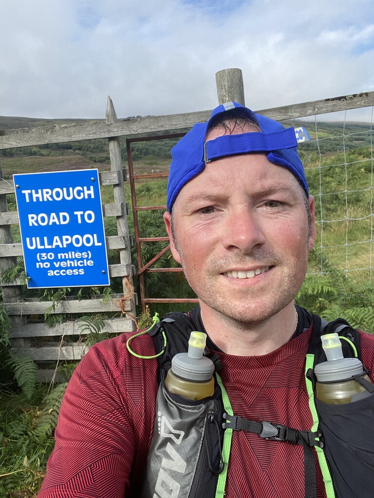
I was running but I had a pain in my lower back which prevented me from running too much. The scenery was amazing and whilst fast waking I managed to take it all in. At this point my estimated finish time was bang on 8 hours. I was worried that any time over this Andy, who’d be waiting in Ullapool would get worried. This made me want to speed up. The track dropped steeply to the Glen floor and to a decent vehicle track. I was making good progress for fast hiking. I even managed to fill up at a stream which had running water.
The Glen is long, and I was tired and hot. I dreamt of jumping into the river if only I had the time. There was no signal in the Glen leading to the anxiety of not being able to tell Andy I was gonna be late so don’t worry. Nevertheless I was happy to be almost there.
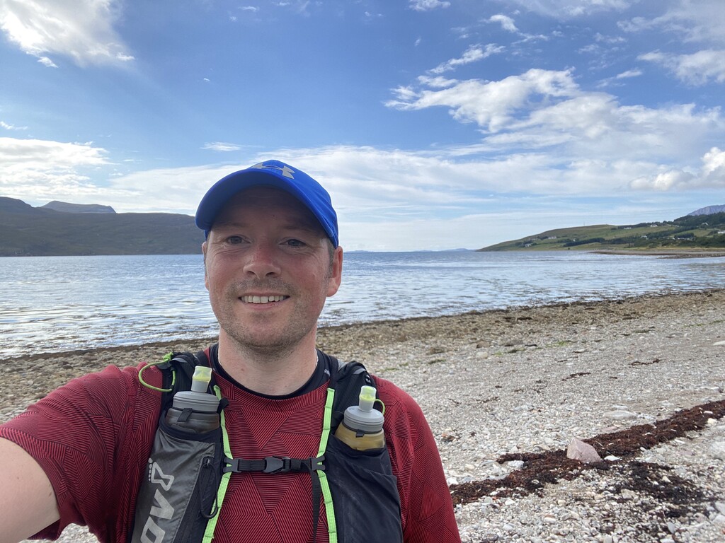
The descent into Ullapool is steep on a rocky track due to a quarry nearby. It wasn’t interesting and was hard on the quads. Entering Ullapool Id opted for the route that goes through woods across the bridge. This would bring me out on the beach on West Terrace.
Loch Broom came into view and it was hard to get my head around that this is the west coast. Leading to the Atlantic Ocean.
8 hours and 12 mins it took to get to the West Coast. Dehydrated and sun burnt , I was glad to get there before the weather warning came true.
I highly recommend this route for a lovely low level and easy navigable route across the country. Although I had Andy to drop me off and collect, it is doable with public transport. At the time of writing there is no FKT on the website for this route - I'm posting my blog on the FKT how did it go section. Only a cyclist had written an account. So although I might have a FKT, my time would be easily beaten, and I can’t have been the only one to have run this in a day, surely?!
I’d love to hear from those who have or are considering this route.
I took 3 soreen malt loafs, a boost bar, wispa gold, 2 baby bells and a packet of Tuc Cheese Sandwich biscuits. I ate all, except the Tuc biscuits.