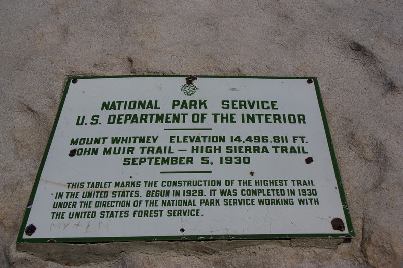
The High Sierra Trail runs 49 miles from Crescent Meadow in the Giant Forest area of Sequoia & Kings Canyon National Park to a trail junction with the John Muir Trail at Wallace Creek. From there the HST & JMT are the same trail to the summit of Mt Whitney. Hikers must continue another 11 miles from the summit to reach the trail head at Whitney Portal. So, as a practical matter, the HST is really 72 miles from Crescent Meadow to Whitney Portal. Reading most descriptions of the HST one gets the impression that it technically includes only the 49-mile section west of the JMT. However, the Mt Whitney summit plaque (below) suggests that the HST reaches the summit. Still, there are questions about the eastern endpoint of the trail, as discussed by Marcia Rasmussen on our old website. It seems most complete to consider the HST as running from TH-to-TH (Whitney Portal to Crescent Meadow), and including the summit of Mt Whitney. But, people should just be clear about what they have done, and provide intermediate splits so that times can be compared. Also, it seems most sensible that those wishing to yo-yo the HST (for time) will start at Crescent Meadow and turn around on the summit of Whitney.
Most hikers travel in the HST in the west-to-east direction, which allows some time for acclimation to the higher terrain to the east. However, the higher altitude of Whitney Portal (8360') vs. Crescent Meadow (6700') argues for speed attempts to be done east-to-west. This is especially true since Mt Whitney, just 11 miles from Whitney Portal, is at an altitude of 14,500 feet, providing for a net loss of nearly 8000 feet from this point to Crescent Meadow. The permit process (below) also makes east-to-west trips more practical.
A note on permits: To do the HST in one push (without camping) one requires only a day-use permit for Mt Whitney. This page describes the procedure for obtaining permits. Basically, you can enter the lottery in February (by mail), or you can show up by 2PM the day before your hike at the Interagency Visitor Center in Lone Pine and try for (by another lottery) a walk-in permit. Walk-in permits are normally available, but definitely not guaranteed. Even if you have a permit reservation from the February lottery you must still pick it up at the Interagency Visitor Center in Lone Pine the day before your trip.
Despite the quality of the route & long history of this trail, speed trips on the HST are rare. Perhaps the 300-mile, 5.5-hour car shuttle for a 72 mile run has something to do with this! Also, the HST is a VERY committing route. Once you drop down off the west side of Whitney the bail outs are extremely long and will deposit you at remote trail heads a LONG way from your car.
Here's what Marcia Rasmussen has said about the route of the HST, which differs somewhat from what we propose above:
The truth is that there is a bit of disagreement over what actually constitutes the HST. After doing a little digging, I would submit that our best resource might be the Starr's Guide, written by Walter Starr, Jr. in 1948. Starr describes the HST as a trail that goes from the JMT (at Wallace Creek) down to Giant Forest. The Sequoia National Park website also gives this version of the HST. www.nps.gov/seki/planyourvisit/high-sierra-trail.htm/. The plaque you picture is commemorative in nature, and not intended as a trail sign. It marks the completion of a trail network, which includes the JMT and HST, though the HST itself does not reach the point where the plaque is placed. The HST is a connector trail from the JMT to the trailhead at the west in Crescent Meadow. Of course, nobody hikes JUST the "official" HST, because it ends out in the middle of nowhere. Everyone wants to go either to Whitney summit or Whitney Portal trailhead, so it is generally done to include one or both of those trails.
About the plaque. I had all kinds of questions about this, the first of which is the 1930 completion date for the "John Muir Trail/High Sierra Trail." Neither of these trails was completed in 1930! So I called the Sequoia Park Historian to ask. His answer was that the
JMT and HST were considered one trail system during the time of construction. The whole system was actually called the "High Sierra Trail" in the beginning, before one particular line was named after John Muir. But, according to the Historian, the plaque was actually to commemorate the completion of the Mt. Whitney Trail--the switchbacks and the trail along the Crest, in particular. That explains the date, as well as the "highest trail in the United States" reference. So the plaque has very little to do with the present-day HST and JMT, except that all of those trails were considered to be one TRAIL SYSTEM at that time. The current designations came later.
This explains the plaque, but does very little to answer the question of where the HST actually goes. I have learned part of the answer, but not the part that matters in this context, regarding the eastern terminus. Meanwhile, I have become interested in the HST history for its own sake. The story is quite colorful. I will have the opportunity to speak with the retired Park Historian next week, and plan to pick his brain. He has delved into the HST history more than the current Historian. The current Historian offered to let me paw through the Park Archives, where he says there are "two boxes" of primary documents from the trail construction era. If I find enough material that is not widely available, I may write something. In any case, I'll check back here if I find any good answers.
Comments
Here's an "honorable mention" trip by Trevor Hallstein, posted on our old site. His time of 20h15m (with Whitney) was not an FKT, but pretty quick.
I had a spike of interest in ultra running after reading a report a friend of mine sent out about running the High Sierra Trail. The description made me think, "holy shit if I get in better shape I can run across the mountains too!@%@^ I CAN RUN ACROSS THE MOUNTAINS!!!”. It had never occurred to me that someone could or would do something like that. A year prior I had sent out a note about a midnight departure under full moon from Pear Lake cross country skirting around Moose Lake to Elizabeth Pass and out to Wolverton. A real highlight of that excursion was seeing a friendly Pika with evenly harvested stalks of grass stuffed sideways in its mouth. After sending this trip description to Topher, a few weeks later I got a message and a trip report from him which set me on a course that changed my relationship to traveling long distances in the mountains and put me in touch with a source of latent power for moving through and being in the mountains I didn’t know I had and which has been a real gift to discover and tap into.
Location Elapsed Time Time for Wednesday Sep 16th 2015
Whitney Portal Trailhead 0:00 (2AM)
JMT Intersection 3:39 (5:39 AM)
Summit 4:31 (6:31 AM)
JMT Intersection 5:10 (7:10 AM)
Crabtree Meadow 6:19 (8:19 AM)
Wallace Creek 7:14 (9:14 AM)
Upper Kern Canyon 7:48 (9:48 AM)
Junction Meadow 7:58 (9:58 AM)
Lower Kern Canyon 9:55 (11:55)
Big Arroyo Junction 13:45 (3:45 PM)
Kaweah Gap 14:56 (4:56 PM)
Bearpaw High Sierra Camp 17:15 (7:15 PM)
Crescent Meadow HST Trailhead 20:15 (10:15 PM)
Shortly after finishing I wrote down, “..and so, by means of 'replication of route' I have determined Leon Llevas Pantalones is a badass. But does he have a green banana sling? I think not. Outfit poorly received on the trail by the old timers. Finished up last night at 10:15 PM, 20 hrs 15 m."
So there you have it. Full trip report which will make the outfit comments clear now follows. A story of tingling nerves, scenic vistas, and how I nabbed the FKUT. Fastest Known Underwear Time.
Since reading the trip report of Topher’s excursion on the High Sierra Trail from Whitney Portal to Crescent Meadow, I had always had in my mind an intention to give it a shot. The thing that kind-of amazes me is that all of this got rolling in June of 2014, a little over 15 months earlier, when I had a few road marathons under my belt, but nothing quite like these long-ass mountain runs. The opportunity to do the HST popped into my mind as I was driving out to Shepherd Pass Trailhead. I had a few friends who had set out from Wolverton and were hiking across the Kaweahs and the great western divide on their way east. For some reason, I had not appreciated that the car drops would be in almost the perfect place for the HST shuttle needed. On the drive from Sausalito, the idea floated around in my mind, somewhere between “maybe”, “definitely”, "I’ll see”, and “hmmm". I had returned from Europe a week earlier where I had participated in UTMB, and wasn’t quite ready to join them at the start of the trip, so we planned that I would set up the car shuttle by dropping my vehicle at the terminus of the trip, and hike-run back in to meet them. A friend in the main group and I both had DeLorme InReach units which allowed us to send and receive messages via satellite. This allowed us to both track each other’s location, and we converged at Picket Creek near Kaweah Basin. It’s the first time we’d tried this so seeing the megamid poking out was a true relief to my eyes. I had with me a Mountain Hardwear Summit rocket 20 pack stuffed for the 4 day hike. After the trip, we drove down to Lone Pine and spent the night followed by breakfast at the Alabama Hills Cafe. While they were ordering breakfast I popped over to the drug store for some Vaseline, the hardware store for a space blanket, and then over to Elevation to pick up packets of sport beans. I had a liter of Roctane GU powder which I’d planned to take on the hike but which I left in my truck to use for the run if the crew agreed to drop me at Whitney Portal. I didn’t want to leave behind anything of value, so I planned to use some old pieces of an eggshell thermarest foam pad, a fleece sleeping bag, and the space blanket to bivy before departing Whitney Portal. I was hoping it would take me 15-20 hours, and so I thought leaving Whitney Portal at 2AM would allow me to run as much of the course in daylight. The Mountain Hardwear pack had a major flaw as a running pack in that the great suspension on their running vest and vestpack had been abandoned in favor of a rigging system which came down to one pivot point. This caused the pack to rock and put a lot of pressure on my lower back. I took off the compression straps and fed them across the front of the pack to give me an additional set of straps to pull the pack in and keep it from bouncing around. I was hoping the crew could drive back straight to the SF Bay Area, but some folks had left car keys and wallets in the truck at Wolverton, so in the end, they had to take the Generals Highway regardless. Kindly, they dropped my vehicle at Crescent Meadow. At noon we parted ways at WP, and I wandered up the old WP trail, found a nice spot behind a granite slab, and set up my bivy. I didn’t have running shorts, so my plan was to run in my boxer briefs. I brought two different styles, reasoning if that one started to chafe (my biggest concern) I would swap them out, and well, the second pair would hopefully chafe in a different area and things would be how do I say, uncomfortable in a nearby but suitably different location.
For equipment I brought:
Mountain Hardwear Summit Rocket 20, modified with extra straps
3 Soft 500ml Hydrapak flasks
1 liter Gu Roctane Powder
10 packs Sport Beans
Chlorine Tablets
Hat
Hooded Mtn Hwr Ghost Whisper Down Puffy
Two pairs underwear
Z packs rain kilt
Z Packs Rain Jacket
Long Sleeve wool shirt
Montrail Bajada running shoes
LED Lenser SEO 7R
Extra Batteries
iPhone
It got really effing cold around 8PM, so I moved back down the trail to the overnight backpackers area, and went back to sleep. I did discover that your body (well, my body) releases a lot of water vapor. I didn’t even have my head in the space blanket bivy, but just the water vapor leaving my body had made the fleece super damp in only a few hours. I squirreled this information away since as a rescue item, I’m not sure a non-breathable space blanket is a really great survival item any longer. The victim will end up getting damp, wet, and then probably cold. Around 10PM I got super cold again, so I squirreled myself away in one of the outhouses until 1AM. It was out of the wind and warm, but boy was I glad when it was time to start getting ready for the run! I remember looking up at the clear crisp points of light and felt the stars blazing through me and cleansing my nostrils and chest.
I headed out at exactly 2AM wearing my exoficio boxer briefs.
Sure enough, at about 2 hours, I had to swap them out due to some chaffing which seemed like it was not gonna be real fun for much longer. But, the 2nd pair of underwear would turn out not just to be extra weight for no reason. Approaching trail crest, the weather was gusting, and after turning the corner, it really started howling on the west side of Whitney. I had to bust out the retired pair and pull it over my head and use it as an impromptu face guard as it must have been subzero with wind chill and everything speckled with snow and ice. I was also wearing a z-packs rain kilt, but with Whitney howling and the Marilyn Monroe effect on the kilt I thought my popsicle dick would fall off. I arrived at the summit at sunrise and saw an orange sun rise over the horizon. I had passed a well clad man on the trail to the top, and he found me in the summit hut, remarking, “I am not understanding how you do this in the shorts.” in a thick european accent. I was like, “What! First of all they are not shorts, and second of all, I also have a pair on my head.”.
I had the weirdest mind/body disassociation from the JMT cutoff going west from Whitney all the way to the Kern Hot Springs. It was crazy. My mind was dizzy, hallucinating, and mixing up the past and future by plus/minus 5 seconds. I'd go by people and say ‘hi' and then be like, 'were those people, did I just say hi?'. A couple of times I saw donkeys which turned out to be tree stumps, tents which were boulders. I eventually had a conversation with my body and said - “Well, you don't seem to be tripping ( actual falling ) so I'll surrender control and go along for the ride." It involved a mastery of paranoia aspect to be honest because I was running and all like whoa - how is this possible - I'm so dizzy but I'm not falling. It was CRAZY. Upon later reflection I'm guessing I had some hypoxia altitude sickness brain thing and a nervy C5 C6 issue from the backpack. It was the coolest thing ever, but I'm glad it ended. Leaving Big Arroyo and approaching Kaweah Gap from Nine Lake Basin was stunning and the Middle Fork Kaweah River drainage west of the gap is infucckingcredible. After coming over the kaweah gap at 5pm and watching the sun glaze the water falls and granite spires I could hardly run over the next two hours as I kept looking back eyes feasting on the scenery, and musing that I might die from "inundation of beauty” - the granite domes, deep pools of water, and cascades absorbing the setting sun’s rays and growing in golden intensity. At Precipice Lake a Pika said “hi” and welcomed me to her watershed for the final leg! The guests were finishing dinner when I dropped down to the Bearpaw High Sierra Camp and it was all I could to not bust in like a hungry bear and eat everything in sight. Instead I simply said ‘hi’ and ogled their piles of bananas and stirfy. Exiting to Crescent Meadow I thought of that initial excrusion that included the Pika that inspired the HST that inspired me. Thanks Pikas! Thanks Topher!
Honorable Mention:
Luke Garten got a fast time of 16h35m57s on 8/31/2015 https://www.strava.com/activities/383044045
Hi, great site! My partner and I put another track in (with Whitney) from a run in June. We were wondering if it might have gotten lost in the ether...
Cheers
Thoughts on summiting Whitney via mountaineers instead of the main trail? Obviously there is a precedent for main trail but technically there is no set route from the summit to the TH.
Are all of these FKT for East to West direction? Would love to know the FKT for Crescent Meadow to Whitney summit