Location
North Carolina,
US
Distance
20 km
Vertical Gain
1,300 m
Description
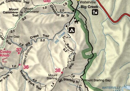
Mt Sterling via Baxter Creek Trail:
| Trail Features: | Panoramic Views, Wildflowers |  |
|||
| Trail Location: | Big Creek | ||||
| Roundtrip Length: | 12.2 Miles | ||||
| Total Elevation Gain: | 4200 Feet | ||||
| Avg. Elev Gain / Mile: | 689 Feet | ||||
| Highest Elevation: | 5842 Feet | ||||
| Trail Difficulty Rating: | 20.60 (strenuous) | ||||
| Parking Lot Latitude | 35.75087 | ||||
| Parking Lot Longitude | -83.10915 | ||||
The ascent has a Stava segment, which starts at the parking lot, not the actual TH.
GPS Track
Morning_Run_Mt_Sterling_RT_FKT_.gpx463.35 KB
FKTs
Male
Female
| Ashley Doty | 1h 9m 33s | |||
| Jason Larkin | 1h 21m 38s | |||
| Chris McCoy | 1h 40m 37s |
| Mary Sketch | 1h 25m 33s |
Male
Female
| Ashley Doty | 2h 10m 37s | |||
| Chris McCoy | 2h 34m 41s |
| Jess Wedel | 3h 35m 23s |
Images
This route on the old FKT site