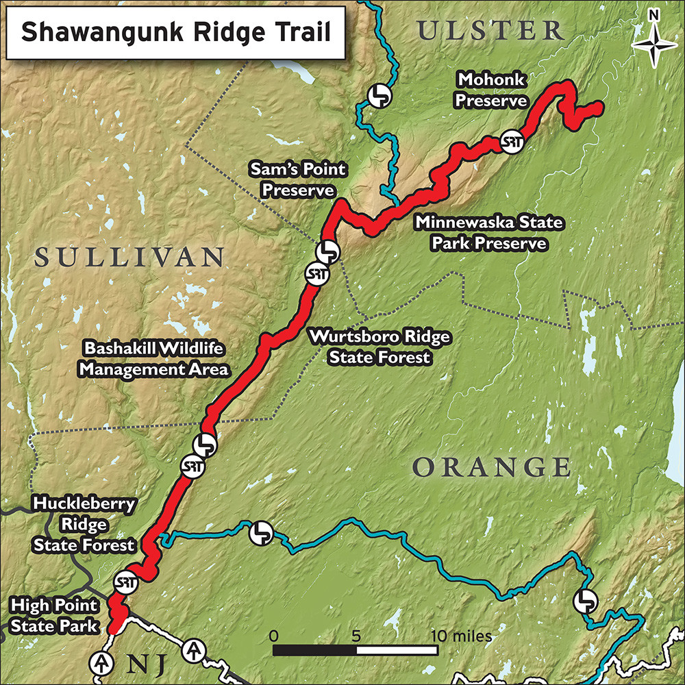
Location
New York,
US
New Jersey,
US
Distance
71 mi
Vertical Gain
12,000 ft
Description
GPS Track
FKTs
Male
| Russ Dresher | 17h 12m 5s | |||
| Justin Kousky | 17h 18m 50s | |||
| Ben Leese | 17h 30m 10s | |||
| Timothy Ela | 19h 17m 0s | |||
| Jason Berry | 22h 2m 0s | |||
| Ken Posner | 1d 0h 8m 0s |
| Ken Posner | 1d 5h 0m 0s |
Male
| Justin Kousky | 1d 12h 32m 29s |
Images
This route on the old FKT site
Comments
I'm working towards an FKT attempt on October 11 - 12, 2019. I'd much rather do the event in September with company, but unfortuantely will be traveling then. I've pre-run everything north of checkpoint #3 (ie north of where trail crosses Rt 52 and climbs to Sams Point). I have no knowledge of anything in the south. I've studied up what I can find online - looks like trail sections (High Point, Huckleberry State Forest, Wurtsboro Ridge State Forest, Roosa Gap) interspersed with long sections of rail trail (Huckleberry Ridge Forest -->211 & Westbrookville --> Wurtsboro). I'm still hoping to preview some of those areas, but might not make it. Any recommendations on what I should hit first? Emphasis on weird navigation?
thanks
Erik
Based on my one run of the course the first half is much faster and easier to follow than the second though there are some tricky bits and a couple of turns that it's very easy to miss.
I'd run Huckleberry Ridge Forest if possible - it's a rough trail and hard to follow in places. It dumps you on the train line which is obviously easy but you have to know when to head up to your right. It's right under a trestle over the track of some sort but the trail is very well hidden and you'll run past it without care.
Gobbler's Knob is also worth scouting. When you're looking for the trail head off 61 it's between the end of the fence and a yellow sign a few yards further down the road. The climb up is easy to follow, though it's possible to get turned around on the top.
Baskakill's easy to follow. No need to scout that. The trail head near checkpoint 2 though is hard to find - you have to scan the trees at the top of the bank for the little blue disk and then just force your way up. If you go up the road as far as the billboard on the corner you've gone too far. The following section from checkpoint 2 to 3 is the run I'd do if I had to pick one. The section around the fire tower is tricky and the back half over Roosa Gap is beautiful.