Description:
Tititea (Mount Aspiring) is set within Otago's Mount Aspiring National Park, it has a height of 3,033 metres (9,951 ft). Māori named it Tititea, which translates as Glistening Peak. It is also often referred to as 'the Matterhorn of the South,' for its pyramidal peak when seen from the Matukituki River.
This route requires route finding, glacier travel and exposed scrambling it should not be attempted in adverse or deteriorating weather. The best time of year is Feb/March.
The FKT Route:
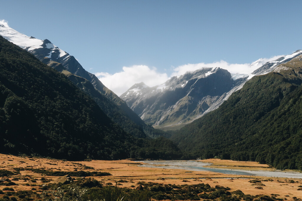
The route begins and ends at Raspberry Creek Carpark.
The first section from Raspberry Creek to Mt Aspiring Hut is ~8km of 4WD road and is done on bike (no e-bikes). After ditching your bike in the trees at Mt Aspiring Hut it’s on foot and ~20km to the summit of Tititea.
From Mt Aspiring Hut follow the well maintained West Matukituki Track past Pearl Flat and onto the Upper West Matukituki Track. As you near the head of the valley the trail ends and route-finding begins.
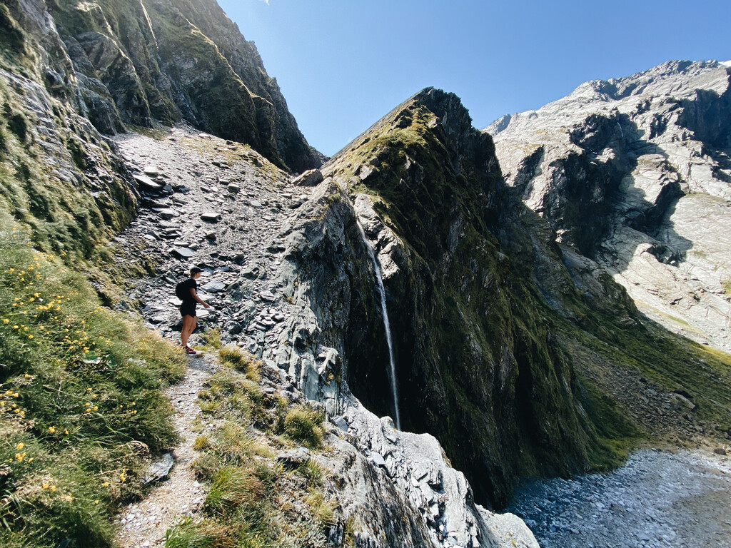
From the end of the valley, it’s steep rock and moss to Bevan Col, which should be done on a dry day. Route finding here is tough and can require a few recce runs to get right in both directions. As you gain elevation into the alpine area you can find small rock cairns that mark the route.
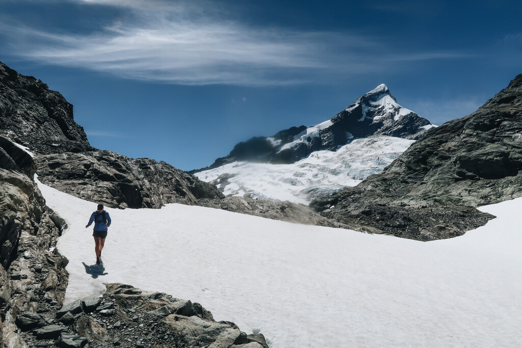
At Bevan Col where you will get your first clear view of the Bonar Glacier and Tititea. From Bevan Col to the summit you will be very exposed to the element. Travelling light and fast in this environment should not be underestimated. Cloud can make the glacier crossing difficult to navigate.
Depending on snow and weather conditions and experience there are many variations to and from the summit. The most popular route is via Colin Todd Hut and onto the Iso Glacier and Therma Glacier before getting onto the NW Ridge. Once on the NW Ridge, it's exposed scrambling and tricky route-finding through the infamous Buttress to the summit.


Comments
On March 19, 2024, I climbed Mt. Aspiring in 8:10 round trip from Raspberry Flat carpark, utilizing a bike to and from Aspiring hut and a paraglider to descend from the summit.
My ascent time was 5:52, significantly behind Alastair’s effort, which is certainly still the proper FKT.
I then spent an hour on the summit in tricky wind conditions waiting for a safe launch window.
A beautiful flight back to the hut and ride out brought me back to the carpark in 8:10 for a lovely day out and likely the fastest human powered round trip time on Mt. Aspiring.
Grateful for a wonderful adventure on a beautiful peak!
https://strava.app.link/kJJugVVNtIb