Unlike other climbing areas such as the Flatirons in Colorado, Yosemite Valley, or Tuolumne Meadows, Smith Rock has not developed much of a public "speed culture" as its focus has been on being home to some of the hardest technical sport routes in North America. This page houses some of the best, most highly rated, easy-moderate rock routes in the park done in car-to-car FKT run + hard scramble style. Each tab is specific to a particular route our link up. Descriptions for each variation are below.
LAND USE NOTICE: When climbing these routes it is always important to respect closures for nesting raptors, as these climbing areas are closed or have limited access from about Jan. 15 to Aug. 1 to protect nesting raptors. Drones are also not allowed during this period. Check the park advisories on this page for exact dates and affected areas.
Dispersed camping is available at Skull Hollow (details here)
Local climbing resource is Redpoint Climbing in Terrebone, Oregon.
Arguably the Best guide Book is This One!
Resource for other fun things to do while at Smith Rock
Each tab blow is specific to a particular route our link up.
Descriptions for each variation are below:
Round River: A fun little sprint + rock climb on 250 ft of 5.4yds rock climbing
Research Route topos and description Here or in this guide book
Distance 3.7 mi
Load GPX file titled "Round River"
Photos of route on Mountain Project, Here on FKT, and Here in strava
Directions:
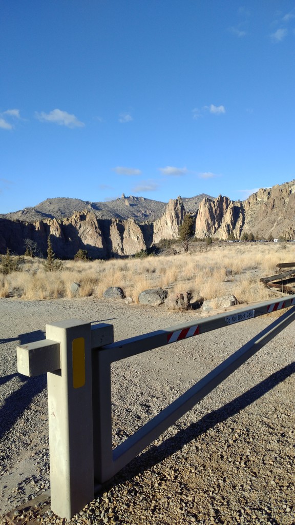
- Start from the gate at start of the Canyon Trail next to the parking lot (See Photo).
- Run down Canyon Trail until the obvious turn down right on "The Chute" Switchbacking to the bridge.
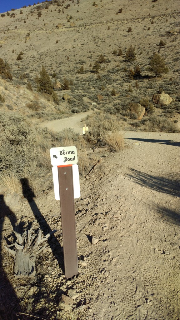
- Immediately after the bridge take the hard right following along the river on Wolf Tree / Burma Road Trail.
- Follow this main trail avoiding smaller offshoots for 1 mile before taking a left to stay on Wolf Tree up some steep switchbacks to merge with Burma Road.
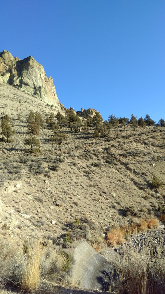
- Follow the first ramp of Burma Road up to the first switchback where you will shoot off the outside of the road switchback onto a small climbers trail taking you up to Koala Rock.
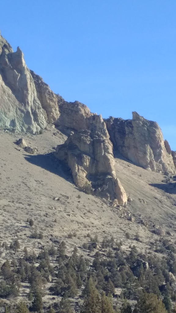
- Follow the trail to where the tree is on climbers left this is the bottom of River Round 5.4. Three pitches of jugs and pockets to top out.
- Then scramble off the back staying to the same climbers left to find the easy class 3 descent.
- Ski the skree (skreeing) back down to where you started the route.
- Reverse all directions back to the car.
Super Slab: This is a fun little sprint + rock climb on 300+ ft of 5.6yds(+1 unexposed pitch of 5.7) to gain the Misery Ridge Trail, then run back down the Misery Ridge Trail and back up to the gate. Research Topos and route descriptions Here or in this guide book
Distance 1.5mi
Load GPX file titled "Super Slab"
Photos of route on Mountain Project, Here on FKT, and Here in strava
Directions:
-Start from the gate/start of the Canyon Trail at the parking lot (see photo)
-Run down Canyon Trail until the obvious turn down right on "The Chute" trail switchbacking to the bridge.
-After the bridge, continue straight on Misery Ridge trail up the switchbacks
-When you see the obvious sign for the “Red Wall” take the smaller climbers trail that deviates towards the routes.
-Find the base of Super Slab. And fire up. Have fun. (Research the route in a guide book or with the link above)
-From the top of Super Slab run back away from the face, uphill then descend a small bowl-like slab to a grassy bowl. —Then climb up another steep but unexposed slab (described as unexposed 5.7) for 30ft and then continue power hiking west, more uphill, to get to a small climbers trail, hike this until merging with the main Misery Ridge Trail
- *As of Feb 2023 - it was agreed upon by Jason and other locals that tagging the Misery Summit is no longer necessary for this FKT even thought Jason's original time included that out and back*
- Run down the Misery Ridge Trail and up to the gate to finish!
Birds in a Rut 5.7yds: This is an awesome 5.7 mile run + rock climb, gate-to-gate effort, that takes you up to the Marsupials highpoint on top of "The Wombat" above Smith Rock State Park. This is a good route. The first pitches are a bit lackluster by Smith Standards, but if the 5th pitch was in the main part of the park it would be one of the most climbed easy-moderates in all of Smith. its good! A few insecure, exposed moves on dirty rock may make simul-climbing the wiser choice for this particular route.
Research Topos and route descriptions Here or in this guide book
Distance 5.7mi
Load GPX file titled "Birds in a Rut"
Photos of route on Mountain Project and Here in strava
Description:
- Start with a hand on the gate at start of the Canyon Trail next to the parking lot (See Photo). This is also your finish, hand on gate.
- Run down Canyon Trail until the obvious turn down right on "The Chute" Switchbacking to the bridge.
- Immediately after the bridge take the hard right following along the river on Wolf Tree / Burma Road Trail.
- Follow this main trail avoiding smaller offshoots for 1 mile before taking a left to stay on Wolf Tree up some steep switchbacks to merge with Burma Road.
- Follow the first ramp of Burma Road up to the first switchback where you will shoot off the outside of the road switchback onto a small climbers trail taking you up to Koala Rock.
- Continue up the climbers left/northwest side of Koala Rock on a switchbacking scree trail to the bottom of The Wombat
- Go Left/northwest along the climbers trail at the base of the wombat until you identify the start of the route to the left of a small juniper
- Climb the entire route as described in Mountain Project or the guide book, tag the summit of the Wombat
- downclimb or rappel off the north side to a climbers trail, run west on the climbers trail up over a saddle then dropping quickly down a steep scree climbers trail back past the start of the route
- reverse all directions back to the gate.
~submitted by Jason Hardrath (STRAVA, IG or FB)
~ "Birds in a Rut" added with Winston Mueller (Strava, IG, or FB)

Comments
FKT... How do we fallow this rout? Both variations go completely off course at the turn around locations? If you look at the Strava map both seem to simply zig-zag in very random ways. Looks to be impossible to follow. can you please clarify this?
Snazuk,
That is because these are run + free solo rock climbing routes (or hard scrambles as Buzz would call it). In the portions where the GPS seems to zig-zag you are climbing up a rock face on the named route.
The process with these FKTs is to research the route (photos, descriptions, etc) on mountain project or guidebooks to make sure you can follow it.
Then, climb the rock route (on a rope, with a partner) to rehearse/memorize the moves and make sure you feel comfortable climbing off a rope.
Then go back to the start to run + free solo the whole route car-to-car.
Due to the GPS jumping around while you rock climb, you utilize the geo-stamped photos taken with your on the route to evidence to those of us who know that you actually climbed the proper route.
The are modeled after the experiences in Boulder, Colorado where many athletes love to run up to them, then solo up the rock faces in their running shoes, then run back down to the car. It is one of the original styles that influenced the formation of FKTs, to mix running and climbing in terrain that could never have a formal race on it.
If you are interested in chasing trail running only fast marks in Smith Rock here are some Strava Segments for the loop runners contest within the park:
Main loop Clockwise: https://www.strava.com/segments/11122860
Main loop Counter-Clockwise: https://www.strava.com/segments/11307274
If you can beat the fastest time, I do feel like this loop is classic enough to be added as an FKT since it has long been contested by many central oregon runners.
Thank you for your question! Hope this was helpful!
with stoke,
Jason Hardrath
Here are 38 more routes for people who want to create new FKTs:
According to the FKT Guidelines: Only "climbing grades 5.8/5a and harder even without a rope are considered climbing".
Cinnamon Slab 5.6 Trad 2 pitches
Rabbit Stew 5.7 Trad
Bunny Face 5.7 Sport 2 pitches
Lycopodophyta 5.7 Trad 2 pitches
Moscow 5.6 Trad 3 pitches
Amphetamine Grip 5.7 R Trad 3 pitches
Friday's Jinx 5.7+ Trad
Gagged and Bound 5.6 Trad
Round River 5.4 Trad 3 pitches
Round There 5.7 Sport
West Face 5.5 X Trad 3 pitches
South Buttress 5.5 X Trad 3 pitches
Cave Route 5.7 R Trad 3 pitches
Living Blindly 5.7 Sport 3 pitches
Spiderman Variation 5.6 Trad
Spiderman 5.7 Trad 2 pitches
In Harm's Way 5.7 Trad 2 pitches
Doorknob People 5.7 Trad
Rage 5.7 Trad
9999 5.6 Sport
Bits and Pieces 5.5 Sport
Sky Chimney 5.7 Trad 3 pitches
Limestone Chimney 5.4 Trad
Lollypop League 5.5 Sport
Munchkin Land 5.7 Trad
Instant Replay 5.7 Trad
East Chimney 5.4 X Trad
First Kiss 5.7 Sport 5 pitches
The Poplar, South Chimney 5.7 R Trad
Peawabe Spiral 5.1 X Trad
North Ridge Direct 5.5 R Trad, TR
Walnut Crack 5.7 Trad
Vegetarian Except For Bacon 5.7 Sport
Hunting Wabbits 5.7 Sport
Don't Ask Don't Tell 5.7 Sport
Charlie's Chimney 5.6 Trad
Little Indian Princess 5.7 Sport
Benedictine Punk 5.7 Sport