Location
New Jersey,
US
Distance
196 mi
Vertical Gain
1,712 ft
Description
GPS Track
NJ SOUTH TO NORTH_0.gpx131.8 KB
FKTs
Male
| Robert Ivan, Anthony Certa | 3d 11h 52m 30s |
Images

Comments
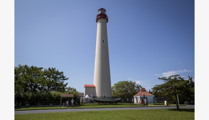
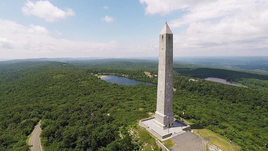
This route spans almost the entire length of New Jersey from south to north or vice versa. It starts/ends at the Cape May Lighthouse in the south and the High Point Monument in the north, New Jersey's highest point. The course, which crosses seven counties, has variations due to the uphill northbound journey and the precedent for southbound travel. best outlets in new York
The current fastest trans-state crossing was completed by FKT athlete Cole Crosby southbound on January 9th, 2020 in a time of 44h42m.
Verification: https://www.strava.com/activities/4603757497
https://nj.milesplit.com/articles/291574/crosby-completes-run-across-nj…
My buddy Anthony and I are attempting to run this as a Group Self-Supported FKT northbound starting in Cape May on Thursday October 3, 2024. We'll be posting updates to our Strava and IG as we go.
We did it. Will be submitting our data for the Group Self-Supported FKT northbound.
Robert https://www.strava.com/activities/12593625998
Anthony https://www.strava.com/activities/12593901046