Height: 1768 feet / 539 m
Lat/Lon: N46 06.662 W81 17.357
Overview:
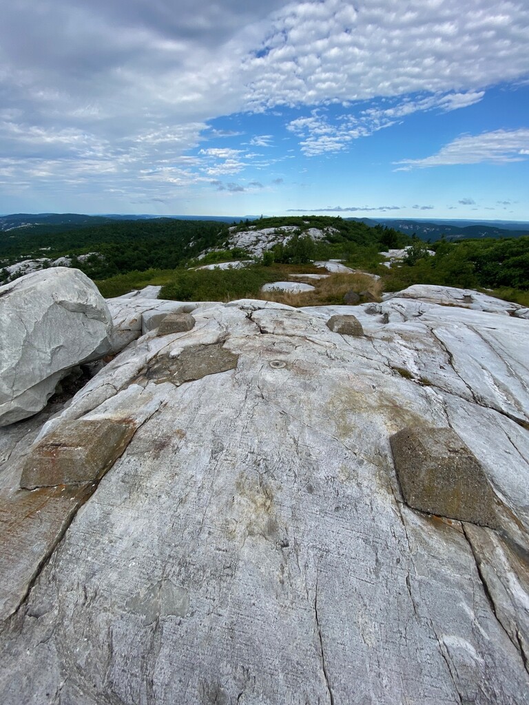
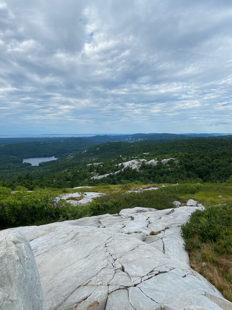
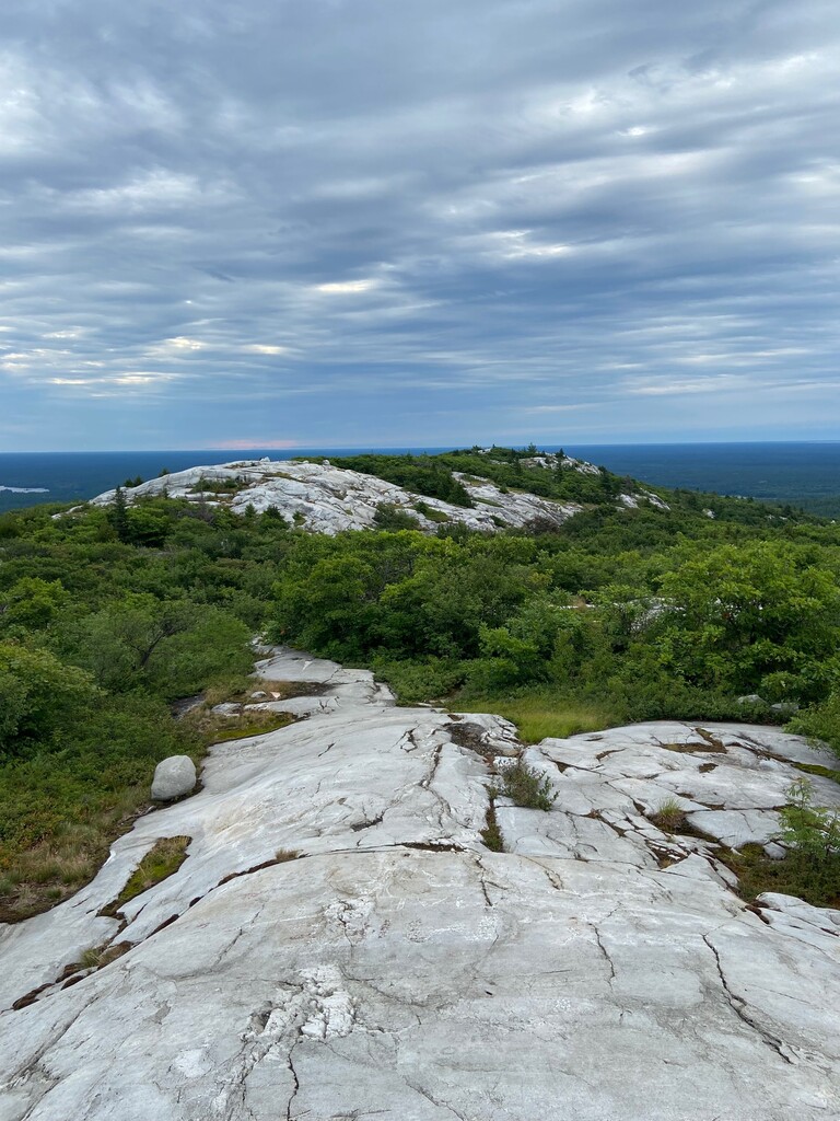
Located in Killarney Provincial Park, Silver Peak is the pinnacle of the La Cloche Mountains, a weathered 3.5 billion year old mountain range that was once higher than today’s Rocky Mountains. The peak is so named because of the silvery gleam the white quartzite gives off in the sunshine. Although not the highest elevation in Ontario, the peak is well regarded for it’s mountainous terrain and sweeping views, and as such is a popular hiking destination.
Directions:
There are several routes to Silver Peak, the most common ones being:
- An overland route via the 7-8 day 80 km La Cloche Silhouette Trail, which circumnavigates Killarney Provincial Park
- A 5.7 km hike to the summit combined with a 3.3 km canoe paddle in from Bell Lake (easily accomplished in a day)
- A 3.5 km bushwhack from the Bell Lake Parking area to the Silver Peak Trail and completing the remaining 5.7 km to the summit on this trail
Below details the route to Silver Peak via Bell Lake:
From Toronto, take Highway 400/69 north past Barrie and Parry Sound. 29 km past the French River turn left (West) on 637. At kilometer 36 on 637, there will be a gravel road turn off at the right (North) to the Bell Lake Access point. Depending on the time of year, parking permits may not be available at Bell Lake and will need to be bought at the George Lake Park Office, which is 20 km further along on 637. There may be a sign at the turn off indicating the status of the Bell Lake permit office. Camping/backcountry passes are not needed if this is a day trip outing. It’s a 9 km drive from 637 to the parking area at Bell Lake. Canoe rentals can be arranged at Bell Lake.
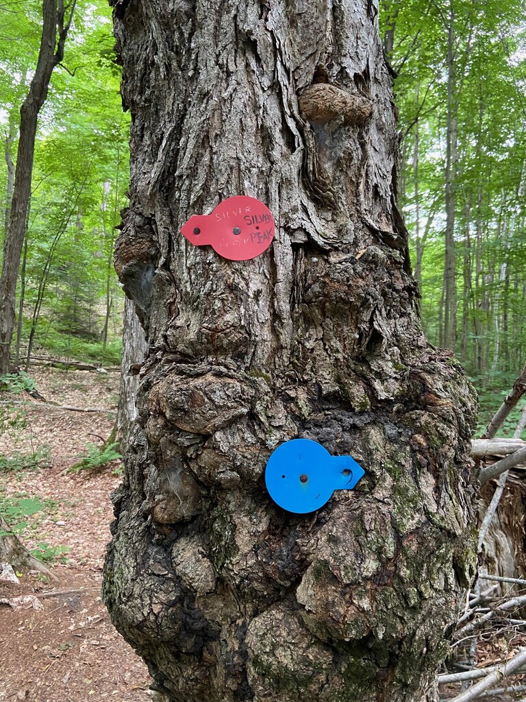
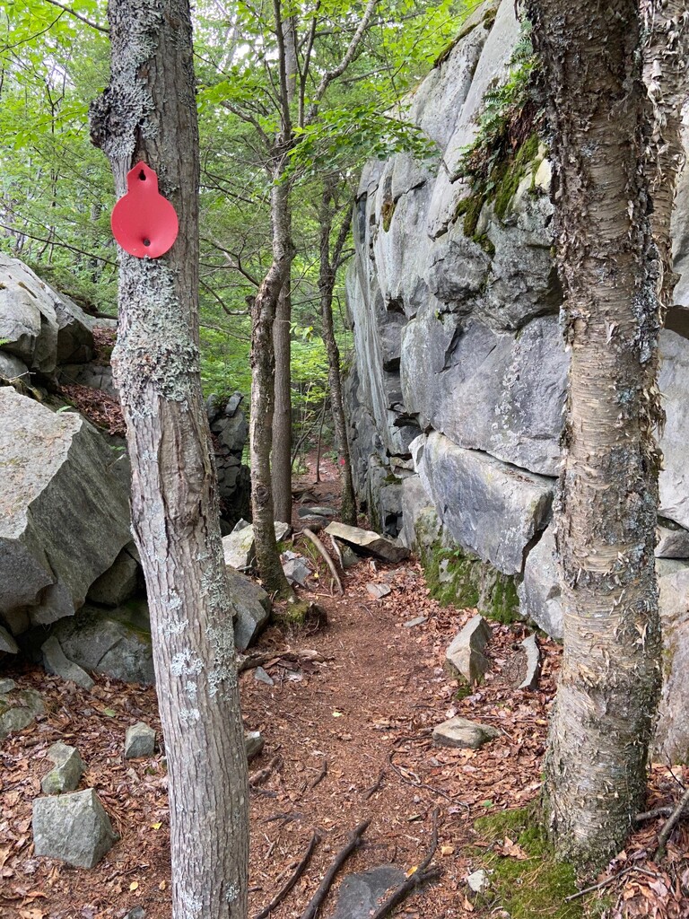
With a canoe, it is a easy 3.3 km paddle north around the head of land and then west to the narrows. The landing for the portage at the end of the lake is a muddy bog. Be careful bringing the canoe ashore here. Optionally, bring a chain and lock to secure the canoe to a tree, as it’ll be left here for the remainder of the day. From the portage, it is a 2.3 km hike to the intersection with the La Cloche Silhouette Trail. Proceed west (right) on this generally well established trail for 1.6 km until it intersects with the Silver Peak side trail which will be on the left. Proceed south along this trail which will climb at a moderate, but steady pace for 1.9 km to the summit. Silver Peak is a ridge with several high points. The highest is nearest the trail and is marked by the footings of a fire tower which once stood on this spot.
Getting to the start of this FKT route is an adventure in itself! I recommend parking at Bell Lake and paddling the 3 km to the dock. This obvious trail will take you to the famous La Cloche Silhouette Trail. Follow this until you hit the Silver Peak side trail which is red blazed. The route is from the first red blaze at the intersection of the La Cloche Trail to where the old fire tower was. It's the highest point and is marked by 4 cement pillars where the fire tower used to be. Make sure to follow the red blazes the entire way up. There is one point in the trail where there's a good size short cut. Do not take as you would not be following the red blazes. Stay on the official trail. There are some great views at the top! Please descend with caution due to the gnarly terrain. Plan for lots of extra time and work to even get to the start of the route. Enjoy!
http://www.killarneyoutfitters.com/trip-planning/hike-silver-peak.php
http://www.ontariohighpoints.com/silver-peak/
https://www.summitpost.org/silver-peak/151503
https://ontarionaturetrails.com/trail/silver-peak-trail/