By Erik Schlimmer
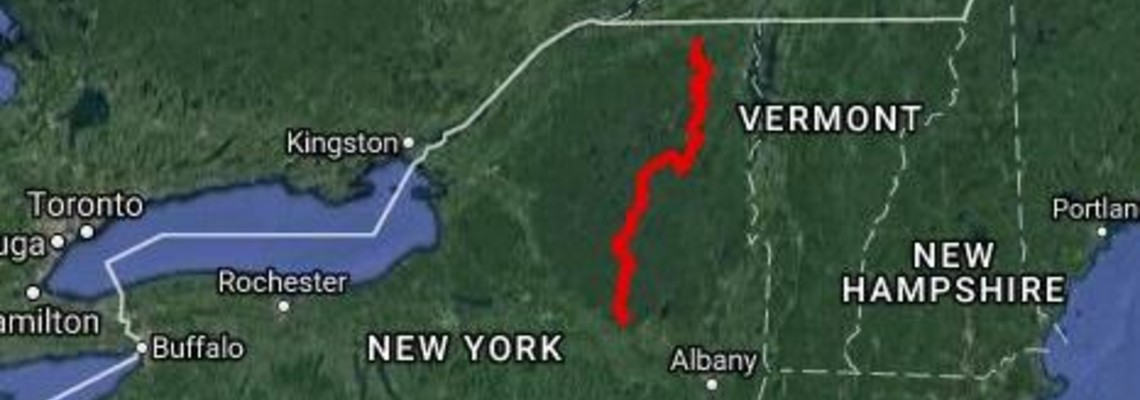
Connecting 185 miles of hiking trails, 50 miles of paved and dirt roads, and 5 miles of trackless woods, the Trans Adirondack Route stretches 240 miles across New York's Adirondack Park, the largest park and forest preserve in the Lower Forty-Eight. Yet what Fastest Known Time readers want to know is, well ... the fastest known times. When I thru-hiked, and thus created, this route in 2010, I traversed it in 12 days flat, yet that time was bested in 2015 by a thru-hiker who crossed the route in 10 days, 6 hours, 46 minutes. In both cases, these hikers were in no hurry. They weren’t "FKTers" at heart.
As creator of this route, my attachment to it runs deep. I'd like to establish a scorching fastest known time myself, but it is not in the cards. The last time I hiked a forty-mile day was a decade ago, my competitive running credentials are limited to one five-kilometer race, and I'm writing this article with my right foot immersed in a bucket of ice water (I sprained my ankle on a run last night). Perhaps I can live vicariously through an FKTer who decides to scurry across the Adirondacks, and if this grasps your interest, we already have something in common.
THE ROUTE
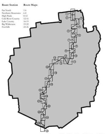
Since the guidebook to the route is composed in a southbound manner, you begin your journey on the northern border of the Adirondack Park in downtown Ellenburg Center, population 800. You're nine miles from the Canadian border and on the first of the route's seven sections: Far North, Northern Mountains, High Peaks, Cold River Country, Lake Country, Big Wilderness, and Foothills.
Far North is the easiest section to traverse since it's all on gravel rail trails and paved and dirt roads. This subtle section is 43 miles long and climbs 2,300 vertical feet.
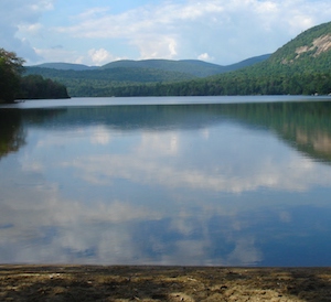
At scenic Union Falls Pond you enter the Northern Mountains section, and the work begins. It's the toughest of the seven sections since it includes the route's biggest climb and toughest off-trail segment. Scramble up and over Catamount Mountain, the Stephenson Range, Marble Mountain, and Whiteface Mountain in one go and you'll climb 7,000 vertical feet. End-to-end this section covers 28 miles' worth of paved and dirt roads, footpaths, ski trails, and snowmobile trails.
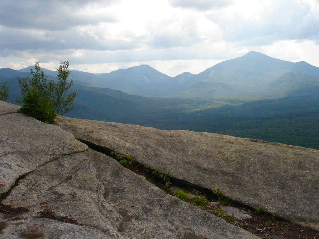
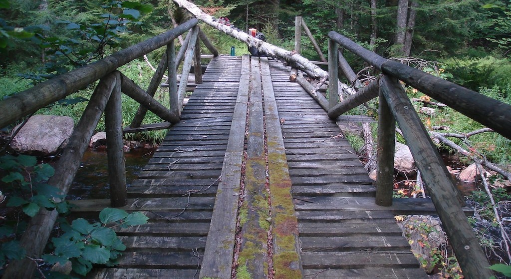
Now you're getting into your Adirondack groove if your thighs aren't demanding you stop. You enter the High Peaks section, which is set in the most rugged and scenic region in the park. Across its 31 miles this section runs below 4,000-foot peaks, along rivers, past waterfalls, and on lakeshores. Another trailless section is tackled, this one notorious for having thru-hikers become confused, turned around, mired, confounded, lost, and surly, usually in this order. After climbing 4,300 vertical feet you end this section at a crossing of the Hudson River where you reach a milestone: You're now into the triple digits. The river crossing is milepost 102.
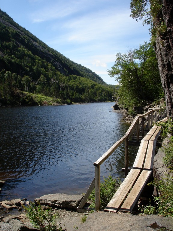
Mountains are a thing of the past as you enter the forty-mile-long Cold River Country section. Aptly-named, this section runs along this river for a dozen miles and dives deep into rugged topography that looks more like something you'd find in Montana than New York. Past old logging dams and the haunts of hermits you continue your run for the southern border of the Adirondack Park. By this point you've climbed 18,000 of the route's 25,000 vertical feet.
The fifth section, Lake Country, is aptly-named, too. Tirrell Pond, O’Neil Flow, Lake Durant, and Stephens Pond are visited within the first seven miles. After another seventeen miles of travel, this section, which has 2,300 vertical feet of climbing, is a thing of the past.
Big Wilderness is the sixth section, and – wouldn't you know it – it's aptly-named, too. Here the route crosses West Canada Lake Wilderness Area, which, at 170,000 acres, is one of the biggest wilderness areas east of the Rockies. Muddy and rooty trails lead to another off-trail section, which leads to abandon paths that demand a keen eye. At the end of this 31-mile section you hit milepost 198 – nearly 200 miles. What a nice, round number.
There's no sense in stopping now. The final section's name, Foothills, gives you hope for an easy finish, but you've still got over forty miles and another 2,600 vertical feet to go. You stumble past Good Luck Lake, Third Lake, Fourth Lake, Pleasant Lake, and a few other beautiful bodies of water but their beauty is lost on you. Perhaps all you want at this point is the end. And then you reach it without warning. Talk about a modest ending. The southern border of the Adirondack Park, 240 miles from your start point, is unmarked where it crosses a dead-end dirt road. There are two houses nearby, and perhaps the residents peer out their living room windows because they've never seen anyone standing in the middle of East Road, especially someone looking so relieved.
 Relief may be the primary emotion experienced, but pride is probably a close second. After all, you just crossed a park that exceeds the combined acreage of Acadia, Bryce Canyon, Congaree, Glacier, Grand Canyon, Great Smoky Mountains, Yellowstone, Yosemite, and Zion national parks. You're one of the few, the proud. Since the route opened in 2013, only thirteen people have successfully thru-hiked it though at least twenty have tried. By comparison, the 135-mile Northville-Placid Trail, the Adirondacks' other long-distance path, sees a couple dozen thru-hikers each year. It has enjoyed a handful of supported, self-supported, and unsupported fastest known times, the first one established in 1973. Meanwhile, a regional path similar to the Trans Adirondack Route is the Vermont Long Trail. That path sees about 150 thru-hikers a year and has been a hotbed of well-publicized fastest known times.
The FKT community – that tribe of trail runner-wearing, Clif Bar-devouring, stop watch-checking, Motrin-eating contrarians – that I've enjoyed a fleeting relationship with for a decade or two now, knows a good time when it sees one. So, perhaps a tribesman or tribeswoman, someone just like you, now feels that they have to see for themselves how big New York wilderness gets.
– Erik Schlimmer is Founding Member of Friends of the Trans Adirondack Route. More on the route: transadk.com Erik's images: https://www.instagram.com/transadk/