Start: Art Loeb Sign, Davidson River, Brevard, NC
Finish: Explorer Loop Parking Lot, Gate in front of Bridge, Bent Creek, Asheville, NC
Route Name: Project Untamed 100 – Western North Carolina, USA
Distance and Elevation Gain: 101 miles, 24,198 ft gain
Route Description
Project Untamed 100 is a self designed route. As a local here, this route touches trails that hold deep meaning for all of us. They’re the ones we spend countless hours on & the trails we use for daily training and the ones we save for big adventure days. The loops and out-and-backs are easy to follow once you’re on them, they’re intuitive, especially with the map in hand. This route was designed to test my fellow WNC trail runners. When they see it, they’ll say, “Woah, did you really connect all of those like that?” It’s also built to challenge the runner driving in from out of town, the one who wants to experience everything this side of the Blue Ridge Mountains has to offer.
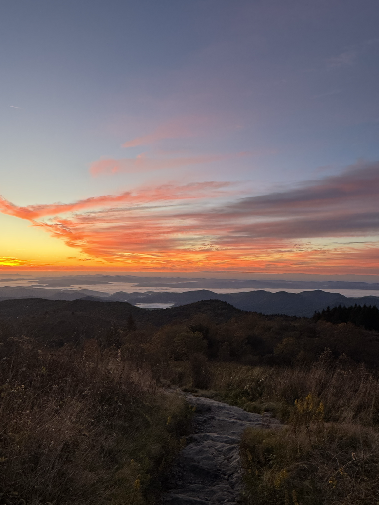
This route starts at the legendary Art Loeb Trail in Davidson River, traversing northbound until you hit the Mountains-to-Sea Trail. This is where the summit bagging begins.
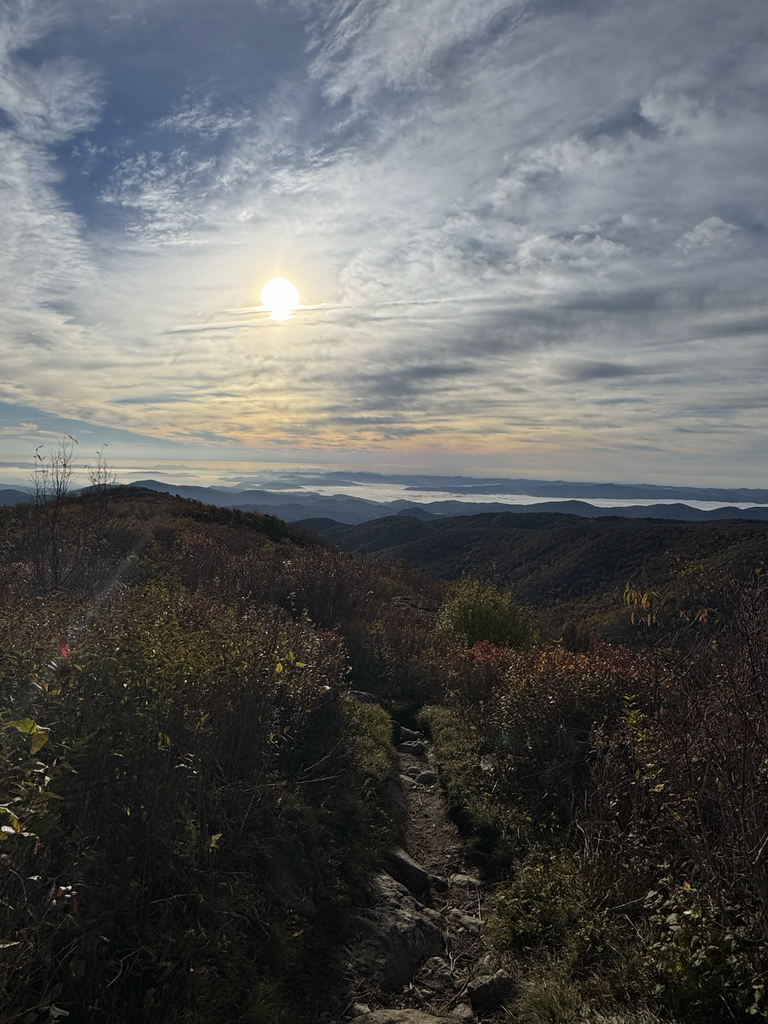
First up is Devil’s Courthouse, a well-known lookout that takes your breath away. After tagging this, head back to the MST and over to Black Balsam on the Art Loeb. You’ll get your first taste of Balsam quickly as you hit the first bald, but you’re not going all the way yet. You have more iconic trails to hit first.
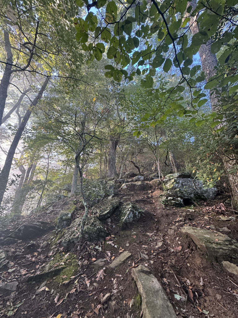
Take the Art Loeb Spur down to the main Balsam parking lot. From there, head through the meadow and climb Sam Knob to tap the summit. After Sam Knob, head down to Flat Laurel Creek, taking a left first, then to Little Sam’s Knob Trail, and connect back to the Mountains-to-Sea Trail. Go right to take it toward Highway 215 through rooty, technical terrain, open forest, and then alongside one of the most beautiful creeks.
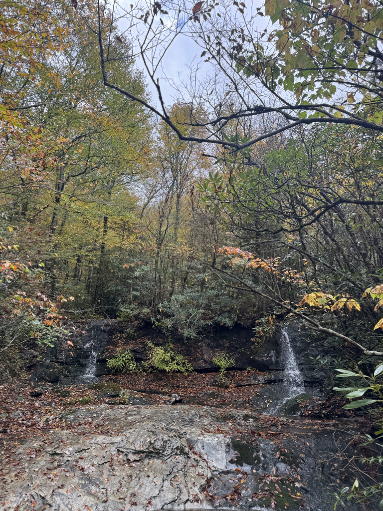
Once you hit the road, there’s a short 0.3-mile traverse that lands you at Flat Laurel Creek on the right, where you’ll head up and take in all the hidden and not-so-hidden waterfalls. Your feet will get wet here, guaranteed.
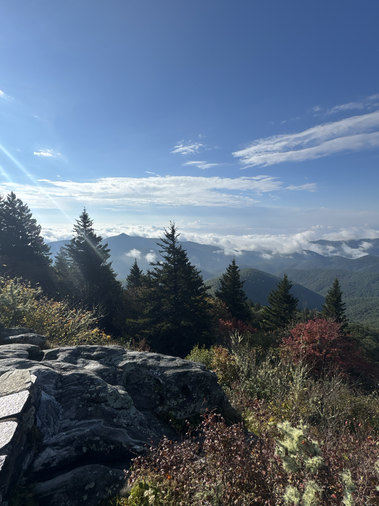
This section brings you back up to the Black Balsam parking lot, where the next adventure starts. Climbing back up the Art Loeb Spur Trail puts you back on the Art Loeb proper, where the views are endless—360 degrees of everything this incredible area has to offer.
Traversing across the balds of Balsam, you’ll tag both Balsam and Tennent Mountain, each sitting at just over 6,000 feet. From there, you are going to make your way to Graveyard Ridge Trail, saying goodbye to the Art Loeb. Connect back to the Mountains-to-Sea Trail in Graveyard Fields.
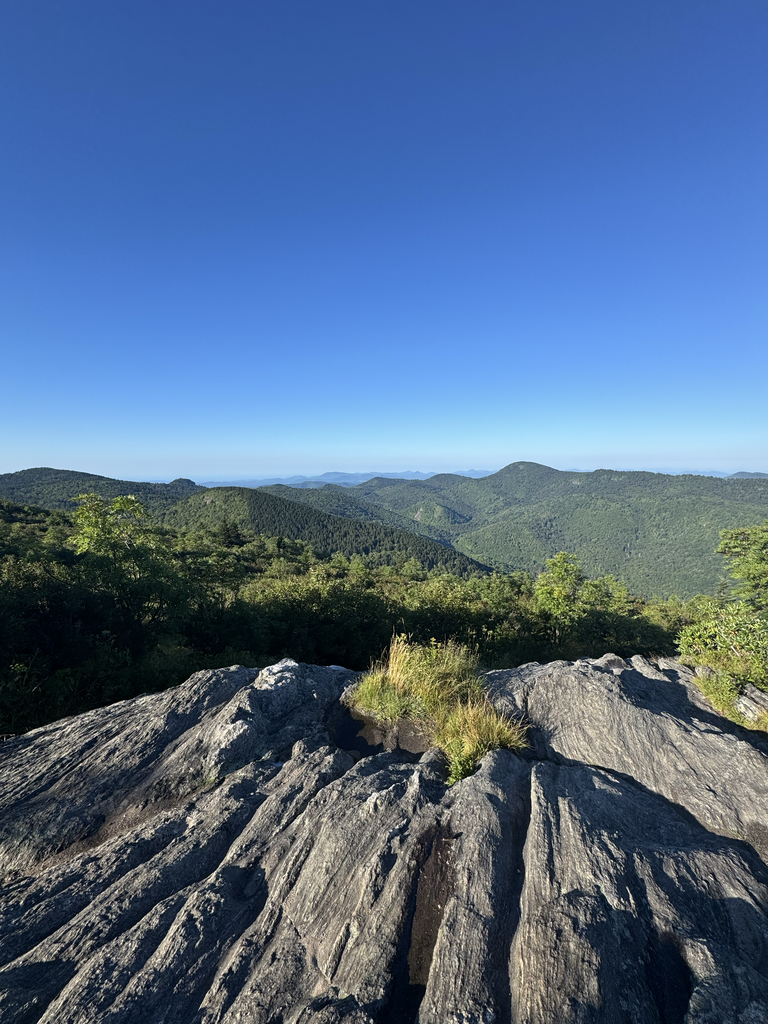
Following the MST, your next stop is Pisgah Inn. Then the local fun really begins with Pilot Rock. Head all the way to the end where it hits Yellow Gap Road. Tap both feet on the road, then climb back out. Shortly after returning to the top, head to the Mount Pisgah parking lot, where you’ll head up Mount Pisgah to stand on the iconic viewing deck before coming back down.
After this get back on the MST and head toward Asheville. This section is known as Shut-In. From here, you’ll complete the entire Shut-In section with a few side quest adventures along the way.
The first side quest starts when the MST (Shut-In) hits Bent Creek Gap Road. Get ready for a loop that will test you. Three local trails—Cold Knob, Greenie, and Three Humps. These climbs could have been skipped, but how you show up when you’re tired is what defines you.
Starting with Cold Knob from the backside first the descend the front side to the start where it hits Explorer Loop gravel. Tap both feet to signify trail completion, then turn around and climb back up and back to Bent Creek Gap Road. Take a right on Bent Creek Gap Road, follow it to Lower Sidehill to connect to Greenie. Climb to the top of Three Humps, make a right, and follow it until the three-way intersection. This is your turnaround point. Head over each of the three summits until you’re back on the MST.
After this loop, continue back down the MST.
You’ll arrive at Sleepy Gap parking lot and trailhead. Go to the bottom of sleepy gap until it hits Explorer Loop, tap both feet, then climb back. From there, hit Grassy Knob, another elevation chaser adored by many. Take it up the backside first, then down to the very end at South Ridge. Tap both feet on the gravel and head back up the same way you came down, connecting back to the Sleepy Gap parking lot and rejoining the MST.
Follow the MST to the start of Shut-In by the Arboretum. Tap the road to signify the trail’s end, then turn around and go back up.
Take a short side trail off the MST to drop into Bent Creek. There’s a sign at the top that says “Lake Powhatan this way.” From there, follow the classics: take a left on Deerfield Loop trail then a Left on Pine Tree, and follow to Explorer. Explorer Loop was the first trail I ever did in Bent Creek, so it’s fitting to end this adventure here—an ode to the start and to home.
After the last section of explorer loop, take a left to not do the loop again. Cross the creek and go to the road. Turn left onto Bent Creek Gap Road toward the finish at the Explorer Loop parking lot. It’s a short 0.6-mile celebration stretch to the end. Once in the parking lot, you’ll see the gate in front of the bridge—you can’t miss it.
Touch the gate, and after this adventure, soak it all in.
Have fun everyone!
Access Information:
Access is quite accessible to crew at many locations along the route. The Art Loeb Trailhead has a parking lot in Davidson River, Brevard. Additional accessible crew spots include the Black Balsam parking lot, Pisgah Inn, and the Mount Pisgah parking lot.
As the Mountains-to-Sea Trail weaves in and out of the Blue Ridge Parkway, there are multiple pull-offs where crew can easily meet runners at specific points. Other reliable access locations include Bent Creek Gap Road, Sleepy Gap parking lot, and the Explorer Loop parking lot at the finish.
Comments
I will be attempting the initial FKT on Project Untamed 100 on Saturday Oct 18th, 2025. Starting at 4:30am est. This will be supported. I designed this route and ready to share it with everyone!
Tracking is available at : https://share.garmin.com/OF3X5