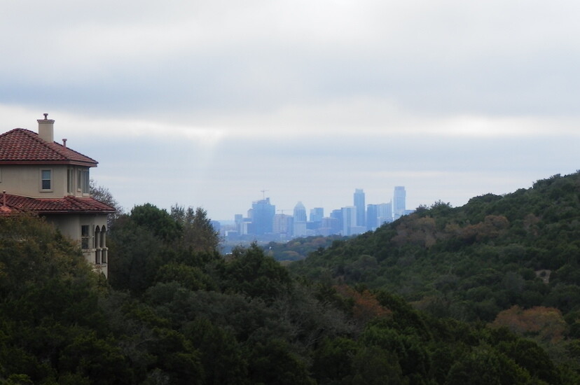
This route links nine trails to generate a 50-mile loop that circumnavigates downtown Austin and areas to the north. The trails range from the the paved Northern and Southern Walnut Creek trails, to the crushed stone of the Ann and Roy Butler Hike and Bike Trail (aka the Town Lake Trail) and the Roy Guerrero Park trails, and to the largely single-track, sometimes rocky and technical Barton Creek Greenbelt, Bull Creek, Great Hills, Yett Creek, and Copperfield trails. Runners can see the distant high-rises of downtown Austin from points along both the western and eastern sides of the route and then from very close as the Town Lake Trail passes immediately south of downtown. Runners also get an appreciation of how Austin lies immediately east of the Balcones fault, as the western side of the route traverses the rough edge of the Texas Hill country, while the eastern side rolls gently through terrain more reminiscent of East Texas.
There is water available from drinking fountains along the route at Bull Creek District Park, Barton Springs Pool (Zilker Park), several locations on the Town Lake Trail, Guerrero Park, Govalle Park, and Balcones District Park. If these drinking fountains are used as the only sources of water, the route has two stretches of approximately 15 miles each without aid. Taking advantage of convenience stores along the route reduces these distances to approximately 10 miles each. The loop can be run in either direction and is most conveniently started from the parking lots at Bull Creek District Park, Barton Springs, Auditorium Shores (Town Lake Trail), Govalle Park, or Balcones District Park. Depending on the season and rainfall, the creek crossings on the Barton Springs Greenbelt trail may be of the wet variety. One section along Walnut Creek traverses public land where the planned trail is not yet completed, and the route uses a collection of informal trails, parallel roads, and a short stretch of walking in the creek bed, which will typically involve some ankle or shin wading. There are numerous other creek crossings along the route, but they are likely to be dry except immediately after rainfall. The roads connecting the trails are chosen just to be the shortest and/or fastest routes, and alternatives are fine.
Aid opportunities and milestones (from Balcones Park, counterclockwise)
Section 1: Balcones and Great Hills (7.5 miles)
0.0 Balcones District Park. Water and restrooms available
0.0 Exit Balcones District Park straight on Eton Ln.
0.3 Turn right on Cabana Ln
0.5 Turn left on Everest Ln
1.0 Turn right on Dorsett Rd
1.4 Turn left on gravel trail to cross train tracks. The turn is just past Hawkhaven Ln, which goes off to the right, and opposite a driveway on the right. Continue straight onto the single-track trail in Yett Creek Park. Stay on the main trail, continuing west. (Next 0.4 miles on trail)
1.8 Leave Yett Creek Park onto W. Cow Path Ln
2.7 Turn right on Duval Rd
3.1 Turn right on Jollyville Rd
3.2 Turn left on Bell Rd
3.4 Turn right on Sierra Leon
3.6 Turn left on Sierra Nevada
3.6 Continue straight to enter Great Hills Neighborhood Park. Stay on the main trail to get to the creek and continue downstream. There are several creek crossings (little water except after a rain). Next 1.0 miles on trail.
4.6 Turn left on Floral Park Dr
4.7 Turn right on Mustang Falls Dr
4.9 Turn left on Morado Circle
5.0 Turn right on Jollyville Rd
5.4 HEB supermarket on left
5.7 Turn right on Great Hills Trail (road)
5.9 Starbucks on right
6.7 Turn right on Hwy 360, aka Capital of Texas Highway
7.1 Turn left on Spicewood Springs Rd
7.3 Turn right on Old Spicewood Springs
Section 2: Bull Creek and Texas Hill Country (9.8 miles)
7.5 Enter Bull Creek Trail (next 1.8 miles on trail). There are several variations of the trail, all basically going along the creek. Any of them are fine for the route. The instructions below are for the variation that I think is the fastest, but there are probably 5-10 different routes that are very similar. As long as you stay close to the creek you are on the route.
7.5 Turn left off of Old Spicewood Springs onto a single-track trail just before crossing a bridge over the main creek.
7.5 Make an immediate left and go up several steps. Turn right on the double-track trail, which parallels the creek but is enough separated from it that the creek is not visible from the trail.
7.8 At the fence, veer to the right. From here, there are several trails that go down to the creek. 7.8 Take one of them and cross the creek. Pick up the trail on the West side of the creek and continue downstream. It is necessary to cross the creek, even though you will soon cross it again, because the east side has a segment with a cliff that blocks easy travel.
8.2 Just before coming to the Hwy 360 overpass, turn left on the single-track trail into the creek bed and continue downstream. There will usually be water here and it is difficult or impossible to keep feet dry. After the overpass, find the trail on the east side of the creek. At the road and low water crossing, turn left and go away from the creek, up the hill into the parking lot on the right. There is a pit toilet but no water. Alternatively, continue along the creek bed and find the trail on the east bank.
8.3 From the parking lot, take the trail to the right that goes back down to the creek. Find the trail on the east bank.
8.9 Cross under Hwy 360. Then traverse the limestone surface on the east bank, gradually moving toward the tree line at the east within 100 yards. As you pass a waterfall in the creek, you should be on a shelf above the rocky creek bed. From here the trail becomes prominent.
9.3 Exit Bull Creek Trail, cross the creek and go up the hill to the parking lot
9.3 Drinking fountain and restroom at Bull Creek District Park
9.3 Turn left on Lakewood Dr
10.0 Turn right on FM 2222
10.1 Turn left onto Hwy 360, aka Capital of Texas Highway
11.0 Cross the Colorado River on Pennybacker Bridge (Hwy 360)
12.5 Wag-a-Bag convenience store on right at Westlake Dr
15.5 7/11 on right at Bee Caves Rd
16.9 Turn right on Scottish Woods Trail Rd
17.3 Turn right on Camp Craft Rd
Section 3: Barton Creek and Town Lake: Austin’s most popular trails (15.3 miles)
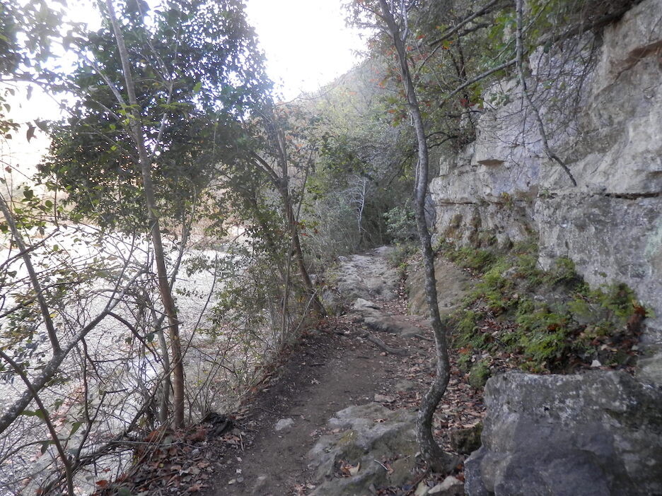
17.3 Enter Barton Creek Greenbelt Trail at the “Hill of Life” (7.5 technical miles on trail, no aid). The trail has mile marker signs every 0.5 miles and is very prominent and heavily trafficked. However, in some places there are multiple trails, sometimes on both sides of the creek, and the main route crosses the creek twice, from the north side to the south side and then back again. As long as you are continuing downstream along the creek, you are on the route. There are also many side trails that go away from the creek. If you are going up a substantial, sustained hill, you are not on the route.
24.8 Drinking fountain and restroom at Barton Springs Pool
24.9 Continue on Barton Springs Connector Trail (next 0.4 miles on trail)
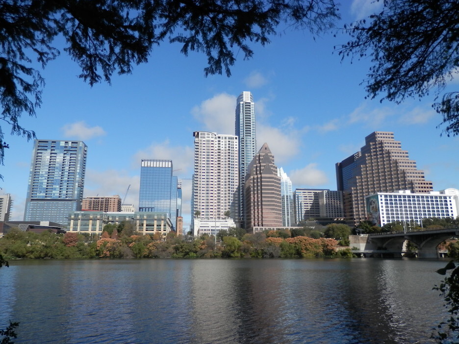
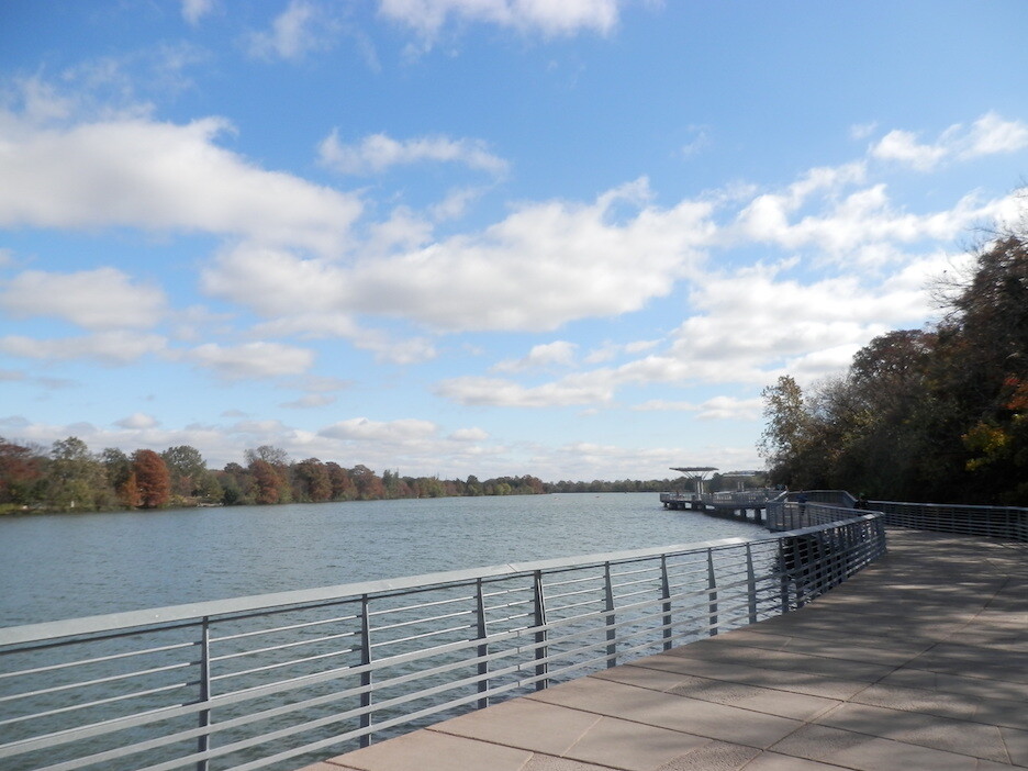
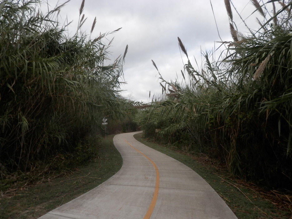
25.3 Turn Right to Cross Barton Creek and enter the Town Lake Trail (next 4.2 miles on trail). The route is crushed stone with short paved portions that extend over the lake in a Boardwalk, with excellent views of the Austin skyline throughout the route.
25.3 Turn left after the Barton Creek Bridge to stay on the Town Lake Trail
26.4 Drinking fountain and restroom at Auditorium Shores
28.5 Drinking fountain and restroom at Peace Point Metropolitan Park
29.3 Stay to the left, staying close to the lake. Do not up the hill and over the dam
29.4 Go through the tunnel, under Pleasant Valley Rd
29.5 Continue on the crushed stone trail, go around the softball fields
29.7 Turn left on the single-track trail, cross the creek where the bridge foundations are. (There is no bridge, but the trail continues on the other side
29.8 Shift to the right to cross the second creek, again with no bridge. Again there is a bridge foundation at the far side of the creek to aim for.
29.9 Continue straight on the center path of three for the shortest route. Take the left trail for a route through the woods and 0.1 bonus miles
30.4 Turn left on the Guerrero Park Road (unnamed)
30.7 Restrooms and drinking fountain on left
30.7 Continue straight onto the paved trail
31.0 Turn left to go over Montopolis Bridge
31.7 Turn left on 5th St
31.9 Turn right on Shady Ln
32.5 Turn right on Bolm Rd
32.6 Enter Govalle Park. Restrooms and drinking fountain across the parking lot
Section 4: Southern Walnut Creek Trail (6.6 miles)
32.6 Enter Walnut Creek South Trail at the left edge of the parking lot. (next 6.4 miles on paved, sidewalk-style trail) No aid on route for next 11.2 miles. Next drinking fountain 14.2 miles.
36.2 Greenwood Food Mart 0.3 miles OFF TRAIL to the left on MLK Blvd (store at 36.3)
Section 5: Unfinished connector to Northern Walnut Creek Trail (8.1 miles)
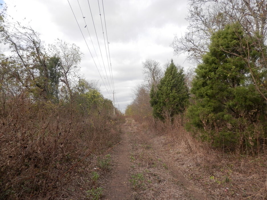
39.2 At the end of the clearing with the power lines, take the single-track trail to the left. If you come to junction with a trail to the right and a sign for “Austin Tennis Center”, you have gone too far.
39.4 Gentle right turn to follow power lines. For the next 2.4 miles, the trail is informal. The goal is to continue along the power lines, heading north
39.9 Cross under Old Manor Rd in the drainage tunnel (dry) and continue on trail
40.2 Cross under Highway 290 on the wide gravel path and continue on trail
40.3 Turn left to stay on the main trail, which goes from the clearing with the power lines to the smaller clearing just to the west. This smaller clearing is the best route from here to Blue Goose Rd
41.8 Leave the trail and turn left on Blue Goose Rd
41.8 Continue straight onto Sprinkle Rd
41.9 Turn right on Sprinkle Cutoff Rd
42.8 Turn right on Chetco Dr
42.9 Turn left on Sly Beaver Dr
43.0 Turn right on Pilgrimage Dr
43.1 Turn left on Braker Ln
44.0 Continue straight past Dessau Rd onto Shropshire Blvd. There is a convenience store on the right, just past Dessau Rd (MiniMax), and a grocery on the left (Mi Casa Market)
44.1 Turn left onto the singletrack Copperfield Nature Trail (next 0.9 miles on trail)
45.0 Turn left to exit the trail onto Trotwood Dr
45.2 Turn left on Pegotty Pl
45.3 Go straight into the clearing with the powerlines and onto the Copperfield Nature Trail
45.3 The goal is to follow the powerlines and Walnut Creek to the underpass at Interstate 35 (0.5 miles). The clearing includes two deep ravines (10-20 ft drops) and may have thick grass with little detectable trail. I think the easiest route is to circle to the right (north) to cross the first ravine on an established single-track trail and continue in the powerlines clearing along game trails toward the second ravine, while looking for a passable route down to the creek. The second ravine is very steep and impassible (as far as I can tell), and you need to be in the creek to get under I-35 anyway, so get into the creek at the first reasonable chance. Depending on the recent weather, you may be able to walk next to the creek in some places, but you will likely need to do some ankle- or even shin-deep wading in this section.
45.9 Immediately after passing under I-35, turn right to go up the concrete drainage ramp and then continue on the I-35 service Rd
46.0 Turn left on Park Thirty Five Circle
46.2 Turn left on Walnut Park Crossing
46.7 Turn right on N Lamar Rd
46.8 Turn left on Walnut Creek Park Rd
47.1 Enter the parking lot at the first opportunity for the shortest route to a drinking fountain. Continue west through the parking lot to get to the Northern Walnut Creek Trailhead.
Section 6: Northern Walnut Creek Trail (3.3 miles)
47.3 Enter Northern Walnut Creek Trail (next 3.2 miles on paved sidewalk trail)
49.6 Continue on trail to cross under Mopac Expy, then circle clockwise to continue on trail
49.8 Turn right to stay on Northern Walnut Creek Trail
50.5 Northern Walnut Creek Trail ends at Balcones District Park
50.6 Drinking fountain and restroom at Balcones District Park
FKTs
| Rick Russell | 10h 43m 8s |
Comments
Awesome contribution to Austin!