Penguin Cradle Trail
PCT is one of the most challenging established multi day bushwalking traverses in Tasmania, crossing 3 mountain ranges.
Starts with 3km of road from the Penguin statue at the beach. The 20km of Dial range trails are then very pleasant with well built and maintained trails through varied beautiful forest types making for comfortable running flow - although not officially part of the PCT, the FKT route includes the summits of Mt Dial and Gnomon which add around 3kim and 200m vert. Then 11km of rural roads.
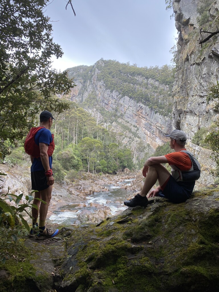
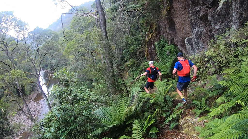
Leven Canyon is just absolutely awesome!! Generally very technical and super steep yo-yoing narrow formed trail. 15km of trail (4-5hrs) then 2km road to Taylors Flats.
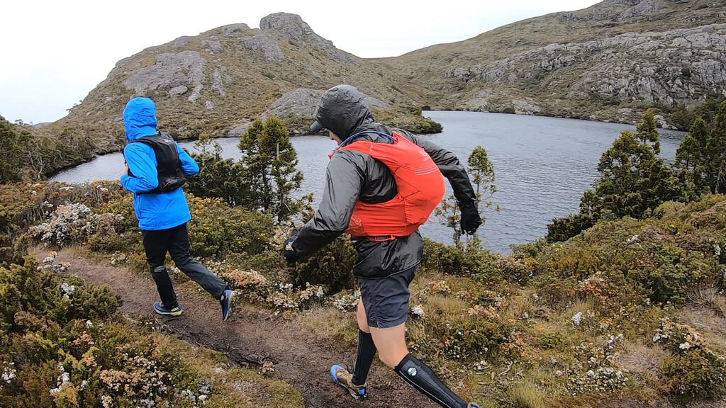
Black bluff range is something else... a nice long climb on a great track brings you to a lovely alpine lake then unformed alpine heath track at >1,000m elevation super exposed to weather for 25+kms. This can be a very serious section if bed weather or low visibility as the track is very faint. Even in good weather, it's very slow going with high ankle rolling potential at every step, occasional hidden knee deep holes, and the slightest southerly squall tears through you and slows you to half the slow pace you were already doing at 60-80km in... what an experience! On a clear day you can easily see Cradle from just past Black bluff - it certainly doesn’t look 30kms away, but takes around 7hrs to reach!
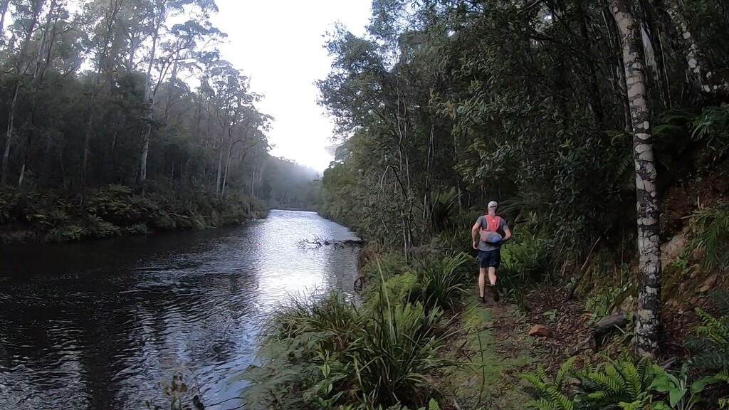
Cross the Belvoir Rd and only 21km to go. Speelers track to Cradle Mountain Lodge is magical with rainforest, pandani, and waratah. Grab a well earned drink, then onlly 6km on the really spectacular cradle valley boardwalk finishing at the start of the Overland track at Ronny Creek.
Massive thanks to the North West Walking club for designing and building the Trail in the 1970s and maintaining it to this day. Penguin Cradle Trail - North West Walking Club (nwwc.org.au)
Penguin Cradle Trail + Overland Track (178km, 6,500m +/-)
Connecting the Penguin Cradle Trail (PCT) with the Overland Track (OLT) links together two well known remote and demanding trails.
Both trails are described within FKT routes and through the North-West Walking Club (NWWC) and Tasmanian Parks and Wildlife Service websites.
This combined route is challenging for several reasons: distance covered, remoteness, number of ranges traversed, exposure to weather, trail surface and access restrictions on the Overland Track.
The PCT-OLT route leaves Penguin and traverses the Dial Range (using the traditional route variation described by the NWWC), Leven Canyon and Black Bluff range to reach the Cradle Mountain tourism area, before following a board-walked track beside the Dove River to reach Ronney's Creek - the start of the Overland Track.
From Ronney's Creek, the Overland Track climbs past Crater Lake and Marion's Lookout to travel around the exposed alpine cirque of Cradle Mountain. As the track nears Barn Bluff it descends down into Waterfall Valley and goes out across alpine Moors past Lake Windemere and Pine Forest Moor. The track descends down to Frog Flats on the Forth River before rising back up to the button grassed Pelion Plains. Climbing through rainforest the track reaches the Pelion Gap (turn off to Mount Ossa - Tasmania';s highest mountain) before descending again down a valley overshadowed by the Du Cane Range. Travelling through myrtle forests (filled with slippery roots and mud) the track climbs to the Du Cane Gap before opening up into Eucalypt forest during the descent to Lake St Clair. Whilst walkers may take the ferry here, the journey continues for another 18 km around Australia's deepest lake to reach the visitor centre at Cynthia Bay on the southern side of Lake St Clair.
Comments
Hi Lincoln, awesome run man! I noticed your data is a bit different to the info I've been looking at for the trail. Do you think that the official trial without any side trips and accurate GPS data, finishing at the lodge, would be closer to 80km?
yeah maybe @dbyrne, the 94km is the distance mapped on the suunto app for the route taken. Strava recordings were between 96km and 108km. Would definitely recommend the FKT route set to gain the high traverse of the northern part of the Dial range and also to finish at the start of the Overland track