


I began training for the Pennsylvania Mid State Trail FKT attempt around December of 2020 but I started thinking about attempting it a few years prior. Hiking this trail has always been important to me because as long as I can remember I’ve had an affinity for Pennsylvania. I grew up in NY but went to baseball camp and vacations in Pennsylvania with my family. I was always fond of the ruggedness and the wild feel of the country. I’ve always felt compelled to explore as much of its vast forest as possible. Three weeks prior to the attempt I went out for one last 170 mile training trip that included an FKT of the 97 mile Donut Hole Trail in Pennsylvania. During this hike I experienced a subungual hematoma (blood under the toenail, nail turned black, extremely painful) in both my big toe on my left foot and the nail next to my big toe on my right foot. Over the thousands of miles I’ve hiked, with multiple 40+ mile days, I’ve never experienced this before. I subsequently had the big nail surgically removed on June 4th and was unsure if I would be able to attempt the FKT. On June 11th, three days prior to the start of the FKT attempt the Doctor confirmed the toe had fully healed and gave me the OK to head out on the trail. As I left the doctor's office she said “Good luck!” and it started to sink in that I would actually be setting out on this massive endeavor in just a few days.
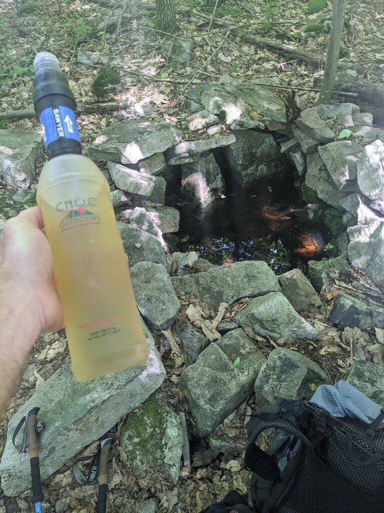
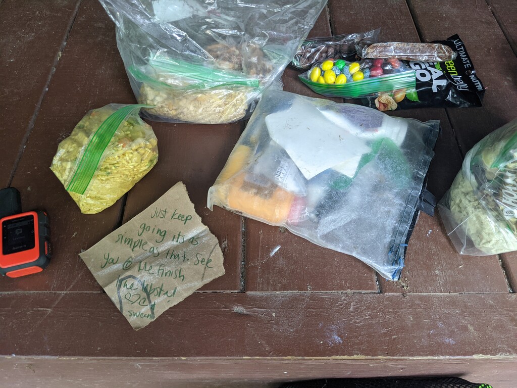
In the spirit of the Fastest Known Time I planned to follow all laws, rules and regulations and only camp at legal campsites along the trail. This complicated the FKT attempt because there are only two legal campsites within the first 86 miles of the trail heading Northbound. The first is a shelter at mile 35.5 and 2nd is a shelter at mile 86. The last legal site from the Northern terminus is 35.4 miles. I was also making an unsupported attempt carrying all of my gear and food from start to finish, except water from natural sources. I did not utilize any taps/faucets along the entire trail and I carried all trash and leftover food. I started with 21lbs of food and only had 9.2 ounces remaining, two dehydrated meals. My pack base weight was 10.5lbs. This included two 20k mAh power banks, 24 ounces total, 14% of my entire pack weight. Starting weight of my pack was 31lbs.
Gear Checklist: https://docs.google.com/document/d/1ZNIOTMgn1IGUD5IdD3q-Cm8UJVzqASpgNwx…
Food Checklist: https://docs.google.com/spreadsheets/d/1WkXPV-7tbAGfZz9Zxb7EimzAVEDa_tB…
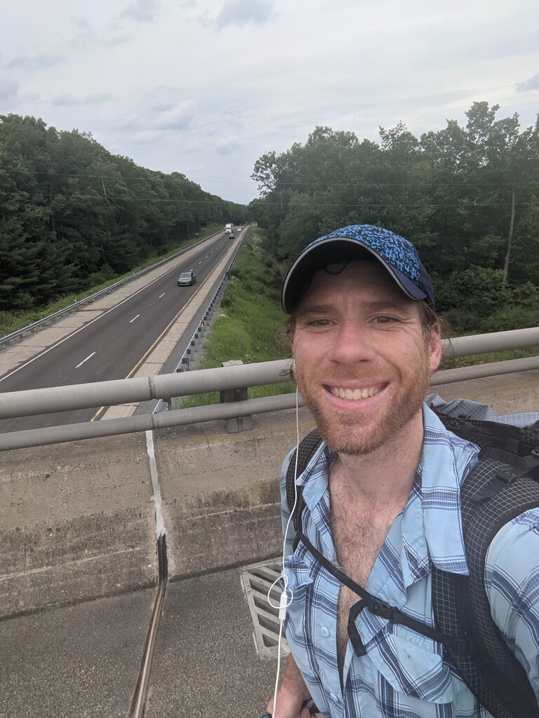
Day 0: My wife drove me to the car rental in Philadelphia and I made my way to Cumberland, MD where I dropped off the car. I grabbed my pack and road walked 19 miles to the start of Section 0 of the Mid State Trail near Green Ridge State Forest. Camped overnight near the trailhead.
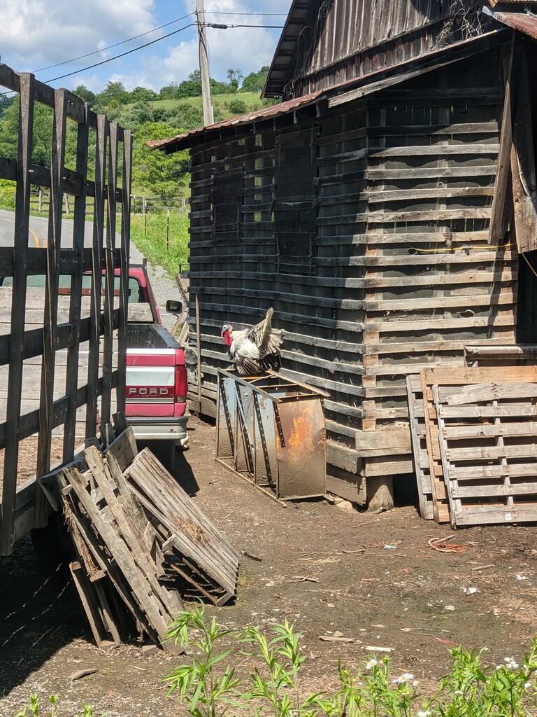
Day 1: Woke up and began walking Section 0 of the Mid State Trail which is a ~3 mile road walk. Stopped at the Glendale Church of the Brethren in Flintstone, MD where I charged my phone, ate lunch and hydrated next to a beautiful stream. Left the church around 10:45am for the start of the FKT at the MD/PA border. A turkey at the border kept me company while I anxiously awaited the start.
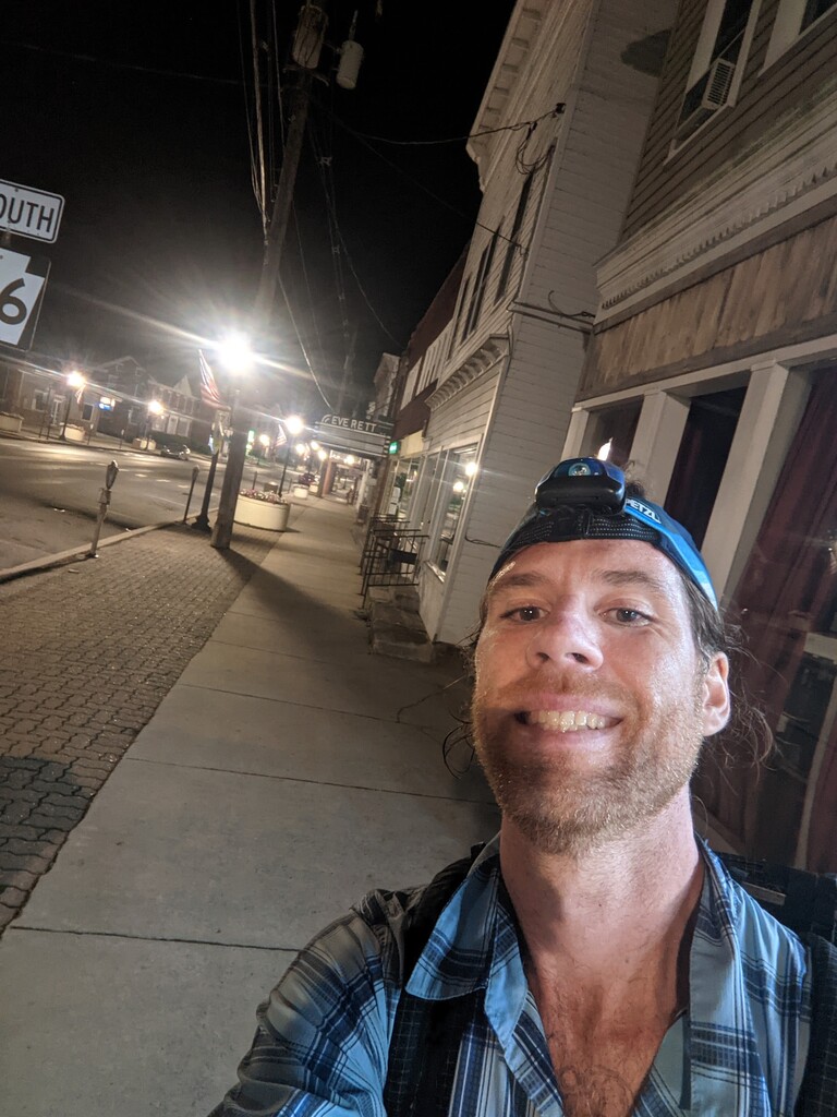
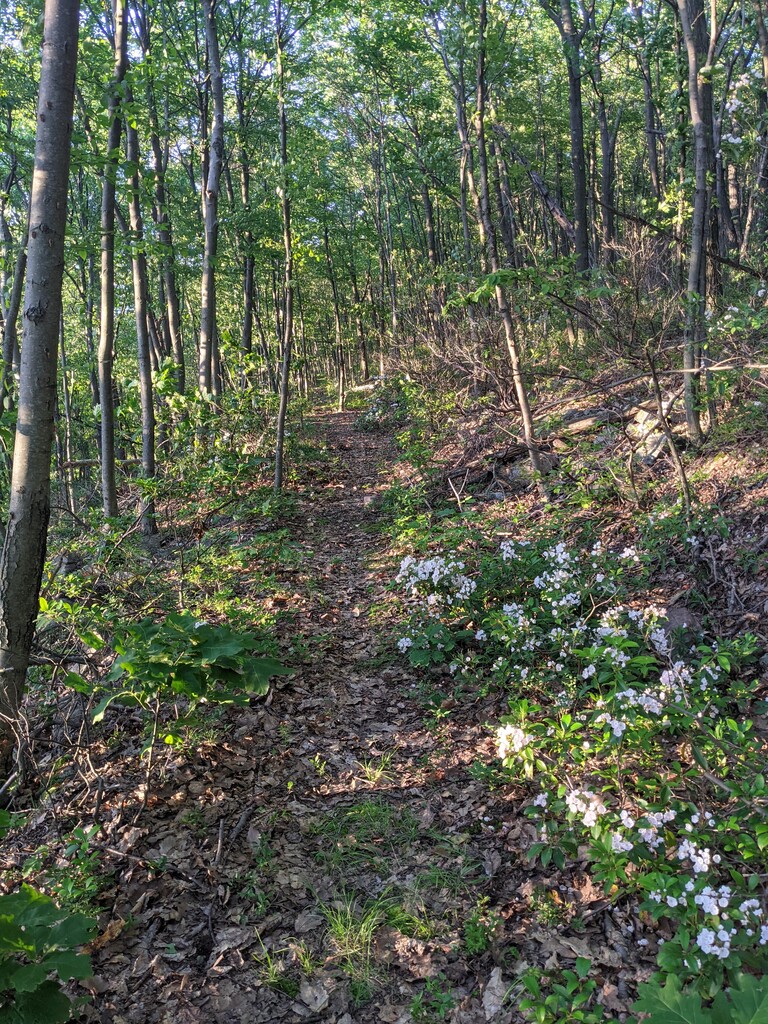
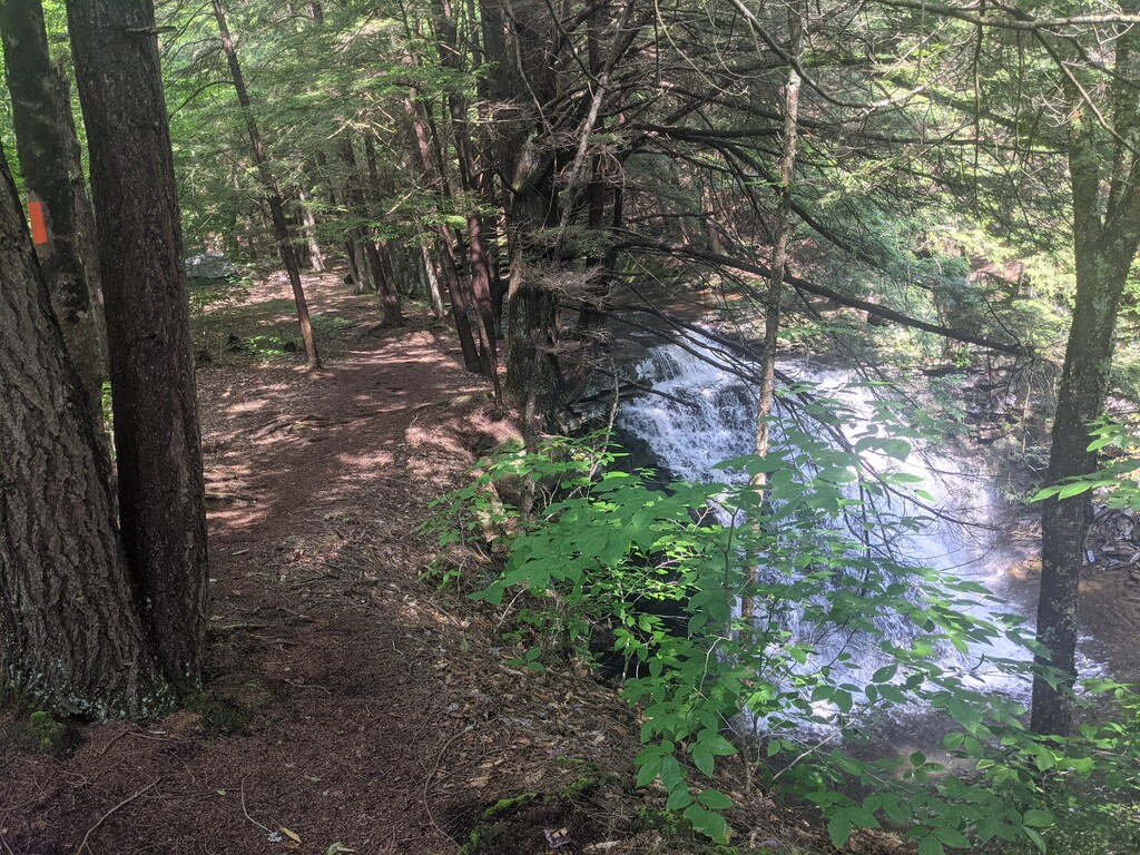
Segment 1 / Start of the FKT - Miles Hiked 34.16 - Hours Hiking 13:17 - I began walking at exactly 12:00:00pm on Monday, June 14th. I decided on a late start because I knew I would only be hiking 35 miles the first day and final day due to the limitations of legal camping. My goal was to beat the unofficial self-supported FKT of 8 days 3 hours. My plan was to start hiking at 2am the final day which would allow me to beat the time by 1 hour. Little did I know how much this plan would change. I was familiar with the first section through Buchanan State Forest as I had hiked parts of it before. It was rather uneventful but pleasant walking. I soon began to realize that the cicadas would be unrelenting with their buzz for the next few days. They would occasionally fly into my face, latch onto my clothing and go down my shirt. They were everywhere. I left the State Forest and began hiking out of Rainsburg Gap into State Gamelands 97. As I reached the ridge it began to rain for about an hour. The rain made ridge walking along the rocks extremely difficult and the briars were tearing at my legs. Luckily I was prepared for this by previous FKT holder Eric Kosek’s advice, so I wore long pants and my Dyneema rain kilt. The briars still managed to scratch me through my pants and my hands and arms occasionally. I finally descended into Everett, PA around 1:15am where I spent the night at the shelter in Tenley Park.
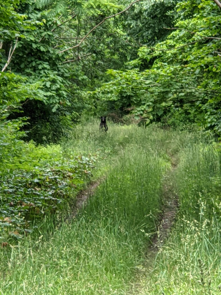
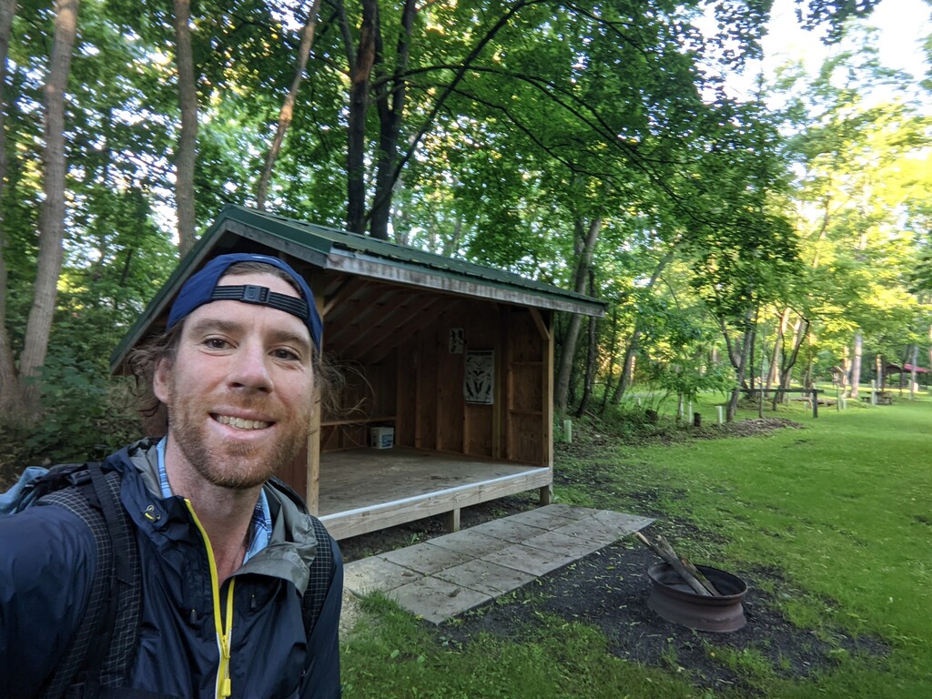
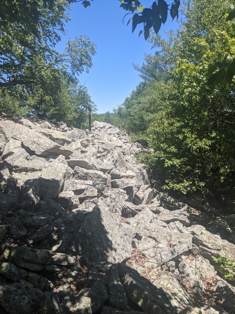
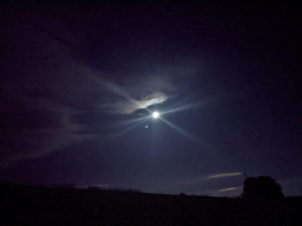
Segment 2 - Miles Hiked 51.17 - Hours Hiked - 20:05 - Hours slept previous night 3 - Left Tenley Park at 5:30am and easy hiking/road walking for the first 5 miles. I reached a dairy farm that the trail travels through. I said good morning to the farmer's wife and to the farmer who were getting ready for the day. The farmer asked me where I was headed to and I replied “Williamsburg”. He looked at me puzzled. I said “It’s about 40 miles North of here. He laughed and said “Two, three days to get there. Lots of ups and downs.” I grinned back and said “nope, I’ll be there tonight. You have a beautiful farm. Have a wonderful day!” and headed 1100’ up the mountain. More rocky ridge walking and briars for about 6 miles, down to Loysburg gap and then back up to the ridge. I don’t really enjoy this type of hiking because I have to remain focused the entire time in order to prevent an ankle roll. If I’m hiking big miles I much prefer to ‘zone out’ and just walk without thinking. The hiking was a bit easier as it descended to forest roads and off the ridge. I encountered my first bear of the trip on a forest road where it investigated me above the tall grass while standing on its hind legs. The bear was standing about 50 yards away. The underbrush was thick on either side of the trail so I knew there was no way around. I smacked my trekking poles and growled “Hey bear!” but it just stood there. Finally, after about 5 minutes it just wandered off into the woods. I hurried past, not able to see where it had gone, but hoping it was far enough away I didn’t feel threatening. I went back up to the ridge right as the sun was setting. Ridge walking along slippery, angled rocks in the dark was not very enjoyable. Around mile 35 I also noticed my left knee was starting to experience a very sharp pain with every step. It was a pain I’ve never experienced before but would last for the remainder of the trip. I can only assume it was related to my IT band as I also felt tightness in my left hip. I would constantly stretch the IT band and roll it with my trekking pole for the next 5 days. I finally reached a power line swath and the trail on the other side turned to a forest road. I was incredibly relieved. I then reached a paved road and realized the trail followed this for the next 5 miles. I’m normally not very fond of road walking, but at mile 40 after many miles of slippery ridge walking through briars, it was welcomed. The moon and stars were striking as I walked past farm fields. A skunk scurried across the road in front of me while on the outskirts of Williamsburg. I followed the rail trail to Mt Etna Station Shelter while eating my “dinner”, a cold soaked backpacking meal. What I assume was a flying squirrel flew over my head and landed on a tree. I was stunned at first and thought I may have been hallucinating, but I followed the squirrel along the branch with my headlamp and it was certainly real. I believe it was also carrying a baby squirrel in its mouth. Arrived at 1:30am, blew up my uberlite sleeping pad and quickly passed out in the shelter.
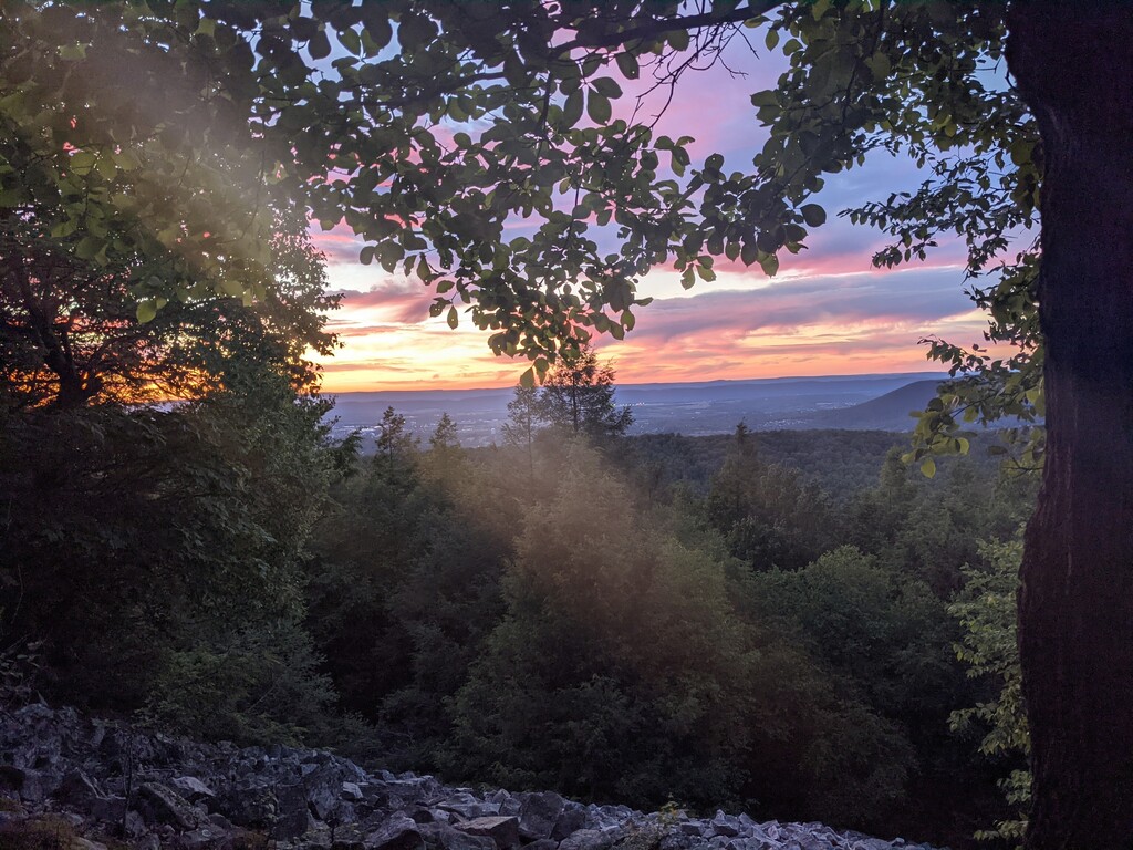
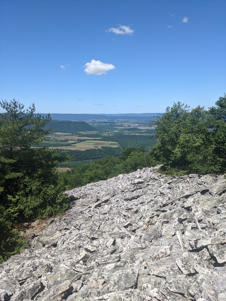
Segment 3 - Miles Hiked - 36.48 - Hours Hiked - 16.5 - Previous night hours slept 4 - Began hiking at 6:45am, again on the rail trail. Entered Rothrock State forest and ascended to yet another ridge. The next 15 miles were along Tussey Mountain and by far the most difficult section of the trail in my opinion. I’m normally able to average ~3 mph on typical PA trails but this 15 mile section took me over 8 hours. The rock hopping drastically slowed my pace and there was little water so I had to ration myself with the 1 liter I carried up the mountain. I finally reached a stagnant spring but was still happy to hydrate. Along the ridge, I encountered my 2nd bear. I saw it from about 50 yards away and shouted at it, clapping my poles. It quickly ran off the ridge. About 2 miles later I rounded a corner blinded by a pine tree and within no less than 20 yards I stumbled upon two more bears, one of which was the largest I’ve ever seen in the wild. It must have been at least 300lbs if not more. Fortunately they heard me before I saw them and were both running in the opposite direction. The larger bear immediately ran off the ridge but the smaller one (I assume an offspring) kept running North on the trail. I continued smacking my poles and growling at it. After about 400 yards it ran off the ridge as well. About 5 miles later it struck me how drastically different the outcome of that encounter could have been if the giant bear took aggressive action instead of being evasive. I eventually reached Jo-Hays vista and was relieved to be finished with the section. There was also a sign with distances to MD and NY, I realized I was at the 1/3 mark of the trail. Dropped off the ridge and into the forest for easier walking. Unfortunately it was dark when I walked past Bear Meadows Natural Area as I wanted to see this section of trail. I’ll be back for a return trip for sure. Camped in my tent for the first time of the FKT at a beautiful campsite under pines just outside Big Flat Laurel Natural Area. I was hoping to make it further this day but the rock hopping had really exhausted me physically and metnally. Arrived around 11:15pm
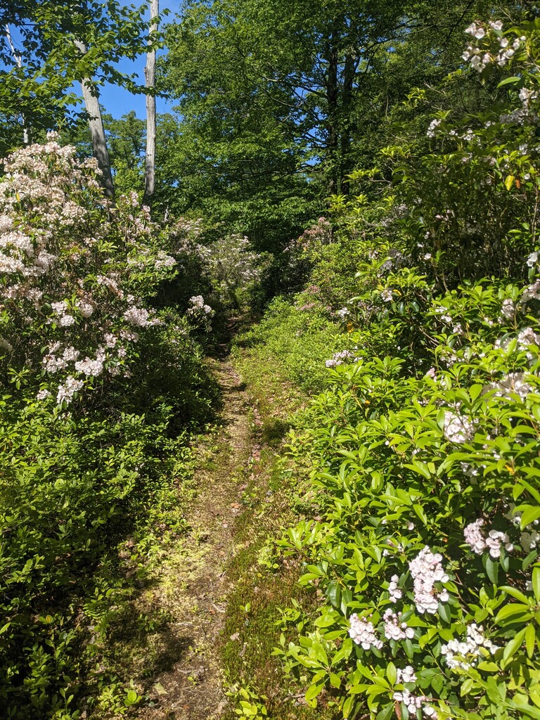
Segment 4: Miles hiked 39.68 - Hours hiked - 16:26 - Hours Slept previous night 5 - Left camp at 5:45am and enjoyed forest walking for many miles. I slowly began to notice the toe next to my pinky toe on my right foot was starting to experience a burning feeling in the nail. The severity slowly increased to the point where it was extremely uncomfortable to walk. I discovered that my nail was extremely tender and with every step the crease of my trail runner was pressing on the nail causing more pain. The nail itself also appeared loose. The previous days rock hopping most likely contributed to it. All in, I spent at least 2 hours stopping to tend to the toe. I used Leuko tape to tape moleskin to the nail, applied anti-friction cream, changed socks, removed my Injinji Toe Sock liners. I finally discovered that my middle toe was pressing against the injured toe so I tightly taped the injured toe to my pinky toe and this mildly resolved the issue. The pain was so tremendous I didn’t know if I would be able to withstand it for another 4 days. This was definitely the low point of my trip as I was starting to feel devastated that the entire journey might be derailed by a toe nail. I decided to press on into Bald Eagle State Forest as this is one of my favorite places in all of PA. I’ve spent a lot of time fly fishing in Penn’s Creek and am very familiar with the area. I decided I’d at least suffer until the next day and then decide how to proceed from there. As soon as I entered the forest the trail became much less rocky and I was able to make excellent time. After 13 quick miles I reached Poe Valley State Park and then Poe Paddy State Park. The easy walking without rocks provide some relief for my toe and it started to feel much better. I reached camp at Bear Gap Trail at 11pm.
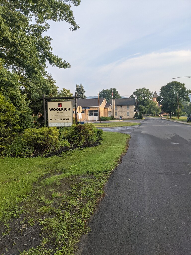
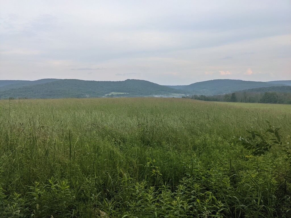
Segment 5 - Miles hiked 49.29 - hours hiked 20:23 - Hours slept 5.5 - I woke up, immediately pressing my injured toe and was pleasantly surprised that it had improved significantly while I slept. I started walking and was elated that the pain appeared to have subsided. It was a gorgeous day and I was happy to be walking in the woods. I walked past RB Winter State Park and paused momentarily to admire the beautiful lake, daydreaming of swimming in the cool water. Reality kicked in and I continued to walk, passing the first out of only three hikers I would meet on the trail. We chatted briefly, I explained what I was attempting and I continued on passing the halfway sign shortly after. At this point I decided to start planning the finish of the trail. I had originally told my wife I would meet her either Monday evening (fast pace, 7 days 12 hours) or Tuesday afternoon (slower pace, 8 days 2 hours). I started thinking about a blog post by Joe 'Stringbean' McConaughy and his recent Long Trail FKT. This post was extremely helpful regarding sleep strategy as well as food strategy. He mentioned he received advice from Heather ‘Anish’ Anderson to take 2 hour ‘dirt naps’. If you only sleep for 2 hours the body still experiences a full sleep cycle and is tricked into feeling like you got more sleep than you really did. I was thinking if I could make it to Sand Run Falls campsite by 8pm on Sunday (mile 279), I could sleep for 2 hours, wake up at 11pm and hike 48 miles straight to the finish arriving around 6pm Monday. As the day went on, I started to think more and more about splitting the miles in segment 5, 6 & 7, arriving at the Wimbrough Campsite (mile 292) at 8:30pm and going with the 2 hour sleep plan. This would allow me to break the 7 day mark. The thought of this really excited and motivated me. I finally decided that this was my new goal. Although I slept for 5.5 hours the night before, 20 straight hours of walking took its toll and I was starting to experience sleep deprivation. I barely remember any of the trail between Ravensburg State Park and Woolrich. Although I do recall walking along the Susquehanna River next to a farmers field, feeling exhausted, stopping, bending over to put my hands on my knees, closed my eyes and I’m pretty sure I fell asleep for a minute or two standing up. I rolled into Woolrich Shelter at 1:45am.
Segment 6 - Miles Hiked 45.44 - Hours Hiked - 18 - Hours slept previous night - 3.5 - Packed up and left the Woolrich Shelter at 6:45am. I knew I would need to make it 45 miles today and there would be an immense amount of elevation. However, I absolutely adore Tiadaghton State Forest and was excited to see parts of the forest I’ve never experienced before. Many ups and downs until Ramsey but relatively easy hiking. It was an extremely humid day and I was sweating profusely. No matter how much water I drank, I was always thirsty. The previous 5 days of hiking was catching up. I reached Ramsey and was familiar with the next 10 miles of trail so it made for quick moving. I met the 2nd and 3rd people hiking together that I’d see the entire length of the trail in this section. Passed through Little Pine State park and began the very steep ascent up to the plateau. Almost as soon as I reached the top it began to torrential downpour and thunder. I feel like this happens more times than not when I’m on top of a ridge. As soon as I got up on the plateau the trail really smoothed out and was in great condition. After about an hour the rain stopped and I gained a feeling of euphoria. I realized that the 31lb pack I started with was now “only” about 18lbs and I was actually able to run a bit with it. I made very quick pace and this was also my favorite section of trail. It felt extremely remote and wild. I eventually started night hiking and reached a forest management road with chest high grass. I followed this road for miles and was completely soaked and freezing from all of the rain. This was the most difficult night of hiking as my feet had been wet for about 9 hours at this point. Finally reached Ashworth Hollow campsite at 1am perched on a tiny flat area above the confluence of what sounded like two raging creeks.
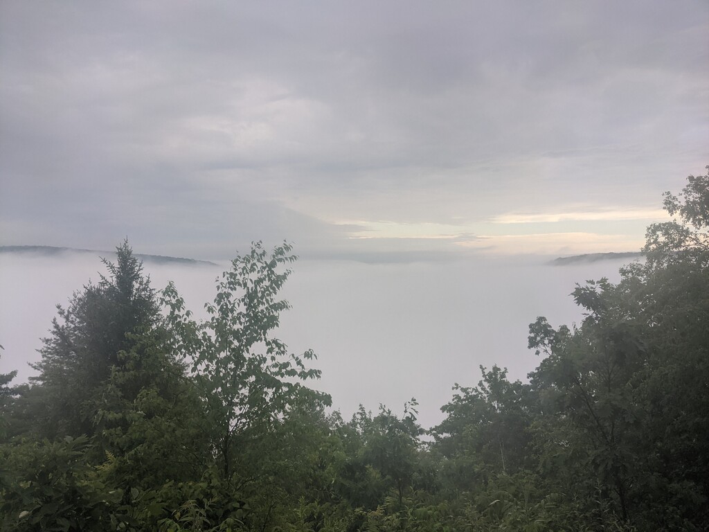
Segment 7 - Miles Hiked 41.44 - Hours Hiked - 15.5 - Hours slept previous night - 4 - I had originally set my alarm for 4:10am, hoping to leave by 4:30am. I realized I had snoozed my alarm without realizing, looked at my phone and it was 5:10am. I panicked, knowing that this was my last full day and I had to make it to camp that night by 8:30pm in order to get 2 hours of sleep for the final push. I jumped out of my tent, threw everything into my pack without organizing it like I typically do and left camp within 15 minutes of waking up. I reached Gillespie Point just as the sun was rising but unfortunately it was completely socked in by the clouds. Again, I’ll have to make a return trip. Two 1000’ climbs in the first 6 miles but the rest of the day was relatively flat. I was a bit anxious because the climbs had put me even further behind schedule. I began hiking along Stony Fork which was absolutely breathtaking with it’s chutes and slides. I reached Haunted Vista near the Anna Mine and a forest road. As I looked at the map I realized the MST followed a paved road for 6 miles through the town of Antrim, PA. I was elated as my pack was light enough to allow me to fully run so I could make up almost all the time I had lost oversleeping. While running through the town of Antrim a small dog began barking from inside a house. Suddenly a man opened the door and yelled “Hey! Where you headed?!” I replied “New York!” He offered me a soda or other beverage. Sadly I knew I was limited by my time and didn’t feel like explaining the intricacies of unsupported vs self-supported guidelines, so I thanked him graciously but declined. He smiled and told me I was about to enter “The best section of the entire trail, Nickel Run”. I waved, thanked him again for the offer of a soda and ran off. I jogged almost the entire 6 miles of road and most of the trail down Nickel Run, which was indeed beautiful. Passed Sand Run Falls (I will be back to camp at the falls) and finally out of the forest onto paved roads where I knew I’d be able to make up more time. I jogged the roads and entered private farmland. The week earlier I spoke with Eric Kosek, the original supported FKT holder asking for words of wisdom from his experience. He cautioned me of the tall grass on the private land sections “It was annoying, but you’ll be at the end so you won’t care”. I finally reached this section and was pleasantly surprised to see a yard wide mowed path through the field. I smiled and thought “Ha! It was mowed just for me!”. Little did I know there were at least a half dozen more fields not mowed that I would have to negotiate across with soaking wet (another hour long afternoon thunderstorm, just to ensure my feet stayed soaked) chest high grass. I reached the Wimbrough Campsite at 8:30pm. It was finally the first day I didn’t have to night hike. Quickly set up camp and was in my tent by 9pm, setting my alarm for 11:10pm, 2 hours later. I went to charge my headlamp as it had died the previous night while hiking and discovered my 2nd battery bank was out of power. Fortunately my phone had 98% and I had a backup Fenix flashlight that uses a single AAA battery, along with 2 additional batteries so I wasn’t terribly concerned.
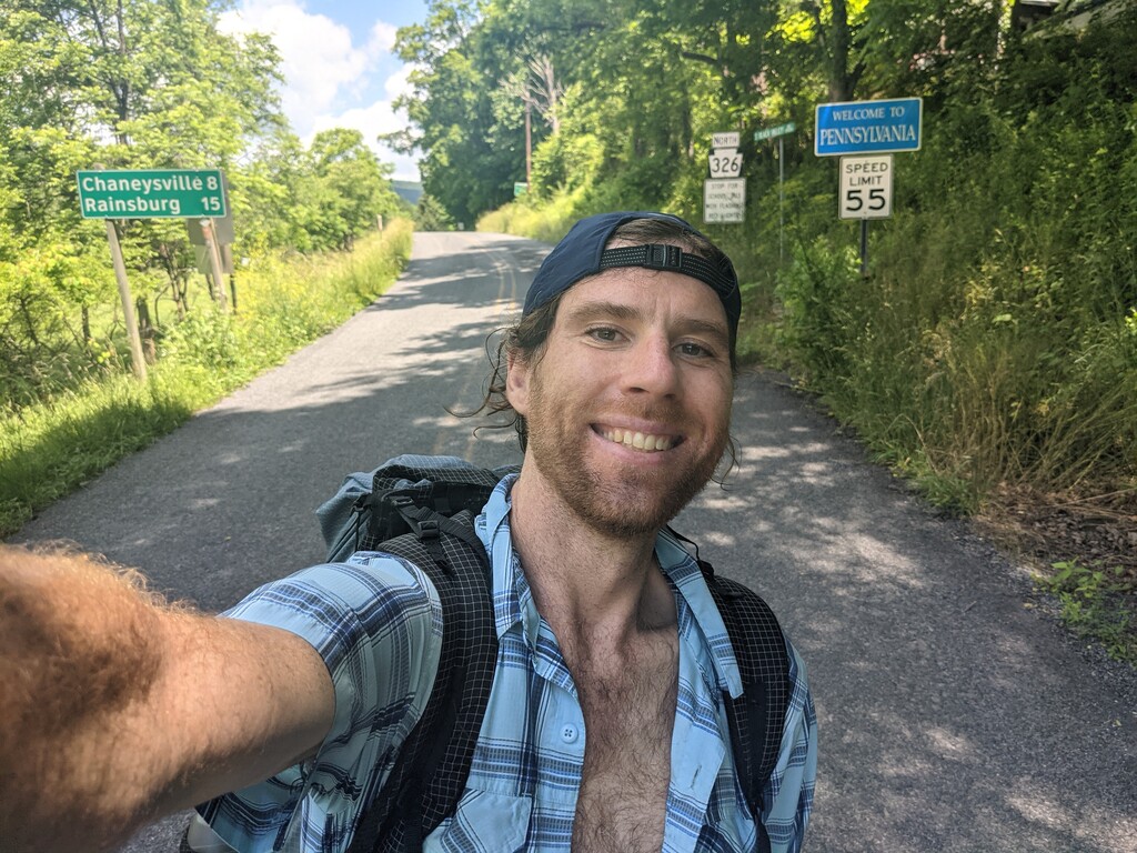
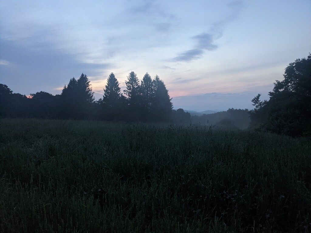
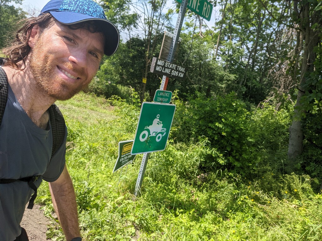
Segment 8 - Miles Hiked 35.4 - Hours Hiked - 11.5 - Hours slept -2 - Wimbrough Campsite is nestled in a slight valley at 1500’ between rolling farmland along a stream lined by trees. I was jolted awake by a flash of light that was quite startling. No more than 5 seconds later I was rocked by one of the loudest claps of thunder I’ve ever experienced. Another flash and clap a minute later, then the lightning started to become more frequent. I grabbed my phone and thought “Please don’t it be 11pm”. It was 10:55pm. My mind started to race. I knew the next 5 miles were across exposed farmland at 1500’ with very little blazing. Do I take the chance to cross them during a thunderstorm? I won’t be able to navigate with my phone if it’s downpouring. If I don’t leave at exactly 11:45pm my chances of completing the trail in sub-7 days are minimal. I lied there for about 15 minutes trying to decide what to do as rain poured down on my tent. I finally decided to turn off airplane mode on my phone and fortunately, I had one bar of service. I checked the weather and to my relief the thunderstorm was only about a mile wide and almost past me. I did notice there was a huge storm about 5 miles to my North and another just to my South. I decided to take the chance and see if I could make it the 5 miles before another storm popped up. I raced to pack my gear and set off on the trail at 11:50pm, 20 minutes after I had intended. Night hiking along the private land was extremely difficult as it was mostly open fields and not blazed very well. A bit after I crossed Route 6 and was about to ford a stream, the Fenix flashlight slowly got dimmer and dimmer and completely died. The battery was fully charged so I have no idea why it died so quickly. I grabbed the 2nd AAA from my pocket and put it in. The light flickered but immedietely went out. I couldn’t get the light to turn back on even after removing the battery and putting it back in multiple times. The batteries were a bit wet from the rain, so I assumed that was causing the issue. Everything was soaked so getting them dry was futile. I started to panic as it was 12:30am and wouldn’t be light for another 5 hours. I wasn’t convinced my phone battery would last for 12 hours if I used my flashlight for 4 hours. I was standing in the pitch black, in the middle of a field, at the edge of a stream, somewhere in Northern Pennsylvania all alone. I put in the third AAA battery and the flashlight stayed lit. I decided to not mess with it and began hiking as fast as possible to see how far I’d get before it died. I figured if I could at least get 3 hours I could use my phone for an hour and still have enough power to track myself to the finish. I don’t have a GPS watch, I use my phone to track via Strava and Garmin Inreach Mini as a backup. However, I knew I’d need my phone for navigation at the very end during road walking and more private land. I made it across a cow pasture, more fields. As I was walking across the vast fields I could see three dimensional thunderstorm clouds to the North and South backlit by the moonlight with lightning shooting straight up into the sky and down to the Earth. All across the field fireflies were flickering everywhere. It was an awesome sight and a moment I will never forget. Although I lost quite a bit of time dealing with the flashlight and navigating cow pastures with barbed wire fences and mud up to my knees, I made it through Hills Creek State Park and into State Gamelands 37. Everything went from being somewhat lit by the moon to pitch black of the forest. Hiking was much easier though as the trail was well defined and blazed. As soon as I reached the top of the Gamelands the trail turned into a management road and the sun began to rise. I started to run as I didn’t need my flashlight any longer and jogged most of the way down to Ives Run Recreation area. I continued to run on most of the roads and anywhere possible on the few trails that traversed private land. My toes and insides of my heels were completely blistered and raw by this point from essentially being wet all day for the past 6 days. I also knew I was going to lose at least 4 toenails in addition to my big nail I had already had removed as they were black and sore. Running was excruciating, but I knew I had to make up as much time as possible in case the trails around Cowanesque Lake were not well maintained. I kept checking my phone to see how much time I had left vs. how many miles left. I kept closing the gap and my goal was to be at 6 miles from the border by 10am. I knew the final 2 miles were road so I had a good chance of completing that in 30 minutes even if it was straight uphill. I reached the lake at mile 27.5 and was delighted to see the trails were grass and recently mowed (I’m eternally grateful for all the work you put into this trail Peter Fleszar. If you didn’t mow this the day prior, no way I would have finished in less than 7 days). I pushed myself to run as much as possible but was completely exhausted by this point. I also neglected to get water at the last natural source and hadn’t had any in at least 2 hours. The trail around the lake was extremely exposed and the sun was brutal. At the North side of the lake I finally crossed a stream and purified 1 liter of water. This gave me the final push to make it the last 3 miles. I checked my time and mileage and realized I had 90 minutes to complete the final 3 miles, I would definitely make it under 7 days. I was elated. I continued to run the next mile and the first section of the road until it began to go steeply uphill. I walked the rest of the way and reached the NY state border at 11:39:16am on Monday, June 21st. My wife was en route from Philly with my 2 year old daughter and was about an hour away. I called her to let her know I had done it. I hung up the phone, dropped my pack, took off my shoes and socks and lied on the side of the road against my pack until she picked me up. One nice stranger driving by asked me if I was alright. I smiled and gave him the thumbs up.
Comments
Congrats on your feat. Speedy recovery to your feet. ✌️
Awesome Bob! I enjoyed reading your MST journey report.