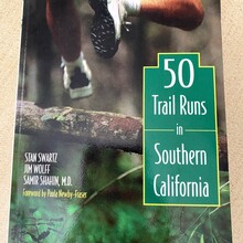
This loop is pretty much straight forward. As described in the book from Stan Swartz, Jim Wolff and Samir Shahin, M.D. "50 Trail Runs in Southern California" it goes around Strawberry Peak using the following trails: Josephine Peak Road, Strawberry Spur Trail, Colby Canyon Trail, Strawberry Peak Trail, Barley Flats Truck Trail, Gabrielino Trail and the Nature Canteen Trail. The loop is about 16.5 miles long including 3.5 miles of fire road, a short section of paved road at the Switzer Picnic Area, and all the rest single lane trail with about 2,700 ft of elevation gain. There are 2 main parking lots that require the National Forest Pass: Red Box Picnic Area (Forest Rte 2N24, Palmdale, CA 93550) and in front of the Clear Creek Fire Station (701 Angeles Crest Hwy, Tujunga, CA 91042). Those are 2 recommended starting points. There is water access at the Red Box Picnic Area, and the Haramokngna American Indian Cultural Center located there sells passes on site for parking if you forgot yours.
There is a Strava segment for this loop (CW from Clear Creek). You need to beat the Strava times to get the FKT: https://www.strava.com/segments/23461834


Comments
On Strava, there's actually a segment for this loop, and Christophe is currently 149/154 of the finishers of it with the winner running it in under 2h. https://www.strava.com/segments/23461834.