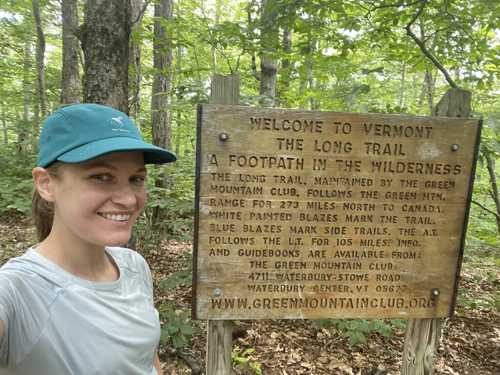


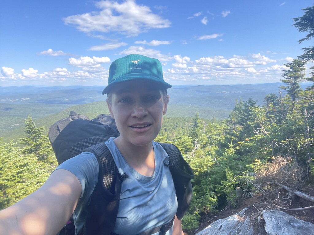

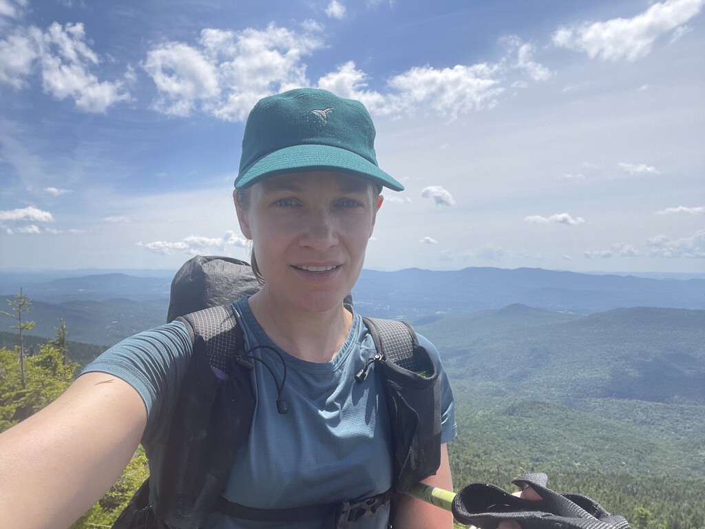


On Monday, July 11th at noon I began my third fastest known time attempt on the Long Trail. After my first two failed attempts I'm not going to lie- I felt silly and embarrassed for thinking of trying again. Like.. was there something wrong with me? Was I obsessed? Did I not know when to just let something go? Were my priorities screwed up? I had to have a better reason to be out there than trying to be the fastest, because that kind of misses the point of doing a thru-hike. Why did I come to Vermont? Well, I wanted to hike the Long Trail. I love being out there, I love the mountains, I love the adventure of it all. Starting a trail is like beginning the first chapter of a story. If you close the book before getting to the end, you'll never find out what happens. I often get in the mindset of "perfection or nothing", and the first two times were certainly imperfect, and I gave up very easily.
Initially this thru-hike wasn't planned to be an FKT attempt at all. After the first two experiences didn't end well, I wanted to just have fun, enjoy it, and put zero pressure on the outcome. I like to have goals and challenge myself still, so I starting jotting out a more conservative plan that seemed challenging but doable, that way I could enjoy the trail more, get a little more sleep every night, and not feel anxious, rushed, or stressed about meeting my own typically wild expectations. Instead of trying to squeeze every last ounce of energy out of myself every day, I'd stick to my planned daily stopping points. As I was writing my plan, when I got to day six, I scrolled up my Long Trail map, looking for a good place to stop around 35 miles for the day and landed on Bear Hollow Shelter. That's when it dawned on me... Bear Hollow Shelter is only 53.5 miles away from Canada. Last year in my supported attempt, I ran and hiked from the US/Canada border to the gate at West Settlement Road in a day, which is only a couple miles short of Bear Hollow Shelter. In my first self-supported attempt a couple weeks ago, I ran and hiked the 45.7 miles from the US/Canada border to Roundtop Shelter in even less time than it took me in my supported attempt. Holy crap! Theoretically, I could stick to this more "relaxed" plan all the way up until the last day, and if I felt good enough and wanted to try, knock out the final 53.5 miles in the last day and break the record.
See, this is when I wonder whether something is wrong with me, because even when planning to do something for fun, I can't help but get excited about all the possibilities of seeing how far or fast I could go. Maybe that is just my idea of fun at the end of the day. Still, I didn't want the pressure of calling it an FKT attempt. I was going on a thru-hike. I would relax, enjoy it, have fun, and just allow the journey to unfold. Of course being a premiere route you have to share your intentions ahead of time, and I wanted to keep the possibility of an FKT open, so I left a note on the Long Trail FKT message board, notified Fastest Known Time and shared my tracking info, texted my family and a few friends that I was heading back out to the trail, and that was that. No social media this time, no big declarations. I just wanted to do this for myself.
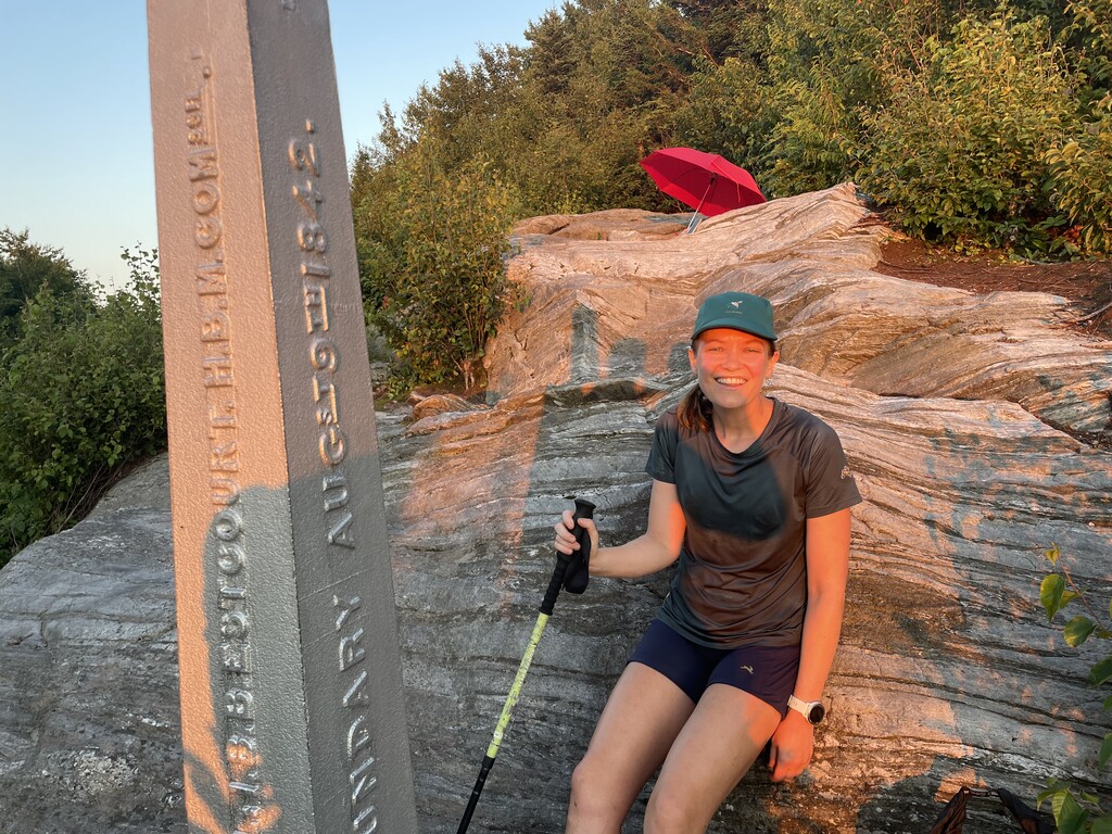
In another twist, this time I decided to start from the southern terminus and do a northbound hike. I started my previous attempts from the northern terminus, that way I could knock out the hardest sections first. Psychologically, however, I didn't want to go into this feeling like I was repeating history. You know, the definition of insanity and all of that (doing the same thing over and over again and expecting different results). I think there's also something to be said about easing in with the "less hard" part of the trail first, that way you can find your rhythm and give your body a chance to adjust to the task at hand. That being said, there is no one right way to do the trail, only what works best for you personally. I'm realizing this to be more and more true.
Day 1 - Monday 7/11/22
MA/VT State Line / Southern Terminus (0.0) to Goddard Shelter (24.1)
24.1 miles / 5,938 ft gain / 4,701 ft loss
3.1 mph
Start: 12:00pm
Finish: 7:51pm
Elapsed: 7h 51m
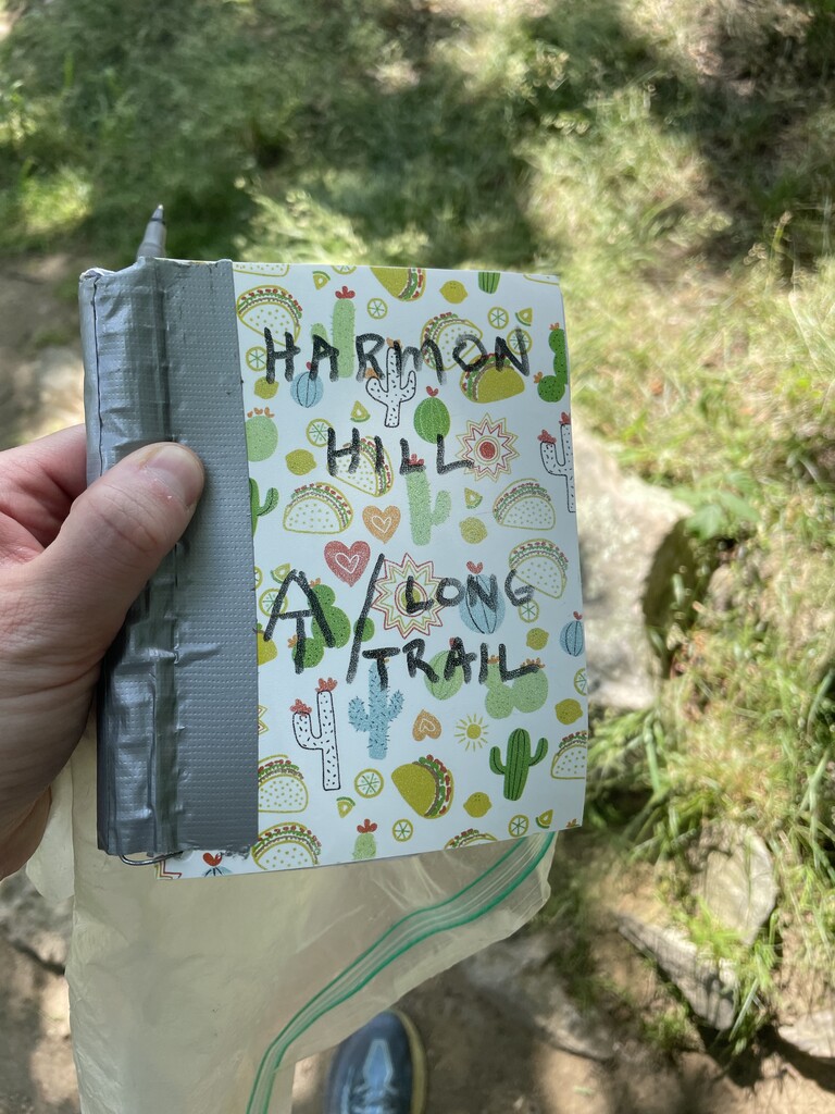
This was overall just a beautiful and enjoyable day. The sun was out with patchy clouds, the trail was lovely and runnable, and it was all just so very green whether it was in the dense foliage of the forest or the fern-filled meadow atop Harmon Hill. One mistake I had made in my second FKT attempt the week prior had been not eating enough and bonking hard on the second morning. So this time I planned my nutrition a lot better, measuring out exactly how many calories I'd need per day and then rounding up even more, and then separating my food into different ziplock bags for each day. I had to eat all of the food in the designated bag by the end of the day, as if it were my job.
I only came across several hikers on the trail that day (including Bud, a hiker I'd met on the Pinhoti Trail Alabama earlier this year who has literally been hiking north since- so funny we bumped into each other again), so it was shocking to arrive at Goddard Shelter to see the shelter packed and tents everywhere like a little tent city. It was clear I was smack dab in the Appalachian Trail "hiker bubble". Two very nice young women that were also thru-hiking the LT asked if I was looking for a place to pitch my tent and pointed me in the direction of a tiny little clearing in the woods. It was definitely on a slope, but I was tired and happy to plop down wherever. I did read that there were some nice tent sites just a quarter mile ahead at the summit of Glastenbury Mountain, but Karl Meltzer, my coach, had reminded me several times before I started specifically NOT to go farther than I'd planned, even if I felt awesome. So I stuck to my plan. I eagerly downed my breakfast burrito that I'd picked up from a grocery store in Williamstown and had been saving for the end of the day- wow, I didn't know cold eggs, cheese, and potatoes could taste so good. Like, I am still thinking about that burrito. I curled up on my slope, turned sideways toward the upward direction which seemed to hold me in place, and drifted off for a full night of sleep.
Day 2 - Tuesday 7/12/2022
Goddard Shelter (24.1) to Peru Peak Shelter (64.5)
40.4 miles / 8,153 ft gain / 8,605 ft loss
2.7 mph
Start: 4:51am
Finish: 7:50pm
Elapsed: 14h 59m
It was nice to start the day only needing my headlamp for about half an hour before clicking it off. The sky was getting light already as I passed by the old fire tower atop Glastenbury Mountain. I hadn't hiked this southern portion of the Appalachian Trail (which shares the LT for the first 105 miles) since my northbound record hike in 2020, and it was neat to retrace my steps and recognize bits and pieces of the trail throughout the day. I got to see parts of the trail in the daylight that I had only experienced in the darkness prior, like the ascent up Stratton Mountain. I found myself remembering really specific things, like "oh there's where I stopped to pee that one time!" and "ah this is where I spilled my guts to my pacer about all my worries and insecurities!"
There were storms in the forecast for that afternoon, so prior to the hike I had made a list of all of the shelters I'd pass by on the trail that day and how far apart they were from each other, just in case I needed somewhere to take cover. I heard the first rumblings of a storm a little before 2:30pm. I had just passed the side trail to Spruce Peak Shelter, but there was still a little bit of time (about an hour) before the storm would roll in according to my weather app, and I had over four miles to the next shelter. My heart started pounding and probably the hair on my arms started to go straight up but I decided to just go for it and RUN! I descended Spruce Peak, dashed across Vermont 11/30, and hustled up Bromley Mountain. Now, I realize going UP a mountain when a storm is coming is probably not the wisest thing, but the shelter was well before the peak and I really thought I could make it. The sky rapidly got really dark, lightning flashed, and almost instantaneously a big clap of thunder boomed right over me. I may have screamed. It began to rain, but then nearly as soon as it had started it stopped. The sky lightened up very quickly. Was it already over? I relaxed my stride, laughed, and continued on my merry way. Then a few minutes later, I heard some more rumblings of thunder and they were definitely getting closer and not farther away. I must have gotten a mini-prelude of what was to come with that first little storm, so I started dashing uphill again and thankfully saw the turnoff for Bromley Shelter. I took the side trail in, passed the privy and bear box, and there it was! There was just one other hiker there, he waved but didn't say anything as he had his earbuds in and was engaged with his phone. Probably two minutes later the heavens opened up and rain started dumping. Like heavy, thick sheets of rain. Wow, I was sure glad I had hustled to get there. I can deal with rain, but getting all my stuff wet and likely getting blisters on my feet would have been miserable!
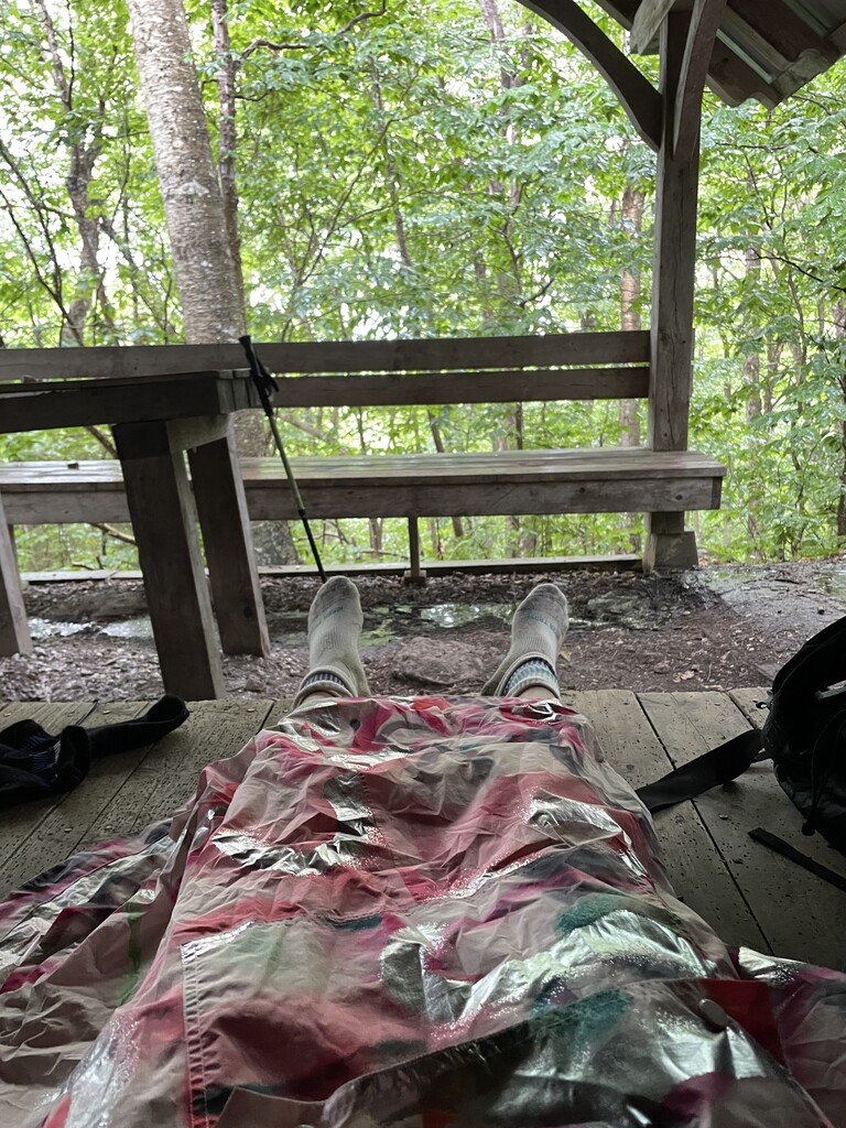
I laid out my foam pad, took my shoes off, put my poncho over my legs as a blanket, ate a snack, and just enjoyed watching and listening to the rain, very happy to be warm and dry. I was also very pleased with the progress I'd already made that day, partly thanks to running the last four miles. I only had 8.1 miles left to my destination for the day, Peru Peak Shelter, and it was only 4:00pm!
Around 4:30pm, after the rain had died down, I packed up my things, laced up my shoes, waved goodbye to my earbudded friend, and kept moving along. The final bit to the top of Bromley Mountain is a meadow ski slope. I turned around and gasped at the pretty view to the south, framed with wildflowers. After the last few bumps over Styles Peak and Peru Peak, I was rewarded with my final descent of the day to the Peru Peak Shelter. I peeked in and saw at least eight hikers packed in a row like sardines. That just didn't seem fun at all! A family pointed me in the direction of an available tentsite, where I set up camp. I took my time eating dinner (tuna wrapped in a tortilla plus a bag of Swedish fish.. a very fishy meal!), cleaning up, filling up my water bottle, and brushing my teeth. I felt relaxed and happy that the day had gone "swimmingly".
Tomorrow my plan was to get to US-4, where I had a hotel reservation and my first resupply box waiting for me at the Inn at Long Trail. According to their website, the pub closed at 8pm and I was feeling very motivated to get a hot meal (particularly they have an excellent BBQ pulled pork sandwich), a hot shower, and a comfortable bed to sleep in. I definitely had to get there before 8pm! So I set my alarm early, 3am, and got right to sleep.
Day 3 - Wednesday 7/13/2022
Peru Peak Shelter (64.5) to US-4 (104.5)
40.0 miles / 8,155 ft gain / 8,878 ft loss
2.7 mph
Start: 3:52am
Finish: 6:43pm
Elapsed: 14 hrs 51 min
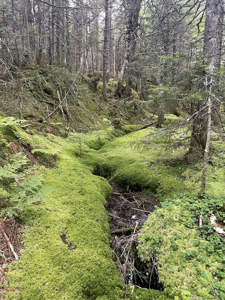
This day was tougher than expected. I felt pretty sleepy in the morning, even after taking some caffeinated Spring Energy gels and a caffeine pill. I was just tired from the previous two days. Thankfully, the trail was very chill for the first part of the day. It meandered along the Griffith Lake camping area, which has an amazing "highway" of bog boards. I remembered being ecstatic about those bog boards when I hiked the AT. My feet hurt horribly then, and it was such a relief not to have to watch out for rocks, roots, and mud; plus the wooden planks have a little bit of give and bounce to them. I can't think of enough great things to say about bog boards. Bog boards!
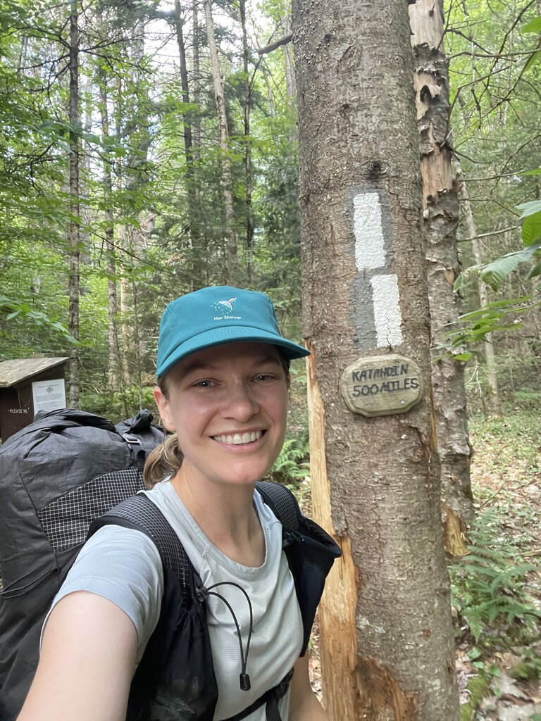
So despite feeling tired I was able to just cruise and take care of business for the first part of the day. I was excited to see the "Katahdin 500 miles" sign just after crossing Upper Cold River Road. I remember seeing that sign when hiking the AT and signing the register next to it with the message, "I can't believe I made it this far!" Very good vibes at this sign. Next came the section that just pummeled me: Killington! I loved Killington my first time passing through it, and I loved it this time too. It is magical up there. But, it would be by far the longest sustained climb of the hike so far, from Clarendon Gorge at 860' to where the trail skirts near the summit at 3,900'. Yowza.
This climb was a total haul and I felt dog-tired by the time I reached Cooper Lodge situated right near the peak. It would be no easy trip down either, with 6.3 miles and 2,000' of elevation loss to my destination at US-4. This was one of those moments where I had to remind myself, "You like it here, you enjoy this!" I admired the lush forest, the bright green moss, and took in yummy fresh earthy smells. Before my hike someone commented, "All that oxygen in the trees, that must be so good for you!" I supposed they were right.
Along the descent my feet started to hurt, again I think I was just really feeling the last couple days of hiking. I was ready to rest. I was happy to emerge at US-4 with plenty of time to spare before the pub closed. I walked across the street, touched the AT/LT sign to mark where I was leaving the trail, and sent a little message with my tracker that I was stopping. From there, I turned right and walked 0.8 miles up the road to Inn at Long Trail, the promised land of hot food, running water, and soft pillows.
I checked in, collected my hiker box that I'd dropped off a couple weeks prior (originally intended for my second southbound FKT attempt), and not wanting to get the bed dirty with my hiker stink, collapsed on the floor with a happy sigh of relief. Wanting to be efficient with my time, I called down to the pub to order some food ahead of time: the BBQ pulled pork sandwich I'd been dreaming about, a side of coleslaw, and a large caesar salad. While they prepared my food, I took a shower and scrubbed the crusty layers of dirt off of my skin the best I could. My feet were in great condition so far, and the only sore spots I had were my shoulders and collarbone from the straps of my pack. Pretty good!
I went downstairs to collect my food and brought it back to my room to eat in bed with my legs propped up on some pillows. I basically moaned in ecstasy as I ate every last bite of that delicious meal. Inn at Long Trail and McGrath's Irish Pub... you are the real MVP.
My original plan had been to wake up super early, like 2am, knowing the next planned stretch of the 40 miles to Cooley Glen Shelter would be challenging, and if I have to hike in the dark I prefer it to be in the morning opposed to at night. The Long Trail would soon separate from the AT and go into some more rugged/peaky wilderness areas. But gosh, it was so nice sleeping in a real bed and I wanted to take advantage of getting some good rest after the challenging climb and descent from Killington. So I set my alarm a little later, 3am, just to get a tad more sleep.
Day 4 - Thursday 7/14/2022
US-4 (104.5) to Emily Proctor Shelter (141.2)
36.7 miles / 9,810 ft gain / 7,762 loss
2.6 mph
Start: 4:36am
Finish: 6:38pm
Elapsed: 14h 02m
I took my time getting ready in the morning so I could reorganize my pack, separate my food into different bags for each day since that had been working really well so far, and simply relax and drink some coffee before starting. It's the little things! I checked out of the hotel around 4:20am and hiked back down the highway 0.8 miles to where I'd left off on the trail.
Wow, I felt amazing this morning. The big meal and restful night had given me a new sort of energy. The morning coffee probably had something to do with it too. I felt happy, bubbly, and just chatted it up with other hikers on the trail. I think I listened to music and a podcast for the first time since starting the trail. There were far fewer hikers now since the Long Trail had finally split off from the AT.
It also helped the trail was super nice single track and just cruised along for most of the 20 miles to Brandon Gap. The miles just flew by. I felt relaxed and not rushed, and even took a nice little lunch break at Sunrise Shelter, making myself a tuna and Laughing Cow cheddar cheese wrap.
I really enjoyed the ridgeline past Brandon Gap and the Horrid Cliffs. The trail felt relatively easygoing and rolling and the weather was generally pleasant. It was getting pretty warm, however, and my water was getting low, so I took a quick detour down the Sucker Brook Shelter side trail to collect some water at a stream (it was the tiniest trickle of water, I could barely fill half my bottle because of the angle!). I'm so glad I stopped though, because little did I know that was the last water I'd see for a looong time.
The trail then wound through some ski slopes. I heard an engine and weird clanging sounds and thought, "Hmm that's weird, I didn't think I'd be close to any roads for a while." I drew closer and closer to the sound, wondering what the heck it was, then I emerged from the forest onto a ski slope meadow and suddenly a huge construction vehicle was rumbling its way right across the LT just in front of me. It was totally bizarre and jarring to see live machinery out there in what was otherwise mostly a pure nature experience.
The Long Trail crossed over the same meadow several times as it zig-zagged down the slope, so I was literally following the vehicle downhill. On the last crossing, I had to pause for a second to figure out where the trail went. I waved hello to the construction worker, and he pointed across the meadow and said "The trail's that way!" Alright!
I popped out at the next road at Middlebury Gap and entered the Breadloaf Wilderness, where I'd planned to hike to the Cooley Glen Shelter to end my day. This section proved to be way more difficult than I'd remembered. On top of being a little more technical with lots of rocks, roots, dips, and turns, this section of trail seemed to be a little less maintained than some of the other sections of the LT. Or maybe there was a recent storm, as there were quite a few blown down trees. I made okay time through this section, but found myself really huffing and puffing and starting to feel frustrated by all the little obstacles and climbing up, down, and around all the trees. Since I was higher up in elevation, the forest was very dense and the trees had stout, unbending branches that were sometimes difficult to squeeze through. I found myself getting thirsty, and my water was getting low, so I whipped out my phone to check where the next water resources were. Well, unfortunately, the next stream at Boyce Shelter was totally dried up. I collected some water from a puddle and that would have to do.
My mood was starting to sour, so I paused and looked ahead on my map. My plan had been to go to Cooley Glen Shelter for a 42.9 mile day (plus the 0.8 mile early road walk). But the next day I had "only" planned a 34.4 mile day to the Duxbury Road Trailhead (though that was on purpose, knowing the trail would get more difficult). Oh! I really didn't have to go 42.9 miles. Really, I didn't have to do anything at all. This was my hike and I could do whatever I want. If I wanted to, I could end my day early in just a few miles at the Emily Proctor Shelter and just add on a little the next day. So that's what I decided to do. I felt weirdly guilty for deciding to end my day earlier than planned, but as I hiked on and I felt better about my decision as the next few miles continued to be frustrating and slow going with the continuous ups, downs, and blow downs. I reached the top of Breadloaf Mountain and had to laugh at how "crumb-y" I felt on a mountain named Breadloaf. I couldn't be upset though because my day was just about done and soon I'd be able to kick back, eat dinner, and relax.
I had seen absolutely zero hikers since collecting water at Sucker Brook, and wasn't surprised to find the shelter totally empty. Sweet! I hopped onto the platform and started unpacking my bag, recharging my electronics, cleaning up and changing, and assembling a turkey pepperoni and cheese wrap. Just then, two young hikers arrived at the shelter. Darn. Don't get me wrong, I don't own the shelter, they had every right to it too, but I had been anticipating a quiet night alone. Oh well! The hikers were perfectly nice and polite, though they decided to make a campfire at the pit right in front of the shelter, and the wind blew all of the smoke right into the shelter as I was trying to go to sleep. I could have easily gotten up and just set up my tent somewhere close by, but I didn't feel like it. I also started to regret stopping early, as I could have made it to Cooley Glen with plenty of daylight still, and I might have gotten better rest there. But I had literally made my bed and was going to lie in it, darn it! I told myself to stop being a grump and curmudgeon. These boys had just graduated high school two years prior, which meant they were seniors during the first pandemic spring, which had to have really sucked. They told me how they'd thru-hiked the Long Trail upon graduating, which I thought was pretty cool as there are all kinds of things they could have done with their summer, and they chose to do that.
So, I didn't fall asleep as early as I would have liked, but I reminded myself that I was out there for fun and doing a really a cool thing, and that was enough.
Day 5 - Friday 7/15/2022
Emily Proctor Shelter (141.2) to Duxbury Road Trailhead (181.9)
40.7 miles / 11,276 ft gain / 12,869 ft loss
2.3 mph
Start: 2:50am
Finish: 8:29pm
Elapsed: 17h 39m
Since I had stopped so early the night prior, I got an early start the next day to give myself enough time to get to my next destination, the Duxbury Road Trailhead past Camel's Hump. Prior to starting the trail, I parked my car there with my next resupply box inside, plus I could just sleep in it and not have to make camp! I reached out to Fastest Known Time ahead of time to make sure "caching" my car fell within the self-supported guidelines, and they said yes! So similar to reaching the Long Trail Inn before the pub closed on night three, I was very motivated to reach that trailhead on night five.
Getting ready in the morning was extremely frustrating and slow going, by my own fault. Conscious of the two boys in the shelter and not wanting to wake them up, I got ready as quietly as I could (which probably still wasn't very quiet), and changed and packed up my stuff in all the wrong order and just stuffing things wherever using my headlamp as little as possible. The moon was shining brightly, so I could actually see pretty well without it. Honestly if I had just not worried about making noise and used my headlamp, I would have gotten out of there way sooner even if it meant being annoying to the boys for 20-30 minutes in the middle of the night. Oh well!
As I made my way down the trail toward the next shelter, I no longer regretted stopping early the night before, as the miles continued to be difficult and slow going. It was better to do it on rested legs at the beginning of the day, rather than tired legs at the end of the day. I paused to click off my headlamp and admire the view from a clearing, the silhouettes of mountains illuminated all around me by the moonlight.
I found myself feeling very annoyed knowing that all the stuff in my pack was disorganized, to a point I couldn't focus on hiking. I also didn't do much to "get ready" in the morning like brush my teeth or put on sunscreen like I usually do, which felt bothersome. Going through the very brushy wilderness I also just felt like I had bugs and cobwebs and dirt all over me and just felt gross. As soon as it got light out, I threw down my pack and took maybe 10-15 minutes to completely reorganize everything, put all the food I needed in the front pouches of my pack for easy access, wiped down my face and neck and put on sunscreen, ate a gel, brushed my teeth, and clap some dirt out of my shoes. Ahhhh. Way way better. Feeling "put together", clean-ish, organized, and ready for the day did wonders for me psychologically.
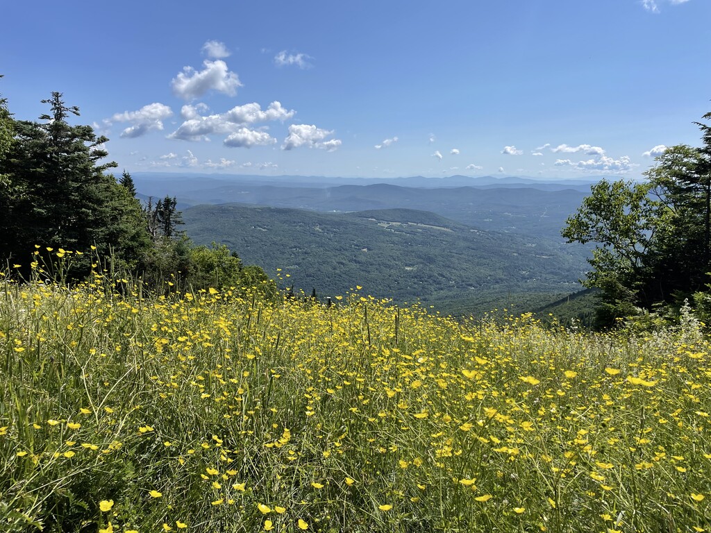
The trail started to descend to Lincoln Gap, and I could hear voices echoing down below. Civilization! Kind of. I mean it was just a road with a parking lot. It was fully light out at this point and I felt bouncy and energetic. I bounded up the trail from Lincoln Gap, feeling a little boost as I remembered really liking this section when I hiked it southbound the year before. I climbed to the top of Mt. Abraham, and turned around and gasped at the view behind me to the south. Look at all those mountains behind me! I climbed those and now I'm here! The trail crossed over and occasionally followed some ski slopes and meadows and I paused every so often to admire the wildflowers and butterflies.
The only downside was water being very scarce. It hadn't rained since the storm on Tuesday and the mountains were very very dried up. This was awesome in terms of the trails being dry and not muddy! Some of the ski lodges (basic cabins open to hikers) had some rainwater caches outside but I felt nervous about drinking from them. Anyone could dump anything in those caches and who knew what was in there? So I just conserved the water I had and prayed the streams past Appalachian Gap wouldn't be dried up.
Crossing Vermont Route 17 at Appalachian Gap was very exciting. It's where I'd given up on my supported attempt the year prior, now here I was five days into my northbound hike and entering familiar territory, as I'd done this next section plenty of times. I was out of water, so it made me a little nervous to leave the last road I'd see for eighteen miles, and eighteen tough miles at that. Thankfully I came across a flowing stream not long after. I drank my fill and filled up my bottle to the brim. Ahh!
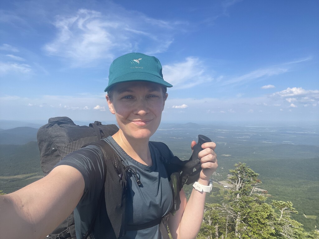
I caught a nice view of Camel's Hump at Molly Stark's Balcony then descended down to Birch Glen Lodge. I remembered from my practice hikes that the trail was pretty easy going from there Cowle's Cove Shelter, but then after that was tough, tough, tough. The thing is, you get rewarded greatly for all the tough climbs in this section with just beautiful views and open ledges. Burnt Rock was a delight to climb up and over. Next was Mount Ethan Allen with a great overlook to the east. Then came the mother of them all: Camel's Hump, an open and exposed rocky, climb-y 4,000 footer. I was something like thirty miles into my hike for the day, and this was a serious climb. A fair amount of day hikers were out and I got lots of compliments on doing a climb like that with my big pack, which made me feel good.
On the way up I heard my phone ding, so I paused and saw that I received a text message with some very good news, something that's been hanging over my head for a while. I let out a celebratory whoop and felt a weight being lifted off my shoulders. What amazing timing, having something in my "real life" working out as I hoped as I'm climbing up and over one of the most magnificent mountains on the Long Trail!
I paused at the summit to take a few photos then started the long, long, long descent down to the trailhead where my car would be waiting. Similar to how I felt on Killington day three, I felt ragged and exhausted and ready to be done. If it weren't for my resupply box, a "real" meal of packaged rice and beans, and a fuzzy blanket and pillow waiting for me at the Duxbury Trailhead, I surely would have called it a day at Bamforth Ridge Shelter on the way down.
But, I was motivated, so I just continued to chug water, take my electrolyte salt tabs, and keep eating (I was so sick of eating, it felt like a chore). It had been a long day and I felt proud of myself for how far I'd come. I'd continued my streak of not needing to click on my headlamp at night, which felt pretty neat. I sighed happily as I reached the trailhead, and let out an extra sigh of relief seeing that my car had not been broken into or vandalized, considering it had been sitting there since Sunday. I dove into the car, blasted the AC, cleaned myself up, charged up my electronics, mixed up my pre-packaged rice and beans in a big mixing bowl and plastic spoon, and felt happy as a clam.
Day 6 - Saturday 7/16/2022
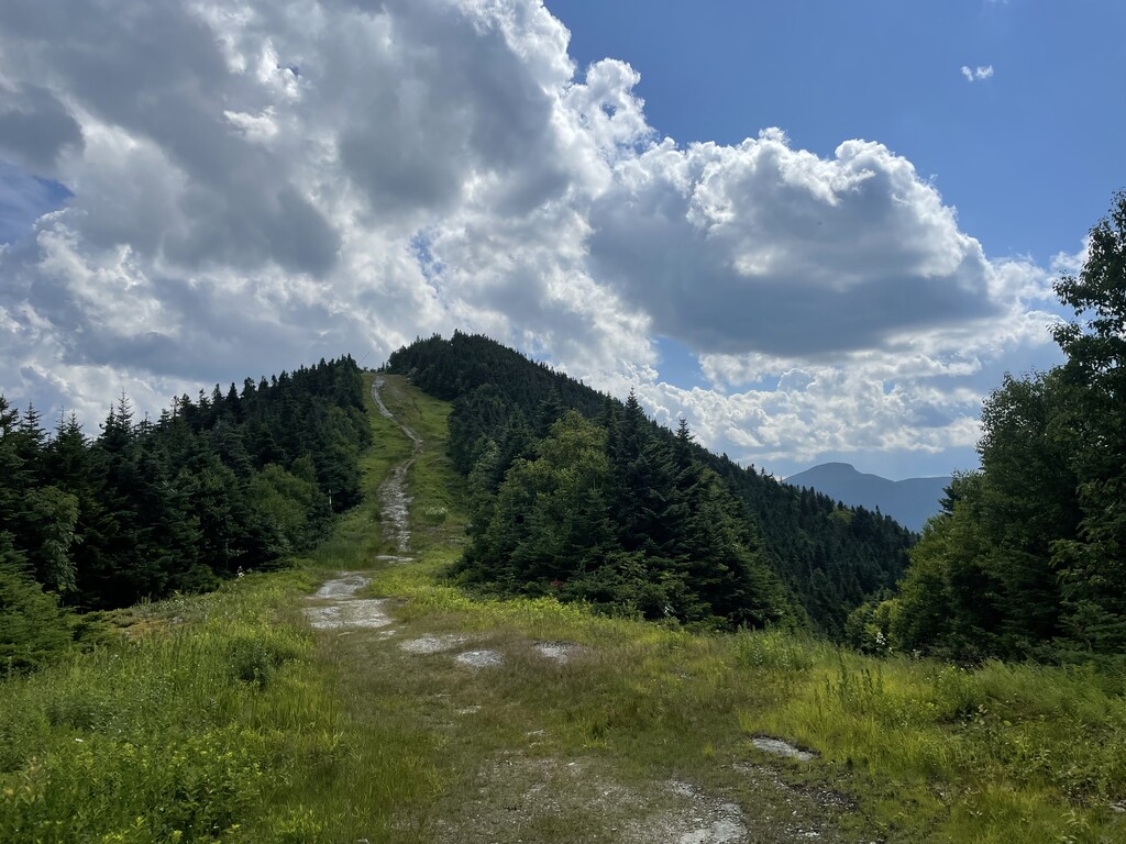
Duxbury Road Trailhead (181.9) to Bear Hollow Shelter (218.3)
36.4 miles / 11,263 ft gain / 10,079 ft loss
2.3 mph
Start: 3:04am
Finish: 6:38pm
Elapsed: 15h 34m
When I left the trailhead this morning, my pack was as heavy as it had ever been. I knew water would be scarce heading up Bolton Mountain, so I filled up an extra liter and stashed it in the main compartment. I also knew I was getting ready to face some of the most challenging miles yet over the next two days or more, and I would need to eat even more than I had been. I felt very aware of the time and how I spent every hour would count a little more in the next couple days. If I wanted to give myself a chance to do that last day push and achieve a record, I would need my second-to-last day to end early, to give myself a chance to sleep for at least a few hours before the long haul. All that being said, I didn't think I would actually do it. I had already moved on toward making some "B" and "C" goals. The time I would need to finish within for an FKT was 6 days, 11 hours, 33 minutes, the unsupported women's time set by Mikaela Osler last summer. Now, my hike was not unsupported like Mikaela's (where you carry everything you need with you from the start and accept zero help from others)–I went self-supported, which means I can cache things for myself, buy things along the way, stay at motels, beg for help from strangers; the main thing is being self-reliant and not having any pre-arranged help. However, in order for a self-supported FKT to be officially recognized by Fastest Known Time, I would have to beat Mikaela's unsupported time, considering the advantage of being self-supported. The actual women's self-supported record belongs to Jennifer Pharr Davis, set in 2007 with a time of 7 days, 15 hours, and 40 minutes. So in my head I had basically already thrown out the possibility of finishing in six and a half days knowing how hard the trail ahead of me would be, but thought things like, "How cool would it be to try and go under seven days? I could say I finished the long trail in under a week!" Or "How cool would it be to try and go after Jennifer's record?" She's a legend and awesome human being, and it would bring a great deal of personal satisfaction even if my hike didn't get accolades or recognition.
Anyway, while I was feeling aware of all of this, I didn't stress about it. I didn't feel attached to the FKT goal, because I didn't want to feel the crushing pressure that I'd put on myself on the past. I was here for myself, I was here to have fun, I was here to enjoy the Long Trail. At some point David Horton called me and asked how things were going, and if I was still on record pace. I responded, "Well technically, yes... but I would have to do the 88 miles from Duxbury in two days. And not just 88 miles but 88 really hard miles. So I don't know." He told me to just see how far I could go that day, and that's all I could do. He was with Steve Feller (New York Steve! he hiked with me on the AT and made an appearance in Jennifer Pharr Davis's book on her AT record), and he told me that he and Steve would still like me either way. I laughed and said thanks.
I very slowly made my way up the long ascent to the top of Bolton Mountain. Again, my pack just felt unbelievably heavy. I knew it wouldn't do any good to try and power through or rush, so I just took my time and accepted that the climbs today would be hard- but you know what? The more I ate and drank, the lighter my pack would get, so that was a motivating way to continue eating, drinking, and taking care of myself. I was glad to be knocking out the section between Bolton and Mansfield early in the day, as every time I've done it in the past has been hot and in the afternoon. It meanders and seems to go on forever. The Hellgate 100K has a "forever section" and on the Long Trail this is my personal "forever section". It dips down to some ponds somewhere in the middle and it gets kind of weedy, and for whatever reason I just hate it. Maybe it is blasphemous to say I hate part of this trail that I love, but considering I've felt that way in this section every time, it's just the truth!
It was Saturday, so there were lots of hikers out and about, and I even saw several trail runners. One woman in particular was moving very lightly and quickly. I had just started backtracking as I'd lost the trail for a second. I asked her, "Hey, I think I lost the trail, do you know which way it goes?" and she pointed down the direction from where I'd just come. Hmmm. I told her I wasn't so sure that was right, did she see a white blaze? She seemed to be in a hurry and clearly was not wanting to poke around with me and figure it, and on she went! A few days later, I read about a woman that set an FKT on the LT from Bolton to Mansfield that same day, so that must have been her- no wonder she was in a hurry! Then I felt like a doofus for holding her up. I found where I'd made the mistake and got back on track.
Getting out of the "forever section" was a huge giant relief. Now I had the huge giant ascent up Mansfield to look forward to, but similar to Camel's Hump it's one of those climbs where the effort pays in dividends with amazing views and just feeling like you're on top of the world. On the way up were some big boulders with treacherous drop-offs, ladder climbs, and sections where I definitely wanted to make sure I was hanging onto something. I had to remember to keep my weight forward, as my heavy pack made it easy to tip backward if I wasn't careful. Climbing Mansfield was the hardest I'd breathed the entire trip, to a point I got a nosebleed; surely cumulative from breathing in all the dusty, dry mountain air all week. Also, TMI (but whatever), I'd started my period that morning but hadn't thought to pack any feminine products so I was just bleeding everywhere. Cool cool! I guess another reason my pack was a bit heavier was that instead of taking a minimal amount of cleansing wipes in a sandwich bag, I just threw the entire package in my pack knowing I'd probably want it.
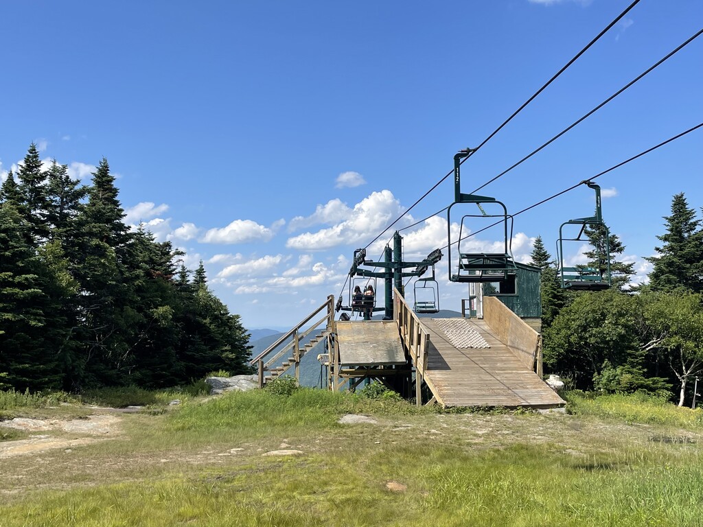
Heading northbound on Mansfield for the first time proved to be much harder than going south. Because even after you get to the southern summit, the Forehead, the trail continues upward until reaching the highest point of the Long Trail (and the highest point of Vermont!), the Chin. It was very crowded up there, as it was a Saturday, and there is easy access to the top via the toll road and ski lift. Tourists and day hikers everywhere! I weaved my way through the crowds as politely as possible, though I did have some impolite/selfish moments when I got impatient going down the other side of the Chin, and skipped on down some of the steep, technical bits, dancing around other hikers as they made their way up while hanging on for dear life. Forgive me, hikers!
The rest of the descent to Smuggler's Notch went by quickly. I felt energized and invigorated from Mansfield and actually excited for the next section. Smuggler's Notch was where I'd quit my self-supported attempt a couple weeks ago, where my dad had come and picked me up. I remembered just how physically depleted I felt then–it was awful–and I could just tell I felt so much better today. I knew I'd be okay for this next section. The next ascent was a long one, but never too steep or physically demanding (comparatively to Mansfield). I passed by Sterling Pond, where more day hikers and families were enjoying their Saturday afternoon. Madonna Peak (my favorite), a grassy ski slope, was filled with wildflowers and looking as beautiful as ever. Before disappearing back into the woods, I turned around and took in the view of Madonna sloping upward and Mansfield peeking out behind in the distance. I was moving!
Climbing up Sterling (Whiteface) was beastly, as usual, but it didn't bother me so much because it was the last tough climb of the day. After that, all I had to do was sail down to Bear Hollow Shelter on the other side. I briefly considered continuing past Bear Hollow Shelter as it was still very early in the evening (6:30) and I'd "only" gone 36 miles that day, and wouldn't it be nice to have fewer miles tomorrow? But wait... I'd stuck to my original plan this entire week (besides ending the fourth night a little early) and it had worked out spectacularly so far. I was feeling great, and it's probably because I wasn't maxing myself out every day as I'm usually prone to do. So I stopped.
Having learned my lesson from my experience at the Emily Proctor Shelter, even though there was only one other hiker at the shelter so far, I decided to set up my tent close by instead. That way I wouldn't have to worry about more hikers coming in later and disturbing my sleep (especially since I was turning in early), and I could get ready in the morning as quickly as possible without worrying so much about disturbing anyone else. I treated myself to my last real-ish meal, a packet of tuna in olive oil wrapped in a tortilla. I packed almost exclusively Spring Energy gels for the last 50 miles, knowing I'd want to be able to eat as efficiently as possible with the little time I had. I changed into my night clothes and laid out my gross sweaty shirt, sports bra, and bloody shorts out to dry, hoping the scent wouldn't attract bears (it didn't- maybe my hiker stench offset it). I was in bed by 7:15 or so and debated when to set my alarm. I had until 11:33pm the next day to hike 53.5 miles and break the record. I had to assume many of my miles would be 2mph if I bonked at all, plus there are just some tough climbs. Honestly it could take me 24 hours to get there depending on how I felt. So I set my alarm for 10:45pm and zonked out.
Day 7 - Sunday 7/17/2022
Bear Hollow Shelter (218.3) to Northern Terminus / Canadian Border (272.0)
53.5 miles* / 16,909 ft gain / 14,918 ft loss
2.6 mph
Start: 11:28pm (Saturday 7/16)
Finish: 8:12pm (Sunday 7/17)
Elapsed: 20h 43m
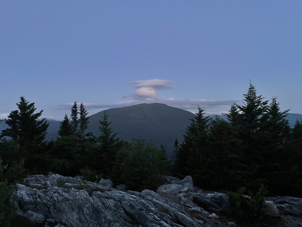
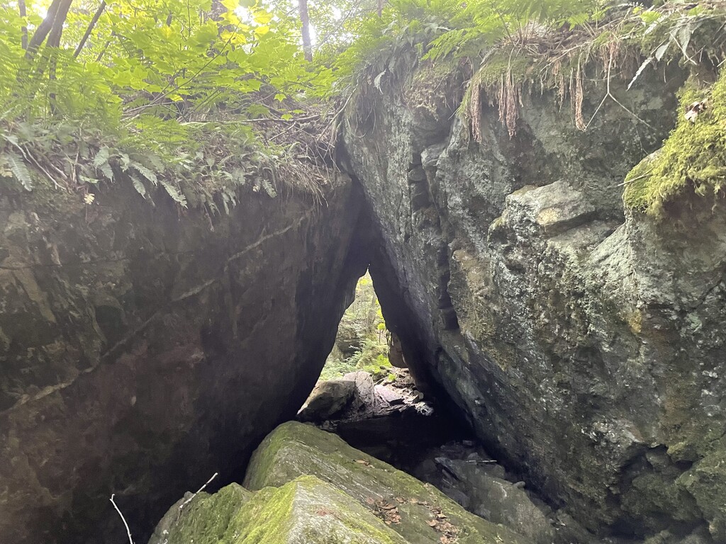
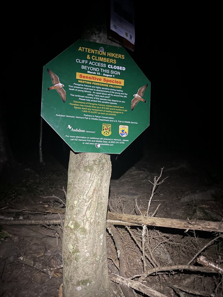
*I took the mandatory reroute around Prospect Rock to avoid disturbing nesting falcons (see photo). This cut off about a quarter mile from the regular route.
I woke up to my vibrating phone alarm, bzz-bzz-bzz-bzzzzzz. Bzz-bzz-bzz-bzzzzzz. I had chosen the "Beethoven's 5th" setting which always amuses me. It was surprisingly easy waking up. I was delighted that I had actually been able to fall asleep right away, as it usually takes a bit of tossing and turning before I can settle down, trail or off-trail. I took some time to tape my feet even though they were still looking and feeling pretty good to that point, as I didn't want to have to stop later in the day to fix any hot spots. I preemptively slathered on some anti-chafe cream on my thighs and butt, brushed my teeth, and did all my morning things. I wanted to feel really good starting the day. I put my dried out hiking clothes back on, packed up my tent, had a caffeinated gel, whispered goodbye to my friend in the shelter who I'd clearly woken up (ugh, sorry!) and she whispered, "Good luck and have fun!!" back to me.
I set off at 11:28pm. 24 hours and 5 minutes of time left to spend. I had this thought of how going for records/FKTs is just like being given an allowance; an allotment of dollars and cents. You're given a certain amount of time and it's up to you how you'd like to spend it. It's all about finding the right balance that works for you. Like those backyard ultras when you're given an hour, on the hour every hour, to complete four miles (okay 4.167 miles). You can take up that entire hour to complete four miles at a more leisurely pace, but then it means you have to go right into the next four miles with no rest. Or you could hustle and finish up the four miles very quickly and have more time to rest and take care of yourself, but possibly put more wear and tear on your body from the speedier pace. So, how do you spend your time?
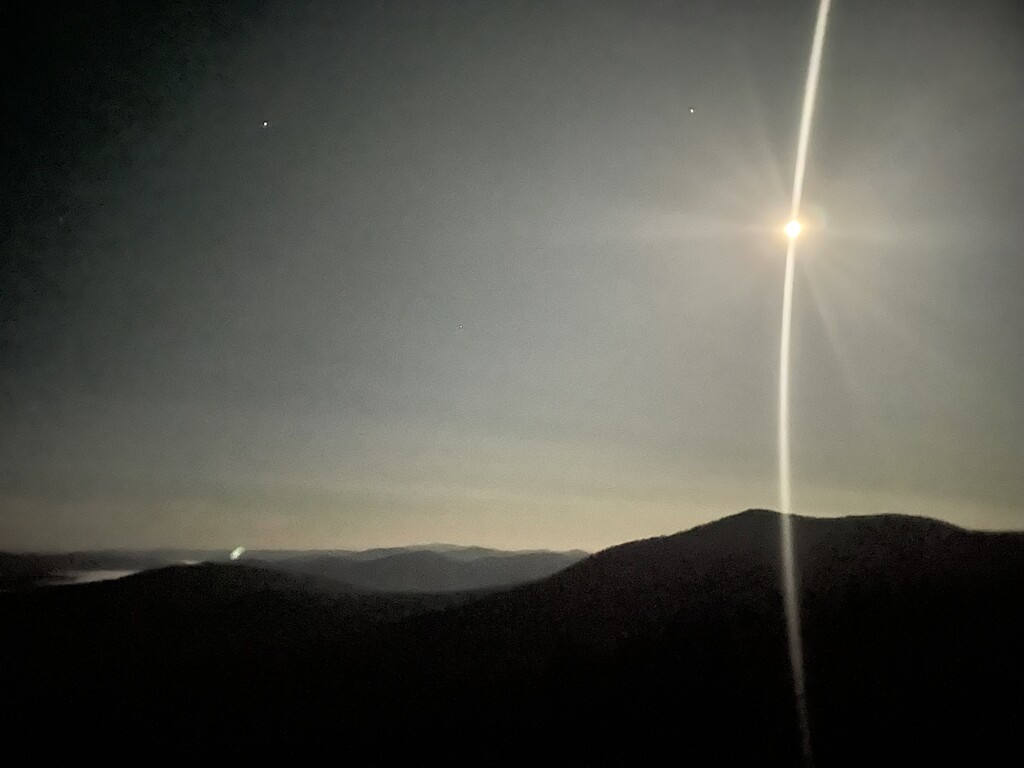
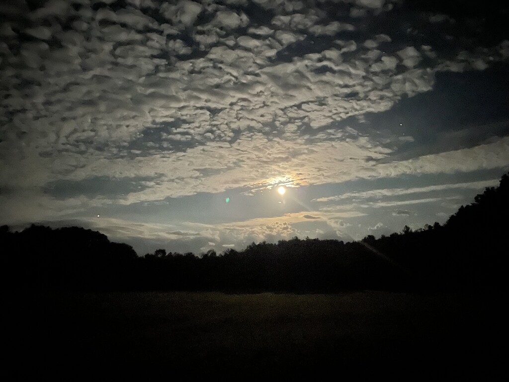
This was on my mind for the first few miles of the day, which were all downhill on a forest road. Super easy. I could go crush it down the hill, but I still had many miles to go beyond that, and how much was too much? So I held back and just tried to relax. These miles would be fast no matter if I ran or walked, so I walked. It was a peaceful way to start the day. Crossing a field in the Lamoille Valley, I paused to turn off my headlamp and admire the raging moonlight. Incredible! I honestly didn't need a headlamp but I also didn't want to mess up my last day doing something silly like rolling my ankle in the dark, so I clicked it back on.
Doing this section northbound so soon after I had done it southbound in my last attempt was a neat way of hitting the "rewind" button. Like going back in time and getting a redo. I gave a little fist pump as I went over Roundtop, where I'd ended my first night. 45.7 miles to go! And gosh, it was only 1:30am. After that I wound my way through the sugar bush, with skinny blue maple tubes criss-crossing all over the forest, back through Codding Hollow, and up to Laraway Lookout. At this point I felt like I knew the trail like the back of my hand.
The climb up Belvidere was hard, but I had received an encouraging text from Jeremy Howard (who has his eye on the unsupported FKT and knows the trail well) that really helped me to break it down mentally. "The section to Belvidere is friendly and then a nice easy climb over Jay and you’re home!" I had to wonder if he was being sarcastic when he said the climb over Jay was easy, but honestly it didn't matter. I just told myself it would be easy. Easy easy easy. I had already done the "friendly" section to Belvidere. Between there and Jay would be a lot of ups and downs, but a lot of nice little milestones in the form of mountains, hills, domes, and peaks. I told myself to just bag those peaks. We're peak bagging!
I didn't want to get my hopes up about how the day would go. I stuck to my 2mph pace prediction to be on the safe side. As in, every time I made it to another mountaintop, I'd check on my map how many miles were left to Canada, and divide it by two, and that's how many more hours it would take me to finish. My prediction stayed pretty steadily at 10pm, and I was definitely moving faster than 2mph anyway. I had until 11:33pm to finish. I was fine! I was literally doing it! But in the moment I didn't feel fine. It didn't seem like enough wiggle room, and what if something happened? What if I bonked? What if I couldn't do it? I started to feel extremely anxious and mentally crumble. When I feel this way, what always helps is looking at the facts. I tried to talk myself down by reviewing the facts. I had a little over 23 miles to go and 13 1/2 hours left to do it. I was making great time. I knew the trail well. I had covered that distance in a day before, I had pulled off 21-22 hour days before on the AT, in much worse physical condition. The facts just weren't helping me this time though. I couldn't think rationally and I couldn't stop freaking out. I didn't know what to do. I called my boyfriend Glenn as I was walking and told him what I was feeling, and that I was afraid I couldn't do it. His response was, "Why does it matter?" Huh. Not the response I expected. But I thought about it and replied, "Actually... it doesn't." It actually helped to think about it that way. Why was I letting this form of external validation hold so much power over me? What was I so fearful of? Glenn reminded me of how far I've come compared to the first two times, which was already a huge win. That helped. After that I called David Horton to update him on how things were going. I reviewed the facts over again with him, and he said "Good. You're doing it! Enjoy this moment. You have it." I didn't feel like I had it, and I was still freaking out a little bit, but it still helped to hear him say it.
I needed water, which had been scarce on the trail as usual, but I remembered from my last attempt there was a barely trickling stream at Hazen's Notch Camp. I turned down the side trail to get to the stream and what I found was just a few puddles, no flowing water. Ughhh. I dipped my bottle into one of the puddles and was able to fill it up about halfway and hoped for the best. After that I consulted with my map. Oh wow. Only three mountains before Jay Peak, and they were all in a row. Buchanan, Domey's Dome, Gilpin. I recited the names of the mountains to myself like Arya reciting her list of names in Game of Thrones. Buchanan. Domey's Dome. Gilpin. Jay. Buchanan. Domey's Dome. Gilpin. Jay.
The climbs were not as bad as I feared and I just knocked them out, one after another. My water was getting low again and I consulted my map and saw there were no great options coming up. Uh oh. It sounded like maybe there was a chance for water at Jay Camp, but it was a quarter mile off trail, and I really didn't want to add half a mile to my day if I didn't have to. I had over forty miles on my feet and they were starting to hurt, the pain surely exacerbated by getting dehydrated. Oh no, I thought, this is what will finally do me in. I knew it was too good to be true. Again I found myself starting to panic- what if I couldn't find water? What if I had to hike up Jay Peak in the heat of the day and bonked the same way I did a couple weeks ago? What if, what if, what if? I descended from Gilpin down toward the next road at Jay Pass. I crossed over a muddy, dried up stream and briefly considered trying to filter some water from a mud puddle, but it was reeeeally muddy. So I passed. Then maybe a few hundred meters later, I gasped when I heard the glorious sound of trickling water. Water! A tiny unmarked stream went right over the trail. I walked upstream a little bit and found the perfect place to sit on a rock and collect a steady trickle of clear water coming down off of some moss. I sat and drank for maybe ten minutes, knowing my body needed it. After filling my bottle to the top, I continued on my way. But standing up again made me realize that I must have some wounds forming on my heels, because they really hurt. I walked for a few minutes thinking, "Well if they haven't bothered me all day, why would they bother me now?" I had fewer than twelve miles to go. I walked a few more painful steps then decided, "Nope, I'm fixing this," and stopped once more. I sat down, took off my shoes and socks, and tended to my wounds. Some dirt had gotten down into my socks and had been rubbing on my heels all day, causing some nasty sores. Somehow the constant movement all day enabled me not to notice. I cleaned them up with an alcohol wipe and threw some bandaids on, then leuko tape on top of that to hold them in place.
I crossed Jay Pass and laughed when I saw someone had left a bunch of jugs of water as trail magic at the trailhead, after all that effort collecting water at the little stream. At least I would have been covered either way! And I'm glad I didn't attempt to drink that mud water earlier.
I reminded myself the climb up Jay Peak was "just an easy climb", as Jeremy said. It's not actually easy, but in a way it is very user-friendly, with built-in stone steps and not too many climby, rooty, laddery obstacles like some of the more rugged sections of the trail. I followed the white blazes painted on the rocks the best I could to the very top of the mountain, and got treated to the most spectacular view of the many, many mountains I had climbed. Wow. From there I had 9.7 miles to go. It was just a little past 4:00pm. I was doing it. I finally relaxed, and then I sat down for a few moments. I pulled out my phone and wrote a quick blurb on social media that I was nine miles away from potentially achieving a record, and here was my tracking info if anyone wanted to follow to the end. I took some videos and photos of the spectacular scenery. I chatted with some families that had walked up from the Jay Resort, who saw me with my pack and asked if I had hiked there. I said, "Yes, from Massachusetts!" to which they gasped, and then I said, "And if I can hike from here to Canada by 11:30pm, I'll set a new women's record!" They told me, "Well, you better get going!" And I said yes, they're probably right!
I had another gel then practically frolicked off of Jay Peak, down the ski slope, and into the woods again. Despite feeling energetic, hydrated, and fed, my feet were starting to scream at me. I had been moving for nearly 17 hours and they were just done. I took some Advil, but it didn't even seem to do anything. It was mainly the impact of landing on rocks going downhill that hurt the most. I was desperate for a softer surface. Then suddenly my foot slipped out from underneath me and I landed hard on the side of my leg and forearm, and let out a scream. That one hurt. I laid there for maybe half a second and popped back up and tried to just shake it off. I was okay, though days later I now have a very nice green and purple bruise on my forearm and down my thigh. Now I just had three baby mountains left. Doll Peak, Burnt Mountain, Carleton Mountain, home. Holy cow. I don't even remember going over Doll Peak, and before I knew it I was crossing the last road at North Jay Pass. From there it was 2.6 miles, 2.6 easy miles to the end. I brushed by some tall grass and pretty wildflowers before heading back into the woods.
The sun was beginning to set and it cast bright flaming orange rays of light throughout the darkening forest. I saw no hikers in this last section, I had the forest all to myself. I sang songs to myself as I walked to alert any animals out there to my presence. I didn't feel rushed, I felt calm and relaxed, and I allowed myself to think back on the whirlwind of all I experienced the past week. The first day seemed like such a long time ago. I felt so much gratitude for the gift of this time in the mountains and I just started saying "thank you, thank you, thank you" over and over again. The feeling of "rewinding" from my past experiences continued as I made my way north on this familiar section of trail for the very first time; I'd only ever taken it south. The forest was quiet and peaceful. I emerged at the outcropping where the pillar marking the US/Canada border and the northern terminus of the Long Trail stood. My friend Ted was waiting with his camera out (here is the video he took). All I could do was smile, laugh, and stumble down to the pillar. I reached out and touched it at 8:12pm, then immediately sat down to relieve my feet. The sunset was beautiful. I couldn't believe it. It didn't seem real.
Comments
For those interested, here are the daily Strava tracks:
Day 1 - https://www.strava.com/activities/7453988875
Day 2 - https://www.strava.com/activities/7466184113
Day 3 - https://www.strava.com/activities/7466184035
Day 4 - https://www.strava.com/activities/7470308173
Day 5 - https://www.strava.com/activities/7475532056
Day 6 - https://www.strava.com/activities/7480595987
Day 7 - https://www.strava.com/activities/7489429885
Video of the finish at the US/Canada border - https://youtube.com/shorts/LAGP5MvnkZk?feature=share
And slightly more finessed daily reports can be found at https://mercuryontherun.com.
:)
You smiled and laughed when you saw Ted? Girl, I was tearing up just reading about it!!!
What an adventure to read through. As someone who is aiming to run the LT this summer, you have admittedly given me a lot of great pro tips. I just love how full of love, and adventure, and acceptance you are- it glows through your writing. I like to think I’m similar, but I have a lot of room to grow in those areas. When I’m out there, I’ll definitely be channeling my inner Liz.
Also, I love how you are on first name bases with David Horton and Karl Metzler - wow!! Maybe someday I’ll be on a first name basis with Liz Derstine!