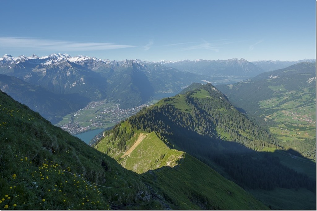
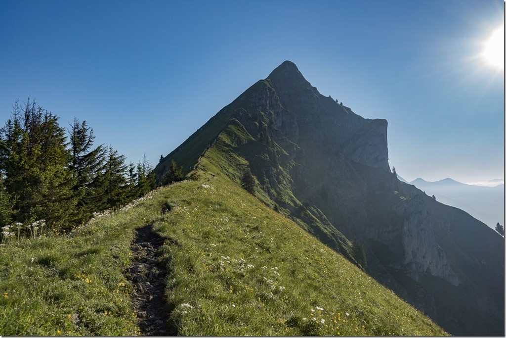
The pictures speak for themselves...this ridge is simply incredible!
The route starts at the Brünigpass rail station and ends at Interlaken Ost rail station. Typically Swiss, it is possible to travel to and from the start and finish by train. And the start and finish are clearly defined. From the Brünigpass there are various routes to the highest peak of the route, the Brienzer Rothorn. But the defined route is rather the fastest and most beautiful.
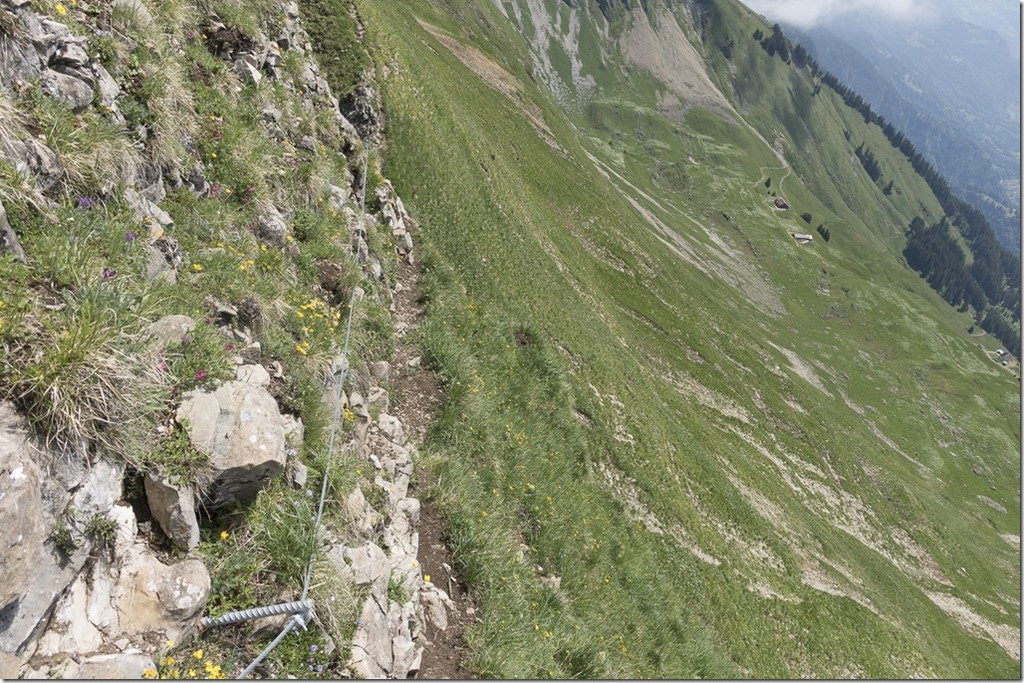
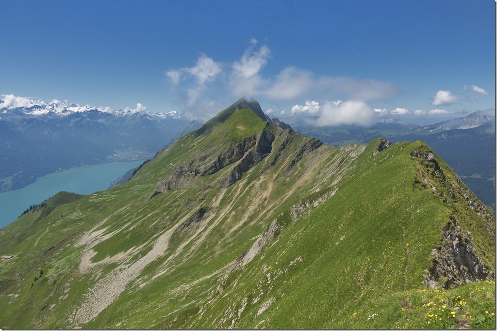
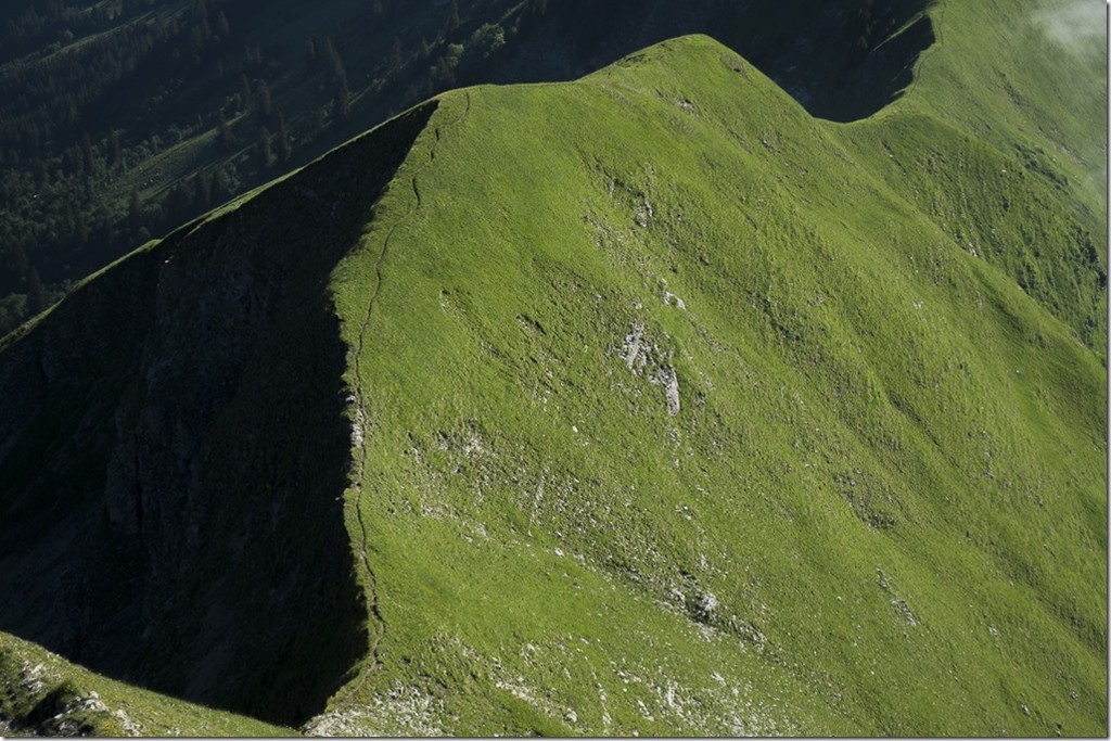
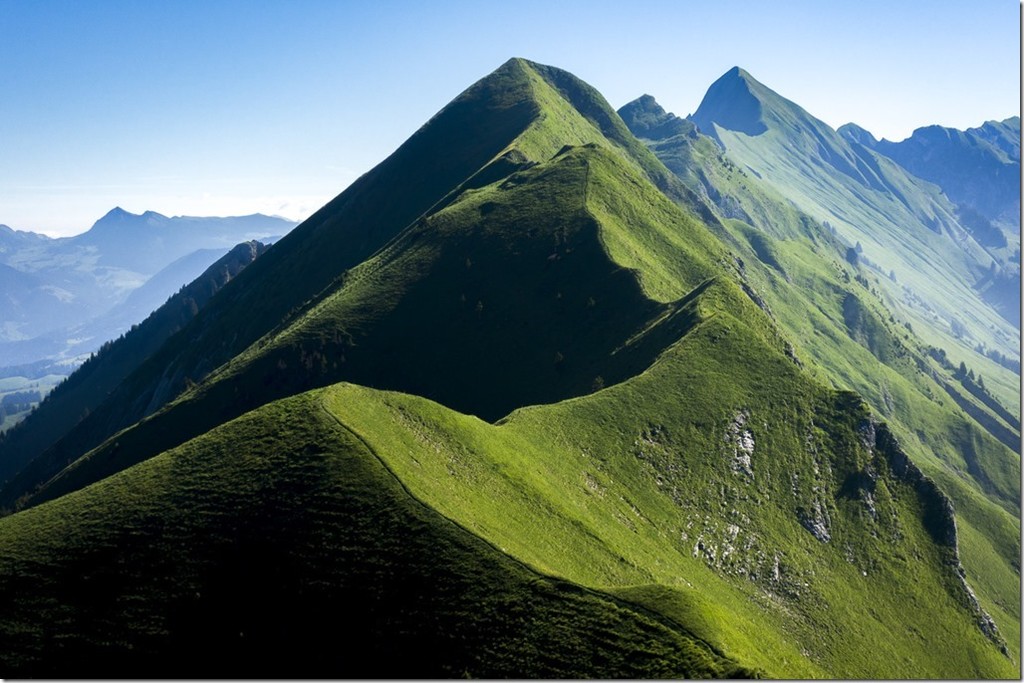
From the Brienzer Rothorn to the Harder, the last summit on the ridge, the route always follows the ridge and is easy to locate by a trail which is sometimes wider, sometimes narrower. Sometimes there is also a marked hiking trail, but it is not continuous.
From Harder the downhill starts on the fastest way to Interlaken Ost station.
"The Best Hike in the World?" - Brendan Leonard, https://blog.theclymb.com/passions/hike/hardergrat-best-hike-world/
Length: 36km
Elevation gain/loss: +3111m/-3555m
- Submitted by Ramon Krebs
Comments
I think there should be two categories for this route (starting from Interlaken going up and starting from Brünig Pass going "down").
Most people who go for this route will start at Brünig pass because it takes less time. Stephan Hugenschmidt ran it upwards out of Interlaken, which makes his time even more remarkable! That is why we need two different leaderboeards.
Had a go at this, aiming for sub 7 hours (7:02 in the end). A lot of rain the night before made it slippery and slower. Amazing route and I really think west to east is the way to do it, you gradually build towards the highest point and the best views, and the final descent is probably more runable. Of course it would be quicker the other way. If you try for the record watch out for the rail crossing after leaving Interlaken station, I had to wait 4 minutes. The gpx file doesn't quite summit the highest point but for sure, one should do this. Enjoy anyone else who has a go. https://www.strava.com/activities/15147773313?utm_source=com.strava&utm…