Athletes
Route variation
Standard route
Multi-sport
No
Gender category
Female
Style
Unsupported
Start date
Finish date
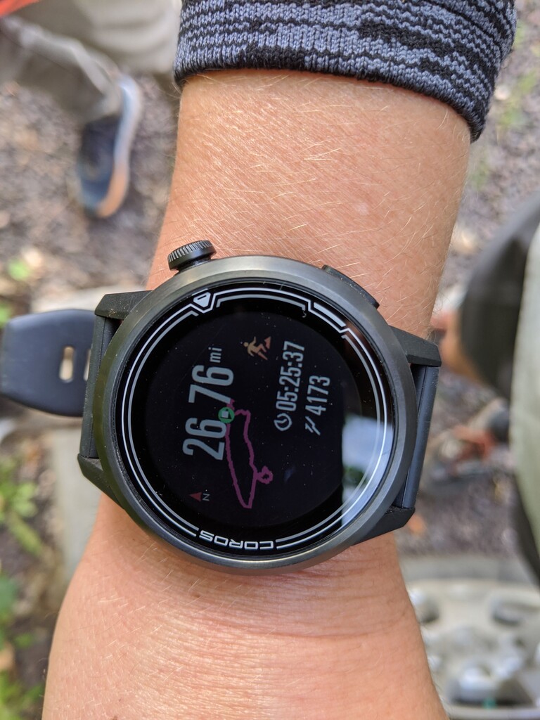
Total time
5h
25m
37s
GPS track(s)
TrailRun20200917115834.gpx5.26 MB
Photos

Report
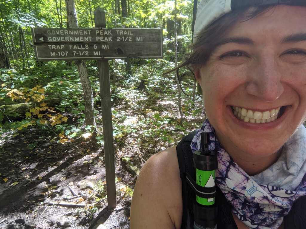
Ran unsupported on 9/17/20, starting at the Government Peak Trailhead going counterclockwise. Beautiful day and run -- foliage almost at its peak! Great views along the Escarpment trail. Got lost a few times when the trail disappeared into the mud or woods. Ran with a Sawyer Mini and only needed to fill up once at Mirror Lake with the cool September temps. Would recommend studying this course in advance as the junctions can slow you down a bit -- so here’s a detailed course description :)
From the Government Peak Trailhead:
- Start and stop at the inner junction (0.1 miles in from the trailhead).
- Head west (counterclockwise) on the Escarpment Trail. The route starts with a ~0.5-mile climb up Cayhuga Peak.
- Continue straight at the junction about mile 3.7 (do not go downhill on the Mirror Lake Trail!). There’s a short oversized staircase climb up to the Lake of the Clouds overlook area -- keep skirting the cliff (i.e keep left) and take the boardwalk down hill at the far end.
- Follow the Big Carp River Trail for about 5 miles to the Correction Line Trail. For me, here the day hiker traffic disappeared. Note the mud pits start as you near the Correction Line junction -- even in the fall, after several days of no rain. Note the river crossing too -- still ankle deep in the fall. You’ll have to decide whether to take your shoes off or get them wet for the next 17 miles. (This was the only substantial water crossing for me, in mid-September).
- At Mirror Lake, take a right at the junction, then continue straight at the next junction (following the arrow towards the Beaver Creek Trail -- NOT onto the raised boardwalk over the creek). From here, you can follow signs for the Summit Peak Loop.
- At Summit Peak, climb the tower and take a picture! This is over halfway (mile ~14), though maybe not effort-wise.
- Coming down from Summit Peak, follow the (only) trail opposite the view. The trail descends fast, and there is a wide but fake user trail on your sharp left after ~5 minutes -- don’t turn!
- Turn left back towards Mirror Lake, and then right at the junction where you complete the Summit Peak Loop, to follow the shoreline of Mirror Lake (past the junction you came to from the Correction Line Trail), passing a couple cabins. The trail continues as the North Mirror Lake Trail for a little less than a mile.
- Turn right onto the Government Peak Trail. This trail is rolling but gradually rising, with a sharp climb to the top for a couple miles (there is a sign and campsites at the summit). After the summit, it’s mostly downhill for another couple miles.
- Turn left at the next junction towards Trap Falls and M-107. This stretch of trail is generally good, following the Upper Carp River (with ample places to refill water if needed). Some mud pits. It’s less than a mile to the Union Spring Trail junction (do NOT take this trail), and then 1.2 miles to your turn onto the Overlook Trail (at about mile 23.2).
- The Overlook Trail loop starts easy, then becomes a steady steep climb for a half mile or so. Then it flattens briefly before climbing more. The descent is very steep and rocky/rooty at times.
- When you reach a hemlock grove shortly before mile 26, there is a fake but more convincing user trail which continues downhill. Be sure to watch the blazes carefully -- it’s easy to get lost here. You want to look LEFT of where this fake trail splits from the real trail, for a dull blue spray painted dot on a hemlock. The real trail is more rooted than the nice false dirt tread.
- From the hemlock grove, it is a rooty but mostly flat finish. Turn right off of the Overlook Trail back to the Government Peak Trailhead.