Short Report
I set off from Pwllfanogl (near Britannia Bridge) at 0700 on Friday 10 Jan 2025 in a clockwise direction and completed the entire loop of the island alone and unsupported at 1043 on Sunday 12 Jan 2025, in a total time of 2 days, 3 hours and 43 minutes. I carried all my food, water and equipment throughout—the weight of which fluctuated between 7-14 kg (15-31 lbs). I took great care to follow the correct route as indicated by signposts on the ground. The total distance covered was 138 miles (which included about 1 mile of minor navigational errors and short diversions to collect water from public sources). The temperature ranged between -3°C and 3°C (27°F and 37°F) and the weather was mostly dry but with some rain. Due to the latitude and time of year, about 60% of the FKT was completed in darkness. I had four 5-10 minute stops to rest on the second night and slept about 10 minutes in total.
Detailed Report
For some years I had pondered the feasibility of completing the Anglesey Coastal Path in a single, continuous, non-stop effort without any support of any kind. After discovering that there was no unsupported FKT and that it apparently had never been done, I decided to set the first FKT in that style. As a native of the island, who lives a 5-minute walk from the path, this goal had a special value to me.
Having spent so much time walking and running along the path over the years, I knew what the key challenges would be. The 137-mile distance itself was certainly achievable in a single continuous push without sleeping. But the unsupported nature of my planned FKT meant that a greater weight had to be carried. This would inevitably mean a slower pace than would otherwise be possible in a supported or self-supported capacity.
I estimated that it would take approximately 2 days to complete and I planned my nutrition on this basis with a total of about 14,000 kcals. Not all of this food was calorie dense and its weight was around 4.5 kg (10 lbs). To add to the challenge, my plan was to complete the FKT mid-winter. Without having any support or backup, I had to carry enough kit to sustain myself in any weather and in the event of serious injury or accident. This base weight weighed around 6 kg (13 lbs). In addition to food and equipment, there was a further significant burden to carry: water. The rules for unsupported FKTs dictate that water can only be acquired from natural sources or public taps. Although there are plenty of streams along the coast, they almost all run through populated areas or agricultural land. For this reason, I decided not to rely on natural sources for water. There was the option to filter, but I was not entirely confident my filter would be effective. The only option that remained was public taps. Unfortunately for me, nearly all of the numerous public toilets dotted along the coastline are locked during the winter months. This would mean long and heavy water portages. Indeed, among them would be two long portages of 45 miles and 48 miles. My peak pack weight of around 14 kg (31 lbs) occurred about 4 hours into the FKT when I still had most of my food and carried sufficient water for the next 45 miles. This was based on a consumption of around 250 ml/hr (8.5 fl oz/hr), which was the minimum I could realistically consume. Throughout the entire FKT, I never carried less than 7 kg (15 lbs). The significant weight to be carried combined with the winter conditions and rationed water added to the difficulty of the challenge.
I took great care in researching the exact route to follow. I wanted to be sure that it could not be questioned nor disputed and that absolutely no corners were cut, even at the smallest scales. The process was not straightforward, as there appeared to be multiple variations of the path. For example, the version marked on Ordnance Survey maps does not exactly tally with the signposts on the ground. There are also high tide and seasonal variations that follow short inland diversions. I eventually decided that the signposting on the ground would take precedence where there was any ambiguity. Where the path splits into two options, whether for tidal or seasonal land-use reasons, I decided that I would take the longer route, for example, around the Bodior Estate, along Trwyn-y-Gader and Mynydd y Wylfa.
The only minor diversions from my exact route were to refill my water carriers at Newborough Forest, Holyhead Breakwater Park and Cemaes, which only added short distances to the overall route. I made a navigational error near Amlwch and a second very minor error between Glan-yr-afon and Caim. These errors, combined with short detours to access water, added about 1 mile to the total distance covered. Other than that, I followed the route exactly as planned.
I planned to start from Pwllfanogl (near Llanfairpwllgwyngyll) at 0700 on Friday 10 January 2025. Although I had spent the previous 4-5 days going to bed early to bank sleep, I may have lost all that was gained by waking at 1 am that morning through nervous anticipation and the eagerness to get going. Nevertheless, I stuck to my plan, which was based on the neap tides occurring that day. The path has a few low tide and high tide options, and I wanted to take the low tide option wherever possible to take the longest possible route variation.
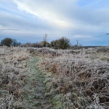
I left my home at 6:45 am and walked the quarter mile to Pwllfanogl, the nearest point on the path. I set off at exactly 7 am as planned. There was a hard frost that morning and the temperature hovered around -3°C (26°F), but the frozen ground worked in my favour, and I was able to move fast as I made my way towards Moel-y-don. By 8 am there was enough light to walk without my headtorch.
My first water stop was Newborough Forest car park, where there are public toilets and an outside water fountain that is available to use all year round. I filled my bottle and water carriers to their maximum capacity of 3.8 litres (1 gallon). My next water stop was 45 miles away at Holyhead Breakwater Country Park, where there is another water fountain accessible year-round. I made good progress throughout the day, focusing only on the next village or prominent landmark. I tried not to think ahead too far because contemplating the whole journey in its entirety was overwhelming.
It was dark by the time I passed Traeth Cymyran near RAF Valley. I continued as long as I could without light, relying on my night vision, but finally relented as I reached Llanfairyneubwll. At this point I decided to wear my waterproof socks as I knew there were some extremely muddy sections in the next 10 miles. I did not regret this decision!
After about 50 miles I started having issues with my running shoes, in that the midsoles seemed to have collapsed somewhat. With my feet sunken deeper in the shoes, I was starting to get some tendon irritation. I realised I needed to address this immediately and had to pad out the shoe underneath the insole in some way. I had nothing suitable in my kit and was forced to improvise using some seaweed! I packed in just the right amount under the insoles, which lifted my feet enough to provide relief. That quick solution worked, and the seaweed cushioned my feet all the way to the final step.
Around midnight I began climbing over the rugged, rocky terrain near Ynys Lawd (South Stack) and Mynydd Cybi (Holyhead Mountain). By this point I was quite low on water, but I was only a short distance from my next water source. At Parc Gwledig Môrglawdd Caergybi (Holyhead Breakwater Country Park), there is a public water fountain near the path. Although the water pressure was very low, I was able to refill my water bottle and three water carriers, which immediately increased the weight on my back by 50%! My next water stop was 29 miles away.
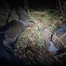
After covering 75 miles in 24 hours, I decided to have my first actual rest stop. I needed to refill my bottle from my water carrier, so I took the opportunity to sit down for 5 minutes. Within seconds of being on the ground, I became light-headed, nauseous and sweaty. I felt I was about to pass out, so I quickly laid down flat and propped my legs against a wall. This brought me round and within a couple of minutes I was on my way again.
By mile 85 I was in daylight once again and starting day 2. I was hoping to finish within 48 hours. For most of the first day I was averaging well over 3 mph, but now I was beginning to slow. The effect of having wet feet for so long was starting to take its toll. This meant I was forced to stop at intervals to maintain the condition of my feet. Hotspots were beginning to form, and the skin was pruning. I knew I had to take the time to address these issues or risk failing to complete the path altogether.
By this point I was beginning to feel the effects of sleep deprivation. Near Wylfa I stopped again to take care of my feet. Once finished, I looked around for my sock. It had gone! I looked everywhere and there was no sign of it. Where had it gone?! I eventually realised it was still on my foot—I had simply rolled it down over my toes to expose my heels. I really needed to sleep but pressed on and concentrated to stay awake and focused on what I was doing. I was forced to deviate slightly from the official route on the approach to Cemaes because the footpath was closed, presumably due to maintenance of some kind
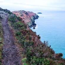
At Cemaes, I refilled my bottle and water carriers for the final time in the well-maintained community toilets. My start time was planned with the tides in mind and to ensure I would pass Cemaes during the daytime because the toilets are not open 24 hours a day. Pushing on, I passed a very scenic section between Llanbadrig and Porth Llechog (Bull Bay). Along this leg, the narrow path weaves along above rocky cliffs. I took extra care as it is rather precarious in places. At mile 95 I neared Amlwch, and although I had recce'd this section the previous week, I had absolutely no recollection of this part of the path. I convinced myself that I had missed a turning, so I retraced my steps for nearly half a mile, only to realise that I had been going the right way after all, so I continued back for a second time! I was annoyed with myself for making such a stupid mistake but accepted that it was just the effect of sleep deprivation and continued onwards.
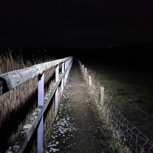
I reached mile 100 in 34 hours, and it was now dark once again. After the rain, the ground was very muddy in places, and this slowed my pace further still. There were some extremely muddy ground conditions around Dulas and Lligwy, which were impossible to cover at a decent speed. At Moelfre I had to follow the long-standing detour up along the A5108 rather than along the coastline. I believe this is due to erosion of the original coastline path.
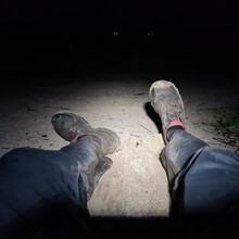
I had a 10-min stop at mile 113 on Benllech beach, during which I think I slept for 5 mins. By this point I was really struggling to stay awake and found myself needing another 5 min stop at mile 116. This was enough to take the edge off, and I kept going, reminding myself that it was not far until Penmon. This effectively marked the final bend leading to the home straight.
On reaching Penmon, I knew the final 12 miles would be along roads and dry tracks, so I took the time to change into a fresh pair of dry socks. This was bliss for my battered feet. My raised spirits were then somewhat dampened when I realised that I still had to walk along the cobbly Traeth Lleiniog (Lleiniog Beach) in the dark. This is hard on your feet and ankles at the best of times, but after 130 miles, it was hard work!
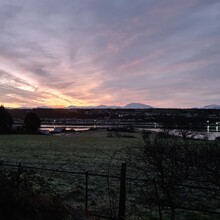
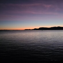
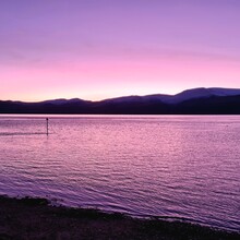
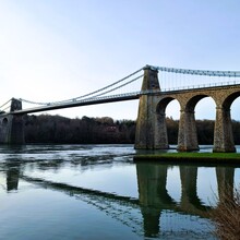
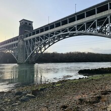
As I approached Beaumaris, my hallucinations were becoming more noticeable and frequent. Although I took some caffeine during the attempt, I had not taken enough to take full advantage of the effect. In total I took only 100 mg on the first night and another 100 mg on the second night, which is less than I would consume on a normal day! On passing Beaumaris whilst climbing towards Llandegfan, I was treated to my third stunning sunrise over the mountains. By this point I knew the 48-hour mark was out of reach, but I was not disappointed or too concerned about the time. I had achieved what I set out to do, so I enjoyed walking the last few miles under the Menai Suspension Bridge and the Britannia Bridge and back to my starting point near Pwllfanogl on the A4080 at 1043 on Sunday 12 Jan 2025. From there I had a final 5-minute leisurely walk back to my house for a well-deserved rest!
I think the time for this unsupported FKT can be reduced substantially to well under 40 hours. My suggestion would be to attempt it during a dry period, either late March or late September. During these periods the numerous (15+) public toilets will have reopened, providing regular access to clean water, meaning no long and heavy water portages. The weather would be cool enough to have a relatively low water consumption rate, yet warm enough not to require much additional kit. The weight carried could be reduced to as little as 6-7 kg (13-15 lbs), making it more realistic to run some sections. A period of dry weather would make the route significantly faster because there are many sections that become extremely muddy in wet conditions and slow progress drastically. This is a key factor to consider. Dry ground would also reduce the risk of foot problems.



Comments
Very well done. A great read too!
Excellent effort, well done! It’s a great journey for sure