I started from Appalachia with 2L of water at 6:44am. I took Valley Way and was delighted to find it clear of snow for the first few miles of ascent. Then I tossed on my Exospikes for traction as it turned into an icy monorail/packed trail. I hit the closed hut pretty quickly, removing my spikes since it was almost exclusively dry rock everywhere above treeline, went up to tag Madison, and then headed back down and over towards Adams. I'd been sweating profusely so I stopped on trail as I ascended Adams to refill the liter I had already drunk; water was flowing everywhere today even if the huts and the summit were all closed.
The climb up Adams was lovely - the wind was the lightest I've ever encountered there, at a gentle ~10 MPH breeze. Then I followed the standard route over towards Jefferson; there were still some snow fields but they were solid after a cool overnight, even though the sun was hot through the high clouds. I stopped at the Randolph Path intersection to slather on some sunscreen, before heading up towards the Jefferson snowfield. The top layer of snow was melting and there weren't clear steps, so I took my time, kicking steps as I went. Once I cleared that section, there was almost no snow up to Jefferson's summit and it was nice to be able to follow the official path there - in full winter, the cairns aren't visible.
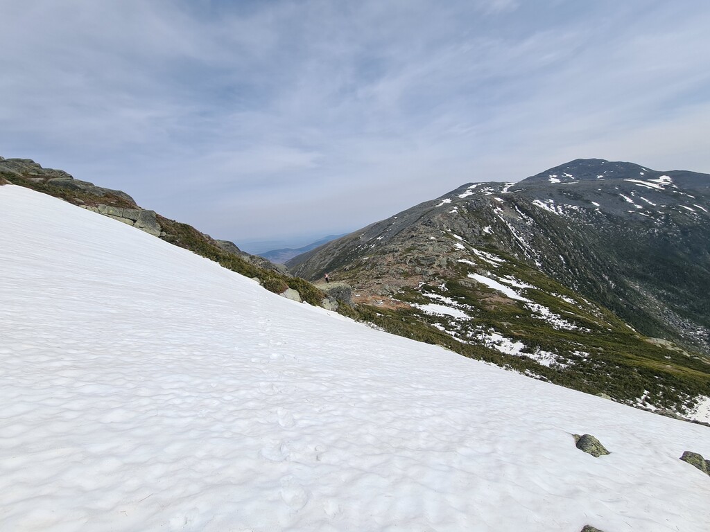
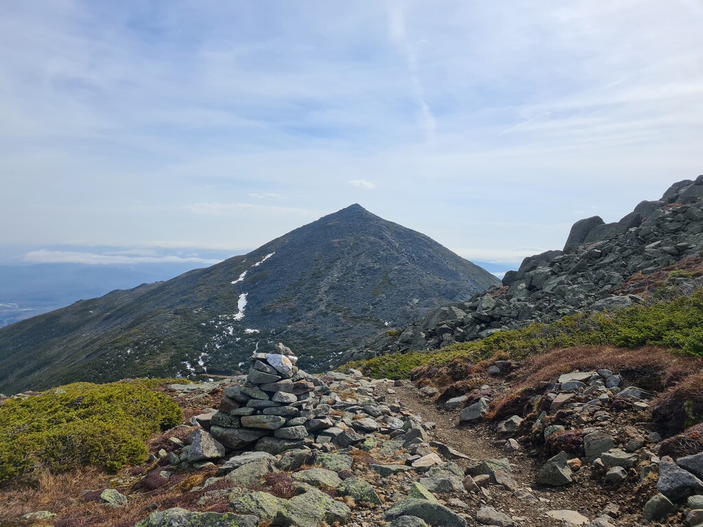
Then it was down Jefferson and over towards Clay. I'd never summited Clay before, so this was a new experience for me. There was a bit more snow up towards the top of Clay than any of the previous summits and no packed trail, so it was a bit slower going. Then it was down and over towards the Cog along the AT. I kept to Gulfside trail until the official Cog crossing since the snow was melted enough I felt secure hiking close to the Great Gulf; there were even some skiiers prepping to descend the Great Gulf, though I had to navigate around them as they were prepping in the middle of the trail.
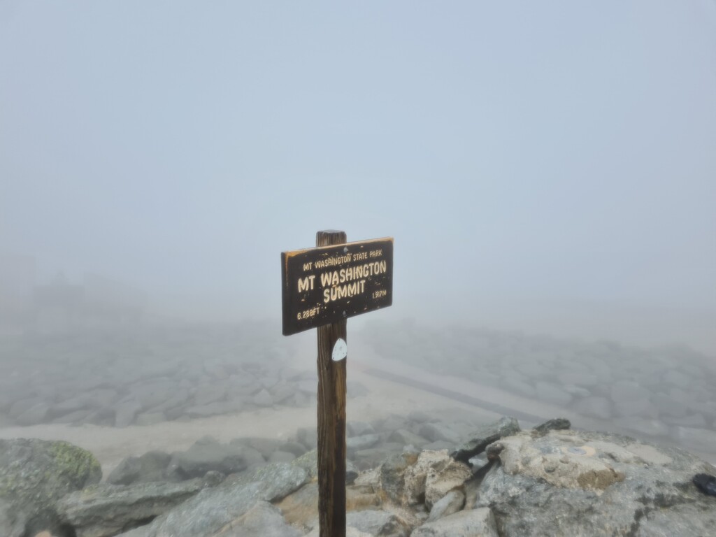
As I'd climbed Jefferson, I'd been watching clouds coming in over the summits. The clouds had started further south, with Pierce and Eisenhower, and then swallowed up Monroe. By the time I made it over Clay, the clouds had moved up to Washington. As I crossed the Cog, I went into the damp clouds. The wind was manageable, at around 30-40 MPH; I traveled cairn to cairn up to the summit sign. I saw a few climbers coming up from the Pinkham side, but the summit was relatively quiet. I was rationing my water and hoping for the summit building to be open, but it wasn't, so I knew I'd be stuck with natural water sources for the rest of the Presi. I looped around and descended by Crawford Path, heading towards Lake of the Clouds. The descent was a mix of awful conditions - there were sections with calf-deep water running over and along the trail, then there were sections with snowfields. The visibility was very bad heading towards the hut and I was within a rock's throw before I could even see it.
The wind had started increasing as well, with gusts up to 60 MPH. I ducked behind the hut, ate a snack because I'd been neglecting my fueling, and added my rainshell and goretex mitten shells to my layers. People coming up from Ammo were congregating at the hut, and they were talking about turning back due to the conditions. I pulled up my Buff wrap to protect from the wind and started up Monroe; I was glad for the quick ascent, since my left eyelashes were accumulating ice from the cloud moisture and ~20-degree windchill. I hit the summit and then scrambled down towards Crawford Path as quick as I could. Once on Crawford Path/AT, I made much better time as the trail smoothed out and the wind gusts were less severe. Once I hit the summit of Eisenhower, the visibility had cleared up heading south and I could actually see Pierce in the distance. As I headed to Pierce, I decided that I'd descend from Pierce to Crawford Notch, rather than add on Jackson like I'd initially thought. The conditions had slowed me down, and I wanted to be sure I had enough time to bike back to my car before sunset. Pierce was an easy climb and then it was all downhill. I ran the descent while there was a packed monorail to smooth out the rocks. Once that ended, I hiked as quickly as I could through the running water to get to the notch.
I made it to the Crawford Path sign and Route 302 at 4:11pm, for a total time of 9 hours and 27 minutes. I left my GPS tracker running while I moved 0.4mi down Route 302 to my bicyle stowed at the Jackson Webster trailhead to begin my 'picnic' portion, so my Strava track notes an additional 12 minutes after I arrived at Crawford Notch.