
When I first heard that Kristina finished/established this route, I thought that it was something that I had no interest in ever trying. That slowly evolved over the past few years, and I started to consider it earlier this spring. I also became intrigued by the thought of trying it unsupported – how would I mentally break up something like this into manageable segments? I’ve run most of my 100 mile races without a crew or pacers, but without any drop bags or food/water/electrolytes at aid stations, how would I manage my gear, nutrition, and pace my food to ensure I didn’t eat everything and leave myself starving for the last 30 miles? For a test run, I did an overnight hut traverse, starting around 7PM and getting only water from the huts. This helped build confidence not only in gear and systems but also mentally. Doubling the mileage unsupported would be uncharted territory, though, and I was excited to set out on something that I was actually unsure whether I would be able to complete.
In late July, I started to keep an eye on the extended forecast for a couple of days that would be mostly dry, not scorching, and ideally before the days started to get much shorter. The weekend prior, I started to eye a Friday start, and the forecast held. My friends Todd and Chris were both kind enough to offer helping with shuttles or rides, the biggest logistical puzzle piece.
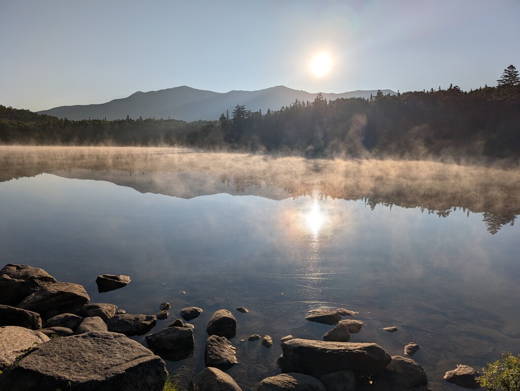
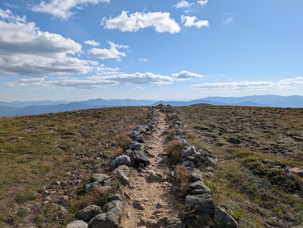
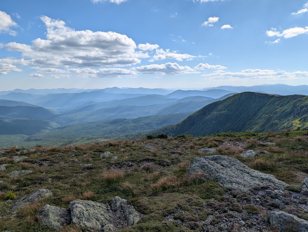
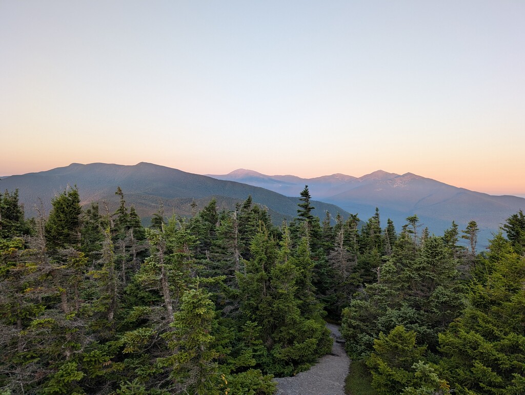
I woke up just before my alarm at 03:00, drove up to Rattle River, turned on my inReach and shot the tracker link to a few friends, and hit the trail at 04:15. The initial ascent went by quickly in the cool morning, and although I was fairly weighted down, I was at least glad not to be carrying a full pack with two sleep kits, as I had been a couple of weeks prior pacing Kristian Morgan on this section. I stopped to enjoy the sunrise and had an otherwise uneventful trip across the Carters. After dropping off of Carter Dome, I took a quick side trip for water before heading up the Wildcats. Dropping down into Pinkham Notch, I stopped to eat a couple of wraps I had packed before starting into the Presi section. Old Jackson Road went by quickly, but as I started up Madison, I was feeling pretty roasted as the temperature increased. This slowed me down a bit for much of the climb, but fortunately once I got above tree line, the temps cooled a bit and there was a nice breeze. I hopped my way along through the northern Presis, and stopped to eat more on Washington. I checked my splits for the first time here and was surprised to see that it looked like I was right on 36 hour pace, as I felt like I had been moving better. My legs still felt good, and I figured I could hopefully make up time on the southern Presi descents, as well as the (only) flat section on Ethan Pond through Zealand Notch. I stopped a few times for photos between Monroe and Pierce – the visibility was perfect, and looking back at where I had been and ahead to where I was heading was both exhilarating and overwhelming. I enjoyed watching the sun start to set behind Willey as I headed down Webster Cliff.
I crossed over 302, and pulled out my headlamp as I started into the Pemi segment. I was able to run much of this section, as I had hoped, and got a little mental boost going by Zealand hut knowing that I had passed the halfway point. The climb up past Zealand went by fairly quickly, but once I hit Twinway, I started to feel drowsiness setting in. I typically don’t run with any music, but had brought earbuds for when I got tired. Unfortunately, they were dead for some reason, despite having been charged the night prior, so I settled for a caffeinated gel and pressed on. I was surprised to see a headlamp heading towards me, and ran across someone else doing a bike and “extended” Whites 100 in the opposite direction, tagging the peaks along the way, over three days. I stopped on South Twin to eat and take a breather, and flicked off my headlamp to enjoy not only the stars, but also a “deafening silence,” as I couldn’t hear a single car or any other noise. I always think of the next section as “purgatory” given that it’s hard to tell whether you’re actually starting an ascent or descent without much runnable terrain and the blocky stairmaster of Garfield Ridge. I was bummed that the spring at the Garfield Ridge tentsite wasn’t even dripping, and knew that I would need to conserve water until I got through Franconia Ridge. Tiredness was continuing to set in heading up Lafayette, and I considered stopping for a dirt nap at some point. I borrowed Andrew’s “chip chip chip” mantra here and kept climbing. Fortunately, once I got above treeline, the breeze woke me up a bit. I tucked behind a cairn for another snack break and to briefly take my phone, which seemed to be dying quickly, out of airplane mode and check the map. I enjoyed running the ridge under the stars, and still felt like I was moving fairly well. I was glad to be able to fill water at Liberty Springs tentsite, which was barely trickling. I jogged down into Franconia Notch as the sun started to come up, which was revived me a bit.
Crossing under 93 and heading up Cascade Brook was also a mental boost, as I knew at that point, barring any injuries, that I was committed to finishing despite some tough terrain still ahead. I got up to Lonesome Lake with the unfortunate timing of breakfast being served and the smell of bacon and coffee wafting through the windows. I settled for an Untapped maple syrup packet, and after a brief break and a photo over Lonesome Lake, continued on. It had been quite a few years since I had been on the section of the Kinsman Ridge trail between South Kinsman and 112, and while I knew it was rough, I had apparently suppressed the memories of just how brutal it is. Even after dropping down towards Eliza Brook, where the terrain eases a bit, I had a bit of a low point with how slow it felt, especially when I crossed the brook and saw the sign that it was still over 7 miles to Route 112. I pulled out my phone to check splits, but it had died. I thought to myself that at least navigation is easy – all I need to do is follow the White Blazes and at least I still have the map on my watch – and a few minutes later my watch beeped for low battery, 10%. I switched it to “UltraMax” mode to conserve battery, but that required turning off the navigation. My main goal was still just to finish, but I was worried that my slow pace through this section would push my finish time out significantly. I had to remind myself of the old Horty saying “it never always gets worse” quite a few times, and I eventually made it down to 112.
I filled all three of my flasks in the river before heading up Beaver Brook. Although it’s a rough climb, I was at least grateful for it to be cooler along the water and in the shade as the temperature started to rise a bit. I had another caffeinated gel, and started slugging out the final ascent. I enjoyed the breeze and views as I topped out on Moosilauke, but didn’t stop for long, as my rough mental splits math seemed like I could finish under 35 hours if I kept a steady pace. I “ran” (amazing how a 12 minute mile can feel like flying at this stage) down to the Glencliff turn and was stoked to see my final destination listed on the sign – Rt 25, 4.4 miles. I tried to run and jog as much of the last descent as I could, and my watch’s “PLEASE CHARGE” beep while on the Townline trail in the final mile provided a little extra kick. I crossed the river and was elated to see Chris and his dog Turkey there waiting for me (with a cold Coke, too – what a guy!). We both hopped in the river for a cool soak (and for me to attempt to wash enough grime and stench off not to offend anyone in a 15 foot radius) to cap things off.
I think there’s still a fair bit of time to be shaved off on this one. I wanted to try to “keep it fun,” and didn’t really approach it with a full racing mindset – I stopped for photos and to enjoy views, wasn’t super efficient stopping to fill water, and took a few breathers. Even just locally in the Mount Washington Valley, there are quite a few trail runners much faster than me, and I suspect that this route may draw in other folks from afar in the future.
Gear: Salomon ADV 12L, Naked belt, merino shirt, Brooks RTW shorts, Coros Apex 2 Pro. The vest-belt combo worked well here, both were pretty loaded but carried the weight comfortably.
Nutrition: I packed around 4000-5000 calories with a mix of assorted snacks (Trader Joe’s brand corn chips were the standout here), gels (Victus watermelon and sea salt was the winner on this trip), and bars. I didn’t feel like I could stomach the bars after around 40 miles, which were a fair amount of my calories (and weight), unfortunately. I had to ride a bit of a line between being hungry and taking in enough fuel. Running most of the back half of Western States on only watermelon and coca cola gave some confidence that I could probably ride that line somewhat comfortably.
Hydration: I carried three flasks, one Salomon with a filter. I brought a tube of electrolyte tabs- a mix of Precision 1000 and Science in Sport, as well as 5 packs of Maurten 160 (wished that I had picked up some 320s). Tailwind and most other liquid calorie offerings don’t agree with my stomach, but fortunately Maurten is fine.