
Many photos& videos: https://photos.app.goo.gl/f5df3b5oPJ6ELCoYA
Ben also recorded a good deal of the trip on Instagram: https://www.instagram.com/thebennylove/?hl=en
His mile-by-mile TR follows.
September 5th
5:53 and 32 seconds (am) I began the MDHT at the Burning Coal Vein Campground (southern terminus)
6:36 and 25 seconds I reached mile 3
7:03 Mile 5
7:16 Mile 6
7:58 Mile 9
8:11 Mile 10
8:25 Mile 11
8:37 Mile 12
8:51 Mile 13
9:04 Mile 14
9:17 Mile 15
9:29 Tom’s Wash
10:00 Mile 18
10:13 Mile 19
10:25 mile 20
11:25 Mile 23
11:40 Mile 24
12:07 Dantz Creek
12:08 Mile 26
12:24 Mile 27
12:39 Mile 28
12:55 Mile 29
1:25 Mile 31
1:41 Mile 32
1:57 Mile 33
2:24 Mile 34
2:46 Mile 35
3:14 Mile 37
3:40 Mile 39
3:55 Mile 40
5:40 Original Mile Marker 0
6:00 Mile 48
6:32 Mile 50
6:48 Mile 51
7:18 Mile 53
8:45 Mile 58
9:14 Mile 60
10:22 Mile 64
Around 10:45, I reached the Wannagan campground where I refilled on water, stretched, and ate before going to bed. Around 11:30 pm, I went to bed at the Wannagan campground close to mile 65.
September 6th
3:15 am I woke up slightly before my alarm was set to go off, I stretched, filled up 4 liters of water, used the bathroom, and hit the trail again around 3:47.
3:50 Mile 65
5:01 Mile 69
5:37 Mile 71
6:32 Mile 74
7:31 Mile 77
8:24 Mile 80
8:40 Mile 81
9:33 Mile 84
10:40 Mile 87
11:20 Mile 89? The picture came out blurry
12:31 Mile 92
12:48 Mile 93
1:06 Mile 94
1:56 Original Midway mile post (about at mile 96.5)
2:46 Mile 99
3:02 Mile 100
3:39 Mile 102
3:59 Mile 103
5:25 Mile 106
5:44 Mile 107
6:18 Mile 109
6:37 Mile 110
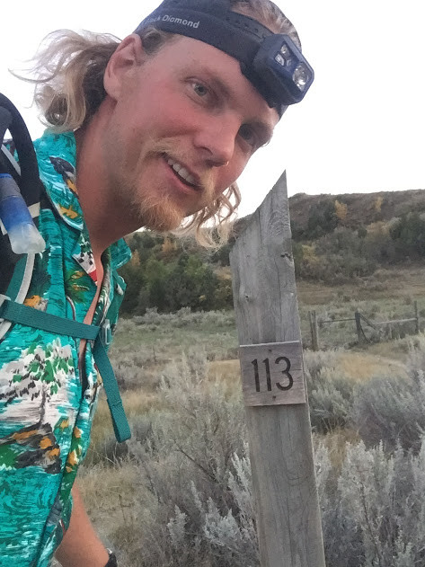
7:10 Mile 112
7:30 Mile 113
8:22 Mile 116
9:24 Mile 119
Somewhere within a mile or two of MP120, I believe around 9:45, I had a mountain lion encounter. I had gotten lost multiple times, once in a coulee, and another time near a water hole (Mile 124 on my Strava shows when I got lost in the coulee) due to the numerous cattle trails that had made the actual trail difficult to follow. My headlamp was dying and I was having a very tough time staying on trail. I changed my headlamp batteries. Shortly after, I did a scan of my surroundings to find one set of eyes looking directly at me. They wouldn’t break contact and I yelled at them only to see the head lower as if it were crouching. I have seen numerous eyes at night while hiking and never felt confident about them being from a cat until this encounter. Deer seem to look away and are usually in groups. This one wasn’t a deer. It was about 50 yards away and directly downwind from me. I was on the side of a hill and it was about 50 feet lower in elevation near a patch of trees in the bottom of the coulee. I picked up my pace and tried to put as much distance as I could between us. It’s worth noting that my splits noticeably increased for the next 1.5-2 hours thanks to this encounter. I never saw it again after that. I didn’t record the time of the encounter as I was more concerned about getting away and making sure I wasn’t being followed.
10:06 Mile 121
10:38 Mile 123
11:11 Mile 125
11:35 Mile 126
September 7th
12:51 Mile 130
1:10 Mile 131
1:15 I took a 15 minute cat nap on the side of the trail
2:12 Got back on trail after getting lost for about 30 minutes. (Mile 138 on my Strava shows this confusion) The trail went left down a heavily overgrown area with numerous sticks across it as if it had been closed. I decided to turn around after the trees had gotten so thick that I had to crouch while walking because it didn’t seem right and my GPS was showing that I was off trail. It was very confusing because this was the most heavily worn trail in the area and I figured it was due to cattle. I followed the more worn down footpath to the east at this point, but it was off from what my GPS was showing. I went back and forth a few times, but after walking the eastward trail and seeing a car, I decided I would go back to the stick covered overgrown trail and try to follow my GPS until I got back on the trail. I found some trail markers, but the trail was very overgrown for the next quarter mile or so until I ran into the actual trail again. I still have no idea where it would have been as it came from the east, but I followed the trail markers, so I’m assuming the trail got rerouted and the signs hadn’t been updated. This was right as I was dropping into a canyon from a prairie high spot. At this point, I needed to speed up to regain my time and finish by my goal of 48 hours, so I began jogging the downs and speed walking as much as possible.
3:07 Mile 135
3:23 Mile 136
3:40 Mile 137
4:28 Mile 140
4:44 Mile 141
I mostly ran the last two miles of downhill.
5:27 and 35 seconds, I reached the Northern Terminus (Mile 144) at CCC Campground
I used the bathroom, waited for the sun to come up, and took a finish photo. I then roadwalked a mile to the highway where I tried unsuccessfully for 30 minutes to hitch. I then walked about 500 feet up the road and took a 30 minute nap under the Little Missouri National Grassland sign.
From here, I woke up and caught a hitch south to Belfield within 20 minutes of thumbing.
I grabbed some food from the Belfield gas station on the east side of the road before catching another hitch south to the Burning Coal Vein Campground. I reached my vehicle around 12:15 in the afternoon, finishing my Maah Daah Hey journey.
**NOTES**
I signed into trail logs when I saw them. I believe I included the time in every entry except the very first one at the Burning Coal Vein Campground.
I consider my hike to be unsupported even though I didn’t use only natural water sources. The waterboxes are marked as water sources on the Maah Daah Hey website. I didn’t cache any water in advance, so I was relying on the water to be stocked. At one point, around mile 91, I actually grabbed unfiltered water out of a cattle trough, because I didn’t trust that the next cache would have enough (and it didn’t). I made it to Magpie Campground out of water.
Water sources on this trail were probably the most challenging part. The only natural sources on the MDHT are very silty, and even then, very few. The trail relies on waterboxes, which generally had less than a gallon of water available. Without them, I filled up at the pump wells located at campgrounds when I reached them. I carried up to 4L of water at times and for up to 25 miles. To do this trail without the caches would require upwards of 40 mile water carries. I believe the MDHT association stocks the caches for hikers.