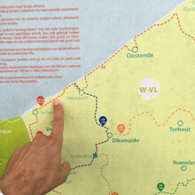
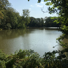
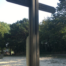
Today, I ran the Kustroute GR5A, from De Panne to Wenduine. I got up at 6am to get as much food in me as possible. The train to take me to De Panne ran at 7am. It delivered me there at around 8. It was about a 2.8K warm up run to the start of the trail, marked by a "wandelpaal".
I chose this route, because it's located in the area that I liveed most of my youth. I passed several houses that I lived in. I ran through some areas that I had ran through when I was a youngster. It was a trip through memory lane.
I had a backpack of about 6 kilos with me. That was about 2 liters of water and the rest was food. I also took a phone (for navigation and pictures) and a power bank to keep my phone and my watch charged. I have a Garmin Watch, I used that one to record the run. At two occasions I went into a store along the route to purchase water, so the run is classified as Self-Supported.
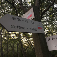
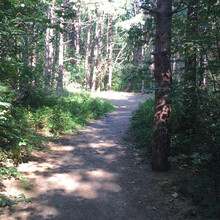
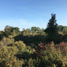
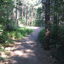
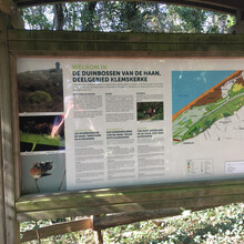
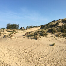
The trail started off on a forest-like terrain. Lots of corners and tiny up- and downhills. That was a lot of fun. Soon the terrain changed to sand. I knew there were going to be sandy parts, but I vastly underestimated the amount of sand running. A bunch of it was in real deep sand and up hill. That was really a way to get the speed (not that speed was my goal) out of my run. It was really good weather. It started at about 13 degrees Celcius. In the afternoon, it got up to about 22, which was hot while running on the sand. I ran from De Panne (where I was born), to Sint-Idesbald (where I lived and went to school), to Koksijde (where I lived for over 6 years), to Oostduinkerke (where I had my summer job). I fell from memory into memory. A couple of times, I was thinking about my memories too much, which made me lose my way. I didn't have the route on my phone when I started, but I downloaded the routeYou app and loaded the trail on there. Although the route is very clearly marked with white and red striped signs, yet sometimes they are a little hidden behind a tree or a car and I was grateful for the trail on my phone, so I could easily find my way.
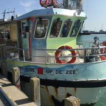
After Oostduinkerke, it came to Nieuwpoort. From Nieuwpoort I got to run on the dyke. Because it was Sunday and a very nice day after a patch of bad weather, the dyke was crowded with tourists. I had to slalom around them quite often. If I would give advice to anyone running this FKT, it would be to run it on a weekday, or in winter time. I think I easily lost 10 minutes, because of tourists that walk diagonally and taking up the road. After the dyke, came the Nieuwpoort boardwalk. Lots of boats were getting out, that was really cool to see. After passing the statue of Albert I, I got to a much quieter part. A very long straight on grassy trail next to the "Ijzer" river. The trail ran then back to the coastline, with another couple of miles through dunes, but with compacted sand and forest trail. This ran a lot easier.
At around 40K it was another stretch on the dyke. Again a lot of people. I was starting to get real thirsty, so I was grateful that there was a shop where I could refill my water. It was getting quite warm and I was suffering a little. My pace started slowing down and I took longer walk breaks.
This was followed by a stretch in a city park, Koningin Maria Hendrikapark. It was nice to get out of the sun for a while, although I did miss a turn there.
At 45K was the first time I thought about stopping. I passed right by the Oostende train station and I couldn't get it out of my head that I could take a train there and be home in less than 20minutes. Running through the city streets with tourists everywhere and fish stalls smelling up the place, I wasn't having the best of time.
Luckily it took a little upswing. The route requires you to take a (free) ferry across the water. I had no idea about that when I researched, so it came as quite a surprise. I was in luck and a ferry just docked and I could get on and on to the other side. It was nice to sit down for a while and still progress! After the ferry crossing, my mind was made up and I decided to finish. After the ferry there was a 2K stretch on sidewalk next to the beach. There were little heaps of sand all over the sidewalk, which made it hard sometimes to run. There were also people biking and not getting through the heaps of sand with their bikes and blocking my way a little.
After that there were two long stretches on the beach. It was difficult running in the soft sand as well on the hard sand, I tried both. I ran in small spurts and walked quite a bit of it.
The last 5K ran back inwards (over a nice bridge across a golf course) and was mostly on forest terrain. I tried to speed up and get my time under 8 hours, but I just didn't have the energy. I also got lost again and I stopped to purchase some more water. I had an 8h goal in mind and finished in 08:03:39.
This being the first time I went over the marathon distance, I'm very proud that I finished and very happy with my time.
The garmin activity is of my whole run, including the run from the train station in De Panne to the starting point and the run from the finish to the tram station Wenduine Konijnegat. I trimmed my Strava activity to only include the FKT route.

