


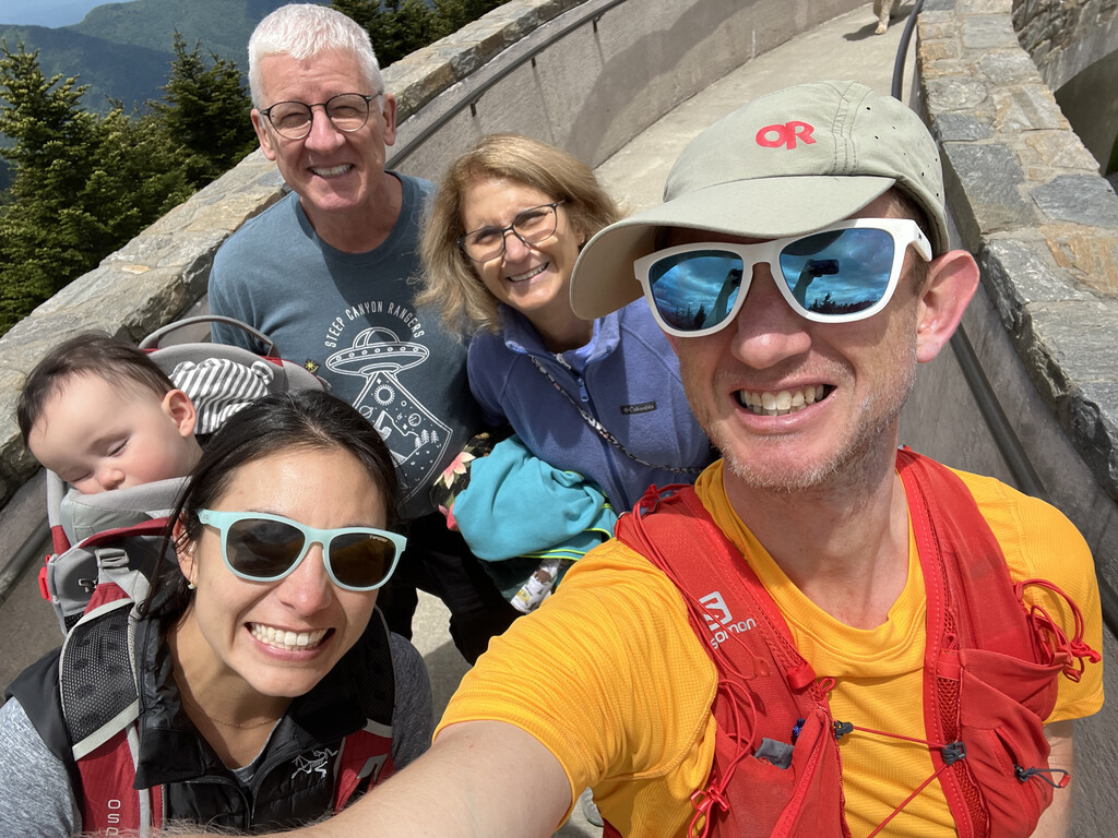
I am a North Carolina native, currently living in Colorado, and the Mountains-to-Sea Trail runs through many sentimental locales from my childhood and young adult years. On June 7th 2022 at 4:41 am, I stood atop Clingmans Dome with my wife, Melissa and 11 month old son, Felix to start a supported FKT attempt on the MST. Melissa and Felix provided support along the entire trip, meeting me at intervals ranging from 4 to 25 miles to resupply me with food and fluids. Melissa would also shuttle our family to campgrounds or motels each night as well, depending on where we stopped. Prior to starting this trip, I reached out to Tara Dower (female MST FKT record holder) as well as members of the Friends of Mountains-to-Sea Trail organization to announce my attempt and gain insight into the nuances of the trail. I used Strava as my primary verification system on a Garmin Forerunner 245 watch that was replaced on day 8 of the trip by a newer version of the same watch due to concerns with battery life. I also used a SPOT 3 Satellite GPS messenger, though this was carried primarily for emergency communication purposes rather than GPS tracking.
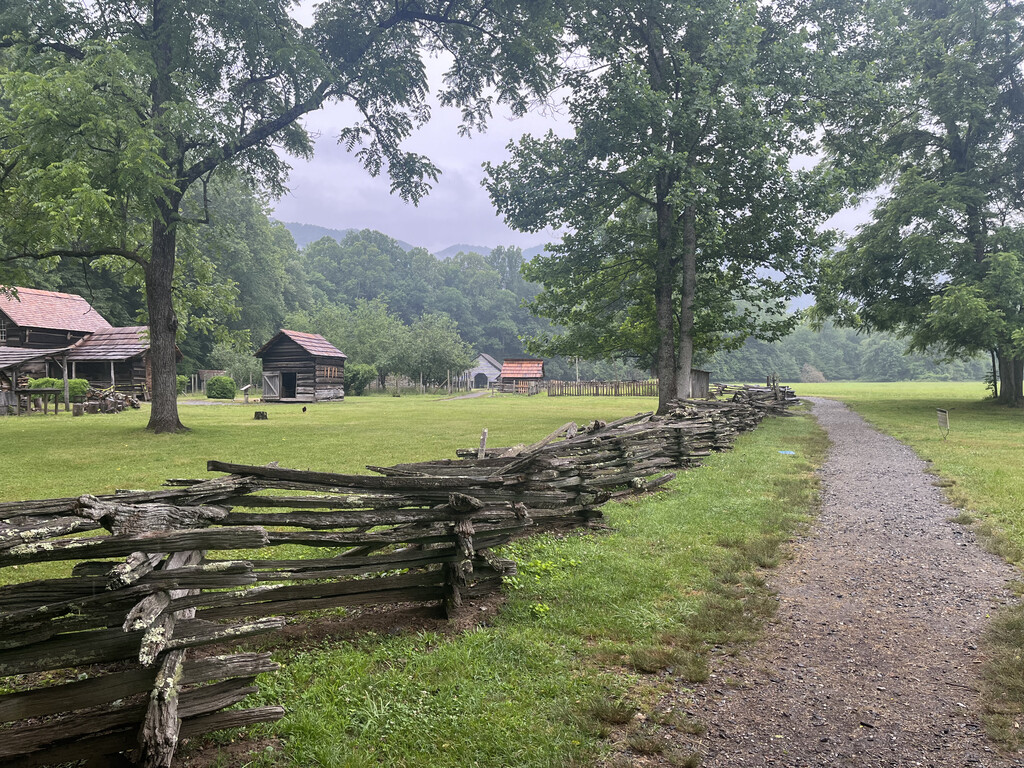
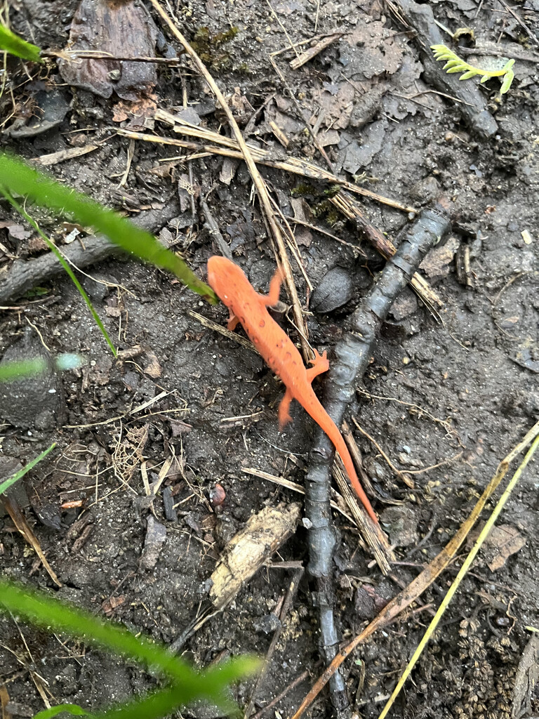
The MST consists of 3 regions which offered distinct highlights and challenges. The Mountain section travels from Clingmans Dome to Elkin and offered technical trails and an abundant variety of flora and fauna. I was convinced that my skin would take on a green hue after spending all day in verdant forests. The mountain laurel and rhododendron tunnels were incredible as well. I saw elk, red eft newts, turtles, fawn, several black rat snakes, and a timber rattle snake. In terms of challenges, it rained for the better part of the first two days which led to wet feet and necessitated shoe and sock changes. I acquired a poison ivy rash on my thighs that lasted several days and counted 30+ ticks on my body. Two of these were lone star ticks and required removal with a tick removal tool. For this section, Melissa hiked in with Felix to walk with me back towards our vehicle accompanying me for approximately 5 miles in total. On the 4th night, we stayed with Paul Dewitt in Marion. He and his dog, Coltrane, accompanied me for roughly 3 miles.
The Piedmont section of the trail travels from Elkin to the Raleigh area. I welcomed smoother, paved terrain but there was a surprising amount of trail to be had as well. The trio of Stone Mountain, Pilot Mountain, and Hanging Rock were terrific trail oases. Additionally, Eno River State Park and the trails around Falls Lake offered winding, soft terrain without a lot of elevation gain which allowed for some longer mileage days. I encountered only 2 thru hikers on this journey and it was in the Piedmont that I met both of them-Tough Love and Out and About in Rockford and Mebane respectively. The challenges in this section came in the form of heat as the heat index rose to 118 on one of the days. A few aggressive dogs were also a concern and I used pepper spray on 3 dogs that left their yards and charged towards me, chasing me off the road on the opposite side. Melissa joined me for 7 miles on day 12. Stephane from the Raleigh Trail Runners joined me for about 15 miles on day 14. Sameer from the Raleigh Trail Runners joined me for another 15 on day 14 as well.
Upon reaching the Coastal Crescent region, approximately half of the 1175 still remained. The golden sunrises along rural farmland roads were a highlight of the early parts of this region. Two ferry rides and nearly 90 miles of beach running in Surf City, Ocracoke, and Hatteras Island were uniquely enjoyable features as well. The generosity of Trail Angels was on full display in this region. On day 16, we stayed at the Beaver Dam Fire Station hosted by Gary and Eva Brock and on day 19, Tim Supple met us for dinner and arranged lodging for us with Robin Goodman in Sneads Ferry. Tim also shared that By this time, I had become fairly accustomed to road running and made many efforts to remain visible by wearing a reflective vest and having 2-3 blinking lights on my front and back as well as a headlamp during low light periods of the day. I ran against traffic and yielded to oncoming traffic, moving to the shoulder to continue running where possible, and stopping and waiting for cars to pass when the slope was too extreme. However, the largest challenge of this region and the trip occurred during this section. On River Road heading towards the Harmony Hall Plantation out and back section, I heard a car coming from behind. The noise appeared louder than normal and as I turned to look, it was right beside me, passing on a double yellow line. No contact was made but I was less than an arm's reach of being hit from behind. The car it passed was my wife who was driving the speed limit. This encounter, and the fact that my wife nearly witnessed me run over by a careless driver, shook me for a while. I futilely shouted and cursed at the car for several minutes after the vehicle was long gone and then broke down and cried. Comforted by my wife, we talked about the situation and decided to continue with extra regard for vehicles coming from behind. In this section, my wife ran with me for 30 miles total. My mom joined me for 5 miles and my dad joined for 2. Felix joined in the stroller for some bike path miles and was pushed by Melissa for 2 miles and me for 1 mile.
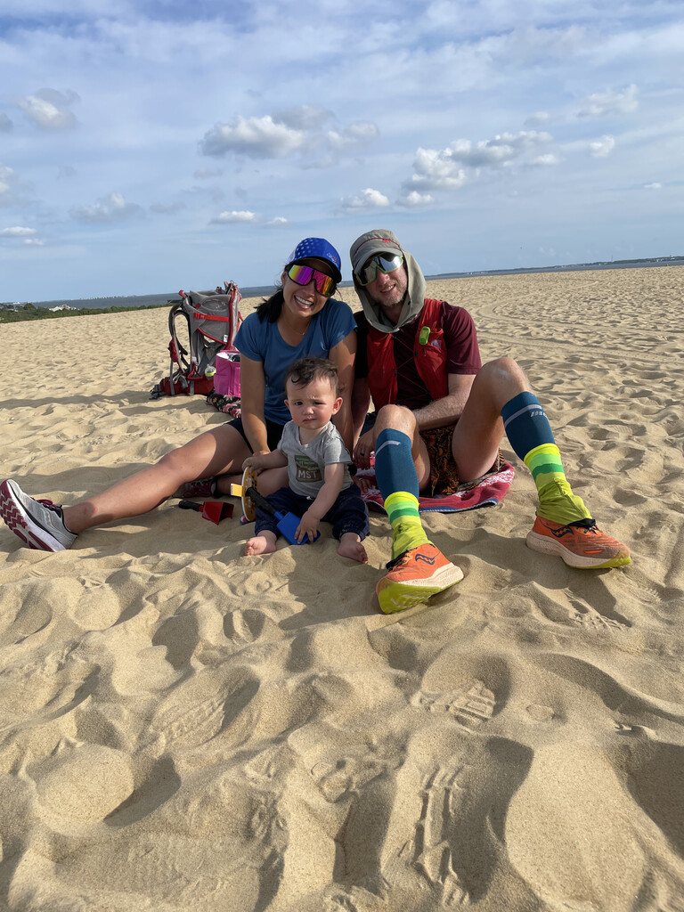
On June 30th at 6:09 pm, I arrived at the summit of the tallest sand dune in Jockey's Ridge. Melissa, Felix, and my parents were there waiting to celebrate with me. The final day consisted of 58 miles and we made sure that I started with enough time to finish before the park closed at 9 pm. A ranger from the park offered a NC State Park commemorative coin as I returned to the parking area as well as the log book for thru hikers.
The MST is a circuitous route across NC that is ever-evolving as there is an ongoing initiative to replace road sections with trail. The current version also involves small out and back sections and loops that I adhered to and I relied on the Mountains-to-Sea Trail App for navigation as well as written directions published by the Friends of the Mountains-to-Sea Trail. There were short portions of the trail that were rerouted due to road construction and I followed these according to the latest updates published by the Friends of the Mountains-to-Sea Trail. Additionally, a few beach closures were in effect due to sea turtle or bird nesting which necessitated running on the parallel road on Hatteras Island. I returned to the beach trail as soon as possible in each area of closure. Finally, in reviewing the Strava data, there appears to be an error in the file on Day 1 from miles 23.5 to 25. There was heavy rain and canopy cover that day and I'm not sure if that impacted the GPS signal. In any case, I did complete this section on foot and there is no road access to the missing segment.
Completing the MST in a manner that challenged me to my physical potential each day is an experience that has been immensely gratifying. What I am most fulfilled by though is how we did this trail...as a family.I am grateful for my parents who joined the support team on weekends and celebrated with us in Nags Head at the finish. Melissa and Felix supported the entire trip and deserve every bit of acknowledgement for their role in the success of this endeavor. Along the way, they had mini adventures and Felix saw lakes, waterfalls, and the ocean for the first time, grew 3 teeth, and has become much more proficient with crawling, pulling to stand, cruising, and communicating. Having these challenges and shared experiences over the three weeks strengthened our relationships and it wouldn't have been possible without their love and support.