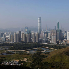
What is the boundary of Hong Kong? https://www.openstreetmap.org/relation/913110#map=11/22.3463/114.1692
What is the northern frontier of Hong Kong? The norther frontier of Hong Kong bordering Guangdong Province of China is patrolled and controlled by the Hong Kong Police Force, its Marine Region and the Immigration Department at land. The land boundary also includes a buffer zone, known as Frontier Closed Area. https://en.wikipedia.org/wiki/Boundaries_of_Hong_Kong
Besides the GPX and Garmin record, I list below places on the route by name for clarity so others can follow.
(Starting point) Tsim Bei Tsui Police Post尖鼻咀警崗
Border Fence Road end to end 邊境路頭到尾
Drainage Services Department Yuen Long Sewage Treatment Works元朗污水處理廠
Fu Yip Street bridge over Shan Pui River 富業街行車橋橫跨山貝河
Lok Ma Chau Water Lily Farm落馬洲荷花農莊
Border Road Lok Ma Chau Operational Base邊界道路落馬洲行動基地
Old Tai Sha Lok Police Post舊大沙落警崗遺址
Old Liu Pok Police Post舊料壆警崗遺址
Tak Yuet Lau Police Post得月樓警崗
Bridge cross Ng Tung River (River Indus) 梧桐河橋
MTR Lo Wu Station港鐵羅湖站
Sandy Ridge沙嶺
San Uk Lang新屋嶺
Muk Wu Nga Yiu木湖瓦窰
Ta Kwu Ling Police Station打鼓嶺警署
Heung Yuen Wai Fire Station香園圍消防局
Lin Ma Hang Road Heung Yuen Wai Village entrance蓮麻坑路香園圍村口
(N 22° 33' 16.1036" E 114° 9' 34.7603")
Bridge cross Kong Yiu Channel bridge缸窰河橋N 22° 33' 4.9352" E 114° 9' 39.6493"
Leachate storage污水收集池
Entire Wo Keng Shan Road整條禾徑山路
Entire Shek Chung Au/Wo Hang section of Sha Tau Kok Road整條沙頭角公路禾坑段及石涌凹段
(Ending point) Sha Tau Kok Immigration Control Point沙頭角出入境管制站
Did anyone run with you for any distance? No one ran with me for any distance.
Did you resupply with food and water, if so, how? No resupply with food.
Water was obtained from coin vending machines, convenience stores and public sterilized-water fountain along the route.
Summary of the 25-27Mar 2020 running:
Total Distance (Km) = 43.87
Duration: 26hrs 59mins 27secs
Elevation gain(m) = 299
Total calorie (Kcal) = 2242
Start: 尖鼻咀Tsim Bei Tsui 22:56 25Mar Tue
Finish: 山咀Shan Tsui 01:55:37 27Mar Thur

