An Exhaustive List of Errors Made
The day started with dropping my van off at Blakely Dam on the east end of the trail, and riding with my dad to Denby Bay on the west end. On the way to Denby Bay I realized that I had completely forgotten to fill the water bladder in my running vest— a laughably ridiculous mistake. I double checked the PDF US Forest Service map, and saw the little water fountain icon at the trailhead. Crisis averted.
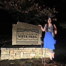
I started the trail at 6:17 am, in the nearly moonless pre-dawn. Temps were warm enough that I started in just my tank top dress. I had come down earlier in the week to Denby Bay to scope out the area, because the GPX route on the FKT page did not exactly match the trail map on Alltrails and the official US Forest Service map. (For reasons that I can only guess are based on the lovely trailhead sign in the ADA Trailhead parking lot, which is not actually connected to the rest of the trail.) So I was prepared for the strange boggy quarter mile bushwhack, and plowed through it by the light of my headlamp without hesitation.
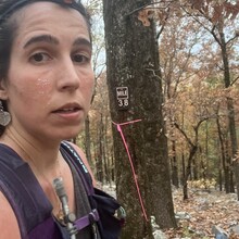
I ran through the darkness for the first few miles, pausing here and there to scan the woods, to make sure I was on the right track. When the trail dropped onto a dirt road, I checked and double-checked the map, worried that I would miss the turn back into the woods, but I would come to find throughout the whole trail that turns were consistently very well marked and when in doubt, following the most obvious path would eventually lead to a sign with an arrow.
Within 7-8 miles, I realized that the 10 days of recovery I had taken between my Womble Trail FKT and this attempt were not quite enough. My legs were feeling fatigued and my feet were screaming. Dozens of dedicated benches lined the trail, sometimes two per mile, tempting me to sit down and take in the view (often of nothing but a hillside full of trees). Only a couple hours into the day, I was soaked with sweat, though the trail had been fairly cruisy. Suspiciously so–I had thought the first 10 miles would contain most of the climbing.
Luckily, there was water available on the trail, and I didn’t have to wait until reaching the one water cache I had dropped near the Hickory Nut Trailhead. I stopped to filter water around mile 11, sat for a few moments, and checked the map to see where I was. Running my finger along the elevation profile on AllTrails, I quickly realized that I had started on the wrong end of the trail. I should have been running from east to west if I wanted to get the majority of climbing out of the way at the beginning of the route. Whoops.
I remembered reading in Jesse’s trip report that the climb up Hickory Nut wasn’t so bad, but that the descent was more technical than he expected. When I reached the first truly rocky area of the trail, I saw what he had meant. By that time, I was suffering some dehydration, but didn’t realize it, because I hadn’t run out of water, and felt that I was drinking consistently. Temps were probably nearing 80. I played a constant game of wondering whether I should be drinking more or stopping more at water sources along the way to filter, but also wanting to conserve time and keep momentum. I ran right by my water cache, gambling that the consistency of water sources would continue for the next 24ish miles. I had dropped it there as a possible rescue, but had planned to complete the run Unsupported if possible.
At mile 20, there is a piped spring alongside a dirt road, with no sign to indicate whether it is safe to drink. I decided to risk it and drank without filtering—filling my hand flask three times and swallowing the cool, delicious water in thirsty gulps. Not long after that, I saw a mother and two small children hiking toward the spring, and told myself that they must be going there to drink, so I was probably not going to die of dysentery.
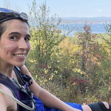
In the next few miles, the overcast skies cleared to blue. During the hottest part of the day, I started to melt down. Nausea came in waves—I forced myself to eat (though nothing left in my vest was remotely appealing) and washed everything down with water. The benches, though fewer and farther between on the eastern end of the trail, became my saving grace. I allowed myself to sit and elevate my feet for only a minute or two at a time. I took in the view—a breeze riffling the pure blue surface of Lake Ouachita, surrounded by the red and gold and green and brown of Arkansas in late October. In a moment of stillness, I forgot my pain and nausea just long enough to want to keep going.
The short climbs on the east end of the trail were only steep and long enough for me to curse them under my breath. But nothing compared to what awaits me on the Ouachita Trail, I know. I ran out of water a few miles from the end, an avoidable mistake. The remaining handful of salted nuts in my pocket might as well have been a handful of sand. Nothing went in the last hour of the run, when I was already quite depleted.
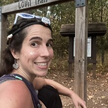
In the last mile, the trail meandered quite close to the road, taunting me as I was forced to turn back away from the end and into the woods. When I finally reached the wooden arch over the Blakely Dam trailhead, I was astonished that I had managed not to leave the contents of my stomach somewhere along the LOViT.
I spent over an hour recovering in the parking lot beside my van, slow-sipping water until I could stomach a few bites of food, until I could face the hour-long drive back to my dad’s house.

