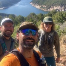
As the dawn sun began to light up the top edges of the low-hanging cumulus clouds, we made our way to our starting point on the south-west corner of McFee Reservoir. Clinton blasted the opening song from a Tool album, one of two CDs he had forever stuck in his tape deck (the other being Mackelmore), and the Jeep was filled with a palpable sense of anticipation. We arrived at the parking area and quickly got underway just after 7am. Right away Felipe pushed the pace along the pavement as we made our way for the Sage Hen trails.
We followed cattle ramps down to the Dolores River and filtered water in the shadow of the McFee Dam 400’ above us. We had that and more to climb to get up and over to Dry Canyon, the furthest and most remote access point to the reservoir. As we topped out and saw the expanse of the lake we were jittery with excitement. We had this route dialed. Two days earlier we had Jeeped out to the only real question mark remaining on the route and scouted an efficient line.
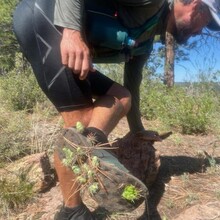
The Dry Canyon switchbacks went down fast. We refilled water quickly and took on the adjacent climb, bushwhacking through the dense thickets and gambrel oak. This section is physically and mentally draining. The scabs would only materialize after another day, commemorating this particularly punishing route. Once on top of the mesa we plodded east on an interrupted trail. We all came to fear the cactus we’ve since identified as “jumping cholla”. We had to stop half a dozen times to scrape and pluck this nasty species out of our shoes, ankles, legs and hands. Paranoia set in.
We were all too relieved to find our way off the mesa and back down to the lake for the most anticipated part of our circumnavigation- the swim. We settled on swimming a ~200 yard finger of the lake and determined it could save us as much as 2-3 miles of rough route finding. We had all packed a drybag and carefully packed our kits away on the shoreline, careful to keep as much air as possible in the bag to act as a floaty if we needed to take a break (we don’t swim good). Once on the other side we filtered water for the last time, had one more climbing bushwhack and made a beeline for House Creek Rd.
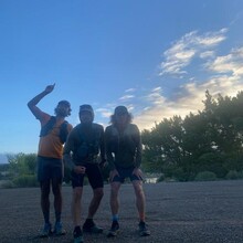
Emerging from the woods onto the pavement meant we were back in familiar territory. There was no more guesswork, no more looking at the gps, it was time to grind. Clinton set the pace with back-to-back-to-back sub 8 minute miles in the midday heat. We turned on to the Overlook trail and realized if we hustled, we just might have a chance at breaking the current FKT by an hour. We cut some switchbacks, gritted our teeth and found our way to the May Canyon bail-out. Once there we just had to ford the Dolores River and finish off our run on the sandy banks. Final time 7:14:53. A new record, by almost exactly an hour.
The previous record holder used a slightly different route on the far west and far east sides of the lake. It may be up for debate, but we think our route is the most efficient yet. There may be some slight alterations if we did it again, but I think we had the route more dialed-in than anyone else to have run the circumnavigation. This route is near and dear to our hearts, it being in our backyards, and we hope more people step up to the challenge and push the limits. It’ll be fun to see how fast it could go.


