
Started at 9:33am at the Hurricane Creek TH. Studied some maps the night before and got eyes on some of the drainages when going up to Twin Peaks earlier in the week. Wanted to run about 0.5mi up the trail and then try to pick a route that wasn't too brushy through the drainage north of Dunn Creek and then gain the south ridge of said drainage. The female FKT holder ran on the trail about 0.3mi and then crossed Hurricane Creek, probably because there is decent enough access to the river from the trail. I got 0.5mi up the trail and realized the trail continues to climb above Hurricane Creek so departing from the river earlier probably makes more sense. Dropped about 50ft to the creek and found the least sketchy crossing I could. Hurricane is flowing fast and hard early July. Crotch deep water, don't really recommend early summer.
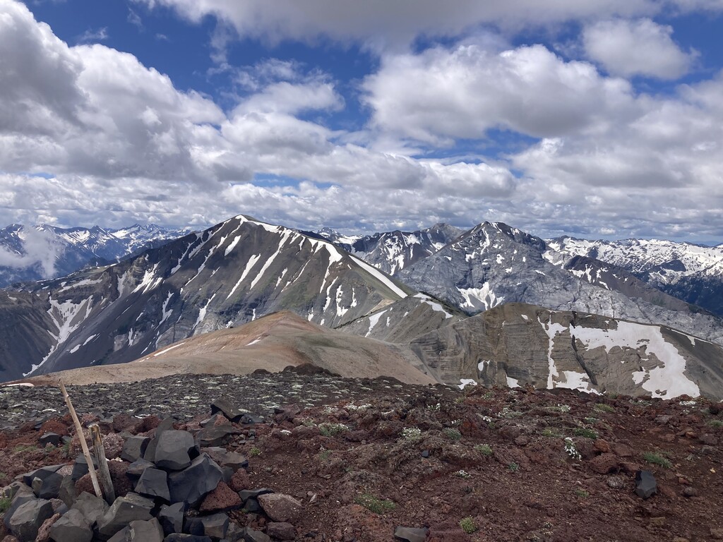
After the creek crossing, I did some bushwacking and was exactly where I wanted to be, however the north ridge of the drainage seemed much clearer of dense ground cover so continued in that direction. The next 1.5mi from the creek was mostly through timber and tried to pick straight forward lines that were clear of undergrowth. Mostly just hiking up and then catching games trails east wherever it made sense. After exiting the forest there was quite a lot of loose shale and it was slower going but at least the ridge to Chief Joseph is in sight. The ridge to Chief Joseph is by far the best part of the route. Very straight forward route finding and much more runnable which was nice. Also, views. Hit the summit at 1:41 on the watch and stopped to eat something, drink some water, take some photos, take a leak, enjoy the views, empty shoes ect. Not really in a huge rush. Left with 1:45 on the watch.
The Chief Joseph ridge descent is fun and fast compared to the rest of the route. Tried to follow the true drainage ridge after exiting the Chief Joseph ridge because on the ascent I was always on a sidehill working up. Did a better job on the descent but slowly got pushed toward the line I took on the ascent probably because there's just less ground cover. Super steep terrain and felt like a just kinda skied down on my feet. I think I had a mile that I lost 2,000ft at some point. Did not pick the best line and was pretty slow once I got closer to the drainage into Hurricane Creek with some rocky drop-offs and thick ground cover serving as speed bumps. Got to Hurricane Creek and realized I was in a terrible spot to cross with very fast and turbulent water. Continued bushwacking downstream. Found a spot that was still sketchy but got across. More bushwacking on the other side. Not a great spot to reconnect to the trail and ended up rock climbing to get back up. Once on the trail it was a nice jog back to the trailhead.
This is an interesting route that is unique in that it's a choose your own adventure, you don't see people, and it's almost entirely off trail. However, I am scratching my head why anyone would prefer this route over the established route to Chief Joseph Mountain, which is shorter, entirely on trail (way faster), and much more frequently used. It's a cool route if you know what to expect, you are looking for an adventure, and you enjoy off trail travel / navigation. However, after doing both approaches, I am of the opinion that the Chief Joseph Trail is the "premier" route up the mountain.