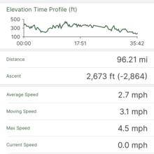
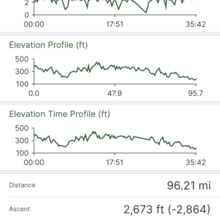
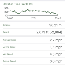
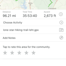
Well that was fun. Finished in 35:53:40 so roughly a day and a half. I did not run at all, just walked consistently at 3mph without many breaks other than a short sleep around the 63 mile mark. Weather was ideal, low 40s in the morning and 70s by afternoon. Biggest challenge was most of the natural water sources were dry or very dirty. The last two "rivers" were filthy and I ended up going dry the last 14 miles. Other challenges were the four or five long road walks and finding a camping spot during hunting season. Other than that it was a very peaceful, scenic trail that is in great shape this time of years. It's also unusually well marked until the last 15 miles with blazes and mile posts/signs everywhere along the way.
If I was to do it again I'd go opposite direction from east to west. The last 20 miles were riddled with barely visible tree roots that act like landmines, and it's hard to watch your footing while battling paranoia (am I on the right trail?) and alternating focus between tree blazes and Gaia's GPS tracker. Must have stubbed my toe hard a hundred times and trying to avoid falling was kind of painful when every joint and tendon was screaming at me.
Funny coincidence I ran into a fellow named Rafael near the halfway mark on Thurs night, he was going the opposite direction trying to set an FKT. Hope his trip was a success.
For verification I posted Gaia and Garmin data. Gaia on my phone recorded the entire trip successfully but the Garmin watch I stuffed in my pocket as backup died around 50 miles. With Gaia there are some minor but perplexing inconsistencies between data showing on my iPhone app and Gaia's website which produced the link above. Total mileage, rest vs moving times, max/average/moving speeds, elevation gain/loss, etc. are all slightly different even though it's the same data file. Couldn't figure out the cause despite several hours trying different browsers and operating systems so I emailed Gaia about it. I took 50+ short videos at mile markers for backup and will put together a video at some point but for now am happy to share via Dropbox if my Gaia and Garmin data are not sufficient.
Regarding transportation I would strongly suggest leaving your car at the finish and deal with getting a ride to the start while you're fresh warm and fully stocked. I finished the hike around 6pm on a Friday and figured Uber/Lyft drivers would be everywhere, but no cars were available despite repeated attempts on both apps. There are no reliable taxi services in Cleveland either, they have to leave from Conroe which takes time and some willingness on their part which I wouldn't count on. The LHST Hiking Club website had some suggestions but none of them worked unfortunately, either got voicemail with no call back or the phone numbers were no longer in use. By the time I realized my situation it was getting cold and dark, I was low on food and hadn't drunk any water in five or six hours. I stuck out my thumb and was very fortunate to catch a ride to New Waverly and get a Lyft from there to my car. Definitely should have dropped my car off first and dealt with transportation to the start while fresh and fully stocked. It wasn't the best way to end a successful hike, and made for a long trip home.


Comments
Nice! I have a hard time imagine doing that trail without help with water (at least this time of year), congrats for demonstrating that it's possible.
Glad you caught a ride from the finish - those trailheads are definitely remote.
Congratulations on your finish!
Thanks Marcy! I actually read your trip report before heading out and really appreciate you taking the time on it.
My general laziness and lack of preparation has taught me to go without water for long stretches, and some of those ponds and streams were so nasty they weren't hard to resist.
Maybe next time I'll try running this trail and set a proper FKT!