
Links
Map: https://caltopo.com/m/9LNU
Strava: https://www.strava.com/activities/10074026365
Gear list: https://lighterpack.com/r/7ha6yn
I’ve been interested in the Toiyabe Crest Trail in central Nevada for years and I’m so happy I finally got my chance to run it! It’s the longest continuous trail in Nevada, and one of the last ultra-length National Recreation Trails that hadn’t yet been attempted for speed. In 2021 I planned to mtb the northern non-wilderness bike legal section, but had to cancel. Later that year I was going to try again after a trail work campout but wildfire smoke was thick thick thick so I had to cancel again. We cleared the first few miles of trail in the smoke though so having some sweat equity in the land I knew I wanted to come back and run the whole thing. Shoutout Kurt Gensheimer for organizing so many trail work crews to put love into the land. (see: https://tahoequarterly.com/fall-2023/sage-wisdom-reviving-the-toiyabe-crest-trail) The TCT was built almost 100 years ago and its remote steep terrain means it hasn’t seen a lot of maintenance since then, til now. Most trip reports note overgrown brush. But it’s in better shape now than it ever has been! I ran the first few miles of the big initial climb of the route on a later camping trip and it’s just so dang nice and beautiful out there. Another pro of waiting years to do the trail was I had plenty of time to gather beta, which was much more limited in 2021. Searching the CalTopo public maps yielded some notes on previously unknown water sources and other trip reports trickled in.
In 2022 I applied for a CalTopo Adventure Grant to run the TCT, was awarded (thanks y’all! Best trip planning mapping software by far!), and set my date for the fall. Turns out 2022 was one of the biggest snow years on record, and it snowed just before my attempt and just kept on snowing. I was so thankful for the sentinel high res satellite images in CalTopo to see exactly how much snow had fallen on which parts of the route. To think just a few years ago you would have to drive all the way out there to see how much snow there was. Or call a ranger station and they’d say “yep there’s snow” but not have detailed info. There was even one storm that dropped snow in fall 2023 before we started but I was able to watch the snow melt day by day and it melted just in time. What a time to be alive.
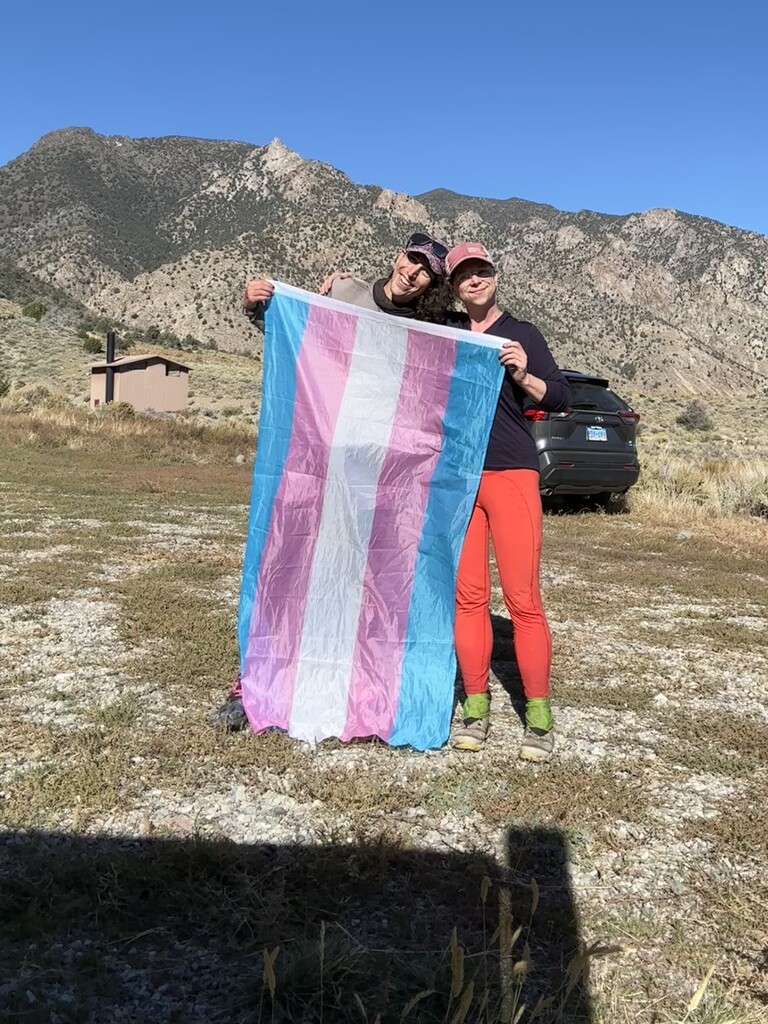
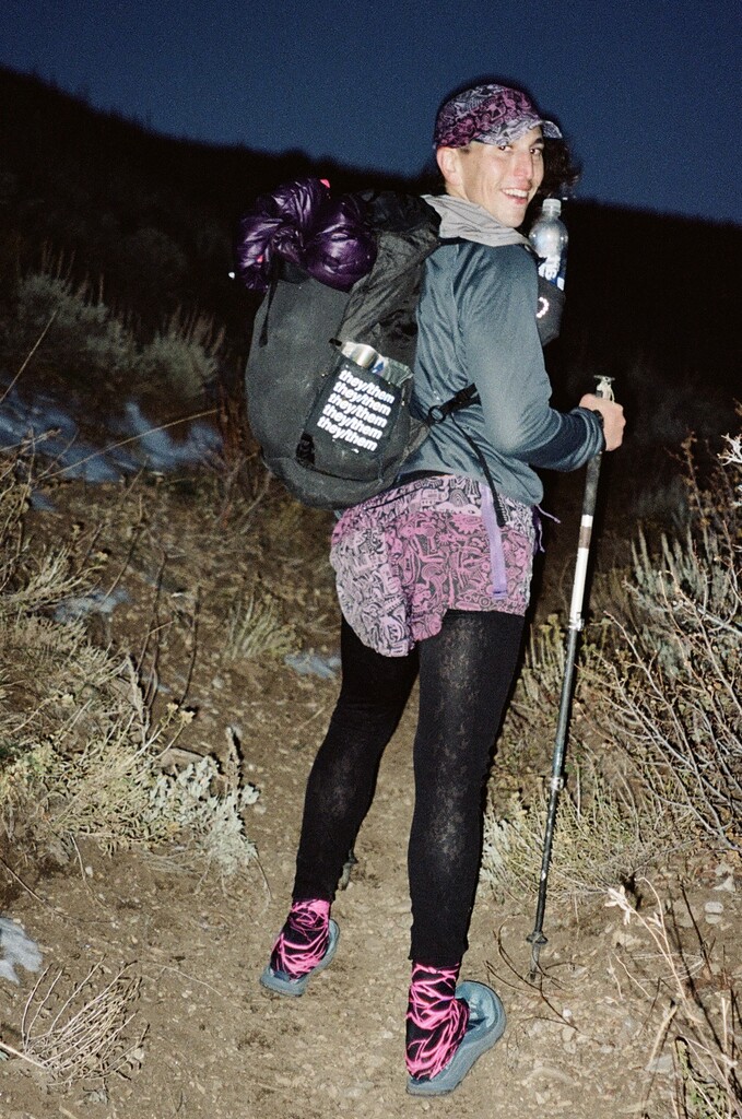
With snow covering the route well into the Spring, I pushed the start to Fall 2023, which was great because that summer I met Cryptic, a PCT hiker I trail angeled for after they came down out of the snowy snowy Sierra where I live. We’re both trans and non-binary and they were obviously good at trails so I invited them to come do the TCT with me and they said yes! When the power of an ultra runner and a thru hiker combine! T4TTCTFKT! We were both anxious the other would be stronger but we turned out to be a perfect perfect perfect match pace and style wise despite doing 0 miles of trail together before the start. Wow! I hired my coach Toby of Queer Runnings in January and got some actual dedicated training in for once. Nice. Thanks Toby. And since I’m doing shoutouts thank you to Pa’lante for the Joey which was the perfect pack for this route.
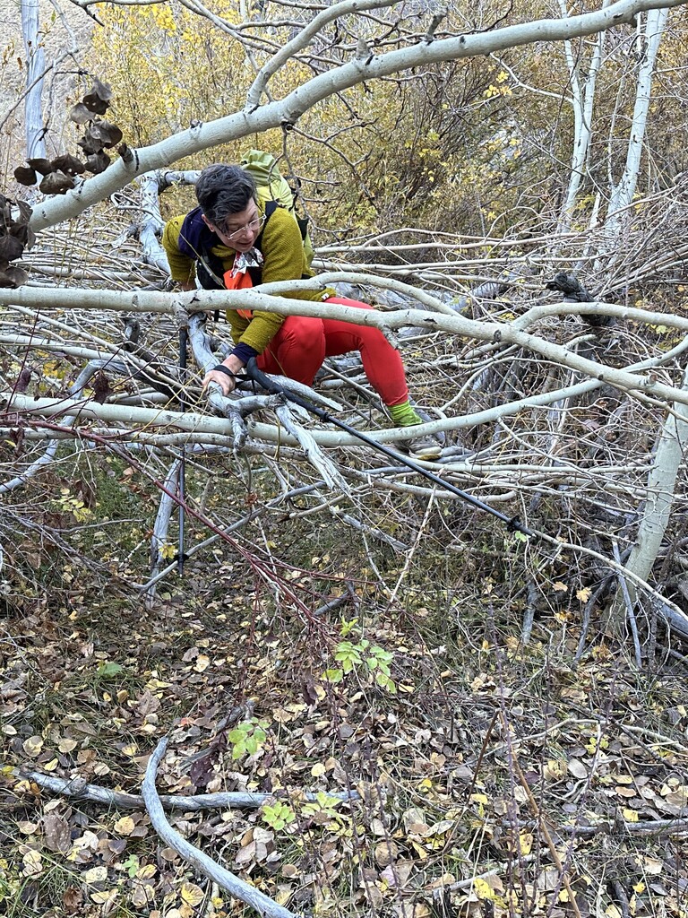
A month before our start date I went and did my own anarchist trail work brushing all the thorns out of the trail bed for the last three miles of the route. Your local trails probably prohibit this but out here in remote central Nevada a sign at the trailhead encourages you to pull and pack out weeds if you’re sure you can identify them. Love the land back! Instead of leave no trace can you leave a positive trace in reciprocal relationship? People are meant to interact with the land. Picking up trash or moving a rock out of your local trail counts. There are lots of special rare plants in the Great Basin too though so make sure you know who is who! Look up the fight to save Tiehm’s buckwheat, which only grows in the Silver Peak range just west of here, and is currently threatened by a lithium mine. Nevada is full of endemic plant species that sometimes only grow in one particular mountain range and that’s the only place it lives in the entire world.
Speaking of land and mining, this land is also known as Newe Sogobia, a vast expanse covering much of Great Basin and much of Nevada. This is Newe (Western Shoshone) land. The Yomba tribe still lives here to this day, with a reservation to the west of the Toiyabe Range. The US recognized Newe Sogobia as Western Shoshone land in the 1863 Ruby Valley Treaty. The US has failed to uphold its end of this treaty. It was specified that non-Natives were only permitted to do resource extraction if royalties were paid to the Western Shoshone. Nevada is the second-most mineral producing state in the US - a constant churn of extraction and land devastation and poisoning. Anyone recreating in Newe Sogobia should work toward environmental justice.
One concrete area to start is repealing the Nevada 1872 mining law. This law, still upheld to this date, mandates that where applicable, which is 15% of all US lands, destructive mining shall be held as the “highest use of the land.” Even if a place would be better served for conservation, recreation, or traditional lifeways, if a company can stake a profitable mining claim, federal land managers can be forced to permit the mining, with no royalties paid to Native people, breaking the treaty, or to the public for that matter. Yet everyone suffers as the earth is poisoned and climate change accelerates. At the brink of mass extinction, we must have a paradigm shift. Referring to places like remote Nevada as “the middle of nowhere” devalues the land for the sake of it being land and disrespects other non-human life forms. Everywhere is very Somewhere to somebody. This devaluing of life for the sake of it being life is what has led to the US using important cultural lands as a national Sacrifice Area for nuclear testing and waste disposal. The thousands of nuclear detonations at Nevada Test Site 150 miles south of the Toiyabe Crest Trail subjected much of Newe Sogobia to cancer-causing fallout. We’ve got to recenter valuing life over capital and expansion. We must stop destroying our last stands of biodiversity, write into law royalties paid to Indigenous people to fulfill treaties we signed in the past, and more in reparations for what our ancestors and modern day extractivists have done to destroy this land, and also simply give the land back. It’s been unceded this whole time. There is no separation between people and Earth.
Sources:
https://nuclearprinceton.princeton.edu/western-shoshone
https://sacredland.org/mount-tenabo-united-states/
https://www.pbs.org/circleofstories/storytellers/corbin_harney.html
https://earthworks.org/issues/1872-mining-law/
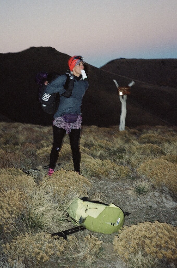
I am blessed to be able to spend multiple days at a time sometimes building my relationship being with the Earth and letting time be longer. Cryptic and I met up at the southern trailhead on Friday and shuttled up to the northern trailhead. The road was washed out on the way to the privy north of the trailhead and it was locked anyway, and a sharp rock gave me a flat we didn’t notice until the morning right before we were supposed to start. Noticed it at the trailhead anyway and figured I’d fix it when we got back. No point in stressing now.
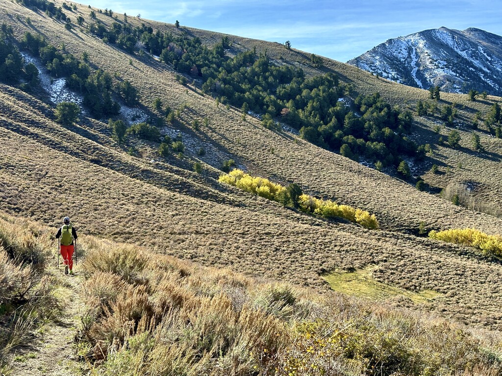
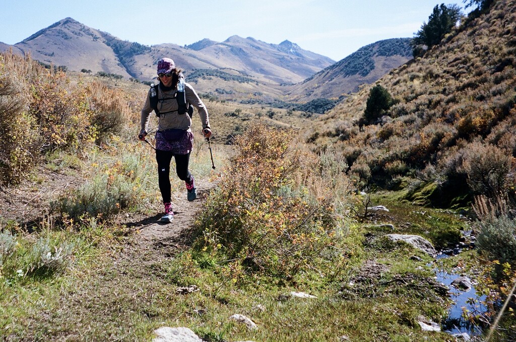
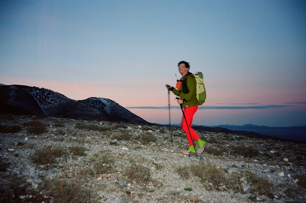
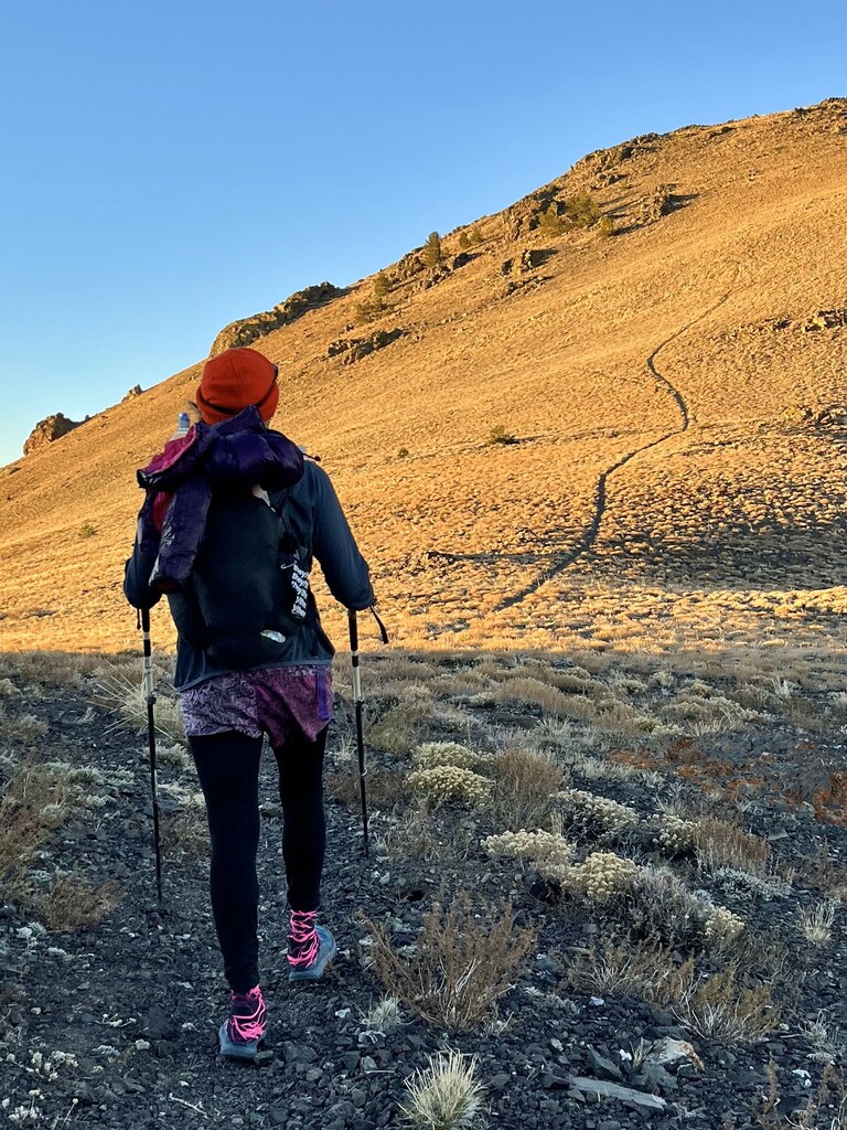
So we took our start photo and started in the dark at 5:48 am. Jogging the first part of the trail I helped clear in 2021 was so nice. Then the first big climb started, 3,000 ft and it was great to have it to warm up and watch the sunrise shining through the low grasses. Steady up the hill and continuing on down. There were tiny snow patches, nothing to get your feet wet or be slippery, just very scenic especially against all the aspens shining yellow for fall when they were around. I loved cruising through the sagebrush sea. The trail was in great condition for honestly almost the entire trail, especially the northern non-wilderness portion where trail workers can get farther back on ebikes. Not rocky or technical at all, I’m talking almost all of it is runnable. What a great trail.
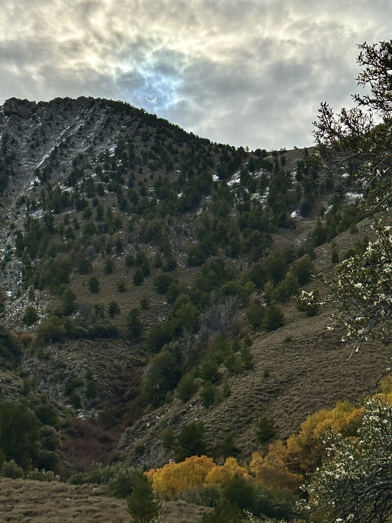
By the time we got to our water stop at Washington Creek (so we didn’t need to haul much up the first climb) it was time for the annular ECLIPSE but we hadn’t planned on dropping into a CANYON on the CREST trail lol so we took a small side trip up a hill to be able to see it over the crest. Eclipse! The whole area darkened for the 90% coverage of the sun from where we were. I’m glad we were able to see it. I wasn’t sure if we were gonna make it there for a second, just dropping down down the trail. So cool to be sharing a unique moment on trail with my new friend. Got easy water and continued on feeling great!
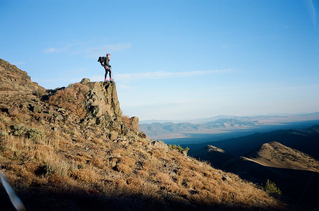
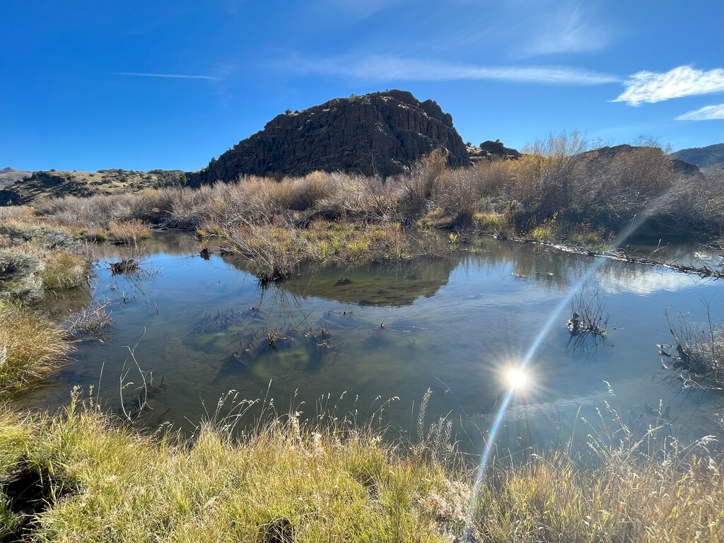
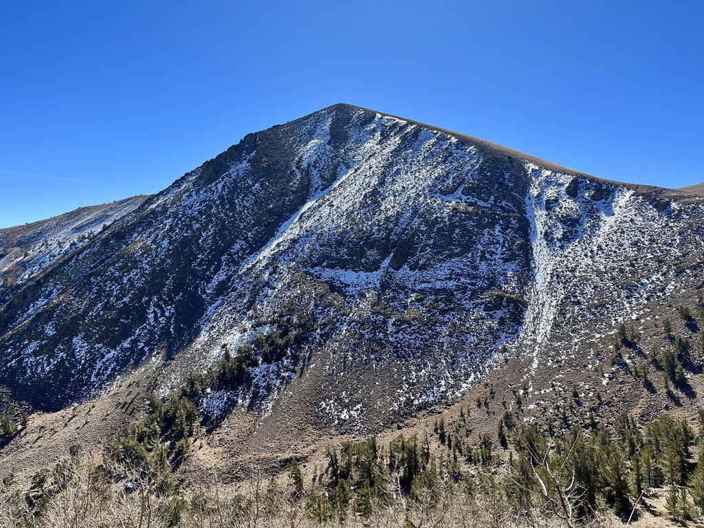
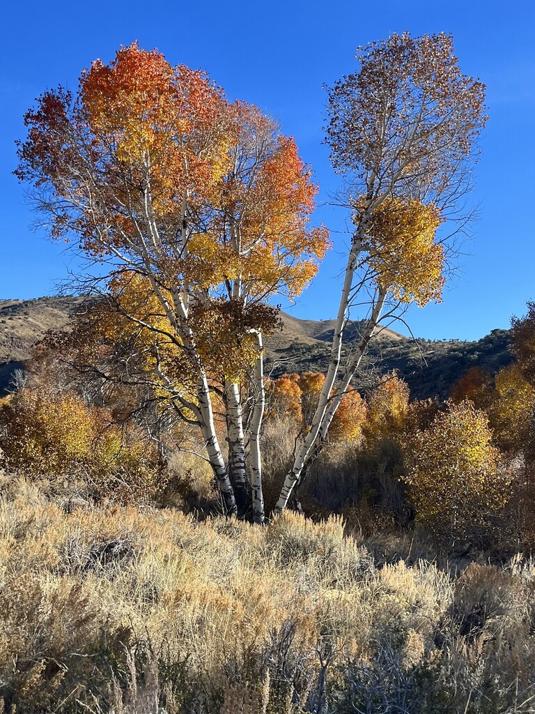
The views into the valleys as you cruise along are amazing. The trail stays up high, around 10,000 ft, which we could feel a bit at the highest points but wasn’t a problem. We saw two wild horses up on a high peak, and it was youth deer hunting season so we saw two father son teams, but no deer, just tracks. Aspens growing where water flowed down the canyons were all blazing yellow and we loved going through the tunnels. There are multiple water sources so we always had some when we wanted but didn’t have to get feet wet the first day. Saw some big mountain mohagony. Lots of elevation change the whole route, and this day ended with a gradual uphill. We stopped for dinner at sunset at mile 27 where the last water flowing across the trail was for the next few miles. We were tired before dinner but got a little second wind and cruised a few more miles.
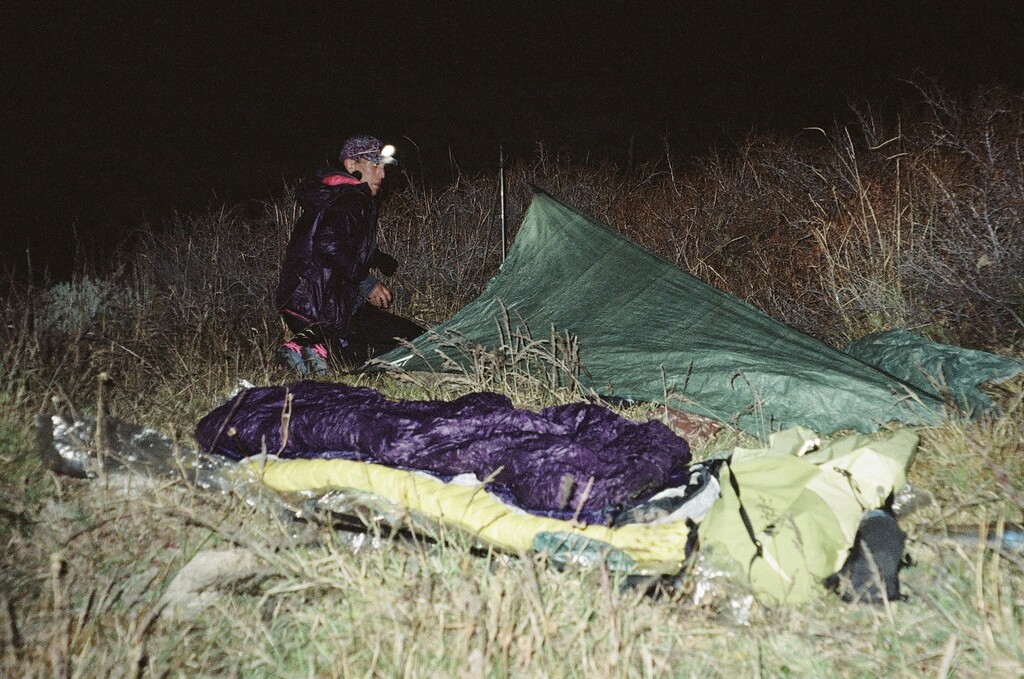
I had marked a campsite option near marysville canyon on the map where a previous backpacker had stayed, but there wasn’t one anywhere. For most of the trail the brush is quite thick on either side of the trail so you can’t just lay down whenever you want. Sometimes it’s miles before a good spot appears. But we didn’t bring enough water to dry camp so we went down to the tiniest trickle of a water source at marysville canyon where Cryptic found a sliver of a spot for us, which was lumpy but worked out great. Central Nevada has some of the darkest skies in the contiguous US and the bright Milky Way sang us to sleep.
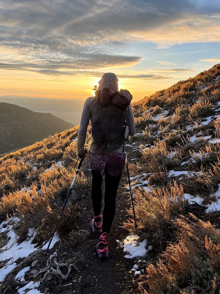
Slept a full night and woke up and got moving before sunrise. Sunrise up on the crest was so beautiful, nothing but rolling mountains and valleys in all directions. Did you know Nevada is the most mountainous state? 314 ranges. And so we kept running when it was downhill and moving with purpose when it was uphill. All the other trip reports I read mentioned cows but we were lucky to encounter no cattle the whole trip! Approaching the high point there was a cool view of the north face of a peak covered in snow, but our route was pleasantly dry. On up and we took a break at the top with a view view view! Cryptic pointed out the California White Mountains (Cryptic has hiked a lot in the East Coast White Mountains, different range haha). And then we ran for miles down to the next water source at the Big Sawmill Creek headwaters where we had lunch.
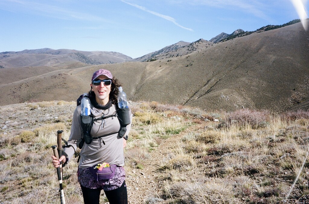
I was so proud of my body on this trip. No blisters, no chafing, no stomach issues aside from a mild case of the altitoots, some expected muscle fatigue from back to back big days but nothing that even hinted toward becoming an injury. My feet weren’t even sore despite my desk job and general low time on feet lifestyle. I was able to move as fast as I wanted whenever I wanted, and I was never “suffering.” I just felt good and had a great time being out and being in motion. Wow. Nice.
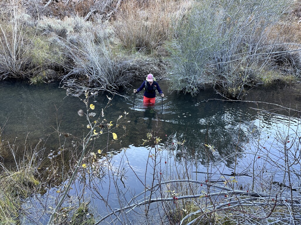
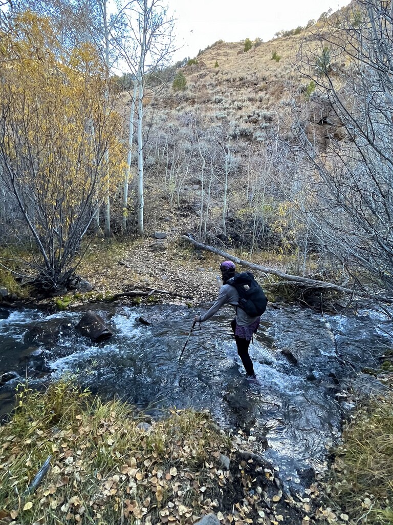
Once at Big Sawmill Creek, there was plenty of water available the rest of the trip. Continuing downhill the water gets more plentiful especially once you get to the actually a real river the Reese River. Crossings played nice though - we didn’t really have to get feet wet til toward the end of the day. The deepest crossing was hip deep at the end of a beaver area but even with the water level being the highest it’s likely to ever be after this wet wet season, the flow was slow and relaxed. The trail was almost always easy to follow and not overgrown for the whole northern non-wilderness section. Once you pass Ophir Pass and the wilderness starts I was expecting a mess based on past trip reports but if you just keep moving forward with purpose, the trail is mostly easy to follow and even if it does disappear it picks back up in a couple of feet. (Easy for me to say mostly following through this section with me checking the gpx from time to time, on my phone, I don’t use a watch, and Cryptic doing the in-front-of-your-eyes navigation.) We lost the trail just a bit in some marshy meadows and coming out of them but we were able to see it up by a tree in the distance in the last bit of daylight and easily got back to the easy travel until we got to the last pass around mile 57 Sobo in the dark.
A word of advice. If you are used to following a line on a gps app or watch religiously, toss that idea out the window for this route. All of the maps are straight up wrong at some point or another. Trust the trail under your feet. Different maps conflict at different places, some will show the trail on completely the wrong side of a creek for instance. Because you could see in Caltopo that the maps didn’t line up with the satellite imagery, before our trip I went through and drew the whole route in in a new line based on where the trail was actually visible in satellite images which was helpful. Then I spent some more time in Caltopo after this trip editing a new gpx for your own future navigational use. While it’s still not perfect, I combined our on the ground track with where I knew the trail to be from experience, editing out our camp and water break blips, and improving accuracy overall. Export the purple Toiyabe Crest Trail gpx in this map https://caltopo.com/m/9LNU to navigate with in the future. Also in the map is our pink unedited track for reference. The lesson being - trust the trail on the ground.
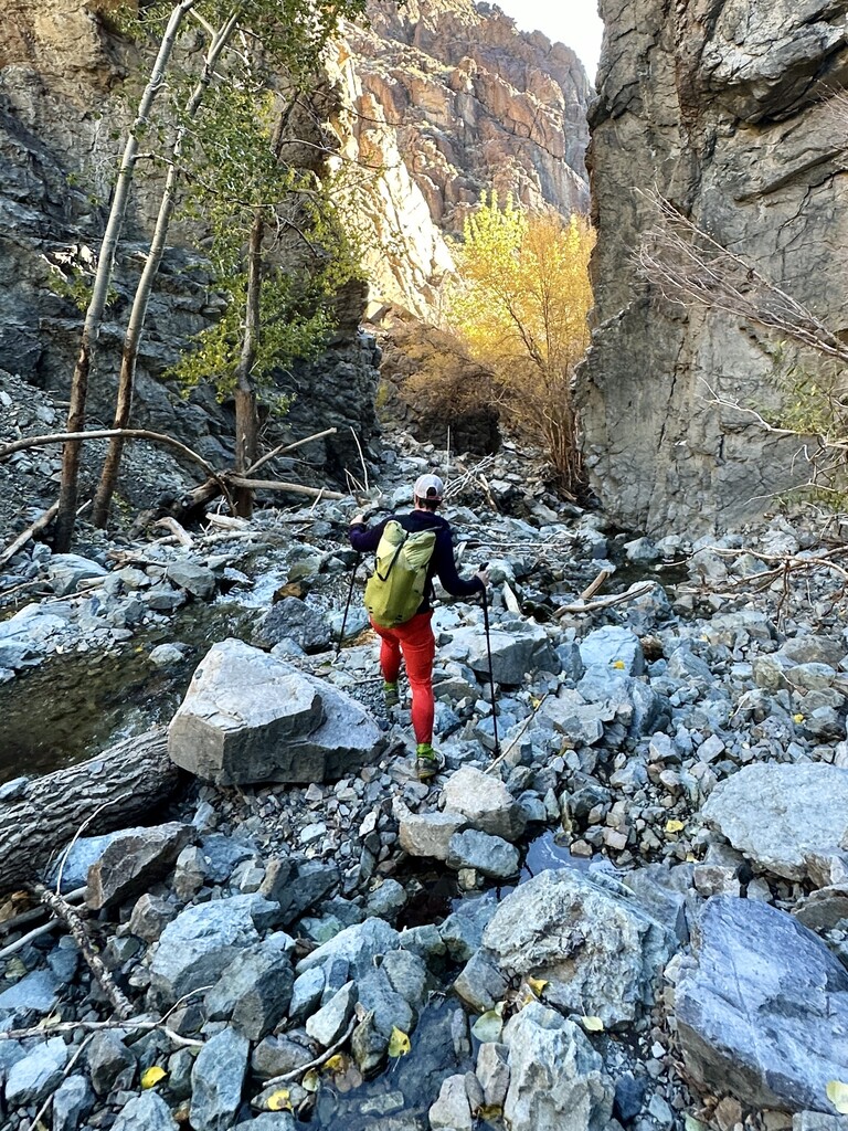
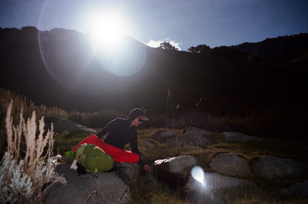
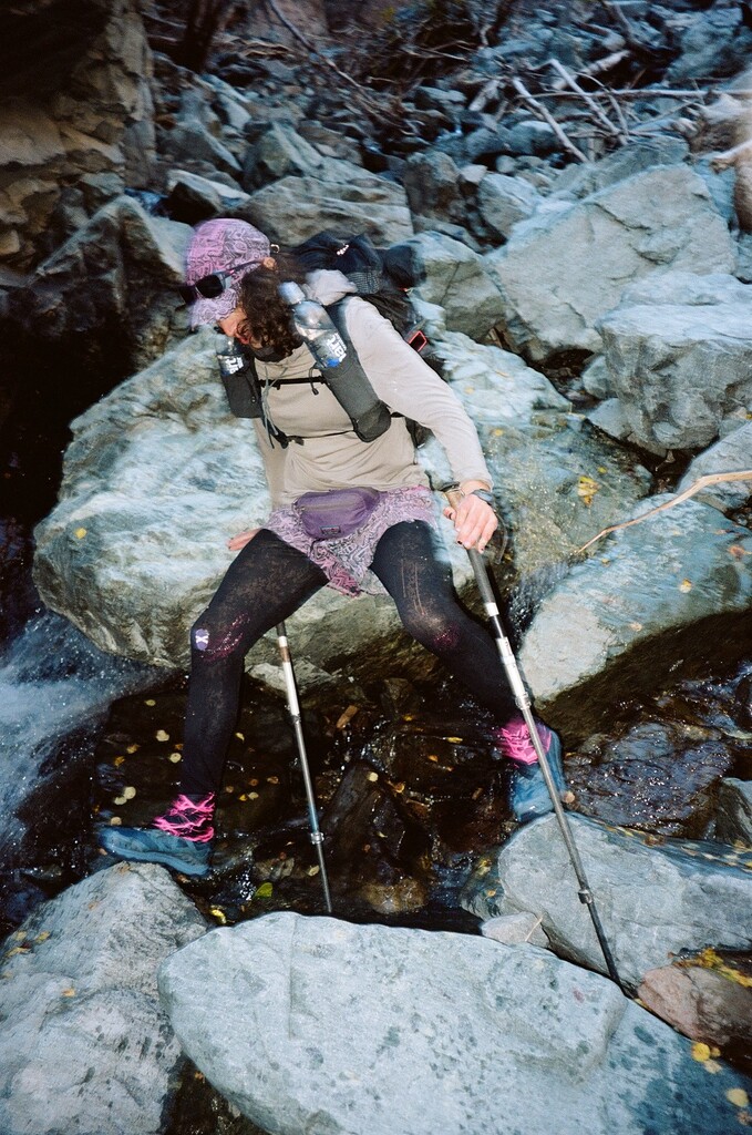
Once you get over the last pass at mile 57 you cross the river many times, maybe ~30 times, so expect to have wet feet past then. I knew to expect this from other trip reports, and my scouting trip, and I also read about the way Tropical storm Hillary in 2023 washed the trail completely out in a section of the south twin river area around mile 60 Sobo. The trail is obliterated and the river is full of talus and downed tree debris with water flowing through it that you need to pick your way through. Though Cry and I were feeling good in our bodies and motivated to finish in two days, knowing what was just ahead, we made the decision on that last pass to camp there. We thought navigating the rock fall in the dark would be dangerous, and the constant wet feet might present a risk of hypothermia in the dark. This was the right call - it would indeed have been hard to find the right way to go in the dark. So another night of sleep it was! Nice thing about setting an okt lol, less pressure.
We woke up to frozen shoes and got moving at first light, the trail brushy, and we were thankful to have sun to navigate with. I was expecting the worst for the washout based on other trip reports but it wasn’t bad at all!! We only had to climb over like two downed trees, and the talus was just a fun section of class 1-2 scrambling around cute waterfalls. We knew there would be many water crossings so they just all were really funny, crossing over so many times. And the rough section was only half a mile or so!
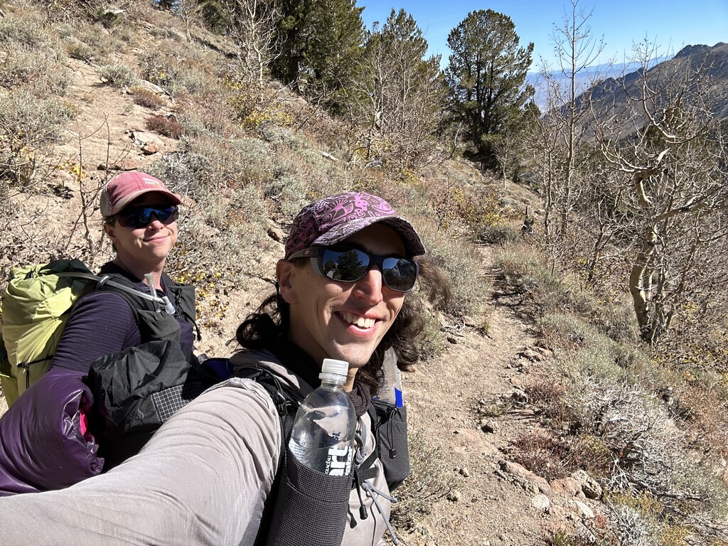
Then it was back to the great runnable trail, and at the last three miles I knew it would be brush and thorn free due to my past trail work. And it was. Nice! So we cruised on out and finished at 10:03 am! For a total time of 52:15:55. Yay!
We took our finishing pics and on the shuttle back to the start we saw a herd of pronghorn antelope running across the valley! The fastest land animal in the world after the cheetah, they can run 65 mph. Did you know there used to be an American Cheetah? They went extinct in the last ice age but the pronghorn live on. There are still modern day mountain lions in the area but of course they are not as fast as cheetahs.
Back at my truck we replaced my flat with the spare, which was low, with no air compressor to be found from the passersby I flagged down and no gas station for many miles and no cell service. Looking for the fire station we couldn’t find we did find a mountain biker who had flown a private plane into the kingston airstrip who loaned us his bike pump for manual air. Made it to the small town of Carvers and got some pizza waiting for the tire shop to tell me they couldn’t fix or replace my tire so I drove home to bishop on my full size spare and it was fine. Cryptic and I shared reflections and poetry on the tailgate before parting ways. Wow what a dreamy trip.
Lots of flowers were blooming even in October - Apricot globemallow, paintbrush, lupine, phlox, milkvetch, buckwheat. Most of the route is exposed and unshaded with low Great Basin shrubs (which vary in color and I think are very beautiful) but the trees on route in patches included beautiful quaking aspens in all colors, mountain mahogany, and piñon and limber pines. We took time to crush a few leaves and sniff the pleasant sagebrush and monardella, nature’s aromatherapy. Our weather was perfect. Highs in the 70s, lows around freezing, partly cloudy with no wind or a light breeze. Wow.
Highly recommended that you come visit central Nevada! At about 100k, this route will definitely go in a day, esp if someone cleans up the washout but even that section isn’t too bad. A bit of a use trail is already settling in. Our total time was 52:15:55, and strava says our moving time was only 17 hours - we just slept a lot and stopped a lot at water. Happy to put up a time for y'all to go chase! Most backpackers in the past seem to go Nobo but southbound gives you elevation loss overall instead of gain and saves your shoes from being soaked until the end, so I recommend going that way. We were unsupported, carrying all our food and gear from the beginning and using only natural water sources. Since we set the unsupported non-binary time, male and female times are also up for grabs! But being as we’re trans masc and trans femme and a lot of other gender stuff, we kinda have all three of those categories and more covered in basically all the ways you can, lol. Sports categories are a whole thing I don’t need to speak extensively on here, BUT the point is that the mountains don’t care about any of that, and regardless of your gender, running the whole Toiyabe Crest Trail is a feat and a unique experience, so come get after it! Beautiful, remote, special place.
Feel free to contact me for route questions or advice, I love helping other runners. I’m @glittergravel on instagram. Good luck and thanks for reading!
Cryptic's trip report
Day 0:
After a late night of travel, I started my day at a rest area near Amargosa, and drove north. With lots of time to spare before meeting up with Jessica at the southern terminus, I stopped for breakfast in Beatty, before spending the bulk of the day at a local hot spring. It was nice to have some time to breathe in the desert and all it had to offer. Burros drank from a nearby pool, as I soaked. I was lucky enough to have the place to myself, and got a lot of gender euphoria out of being able to exist purely in my body, in such a peaceful and soothing place.
Feeling refreshed, I continued to the southern terminus on twin river rd, and attempted, somewhat uselessly, to nap. Jessica arrived at the trailhead about an hour later as I was reorganizing some of my gear. Pa’lante was generous enough to provide me with a new pack for this run, and I took some time to figure out how to pack my overnight gear into a new vessel. After shuffling some things between cars, we hopped in Jessica’s truck and traveled to the northern terminus near Kingston.
The road to the northern terminus was in rougher shape. The grade past the trailhead toward the staging area we camped at was significantly rutted out. We arrived at our campsite as the sun was setting, made dinner, talked deeply and emotionally about life, set our alarms, and got what rest we could before the run.
Day 1:
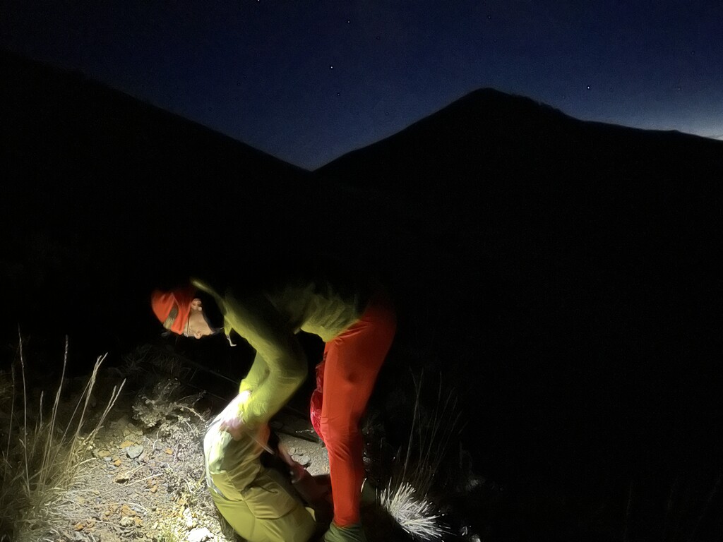
After a chilly night just up the road from the northern terminus, we woke up around 04:00 to get moving before sunrise. Despite very little sleep, I felt ready. Coffee and calories consumed, we packed up and drove back down the hill to the trailhead. At the trailhead we did our last checks to make sure everything was packed and ready. We also discovered that the truck had a flat tire, a victim of the aforementioned rutted road. That would have to wait. We had mountains to move. We started our trackers, snapped our start photos, and started up the trail at ~05:48. After a flat half mile warm up we started the first part of what would be ~10,000 ft of climbing for the day. The trail here was in great shape. We crested the saddle as the sun rose, and took a quick stop to shed layers and put on sunscreen. Following the trail south we contoured around summits, mostly sticking close to the ridgeline. Wild horses grazed near one peak just above the trail. This section was mostly a lot of gradual climbing, but we were still able to open up on some downhills.
As the solar eclipse began, we descended into Washington Canyon. Worried that the massive ridgeline above might, itself, eclipse our view, I opened up a bit hoping to find a spot to view the crescent sun. We made it to a water crossing a couple miles down the canyon, and I ran up a nearby bluff just in time to catch the event. The sun smiled from behind the moon, shrouded in clouds. The world had darkened, but vivid yellow aspens waved from below, while the rocky snow dusted ridge towered above. Jessica, who had stopped to grab water, made it up the bluff just in time to see it, too. Everything felt in its place.
From here the trail made a pattern of contouring up to saddles, and crossing in and out of creases and drainages. Occasionally the trail would disappear as it crested onto ridgelines, lost to time in the rocks and brush. Our gpx file made in Caltopo was invaluable here, as often, the only visible trail was a use path going somewhere else entirely. Panoramic views of high desert tundra were interrupted only by small groves of trees in the arroyos. The blaring gilding of aspen leaves formed vibrant tunnels around the trail at points. Occasional pine groves cast a livid, deep green onto an otherwise beige and brown landscape. Each offered their own welcome escape from the sun.
The descent into Tierney Creek canyon brought us our last easy miles for the day. After a lovely downhill flight and a stop for water, the trail proceeded to follow a series of rough ATV roads. Climbs got steeper, and as we traversed a series of rolling hills, each little climb slowed us down just a little bit more. Still in good spirits, but certainly tired, we stopped for dinner as the sun set. A good long sit and a hot meal did wonders for energy, and we continued from there toward our intended campsite by the light of our headlamps.
At Marysville Canyon we managed to find camping in a clearing by a spring, after some time exploring the area in the dark. It was an extremely rocky campsite with very sparse flat areas, but we managed two human sized spaces for the night. The vegetation here was thorny and sharp, but our site was surprisingly clear of brambles. Some of the best stars I've ever seen twinkled overhead as we did our best to rest up for the next day.
Day 2:
I woke up around 03:00, but we didn't really start working on movement until a couple hours later. We were both vocal about feeling the previous day’s efforts, but still excited for another day in the mountains. This morning, we found ourselves more closely following the namesake crest of the TCT. As the trail wound through into higher peaks, the terrain grew rockier. Talus fields presented the most visible evidence of trail work, with well protected paths laid through rubble and scree. Often, use paths through the brush were significantly more obvious than any, would be “official” route. At the junction with the North Twin River Trail we followed one use path about 500 ft in the wrong direction as it curved off route. Luckily, Jessica was on top of it with GPS in hand, and we corrected our mistake relatively quickly. A series of cairns led us to the sharp right we had missed, and steeply up over the next ridge.
From there, the trail largely disappeared into thick chaparral as it traversed the long sloping saddle to the next massif. We followed a series of herd paths that seemed to more or less follow the route our gpx track indicated through the trees, and found our route forward to the next meadow.
We began our next climb, and while not a difficult one, I was feeling tired and overwhelmed. In a section with spotty shade, I stumbled briefly on a rock underfoot and it was just enough to emotionally tip me over. I stopped to cry it out, letting all the feelings run their course. We took a decently long break here to snack and refuel, and after some heartfelt reassurance and a lot of sour candy, I was feeling ready to take on the trail.
Climbing toward the trail’s high point was tiring and difficult, the altitude quickly depleting my energy. Knowing how close we were to being nearly done with climbing, and excited to reach the trail’s summit we made good time even if breathing was difficult. As we crossed over the high point onto the wide open tablelands of the Toiyabe Crest, panoramic views of the desert below grew increasingly impressive. We stopped briefly to rest and guess at which mountain ranges we were seeing in the distance.
As we lost elevation, I could feel my energy returning. After a lunch stop, we managed 12 minute miles for a bit as we descended through increasingly vibrant tunnels of autumn foliage. Each new grove of yellow and red gave me new life, as we sped along Big Sawmill Creek toward the Reese River.
As we made the left turn to follow the Reese upstream, the trail became increasingly overgrown, shrouded by reedy tall grasses. Here, we also began a series of fords that became increasingly frequent as we gradually gained back elevation. Beaver ponds were plentiful, and a few of our crossing points were waist deep. One of my poles broke as we rounded a bend between crossings. Luckily it was just the bottom section, and I was able to lengthen it and continue as though nothing had changed.
The day was dwindling as we continued toward the last major climb. At one meadowy clearing, we passed the only other campers we found on trail. They had large heavy framed tents that had likely been packed in by horseback or atv. When they heard we were trying to make it out that night one shouted across to us, “y’all got tents?” I found this particularly humorous. We didn't, of course, but it certainly wasn't going to rain. Not far from there was a cattle graveyard along the trail. Several carcasses were strewn about, and bones everywhere. I was fascinated, but I think both of us were a bit uncomfortable, and daylight was a precious resource. We continued to our last crossing to fill up on water.
As we left the water behind and the light began to dim, the trail became less and less obvious. As we traversed the headwaters of the Reese River, what little herd path we had disappeared into brushy wetlands and cattle bogs. We made a good team with Jessica on GPS, and me scouting for signs of a path, quickly solving our way through each confusing little meadow. We made it to visible trail, with the last light of the day and summited our last pass as the sky darkened. We stopped here to make dinner, and consider our next steps.
We had started the day optimistic that we might finish that night. Here, though, we made the call to make camp and prioritize our safety. We knew that the trail ahead was obscured by rockslides, overgrowth, and numerous water crossings. With no moon, and a chill in the air that would certainly be colder near water, we’d be risking hypothermia to continue through wet conditions. We had enough space at our little dinner spot on the divide to bivy for the night, and the stars surrounded us with a dazzling show to fall asleep to.
Day 3:
I woke up this morning sore, tired, and hungry, but incredibly excited to finish off the TCT. We had such little distance to cover, and almost all of it downhill. Just as I was about to pack up my sleeping pad, it popped on a branch poking through my groundsheet. I didn't need it anymore anyways. We fueled up, sipped at what little water we had left, and got moving into the canyon as the sunlight grew workable. We stopped for water once we had a decent place to sit and filter it, and ate a little bit more too.
The trail here was overgrown, and while surprisingly easy to follow in the light, would have been extremely stressful in the dark. We pushed through thick brush, and hopped through low vegetation, constantly eyeing for where to go next. As we moved through groves of trees we found ourselves scrambling through, under, and over blowdowns.
The canyon narrowed, and the trail was obscured by a series of rockslides. We traversed big loose talus fields and pushed through thorns and dense vegetation. Another section found us walled in by the cliffs above, scrambling over cascades, hopping in and out of the water, and wading downstream. This place was wild and feral, and I loved it so much.
Each obstacle we faced in the canyon felt so small and simple after the long mileage of the previous days. I was in my element, playfully exploring over rocks and streams. Skills I learned from exploring off trail in New Hampshire were put to great use here. Jessica had done trailwork ahead, so we knew what to expect from the last 3 miles. With that sudden confidence boost in navigation we were flying.
The leaves crunched underfoot as we ran through the last of the canyon. We climbed upward to our last bit of perspective. The terrain here was loose, and while it must have slowed us down to gain some height, our momentum felt unshakeable to me. We crested the last little ridge between us and the car, and after briefly turning to admire the route we had just traveled, I let go. The valley below beckoned, and the car poked into view below. I picked up speed. I whipped around switchbacks, slowing only to keep from missing each turn. I vaulted over rocks and pushed off corners with my poles. Each step felt more triumphant, and more free. I reached the trailhead at an all out sprint, jumped up and down triumphantly, and turned around in time to cheer for Jessica as they ran down the last switchback in turn. WE DID IT.
We took some time at the trailhead to celebrate, breathe, eat, and gather ourselves. At the northern terminus we had a flat tire to change, and some amount of uncertainty if we had the tools needed to deal with it. As is often the case, the problems of civilization felt somewhat less perilous after some time in the backcountry. Things worked out fine, and we got the spare on. We did have to dig a bit of a well for it, since the jack was just a little too short. We stopped in Carvers, where there was a tire shop, and I picked up pizza from down the road while Jessica talked to the mechanics. We ate and reflected together on the tailgate of their truck, the Toiyabe range looming behind us, then parted ways. I drove south to catch the sunset at a hot spring, while they headed home across the basin and range.