Laure and I wanted a long, challenging run, and after hunting around for nearby trails this route fit the bill. Not sure I would recommend this one...This may be a more fun route if you're already somewhat familiar with the network of trails, but for me it was pretty frustrating to take so much time to stop and attempt to navigate. If someone were able to update the route description with some more details on the places to make turns, it would be a much nicer experience.
We made a good-faith effort to follow the route, prepared by studying it and printing out maps plus following the Strava route on our phones. Despite our attempts, we found ourselves off the course several times. Regularly checking Stava eats up time and battery, so we tried to only check when necessary and that ended up being a lot! I won't detail all the places we missed turns, or stopped bc we thought we were going the wrong way, or did go the wrong way (that's visible in our gpx file/Strava). It is not well signed, in some spots. Do not follow our /gpx/Strava, haha!
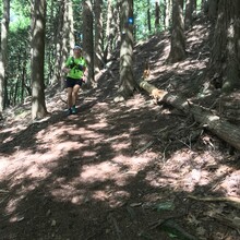
Besides that frustration, this was such a fun day in the woods with Laure! It was her longest run, most hours out, and most elevation. She was, as always, amazing. For me, it was the first time I've been out with another person on an all-day run. Very different feeling than solo runs, and so great.
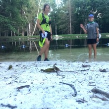
Excellent weather for this, too--breezy, not too hot, and not humid. I carried 3L of water, Laure had 2L, and we took a break and refilled using a filter at a sweet, cold stream near mile 14. Most small streams were dried up, so the main reliable water sources are the ponds. The stream looked nicer to drink. We carried a variety of snacks and gels/nut butter, and reminded each other to eat (so helpful to have reminders!).
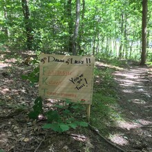
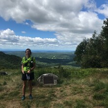
The sections on the Taconic Crest Trail were lovely, and fortunately we got to spend a long time on it! As a very funny and unexpected bonus, Tom had made a sign to cheer us on, and the timing worked out so that as he stopped to retrieve it Laure and I were just arriving. He said he figured it was us because he heard two women laughing on the trail. So, we got a little cheering support (but no other support, as Tom made sure to stick to the FKT rules), it was a great boost before running along the busy Route 20. As described by the original, the Taconic Skyline trail is used mainly by ATVs and dirtbikes, so keep an ear out and be prepared to hop off trail and wait for the fumes to clear.
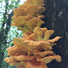
And, there was perhaps the most chicken of the woods mushrooms I have ever seen (plus some gone-by oysters and a gorgeous bear's head tooth mushroom). Laure was very practical about reminding me not to harvest them. I did take one beautiful, juicy specimen to eat later. Not much wildlife out during the day. We saw one doe, a garter snake, and a lot of chipmunks.

Comments
I wish you guys had reached out ahead of time - I wrote some pretty detailed directions (or so I thought!) for a couple BURCS folks who were planning an attempt earlier in the summer, I would have been happy to share. It's a tough course to describe because a lot of the trails aren't on hiking maps, but the intent was to follow (as much as I could) the original Hancock Shaker Village 50 Miler route as well as the two major permutations of Free To Run, and HSV used a lot of Skyline (which I would agree is pretty brutal).