Royal Arch Loop FKT
"You can't help but compare yourself against the old-timers. Can't help but wonder how they'd have operated these times."
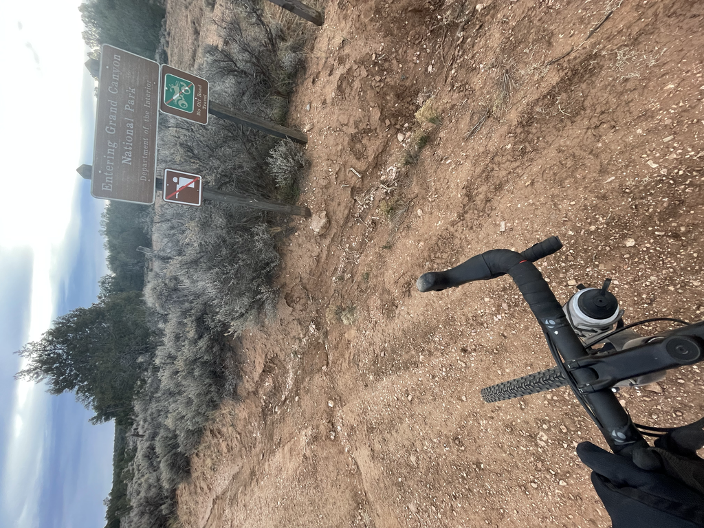
I rolled in to Tusayan Monday afternoon and started down the forest road to the South Bass Trailhead. The official drive out there takes you through the Havasuapi Indian reservation for a couple miles. After driving 20 or so miles on a forest service road I ran in to a locked gate. The gate to enter the reservation and to access the trailhead. Having driven here from Tucson I was a little bummed. The gate is locked and now I can’t access the trail but with he help of a map I found a side ATV track that skirted the reservation and would take me to the dirt road inside of the park and thus access to the trail. I followed this road as best I could in my truck until I got cliffed out 20 meters from the access road. Close enough to ride my bike the remaining 5 miles to South Bass.
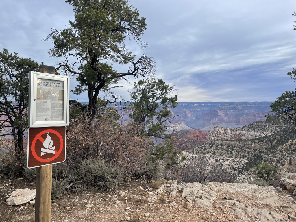
Around 730 AM I left my campsite and rode my bike In the freezing temps to the trailhead. With frozen hands and feet I started the descent down South Bass to the Royal Arch Trail. South Bass is easy to follow but Royal Arch is a bit more complex. Lightly used at best a map is necessary and with the wash outs and drainages GPS was extremely helpful even with it being unreliable under the towering canyon walls.
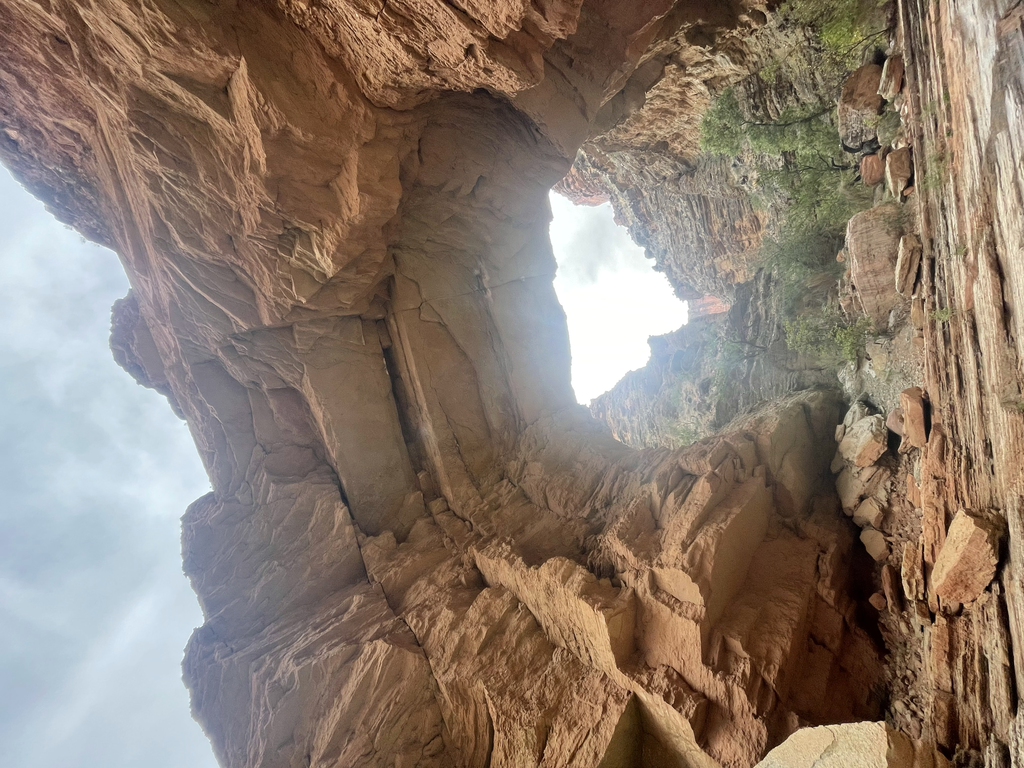
I made my way through the various geologic layers and in to the Royal Arch drainage. Here I found some bits of runnable trail and then boulder hopping followed by more rocks, sand, and ledges. Great temps and views made this tedious task better. Eventually I ran in to a decent size spring and then out of nowhere appeared Royal Arch towering over me. Technically this is a natural bridge but stunning none the less. Right past the arch is a massive spill off with a 200 foot drop as part of a canyoneering route. From here I back tracked a bit up the drainage to an old trail I would follow to a smaller 20 foot rappel off a small cliff band.
I rolled the dice on if there would be an anchor and rope here. Luckily when I showed up there was a fresh anchor and line there for me to descend on. Better than backtracking 15 miles to the trailhead. After checking the integrity of it I dropped down and carried on.
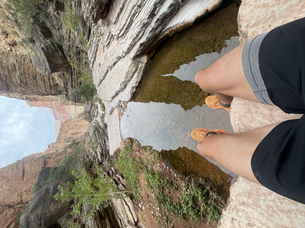
From here I made my way to the river and over the sharp rocks to Elves Chasm where I filtered a couple liters of water, took some pictures, and then backtracked again to the main trail.
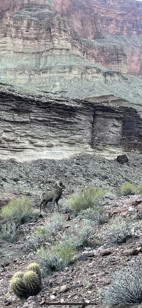
I got to the more runnable Tonto Trail about an hour before I lost light. As the sun set I crested a small hill with a male bighorn sheep that was not excited to see me. After a short confrontation with it charging me and then darting off I continued. Compared to the rest of the route this is an 11 mile cruiser section. That said in the dark with a headlamp it’s very easy to get lost or off trail. It’s basically looking cairn to cairn for hours in the dark.
Eventually I made it back to the South Bass trail which would complete the loop after I made the 5 mile climb back up to the trailhead. Climbing up my legs felt great but it was a hike at best. Night time up canyon through Boulder fields made it difficult and I got off track a bit. This would be way easier with light but with only one real away to go eventually I found my way up and out and made it back to the trailhead. Later than planned and just as I sucked my last bottle dry. Freezing cold on the rim I rode my bike back to my truck stopping once as the nausea set in from the bone chilling cold.
https://www.instagram.com/reel/CWaz4s2pVkP/?utm_medium=copy_link
Gear List
Food: 2 Keto Bricks, half a Green Belly Bar, 2 bottles of SFuels drink mix, LMNT mix, one RedBull, and some chews on the climb up.
Clothing - Buff, Rabbit, and Drymax
Pack: Ultimate Direction
Bottles: 4 Hydraflask, one bladder, and a Katadyn filter bottle,.
Shoes: Hoke One One Zinal.
Maps: Gaia GPS and Coros
Not sponsored by any of these brands but I have done media work for some in the past.