[Note that Deserae's ascent time of 1h17m19s is also an FKT and the fastest female ascent on the Strava leaderboard.]
I found Harquahala while poking about on the fastestknowntime.com website. My races were cancelled for the foreseeable future due to the COVID-19 pandemic, and in the climate of confusion, panic and general anxiety I felt like it might be helpful to me personally to have a challenge to focus on. Not just to give me a sense of purpose, but to draw some of that same focus away from the 24/7 newsfeed and the feeling of the world closing in. Harquahala was the only route I saw west of Phoenix, and reading up on it online it seemed like a cool, unique route. The trail itself is an old mining route, evidence of which you’ll see on the way up the trail. Mining culture holds a certain air of interest for me as I’m originally from the coal mining region in Pennsylvania and I’m familiar with both the history and the economic aftermath.The name Haraquahala means running water, and if you are here at the correct time of year you’ll get to experience the flowing river. It was also short, about 10 miles round trip, which I figured was good for my first foray into FKTs, and for whatever reason didn’t have a time attached to it yet. I decided to go for it. I checked out the route a week prior to make sure I knew what I was doing so I at least was comfortable with where the trailhead was and what the trail was like. In short it was an ass-kicker. This also let me test out using Strava on the trail as I had literally never used the app before - I still own a Timex.
My Harquahala adventure started on the morning drive. I live in Surprise, AZ, about 30 miles northwest of Phoenix on Rt 60, so I continued northwest towards Harquahala, watching the highway markers countdown in the glow of my headlights. I passed through small desert towns. Wittmann, Morristown, Wickenburg with its old west downtown and 4 (yes 4!) welcome signs. After Wickenburg 60 bends more due west, and as I pass through the small town of Aguila with mostly painted plywood structures I can see the mountains just south of me being lit up by the sun rising at my back. I later found out through some online research that Aguila’s major economic activity since the decline of the mining industry was cantaloupe farming. I’m sure some of the former residents of Aguila traveled the route I’m about to run.
As promised in the online directions, between mile marker 71 and 70 there is a lone palm tree growing on the north side of the highway, and just past that on the south side is the dirt road to the trailhead. (Note: if you’re coming from the west on 60 the road will be right before the palm tree so watch carefully.) There is a gate to open and drive through and close behind next to the official BLM sign, this is cattle country. The road back is a little rough, I have a Honda Crosstour and on my first trip I scraped through a wash and popped my bumper off a bit. Easily fixable, but I could see a car with a lower clearance running into some issues
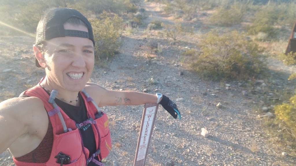
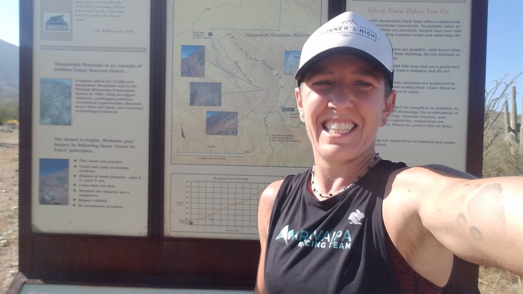
At the trailhead there is a small parking lot, an outhouse, but no water. I did some warming up and stretching, I wasn’t feeling great but I had been determined to keep the date. The restrictions due to COVID-19 were tightening, and even though exercise was exempt from our stay at home orders in AZ I felt like I was pushing it being this far from home. At the same time, I was alone at the trailhead, and only ended up seeing 2 people total, and I wasn’t making stops along the way. At any rate, I didn’t even know if this would be possible in the coming weeks - no more next times. For the run I wore my Aravaipa Racing team shorts and crop, Topo Terrventures, Runner’s High Herbals trucker, Nathan Vapor Mag vest with two twelve ounce bottles of water, a homemade chia gel and a Trader Joe’s ABC bar. I also carried a buff and wore gloves for the first part of the run as the trail runs to the west of some higher peaks and is mostly in shade.
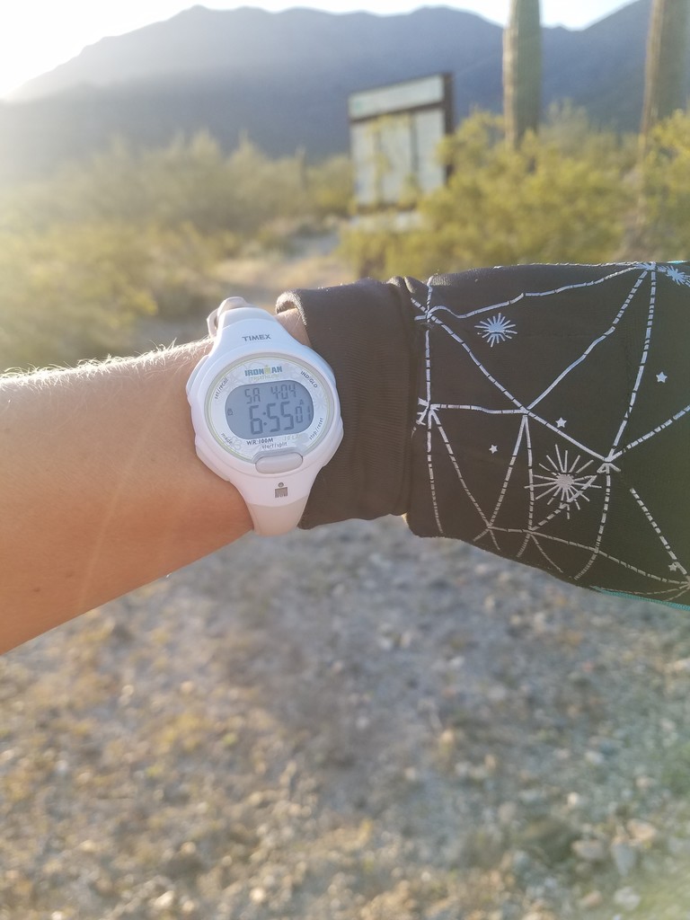
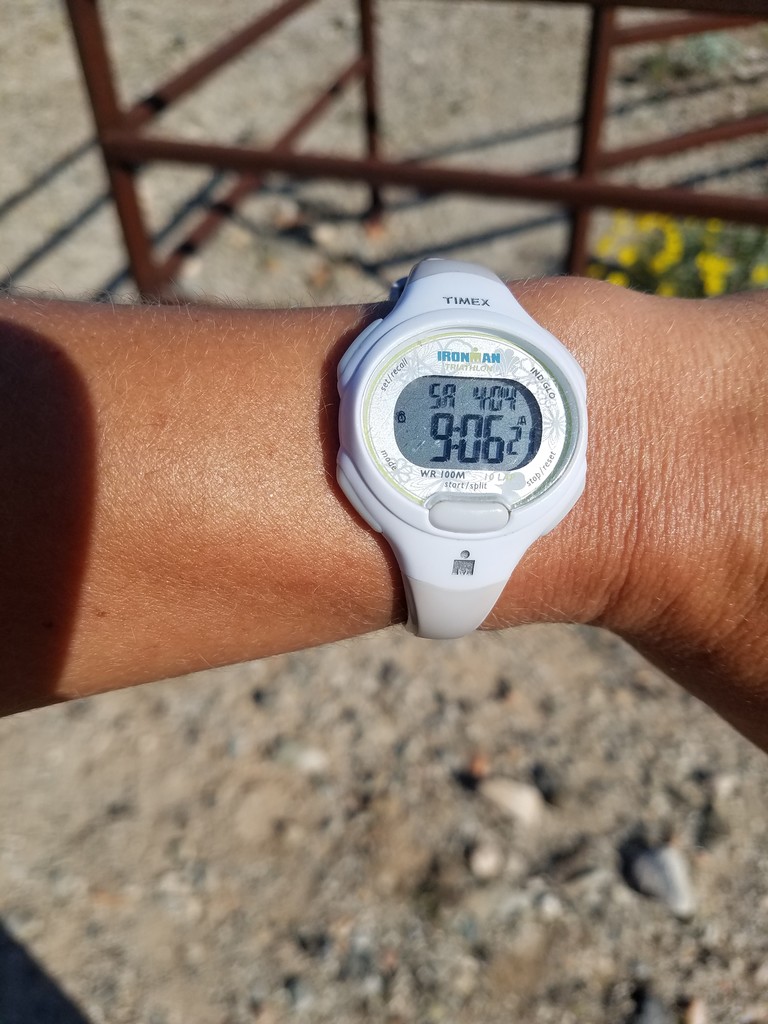
I started just on the inside of the cattle gate, snapping a picture of the time on my trusty Timex watch, hitting record on Strava on my phone and setting off down the trail. Or really up because even at the start the trail is a slight uphill. As the sign at the trailhead notes it is a wilderness area, and this trail has a little bit of everything. Big rocks, loose scree, ankle biters and sniper rocks all jumbled together in patterns that require you to constantly look for footing and at times fight for footing. In the parts of the trail that are dirt it reminds me more of trampled snow, crusted up with footprints and hoofprints hardened into the surface. Around a half mile there’s a big, old, rusted, water tank and some smaller rusted containers scattered about. There’s a cactus skeleton on the right of the trail that marks approximately a mile from the trailhead and my feet, ankles and calves were already burning a bit from the effort.
I continued pushing upwards. I was definitely feeling the effort more in my legs than in my breathing. Around mile 2.5 there’s a lage, flat rock to the left of the trail with a bunch of smaller rocks scattered over it. I’m curious as to whether they were deposited by the water when it was high, or if previous hikers placed them there. Just around the bend is a water crossing, and after that the trail really gets wild. There are numerous plants overgrowing the trail, which is slightly problematic for two reasons. First, they obscure the trail and add another level of challenge to the footing. Second, desert plants are not friendly. I donated some blood, and managed to brush against the same jumping cholla on the way up and the way down. While the sign at the trailhead indicates a fairly steady slope for the entirety of the trail it definitely feels like it’s starting to get steeper. The good news is that my legs don’t seem to be getting worse, just shifting the type of pain I’m feeling. There is also an exposed pipe running up the mountain in this section so I keep an eye out for it as the trail crosses back and forth so I don’t catch my toe on it.
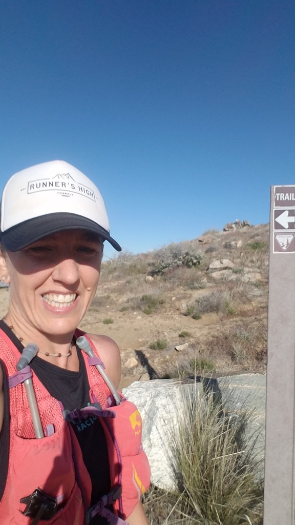
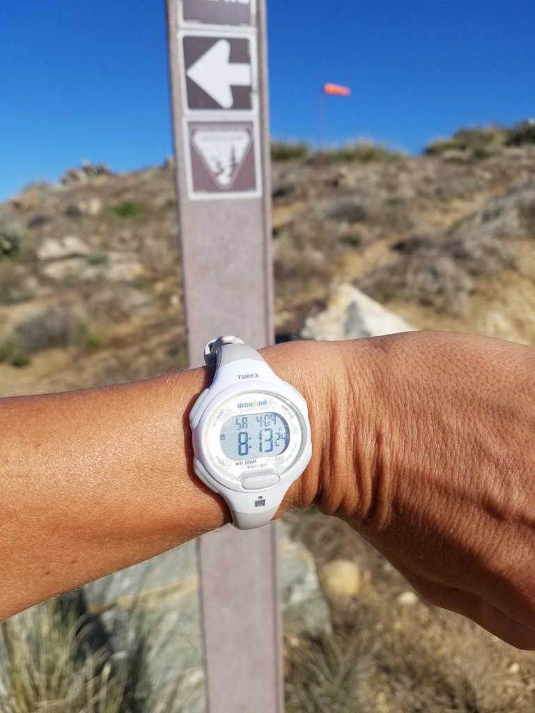
Around mile 4 I pass through the old mining camp. Some of the old tent platform remains are scattered on either side of the trail. Despite the BLM sign’s indication that the trail is 5.5 miles to the top, my measurement is 5 miles, so the camp indicates about a mile to the summit. I take my chia gel here. I know from my scouting the previous week that my work is far from over. The trail climbs steeper, switching back and forth. I see the “top” in front of me with the sun peeking over, but this is in reality the saddle. Once I cross over I can see the old metal building that marks the actual end of the trail to the south. There’s still more switchbacks and climbing, and finally the trail spits me out on a rough, rocky jeep road and I finish the last few hundred meters. I touch the trail marker at the top, snap a few pictures of me and my watch, and then turn to head back down.
While I can definitely move faster on the way down, and the physical effort is low, I’m certainly not making up time. Between the plants, rocks and sharp switchbacks it's hard to keep momentum. Even if I could I’m nervous about catching a toe or hitting an unstable rock and biting it. I concentrate on the ground in front of me, trying to move as quickly as I can with a total lack of flow. I do trip once and by some miracle catch myself with my right foot landing hard on rock. I slow and shake it off and then pick back up again. I’m also reminded on the way back down that at an area just above the mining camp I had encountered a second water crossing the previous week, but this week it is dry, a sure indication that there will be no running water here in the summer. Passing back through the mining camp I get out the bar and start to eat it, trying to get some life back in the legs. The next section continues to be overgrown, and the plants hurt more when hitting them at a higher speed, but it's all part of the adventure.
I reach the rock indicating the halfway point again. At the summit with the way I felt on this particular day I was hoping to take the downhill trip in about an hour, but I now see that I’m slightly under that pace. That, combined with the trail opening up slightly - it's all relative - gives me some motivation to push a little bit more. It’s certainly not speedy, and the footing still isn’t good, but I can at least push a bit. I pass two ladies hiking up the mountain around the mile mark and the cactus skeleton. We greet each other and give the appropriate amount of distance as passing. I cruise now, feeling the pull of the car, and when I pass the water tank again I’m running fast. A few more curves in the trail and I can see the trailhead. I run up to the gate, tap it, stop the Strava recording and take another picture of my watch. I also hike a few hundred feet back to the visitor log and record my time at the trail.
All in all it was a good day, a good effort. I’m glad I did it, laying down the first time for the FKT website for the route. I’m sure there are other ladies who can run this faster, particularly those who are stronger downhill runners, and I look forward to seeing them do so. The route is a bit of an adventure, which is exactly what I was looking for. I’m also thinking that I may want to come back in the fall to see if I can improve my time, or maybe challenging the new FKT holder.
Comments
Great run and lovely write-up. Well done :)