


Loyalsock Trail – 07/11/2020
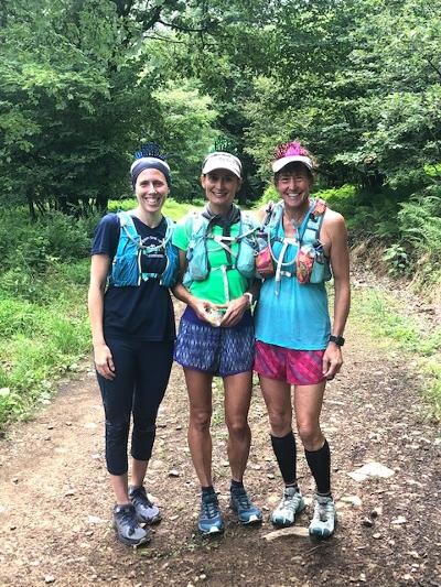
Team: Diane Grim & Anna Piskorska (62.31 miles) Support Runner: Fran Mahalak (last aprox. 20 miles)
Crew: Tom Grim (Diane's husband & Dog Ryleigh)
Start: Corner of Rte. 220 & Mead Rd. @ 4:00 AM
Finish: Rte. 87 @ 12:05 AM
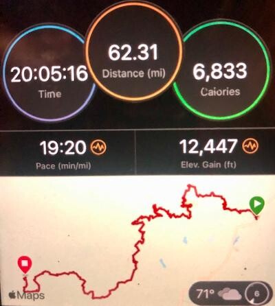
Total Time: 20:05:16
Elevation Gain: 12,447’
Elevation Loss: 13,428’
Type of Run: Supported (2 runners entire course, 1 support runner last 20 miles and
1 “traveling” aid crew(plus dog!) pre-arranged designated locations
The actual Rte. 220 Start of the Loyalsock is actually subjective. Some say the start is actually on 220& Mead Rd.
Some say the start is once you get to the parking lot on Mead Rd. The Sign behind the bathrooms is the start.
The Garmin, driving to the start from Dushore shows the start as the “No Parking sign” (Old entrance) just before Mead Rd. (but there is no trail head marker)
We started our watches at the sign on Rte. 220 at the entrance of Mead Rd. Ran up to parking lot on Right, around behind the bathrooms there is another Loyalsock Trail sign, we started picking up LT markers from that point on.
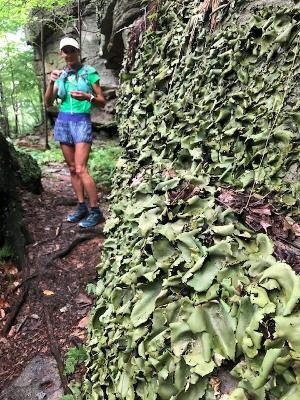
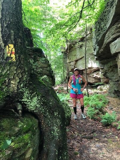
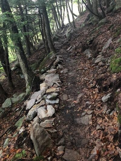
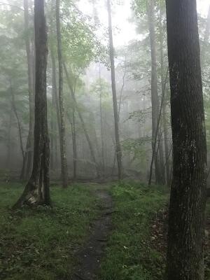
Trail Conditions: Summer conditions- Definitely Green and Lush - Some overgrown trails (vegetation encroaching from sides of trail, limiting footing view). You could tell the difference the farther out the route, the less used and more grown in. Forced to walk sections due to visibility of footing. Some grass sections unrunable due to knee high grass. Fern areas were waist high. Normal Rocks & Roots. Long Climbs, and Long Steep Climbs and a lot of Stream Crossings. Last descent was super steep and rocky. Due to rain, rocks were super slippery. On one of the climbs the rain was coming down so hard, the water rushing down the trail above you was gushing under our feet, and with it came added debris. Oh, did I mention Horse Flies ???
Trail Markings: For the most part 98% of the trail was marked very consistent. The minute you didn’t see a mark you could stop. Retrace your steps, which was usually about 100 yards back to the last mark. Be aware, these yellow LT Markers are not Glow in the Dark. We did have some trouble on some road areas, finding marks at intersections. Most turns in the woods gave you an Arrow as a heads up to the direction you would be turning. We encountered one section we missed a turn due to the undergrowth being so tall it covered the marks on the trees. (Got to the gate, retraced and found trail.) About 5 miles in from Rte. 87 we encountered a very rocky climb (like maybe a dried up creek? Not sure- it had high brush, fallen trees on both sides – marks seemed very far apart there, and not very visible.)Kudos to the trail maintenance for posting notices, marks were moved to other side of trail, due to pipeline work, I think about 3-4 miles from the end. Poor marking where you popped out of the woods before Crystal Lake Road, it turns to Gravel road, we continued on the gravel road with no marks to be found (open fields both sides. Crystal Lake Road is on the right, (we knew not to go that way from the Recon ) you stay straight on Genesee Trail Road eventually seeing LT marks on telephone poles.
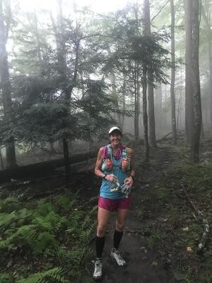
Weather: 70 degrees at start with 90+% humidity (felt like a Sauna) Temperatures climbed to high 80’s + with humidity to match, luckily the trail is mostly under canopy of summer leaves, and open sky is limited to gravel roads. We had 2 major thunderstorms, one which at 1:00 pm we wished we had our headlamps as it was that dark in the woods, and even with my visor the water was pouring in my eyes. The 2nd storm hit and couldn’t be more erie, the air in the woods changed and a fog ensued leaving everything in a haze – the wind picked up immensely and then sounded like a freight train, then the rain came so hard all we could do is laugh and run! After sunset, somewhere on the top of last climb. The humidity picked up and it was sauna like conditions again.
Our Run Summary/Timeline: We started right at the sign on the corner of Mead Road and Rte. 220 at 4:00am
(Timeline is based on time stamps on pictures we took)
In planning the run, We decided to run towards Rt.87 because the area from the start thru the haystacks towards worlds end has awesome runnable surface, being in the dark that made sense to maximize run time.
Haystack Area- Hearing the roar of water rushing thru the haystacks was awesome in the dark. It was absolutely gorgeous when our headlamps shined across it. We came across quite a few campers (non which were awake – except for the man in the hammock – that I lit up with my headlamp, Opps – sorry!)
We reached Sones Pond somewhere around 5:30. Had a bit of trouble locating markers
when we hit the brief road section before the trail into the pond. Bull Frogs were in perfect
harmony with peepers! They were so loud
Sones Pond: High Canopy making visibility widespread. Trail Surface, relaxed (a.k.a not rocky)
Perfect Camping area. The sky was not yet bright enough to see very far into the pond.
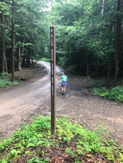
Reached High Rock Spur Rd. Crossing around 7:00
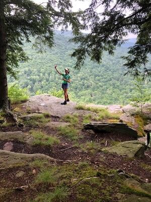
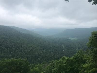
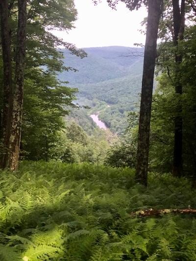
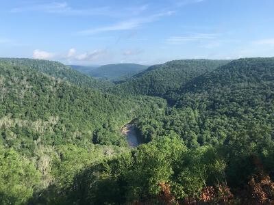
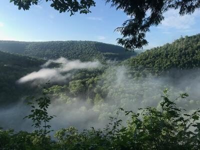
Reached the overlook at High Rock Trail & Loyalsock by 7:15
Great view with fog lifting in the ravines between the mountains
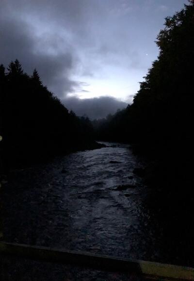
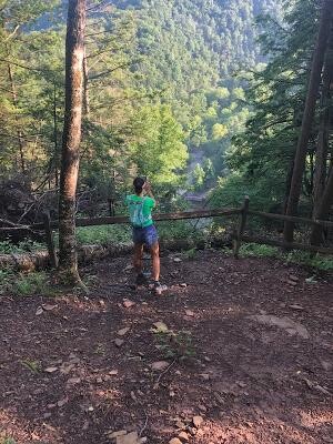
Worlds End State Park: Crossed the bridge near Butternut Trail at 7:30 trail cuts near the rest rooms & Visitors center (good bathroom stop!) Lots of camping, concessions stand if open. Also has a beach which can be seen in the picture to the left.
Great climb out of Worlds End with views back down to the river & beach (picture)
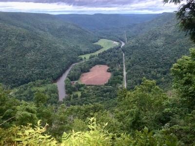
Awesome climb up towards Canyon Vista around 8:00
Reached top of Canyon Vista 8:40 (that’s a long climb, but worth it **Crew Stop - grabbed water/ dropped lights / food/ chargers)
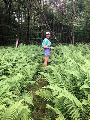
Encountered super tall ferns at 9:45 (they were so pretty and still wet, nice and cooling) Unfortunately you couldn’t run thru them as you couldn’t see your feet, possibly covering fallen logs or rocks, or worst yet, snakes
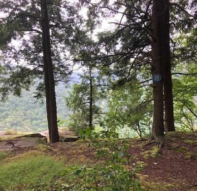
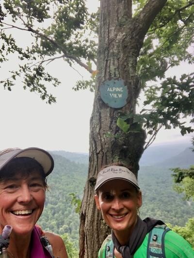
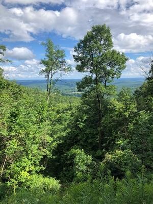
Reached Alpine View at 10:27 and Lower Alpine a few minutes later. Views… Worth the climb
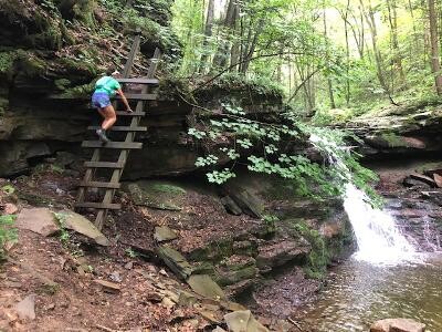
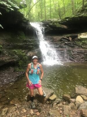
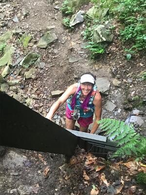
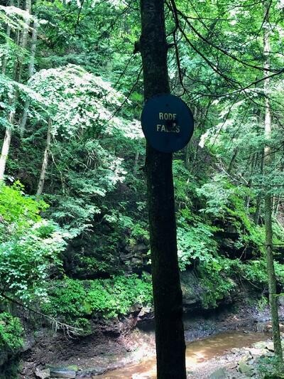
Got to Rodes Falls around 10:50… took pictures, climbed the ladder and checked gear at top, realized my charger cord fell out at bottom….yep, back down and boy that ladder was slippery. Be careful after the falls, your so caught up in its beauty easy to miss the trail turn on left
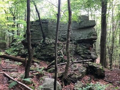
Great Rock formations and different types of mosses just before noon
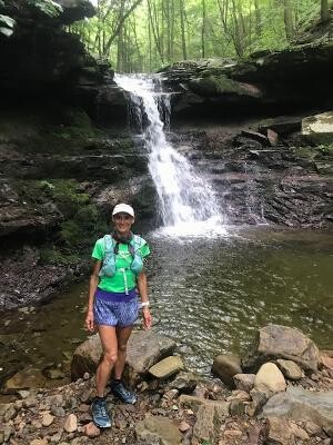
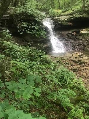
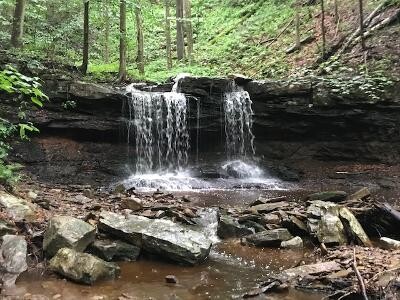
Awesome water falls 1 hour before reaching mile 25
*Crew Stop - Dry Run Road - refilled water/ food/ chargers
Second Thunder storm hit us at 2:30pm , just after aid stop at Dry Run Road, we weren’t out of there 5 minutes when the heavens opened its flood gates. It got real still, a haze rolled in the wind Picked up immensely sounding like a freight train.The woods looked ominous….
Reached Genesee Trail Road at 4:20, (this was a tough place to find LT marks, luckily with recon – we knew to continue up dirt road past the Crystal Lake Road and the marks would then be on telephone poles.
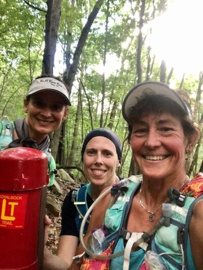
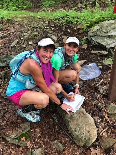
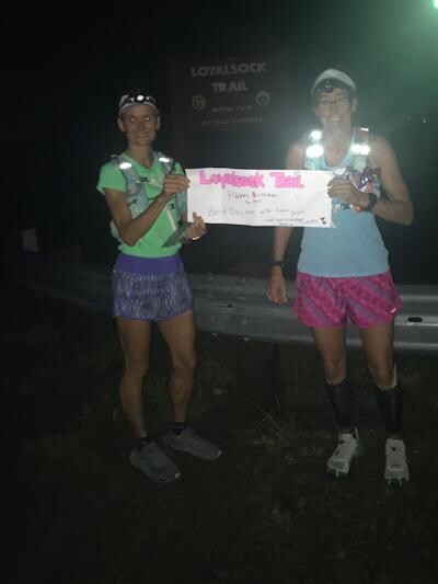
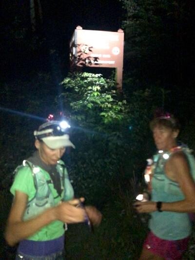
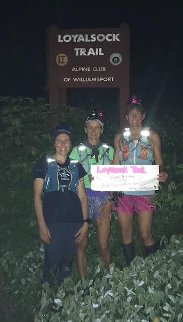
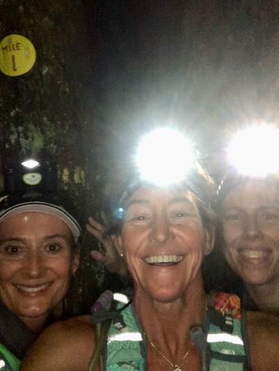
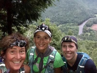
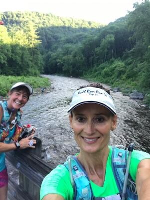
Picked up Fran at intersection of Highland Lake Road & Genesee Trail Road at 5:00ish * Crew Stop - refilled water/ food/ chargers/ picked up headlights) (Yes, we have birthday crown’s on! It’s my 61st birthday!
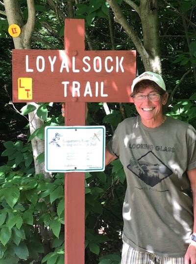
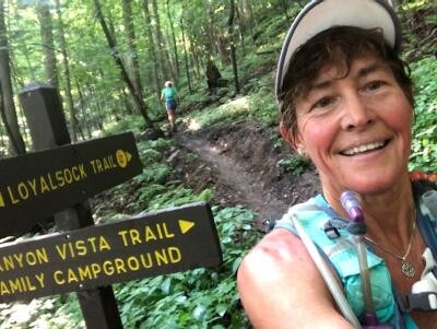
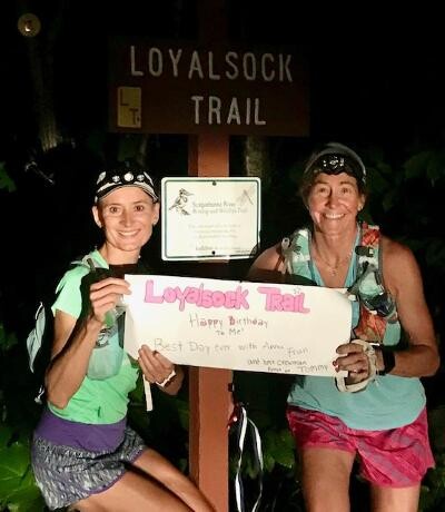
Signed into the Loyalsock log here at 6:15pm (see pix)
* Water drop - had a water drop on Loyalsock trail (around Miller Trail area- crew drove to gate and hike water in)
8:20 Missed a mark on dirt road had to go back and forth until we saw it, but saw this great mushroom (pix)
8:40ish got to top of “awesome climb” (That’s the beauty of headlamps, you can only see as high as you want to!) It just kept going up, with pitches 27/39%
We kept saying there better be a view at the top. And there was, we weren’t disappointed. It was spectacular. Looks to be a great camping area,
there was a fire ring and benches (if I remember correctly)
It got dark fast…after this view (Smiths Knob?) We ran along a ridge hearing tons of fireworks (or gun shots) coming up from the valley below and could
see lights off in the far distance, the edge of trail looked to be a drop off. The grass was very high here, we walked it to be safe, you couldn’t see your feet and the rocks,
(certainly didn’t want to slip off that edge!)
Reached 1 Mile to go plate at 11:20 Woo Hooo!! How bad can one more mile be ???? Ha, little did we know!
That last mile was a brutal steep downhill,. Grab onto everything you can (-39% ???!!!)
We landed on our butts more than once, some spots it was safer to step down backwards so you could hold onto rocks. It seemed to go on forever, and it was like straight down, no switchbacks…luckily we held onto little sapplings that bent over giving us a handrail! At one point the marks seemed to be a bit scattered as we climbed down over the bigger rocks. It was almost faster sliding on the bottoms of our trail shoes when we hit loose small stuff.
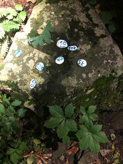
Finally the switch backs started and came across some “Trail Treasure”, white Painted rocks, that said 50k 100k etc. This made my day…..how cool is that!!
Thank you whoever painted them and placed them there, we didn’t take one, they will be forever in our memory! (it's the little things in life that matters)
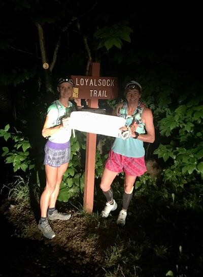
We saw lights getting closer…could it be, did we do it? We reached the bottom of the descent; it actually just dumps you out to the side of Rte. 87
My Husband, Tommy and Ryleigh (the trail crew dog) met us!! (with relief!)
*Crew Stop - Little Bear Road crossing - refilled water/ food/ chargers / grabbed back up lights- this stop took longer than expected
20 hours and 5 minutes of travel time. More than we hoped for, certainly not our fastest effort, but considering the trail conditions, weather,aid stops, taking pictures and just enjoying the amazing breathtaking view we were all pleased. No blood, No broken bones, No getting lost….I say it’s a Win, win!
The perfect Birthday adventure… My longest run to date.Thanks to my training & running partner Anna Piskorska for sharing every mile of it.
Huge shout out and thanks to Fran for joining us in this crazy adventure with like 20 miles to go… (So glad you finally found us, that was an adventure in its own!)
Most of all thanks to Tommy Grim, my husband who made this all possible, without him we couldn’t have done it.
So now we’ve laid it out there for you….The “unknown” is now known to you. Get out there and do it.. Push your limits, whatever they might be. You won’t regret this adventure; it’s breathtaking (in more ways than one)!
Birthday adventure runs are the best! Possible Fastest Known Timed could be Frosting on the Cake!
Diane Grim (age 61); race reporter and birthday girl. Anna Piskorska (48) Team mate
Fran Mahalak (44) (Support Runner)