Had a crack at this lovely, rarely travelled route on a lovely July day - warm but some breeze and cloud for most of the warmest part.
As others have said, you need a GPS device as the route is not well signed!
I had a few places I went wrong or struggled with finding or sticking to the route - mostly towards the end, maybe I was just getting tired (not sure it was only that though!):
-The golf course just after Midhurst. Prepare to duck especially the 1st fairway you cross, and look for the fork left past the lake.
-Farmers field just after Bignor ... no obvious footpath
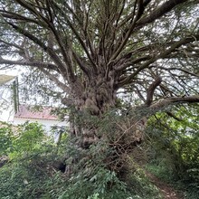
-Second part of the hill climb up just after that - I had to divert to the left and scoot round the woods as there seemed to be no path at all going up through the undergrowth into the woods where the gpx track was. There is another alternative path I could have taken in retrospect to the right (part of south downs way i think)
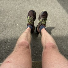
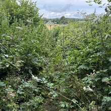
-Three or four places in the last 6km section before Arundel where the paths were totally overgrown with nettles, brambles and other vicious herbal supplements for in some cases quite a long way ... you can see the state of my legs from trying to push on through them - clearly not heavily used and perhaps better not to tackle this in early summer when the growth is at its heights. Was a bit miffed as I was on for a sub 5 hours clocking up until these last little snags.
Also watch out for a couple of very busy road crossings - I had to wait a while at the A29 while nursing my scratched up shins.
Water wise, I carried 3 bottles and refilled two of them at the midhurst public toilets (soap/water/dryer contraptions) ... water tasted a bit chloriney but not other ill effects at time of writing! Crossed a few streams but none of them looked ideal for a refill.
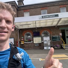
Satisfied with a good day out overall! Got the train down from and back to London with no major issues (only 1 train an hour from Arundel on way back, but gave me a chance to walk in to town to buy some drinks and food after I'd finished)

