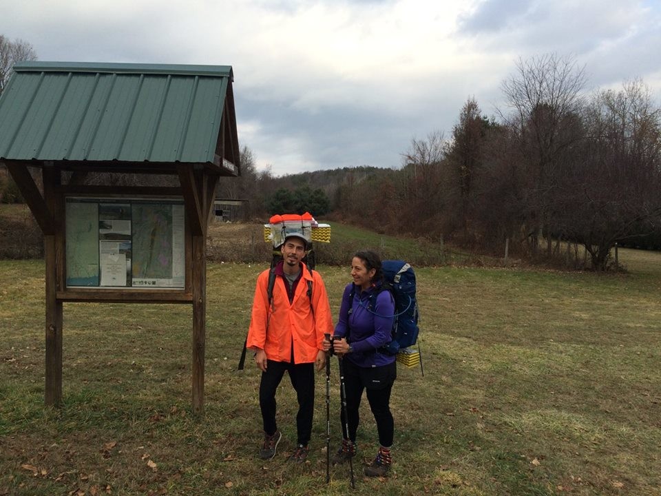

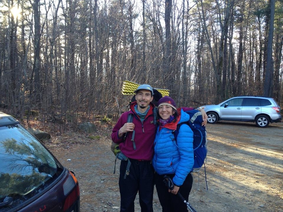
We finished our self-supported M&M thruhike yesterday at 11:48 AM on top of Mt. Monadnock in NH. It was a beautiful day to complete our journey. Saw about a dozen folks on the summit including Jenifer from Antioch College, one of three summit stewards. Not bad for a Wednesday in December! We started at Rising Corner in Agawam at 1:59 AM, although we first traveled south on the trail for a 100 or so yards to the MA/CT state line and neglected to restart the GPS or watch there. In any case, we did the M&M from the MA/CT state line to Monadnock (with all the new re-routes, even the ones that, ahem, Shutesbury, ahem, are not yet blazed) in less than 5 days, 21 hours, 49 minutes.
Here is a link to our planning documents on Google Sheets, including section plan, food plan and gear list (click the tabs). Comments are enabled. Please share your feedback. We will be adding post-trip comments this evening. I learned a lot more about my gear this trip. And food planning too. We dropped 5 food and water caches.
docs.google.com/spreadsheets/d/1WxyO5x8gsmf4NoEenMBBPWYGesOM0gXDaRoecyaojiE/edit?usp=sharing
Photos coming soon once I figure out how to share those. Is there a photo-sharing site you recommend?
GPS day-by-day tracks are linked below. The last ~mile is missing from Monadnock because I accidentally stopped the tracker when I was trying to waypoint. We strongly suspect that some of the days, especially day 1, are way off on the mileage, since they do not match up with the mileage listed in the old guidebook (on sections with no or few reroutes) or section guides on the NET site or M&M site. However, other days seemed spot on. Any thoughts as to why the GPS would mis-calculate mileage more on some days than others? Anyhow, we think the mileage figures are 10-30% high for some of the days, and the elevation data seems off on some days (Day 6 Mt. Grace). Any help interpreting or parsing this data would be much appreciated. I'm going to try to put the tracks on Caltopo and share that too.
Day 1 Rising Corner, Agawam to East Mountain, West Springfield: trails.io/s/nvvwh6
Day 2 East Mountain to Mt. Skinner, Hadley (MHCOC Cabin): trails.io/s/k0bbdz
Day 3 Mt. Skinner to Mt. Lincoln, Pelham: trails.io/s/wxykgb
Day 4 Mt. Lincoln to Lake Wyola, Shutesbury: trails.io/s/7gfc31
Day 5 Lake Wyola to Stratton Mtn., Northfield (RZ Cabin): trails.io/s/z5xm7z
Day 6 Stratton Mtn. to Little Monadnock, Troy NH: trails.io/s/ymmahg
Day 7 Little Monadnock to Monadnock (track ends ~mile from summit): trails.io/s/owkqfw
Enjoy! Feedback and questions are much appreciated.
Miles to go,
- Pizza
Here is the whole GPS track put together on CalTopo with rest areas, water for the first 3 days (after that it was so plentiful we stopped recording it) and shelters. It looks like on this map it did keep recording til the top of Monadnock, but started late on the last day, so I added a correction (~1k) from our rest area to where the GPS picked up on Little Monadnock.
- Pizza
Note that the pair crossed the Connecticut River using a small 2-person raft they carried. They converted trekking poles into paddles with the use of wooden shingles and Velcro. PFD's were not required since it was a raft. According to Clemencia: "Other people have hiked this trail faster, but they have hitched across the river or walked around."