

Basic Logistics:
- We began/ended at Ole Bull State Park. We traveled in the clockwise direction. The trail passes through the parking lot that allows overnight parking for trail users. Steve signed the register at the park office, indicating the vehicle would be there overnight.
- We were in communication with the Susquehannock Trail Club and the DCNR, indicating the dates that we would be on the trail.
Navigation:
- We carried two different versions of GPX files for the loop. I also carried a DCNR map. I studied the map from Guide to the Susquehannock Trail System by Chuck Dillon in advance, but opted out of carrying this one. The U.S. Geological Survey makes electronic and paper copies of 7.5 minute topo maps. However, these probably provide more detail than needed.
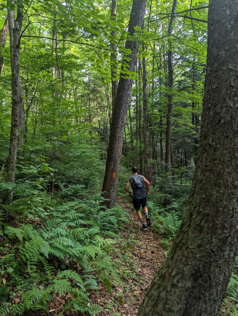
- The trail was blazed well. I believe that it is on par with how other nearby, similar trails are marked. The blazes came often enough and the side trails were clearly marked.
- Almost all turns were appropriately marked with double blazes. However, we did find ourselves questioning a couple of intersections through forestry roads. Not enough to get off track, but enough to stop and take our time.
- There were a lot of trees down on the section of the Twin Sisters trail that is near PA-414. We walked in a circle here and spent several minutes trying to find our way through the downed trees before reconnecting with the switchback.
- At the top of Cardiac Climb, there is what appears to be an active logging site. Since we passed through here in the dark, we temporarily lost the trail and used a GPX file to get us back on track.
Tracking:
- We carried a Garmin InReach Mini 2 for potential emergency and communication purposes. I am including the .gpx and .fit files of this data.
- I also recorded the activity on my watch, which is uploaded to Garmin Connect and Strava. Both links are included.
Trail Conditions:
- Sections of the trail were overgrown (July!), particularly in the Hammersley Wild Area. As the overgrown areas came and went, it made it difficult to get in a flow.
- There was more burn hazel than expected. It was unrelenting and the sheer amount of it made this effort way more painful than anticipated. Briars were also at their annual peak.
- Water table on par for summer. Ran out of water in the Hammersley Wild Area. The run dried up on the Northern end of the Wild Area.
- Quite a few trees down - more than we could have counted. Some were older but a lot looked to be from a recent storm.
Weather and Such:
- The high was around 82 degrees Fahrenheit. The low was around 53 degrees Fahrenheit, just before sunrise.
- For the great majority of the trail, the tree canopy shaded us. There is one exposed section, between Twelve Mile Rd and Cross Fork.
- We experienced a full moon with a clear sky.
- We saw one other human on the trail during our journey. They were off trail with their dog, enjoying the Run by The Pool in the Hammersley Wild Area.
Aid:
start (Ole Bull State Park) 41.539603, -77.716787
departure-- 5:10 AM
distance to next aid-- 10.5 miles
distance elapsed-- 0 miles
notes-- STS goes directly through the large, unpaved parking lot that is just North of the Park office.
1 (Twelve Mile Rd) 41.469654, -77.692840
arrival-- 7:36 AM
departure-- 7:46 AM
distance to next aid-- 12.2 miles
distance elapsed-- 10.5 miles
notes-- STS crosses this road more than once. This is by Long Hollow Trail & Morgan Hollow Trail.
2 (Cross Fork) 41.48232, -77.81669
arrival-- 10:42 AM
departure-- 11:00 AM
distance to next aid-- 15.2 miles
elapsed distance-- 22.7 miles
notes-- Most accessible spot on trail. Small town on the Kettle Creek. General store, restaurant, Post Office, small motel.
3 (East Fork Simmemahoning Creek) 41.58749, -77.90254
arrival-- 3:15 PM
departure-- 3:52 PM
distance to next aid-- 13 miles
distance elapsed-- 37.9 miles
notes-- Crew may want to be familiar with both ways to access this spot.
4 (Patterson State Park) 41.695725, -77.893277
arrival-- 7:34 PM
departure-- 7:59 PM
distance to next aid-- 9.75 miles
distance elapsed-- 50.9 miles
notes-- Bathroom with compostable toilet next to trailhead coming in. May get cell service here.
5 (Denton Hill State Park) 41.760622, -77.815384
arrival-- 10:29 PM
departure-- 10:49 PM
distance to next aid-- 11.25 miles
distance elapsed-- 60.65 miles
notes-- Not really in the Park - Thompson Hollow Rd (dirt) to the East of the park, between mile marker 2 and 3.
6 (Cherry Springs Fire Tower) 41.64594, -77.79601
arrival-- 2:00 AM
departure-- 2:20 AM
distance to next aid-- 12.25 miles
elapsed distance-- 71.9 miles
notes-- Don’t confuse with Cherry Springs State Park, which is not on course.
finish (Ole Bull State Park) 41.539603, -77.716787
arrival-- 6:19 AM
elapsed distance-- 84.15 miles
notes-- Park has nice amenities.
Here is a link to Faith’s personal narrative (TMI version) of the STS FKT journey: https://faithhall.substack.com/p/memories-from-the-susquehannock-trail