Route
Route variation
Standard route
Gender category
Female
Style
Unsupported
Finish date
Total time
15h
48m
0s
Verification
GPS track(s)
Ta_et_al_Press.gpx8.26 MB
Report
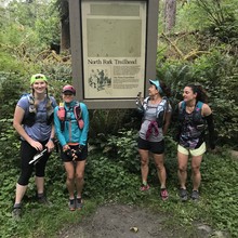
46.9mi point-to-point, starting at the N Fork Quinault TH and ending at Whisky Bend TH. The route's high point is at Low Divide, elev 3602.
Trip report link
https://www.wta.org/go-hiking/trip-reports/trip_report.2018-07-22.5718775999


