


Sunday 29th December 2024
Unsupported Solo Female FKT Attempt - The Royal Saxon Way
Run Report
Distance: 58.19km
Elevation: 723m
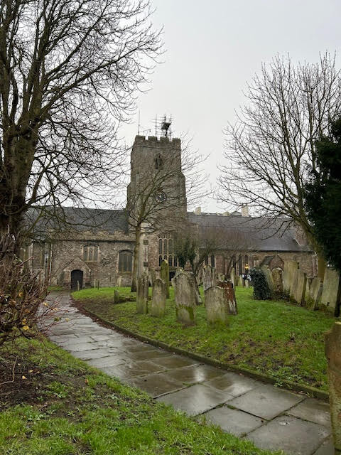
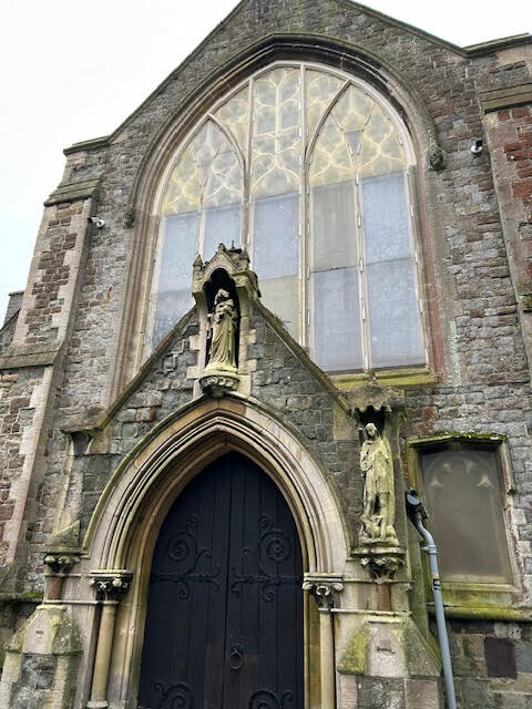
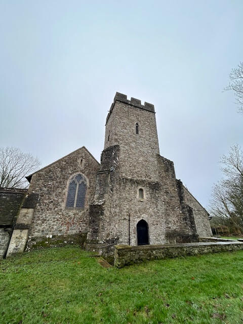
The Royal Saxon Way provides an experience of pilgrimage that is unique in England. It starts and finishes with churches still containing relics of their original saints. Princess Eanswythe (c.630 – 650 AD) founded an abbey at Folkestone in the 7th Century and her relics, hidden since the Reformation, were re-discovered in 1885. The abbey at Minster was refounded in the 1930s on the site of an abbey built in the 8th Century to hold the relics of St Mildreth, Eanswythe’s great niece. A fragment of these relics was taken to the Netherlands during the 11th Century and thus survived to be returned to the abbey in 1953.
The route passes through Lyminge where Eanswythe’s aunt Queen Ethelburga founded an abbey in the 630s. The relics of St Eadburg, abbess at Minster after Mildreth were translated to Lyminge in the early 9th Century. The whole route thus joins together churches that are specifically linked with the Anglo-Saxon Kentish royal family as well as many other ancient churches in a historic landscape that is largely Anglo-Saxon in origin.
This route touches on many periods of history including at Lyminge a site with evidence of occupation by some of the first people returning to the British Isles after the last Ice Age.
The route appealed as an FKT attempt for two reasons; firstly, it had not yet been recorded and would serve as a good opportunity to discover the trail and note any helpful points for future runners, and secondly; my foray into trail running had started by accident on another pilgrimage route 8 months previously, so it felt like a nice way to end the year I picked up this new passion. (It should be noted that previous pilgrimage route was in Spain and involved trails through sun-kissed vineyards, rather than battling through ankle deep mud with 1 meter visibility in England in December.)
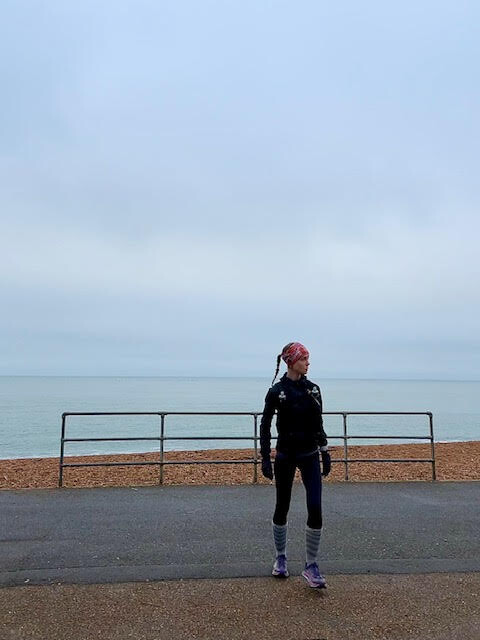
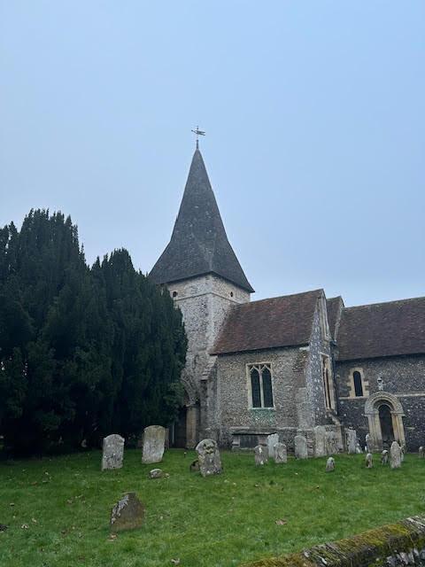
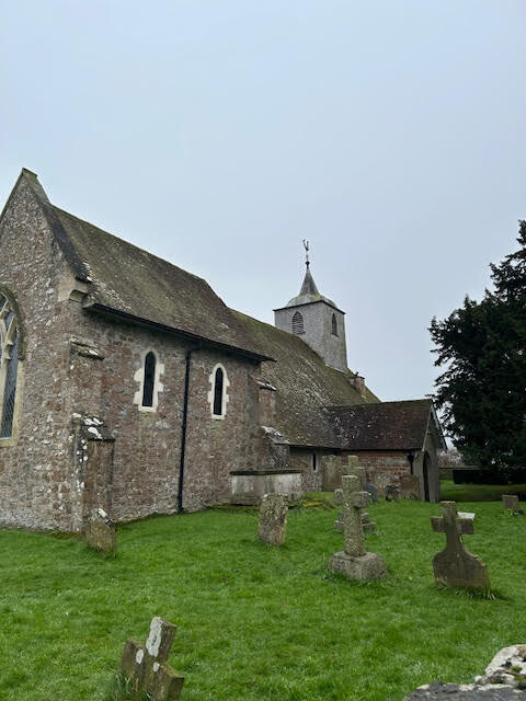
The route starts at St Mary and Eanswythe’s Church in Folkestone, looking out towards the sea, and the first 4.5km or so are along the seafront promenade. The route then curves in through a fairly industrial area, before finally opening up into field and woodland, and linking a further 15 ancient ecclesiastical sites and ultimately ending in Minster.
Conditions underfoot, certainly for the first 30km, were almost un-runnable, due to a combination of thick, sticking mud (making uphills painfully slow and sapping energy from the legs), supposed footpaths across a lot of fields that had long since disappeared to farm machinery and left rocky, frozen mud instead, and a poorly marked trail. It should be noted to anyone attempting in the future that due to the Royal Saxon Way only recently being registered as a route in the last few years, at the time of writing it is marked by a sporadic collection of different trail markers, and map navigation is essential to avoid private land. (And to sense check you are still going in the right direction!) Navigation was further complicated by visibility, with a low hanging mist that didn’t dissipate all day. The promised sunshine never quite burned through! However, the way became easier to run after about 31km and after a slow start to the day, I was able to pick up pace and run, almost without stopping, for the remainder of the route.
Wanting to do the route fully unsupported, (I also an alone the entire route), I carried all water I needed for the duration for the run, using 2 Salomon 500ml soft flasks with an electrolyte mix, and a 1 litre water bladder with a carb drink mix. It should be noted I only noticed (although was not actively searching them out) one public tap on the route, at St Peter’s Churchyard in Bridge (c. 35km), but at the time of running it was out of order. Knowing that an unsupported FKT also prohibits utilising any public services, I packed in advance and carried all of my nutrition; 30g gels, one 600 calorie energy bar, and a mix of savoury (nuts and cheese), with sweet (a couple of Rice Crispie Squares, which carry almost the same amount of carbs as a gel but provide a relief texture and flavour wise.)
Towards the end of the route, several wrong turns were made due to the unkempt nature of some of the footpaths (some undergrowth I was able to hack through, some I had to take detours around). Again, map reading needed as there were long stretches where it was not obvious where the path was, and I had to rely on following the river.
The last hour of the run was spent in the dark, a good headtorch is needed as the path is not obvious and the river is mostly hidden by reeds and rushes. The time taken for this trail could likely be significantly shortened by a an attempt in drier, Spring or Summer months. That being said, I am always pleased on long runs when I am able to pick up a good pace again after losing a lot of motivation – and having the opportunity to see so many pretty villages, and places of historical significance – all within the space of a day served as a reminder as to why I enjoy the sport so much; traversing landscapes and exploring using my own two legs!