
Astronomical Twilight: 6:20a - 6:48a
Hours of Light: ~6:49a - 6:57p
Astronomical Twilight: 6:58p - 7:26p
Ian’s Packing List: https://lighterpack.com/r/6ksrhv
Prep Days (Dec 23rd & 24th): Permits, Water Caches, and Shuttle
December 23rd Drove 7.5 hours from Austin, TX to the Panther Junction Visitors Center. I arrived just after midnight.
December 24th: Woke up, got our NP permit with my friends POD and Disco from The Trail Show who were doing the Outer Mountain Loop - my friend Tyler Priest (Chisos Escalada FKT Route) and partner for this attempt was simultaneously getting a SP permit.
Afterwards, I cached water at Homer Wilson and Terlingua Abajo, along with a quick hike and stretch at Santa Elena Canyon.
Drove back to Chisos Basin to meet Tyler. Then shuttled with Tyler ~2.5 hours from Chisos Basin to Casa Piedra Road Trailhead. We setup our cowboy camps and got in bed around 7p after dinner.
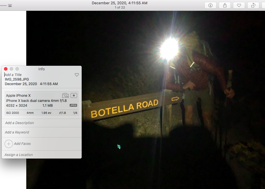
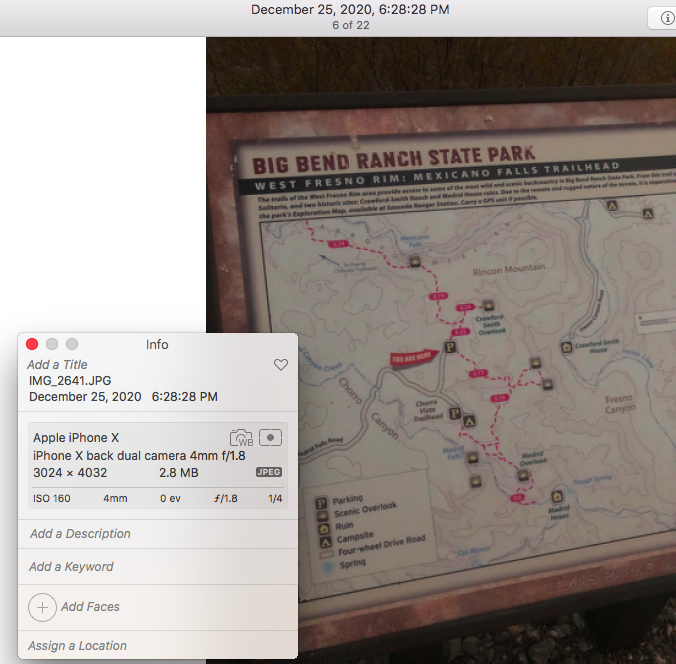
Day 1 (Dec 25th ~53.5 miles): Casa Piedra Road / Botella Road Trailhead to Barton Warnock Visitors Center
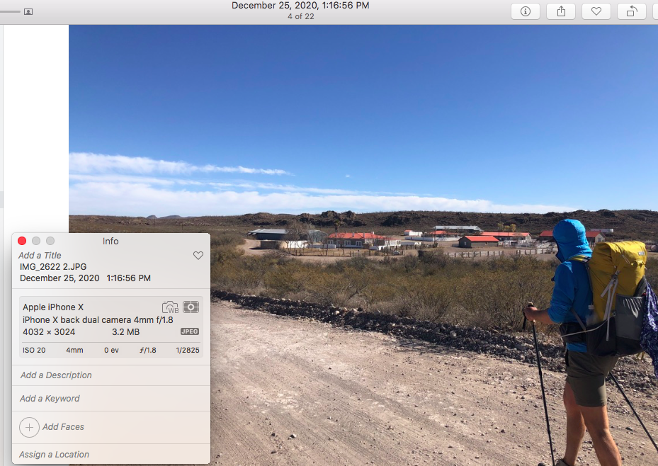
This was an interesting start: I was so psyched to begin, my brain decided that it would be a good idea to sleep for a total of 1 restless hour. Regardless, we ended up starting exactly at 4:11am. It was below freezing all morning along the dirt road and most of Terneros Creek. We saw Venus on the horizon during twilight and chatted the darkness away. Sunlight finally came out along a beautiful stretch of golden Cottonwoods - the perfect time for hot coffee and snacks! We made our way along Terneros creek and then turned right for the long stretch along Leyva creek with all the sandy arroyos.
I walked right by this - but Tyler ended up interrupting a large coyote killing a full sized doe right off the side of the trail! The coyote ran off, which alerted Tyler to turn and look, where he saw the doe stand up with blood pouring from its neck, and watched it stumble off.
Roughly 23 miles in, when going to empty rocks out of his shoes, Tyler noticed some large blisters on both of heels. We tried some tenacious tape, but due to this and his overall shoe/foot discomfort, he decided to slow down and let me go ahead. We enjoyed a nice lunch and quick lie down at Sauceda Ranch, then headed off together for however long our paces matched. We both ended up missing a left turn on the dirt road - we were just enjoying our walk and talking without looking at a map - and ended up 1.25 miles off course. At this point we parted ways, and I took off, determined to maximize the daylight left. I kept a strong pace and made it through a long stretch of cairn travel to the Mexicano Falls Overlook around peak sunset (gorgeous), and kept on going.
Given the cloud cover, there was very little moonlight coming through at this point post sunset. Hiking the Madrid Falls section ended up being scary and dangerous experience in retrospect. Cairn travel was incredibly difficult, and the GPX I had for the route wasn’t necessarily spot on accurate, so I slowly found my way through cactus and ocotillo by just moving in the general proposed direction. At one point, I decided to down climb ~50 feet of cliff band - this was not necessarily the best idea. The rock was incredibly chossy, and crumbled from underneath me without much pressure. I fell on my ass several times, and was truly lucky to not impale myself on a cactus in the process. Despite all of this, on top of being 40 miles into the day, I was still moving with purpose at a good speed and felt like I had energy to spare.
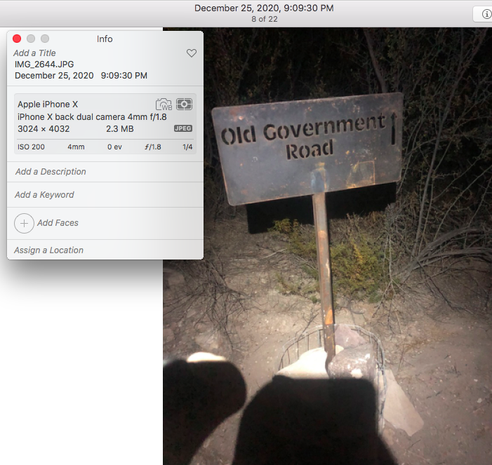
From here on out, I was able to follow a largely defined Epic Trail, which eventually turned into Buena Suerte Road. The clouds cleared, and I was able to hike without a headlamp for the last hour into Barton Warnock. It was incredibly peaceful and quiet. There were points I felt like I was starting to nod off, but I was determined to get my 50 mile day, and complete a full send of the state park in one go.
Eventually I made it to Barton Warnock, and stealth cowboy camped in the picnic area, doing my best to be courteous and neatly sleep out of the way in a corner, in order to wait for the visitor center to open in the morning so I could refill on water and use the restroom. The pre-cooked pepperoni and feta pizza I ate this night was absolute bliss.
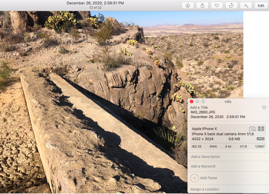
Day 2 (Dec 26th ~37 miles): Barton Warnock Visitors Center to Homer Wilson Ranch
Woke up in my stealth camp around 8a when the visitors center opened and took my time getting up. Ate more pizza, used my phone. Used the bathroom and changed clothes. Filled up on water. Chatted with Scott @ Barton Warnock who was the ranger on duty, informed him of the water situation I noticed, and took off at ~9:30a.
First, finding a gap in the fence to the NP out of Lajitas did not happen for me. I walked along the golf course and eventually hopped over the barb wire, then bushwhacked for 10 minutes until I found the cairned trail leading to the Mesa de Anguilla. After that navigation was fairly easy up to the Mesa de Anguila campsite.
This day was hot - I didn’t want to look at the temperature and have it get in my head, but I was nauseous at several points which was a sign for me to slow down. There were multiple quick breaks that I took specifically to lie down in the shade. But, also saw a couple of wild horses at one point which is always a fun vibe to have on a hike. Making the turn to climb up onto the Mesa from the campsite, I also could not find the appropriate cairns, and once again bushwhacked up a steep ridge. Once on the mesa, route finding was slow going, and it got even hotter. I was not happy during this section, but in retrospect it was gorgeous and desolate.
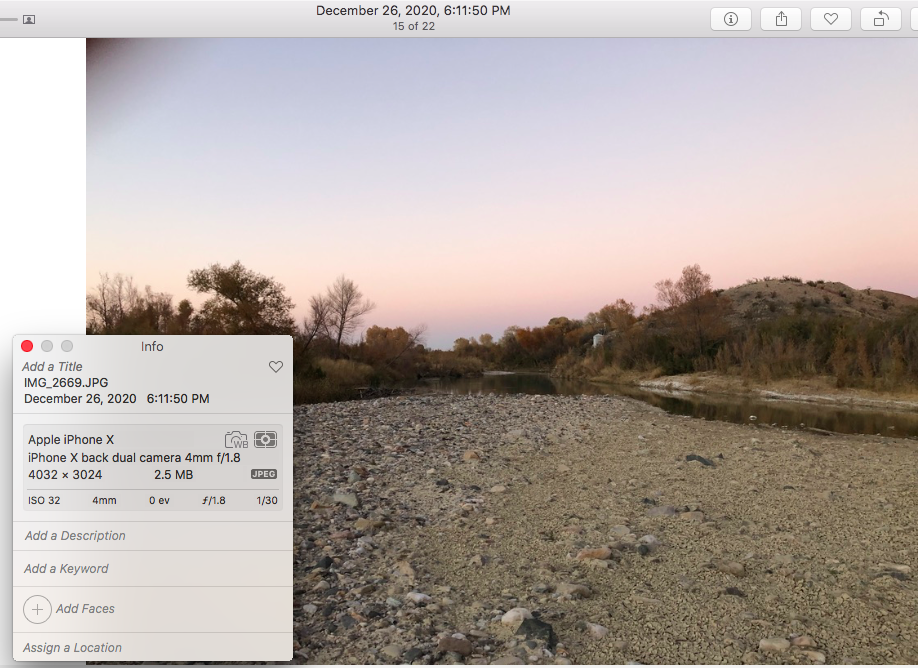
I eventually found my way off the mesa and expected to find easier terrain and route finding - but that was not the case. It is off trail for a couple of miles in the rolling hills below the mesa until you find washes to follow all the way to Terlingua Abajo. This was way slower going than I expected, and I did not make it to Terlingua Abajo until ~6:30 — a full 2 hours behind what I had planned for the day. Just before Terlingua Abajo, I was even forced to ford the river and get my shoes/socks wet, resulting in damp feet all night.
I would not want to get caught trying to navigate through this section in the dark, and overall this section was mentally exhausting with many curve balls.
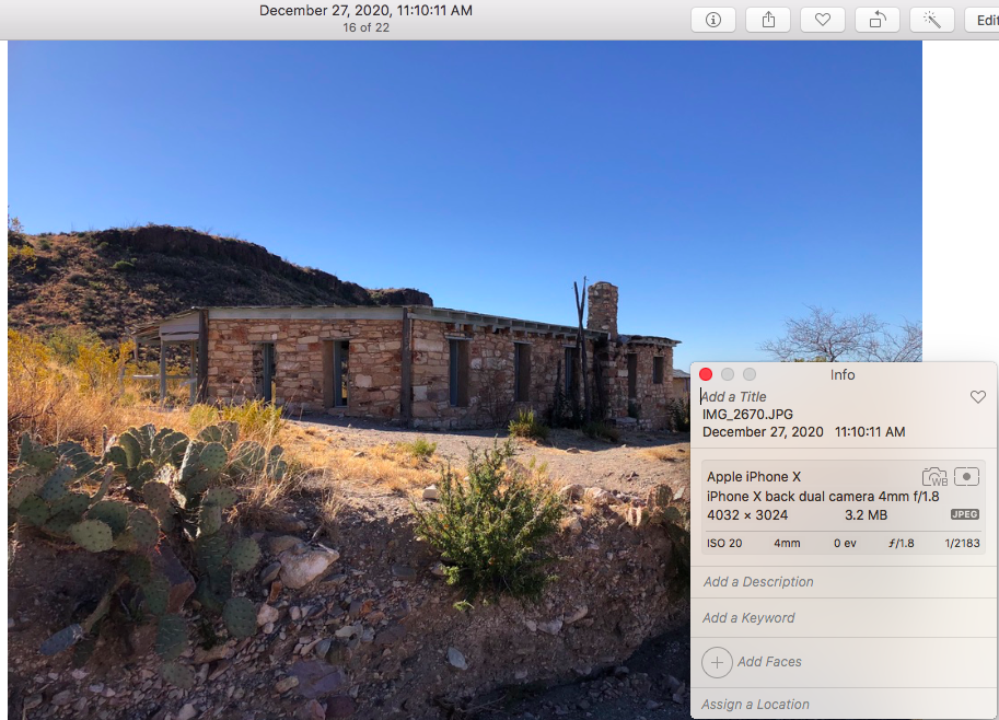
From here, I took a break, refilled with water, ate some pre-cooked pizza, and took off into the fading light. Navigation was much easier and more straight forward all the way to Homer Wilson. Roads and the Chimneys Trail made the night mentally easier despite being absolutely exhausted at this point. The moonlight was *excellent* though, and there was no cloud cover to obstruct those reflected sun rays. Cold for sure, but walking via the moonlight was a wonderful and calming experience for the most part, similar to the night before heading to Barton Warnock along Buena Suerte Road. I eventually arrived at Homer Wilson and stealth cowboy camped in the wash below the water cache around 1:15am.
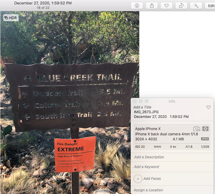
Day 3 (Dec 27th ~9.5 miles): Homer Wilson Ranch to Chisos Basin Trailhead
To say I was tired when I woke up would be an understatement. I had never done this many miles in a 48 hour period. Despite waking up around 9a, I didn’t get started until 11:30 or so. I took my time with eating, packing up, getting water, and hanging around the water cache having a few conversations with OML hikers. Eventually I made my way through the wash near Homer Wilson, to start the final climb back towards the basin.
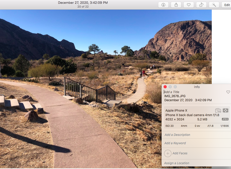
I ended up decided to follow Rafael Mujica’s FKT route instead of the official BB100 route for a myriad of reasons, namely I was insanely tired and had lost my Goggins mentality. I took my time, and eventually hit the Chisos Basin Trailhead right next to the Basin Store at 3:42p on Day 3. Afterwards, there was more pizza, steak, veggies, and a couple of brews.
Start Time: December 25th, 2020 @ 4:11am CT
Finish Time: December 27th, 2020 @ 3:42pm CT
Total Time: 59 hours 31 minutes
Eastbound from BBRSP to BBNP
Comments
What an epic adventure! I've had my eye on this route for some time now, and I'm hoping to attempt it (supported) in March. On the off-chance that this comment is even seen, could I pick your brain more about the experience? I have a fair amount of concern about getting across Mesa de Anguilla and the westernmost section of the National Park. I have both FB & IG if messaging via one of those platforms would be easier.