My trip was self-supported. Prior to my start, I brought 2 days worth of food with me from Walmart. I was dropped off at Massillon Section Point 11 on the night of August 18th, where I spent the night on the porch of the Towpath Cabinn. The majority of my food was bought on sight, avoiding carrying food as often as possible. It was common for me to get lunch and pack out dinner from the place I got lunch to eat at camp. I relied mostly on gas stations for convenience and speed, but stopped at restaurants quite often as well. Water was mostly acquired at gas stations (asking to use the water from their soda machine) and restaurants (asking to use sink in the back or sink in the bathroom). I asked homeowners if I could use their spigots a number of times, and also had to filter water a number of times. Ohio was experiencing a rather severe drought during my run, so water was hard to come by and temperatures were hot, making me drink more. I often carried 3 liters of water whenever I was able to fill up. I carried 2 battery packs with me to avoid having to stop and charge very often. I charged my battery packs whenever I stayed at a hotel or was able to sleep somewhere that outlets were available. If I ever stopped a restaurant, I would sit next to an outlet and charge my phone while I ate. I used the Garmin Instinct Solar 2, which could support GPS tracking for up to 3 days before needing a charge, which was very helpful in maintaining power in my battery banks.
My camping was often not in official tenting locations. I was often stealth camping, waiting until dark to set up my tent and leaving before sun rise. I used a combination of ride share and hitchhiking when necessary. I initially completed "The Little Loop" counterclockwise before heading clockwise to Belle Valley Section Point 25. I received a hitch from here to Stockport Section Point 7 and completed "The Wilderness Loop" counterclockwise. I then headed clockwise to the Southern Terminus at Loveland Section Point 1 where I used ride share to bring me back to Loveland Section Point 9. I then completed the rest of the trail clockwise, finishing at Bedford Section Point 1.
The Southeast/Southern sections of the Buckeye Trail are logistically and physically the most difficult. It involves the most elevation as well as the least amount of options for resupply and water. I would advise planning your food stops ahead of time in these sections, as well as being cognoscente of water opportunities. Speaking for myself, I was forced to move slower through this section due to those factors as well as the majority of trail being overgrown or difficult to navigate. While the northern and western portions of the state are flatter terrain and larger miles, they involve mostly pavement/road walking which did a number of my feet. Both of these situations should be considered prior to starting an attempt.
Day 1: 47.3 trail miles. Started my hike at 4:22AM on August 19th. Stopped at a diner in Hartville for food and to refill water. Finished my day Mogadore Section Point 15 where I got Wendy's for dinner. I cowboy camped on a hill in a truck overnight parking lot next to the interstate behind Wendy's
Day 2: 44.6 trail miles. Got breakfast from a gas station at Mogadore Section Point 15. Got lunch from McDonalds in Mantua. Got dinner from Subway in Burton. I cowboy camped behind the church in Burton and grabbed breakfast from a gas station before camp.
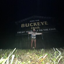
Day 3: 40.3 trail miles. Threw away all my extra food in my backpack as I realized I would be going through enough towns to not have to carry food. Also threw away my cook set. Got food from Beans Coffee Shop and Bistro in Chardon. Got food from Papa Johns in Painesville. Made it to the Northern Terminus and cowboy camped in an out cove in the Mentor Headlands parking lot.
Day 4: 31.85 trail miles. I ate left over Pizza for breakfast. Made it to Bedford Section Point 18 where I used ride share to go to a hotel in Mayfield. Got Mr. Hero for dinner and packed out an extra sandwich for lunch the next day.
Day 5: 40 trail miles. Used ride share to get back to Bedford Section Point 18. Ate packed out sandwich for lunch. Got dinner from a Sunoco in Bedford. Set up my tent on the side of trail in CVNP.
Day 6: 41.3 trail miles. Got breakfast from restaurant in Peninsula. Got lunch from Lock 15 Brewing in Akron. Packed out dinner. Set up my tent at Clinton Camp Site off the Tow Path.
Day 7: 40.5 trail miles. Got breakfast from gas station in Canal Fulton. Got lunch from smoothie place in Massillon. Got more food from Kraus' Pizza of Navarre and packed out dinner. Set up tent on side of road in grassy ditch area.
Day 8: 32.1 trail miles. Got lunch from Leesville Lake Southfork Marina. Got dinner from Deersville General Store as well as all food for the next day. Stayed in Airbnb in Deersville.
Day 9: 40.5 trail miles. Slept at Belle Valley Section Point 4 on grass patch on side of the road.
Day 10: 42.9 trail miles. Got lunch from Senecaville Lake Marina. Got dinner from gas station in Belle Valley. Hitched a ride that night to Stockport Section Point 7 from someone who came to fill up their car with gas. I grabbed 3 days worth of food from the gas station in Belle Valley before the hitch. I slept on the side of the road right next to Stockport Section Point 7.
Day 11: 39.3 trail miles. Only filtered water for the next 3 days while in The Wilderness Loop. This section was incredibly hot and humid, with water coming very rarely due to the drought. Temperatures got up to over 93 degrees every day. Slept on an ATV track on top of a hill in front of someone's house.
Day 12: 41.3 trail miles. Slept at Ring Mill Campground.
Day 13: 41.6 trail miles. Made it back to Belle Valley where I got dinner from the gas station and got food for the next day. Slept in grass lot by gas station.
Day 14: 31.5 trail miles. Brutally overgrown section of trail. I completed The Wilderness Loop. Set up camp on side of road.
Day 15: 42.1 trail miles. Was asked to move my tent at 1AM. Walked 9 miles to a gas station outside Stockport. Slept there until it opened at 5AM. Continued to Chesterhill where I got lunch from Ron's Convenience Store and packed out dinner. Began feeling sick. Camped at Burr Oak State Park Dock 3 Campground.
Day 16: 4.7 trail miles. Woke up not feeling well with extreme case of diarrhea and dehydration. Walked to Burr Oak Lodge, where I stayed for the day, eating food from the restaurant at the lodge.
Day 17: 37.5 trail miles got lunch from American Legion in Murray City. Got dinner from the Marathon/Road Dog in Shawnee. Slept at 100 Acre Shelter. Hardly slept at all and diarrhea and dehydration came back. Very little appetite.
Day 18: 26.4 trail miles. Walked 3 miles to Maxville excessively dehydrated. Attempted to get off trail and walked 1.3 miles towards a major road before turning around and heading back to Maxville. I made my way into the closed community center and found a bathroom where I sat for a few hours, drinking 10 liters of water and clearing out my system. Continued 23 more miles to Lake Logan where I was used DoorDash to get Subway for Dinner and breakfast for the next day. Slept on side of road next to the lake.
Day 19: 35.3 trail miles. Got lunch and dinner from Grandma Faye's Grocery. Slept on side of road in front of house that I asked to get water from their spigot.
Day 20: 43.1 trail miles. Got lunch and dinner form gas station in Londonderry. Slept in woods on side of trail.
Day 21: 42.2 trail miles. Got breakfast, lunch and dinner from Fredneck's Mini Mart. Camped at Butler Springs Christian Camp under a pavilion with an outlet and a spigot.
Day 22: 42 trail miles. Got breakfast from gas station in Sinking Spring. Got lunch from Mel's Main Street Grille in Peebles and packed out dinner. Got extra food for the next 2 days from gas station in Peebles. Camped on side of road.
Day 23: 37.9 trail miles. Camped in car turn around on the side of the road.
Day 24: 45.2 trail miles. Got dinner from Lisa's Wayside Inn in Russelville and got food for the next day from a gas station across the street. Slept in someone's yard right off trail.
Day 25: 44.5 trail miles. Got lunch from MTO Bar and Grille and packed out dinner. Slept at East Fork State Park Camp #2 Shelter.
NOTE: From this point on, there were a plethora of food and water options as you pass through up to 4 towns per day, so I will refrain from putting the specifics as to where I got food. I mostly got food from gas stations moving forward, with the occasional restaurant stop.
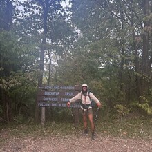
Day 26: 44.2 trail miles. Made it to the Southern Terminus in Cincinnati and used ride share to get to a hotel.
Day 27: 55.9 trail miles. Used ride share in the morning to get brought back up to Loveland Section Point 29 in Milford. Slept in grass area at Caesar Creek bridle trailhead.
Day 28: 48.4 trail miles. Used ride share to sleep at hotel in Dayton for the night.
Day 29: 42.3 trail miles. Used ride share to get back to Rip Rapp Road 2nd Parking. Slept at Eagle Scout Cole Shelter.
Day 30: 42 trail miles. Slept on side of Miami and Erie Canal Trail.
Day 31: 44.4 trail miles. Slept directly on trail in the woods.
Day 32: 43.5 trail miles. Slept at Bend View Metropark parking lot behind port-a-potty.
Day 33: 47.1 trail miles. Slept at wooded Acres Campground.
Day 34: 41.9 trail miles. Slept at Camp Conley LLC.
Day 35: 47.5 trail miles. Slept in grass area at Lester Rail Trail parking lot.
Day 36: 33 trail miles. Finished my hike at Bedford Section Point 1 at 1:08PM on September 23rd.


