Stinson to Diablo FKT Attempt
6:15 PM 6/11/20, Stinson Beach California
Jeff and I got a ride from his husband Eddie our to Stinson. It was a perfect afternoon with temps in the mid-60s and partially cloudy. We had chosen to go after the Fastest Known Time (FKT) overnight due to the potential for heat in the valley during the day and because I’d prefer not to burden my wife with the kids all day.
We wanted to do this FKT self-supported. With my year focus on the Vol State 500k, and the years of self-sufficient long runs, I knew there was more than enough infrastructure to support us along our journey between gas stations and my house that was at the half waypoint. Treating it as a “drop” bag or cache, we utilized an I had set up a table in my garage full of snacks, clothes, tape, and other aid stations like necessities (like a PB&J on homemade Sourdough). Also, we were hoping to not wake the dog and snuck in the back door. Our other support was two gas stations, one in Larkspur and one in Walnut Creek.
We had planned on a bit of an earlier start, but we both needed to finish our workdays. Nonetheless, we were on the beach at Stinson, geared up and ready to roll at 6:10 PM. TANGENT WARNING, Gear list:
- Nike Pegasus Trail Shoes
- Perfect for a mixture of non-tech trail and road.
- Injini Midweight Mini-Crew socks
- My go-to for all trail runs. Injinis have changed my running game. I have not got one toe blister since I switched over a few years ago.
- UD 5.0 Ultra vest
- The brand new update, and I love it. The lower back pulls do a world of wonder to stop the bounce of prior UD packs. I would take it up to 100 miles, but I would want something bigger for the backcountry.
- Kogala Ra with the largest battery pack (#3)
- Simply the best trail light out there. Period. If you don’t have one you’re doing it wrong. 1 Battery, all night during the summer for daylight-like conditions on the trail at night.
- Black Diamond Alpine Carbon Z Trekking Poles
- 3 liters of total liquid capacity 2L tank for water in the back of the vest.
- Two 500ml UD bottles upfront with Nuun electrolytes
- Cover of Ultrarunning Magazine Rabbit Flag Shorts
- Lake Sonoma 50 buff and shirt
- Run steep Get High hat
- Squirrel Nut Butter
- Hand Sanitizer
- Goodr Mint Julip Glasses
- I absolutely love these glasses!
- Spring Energy Gels
- 7x Speednut
- 4 x Koffee
- 3 x Cannaberry
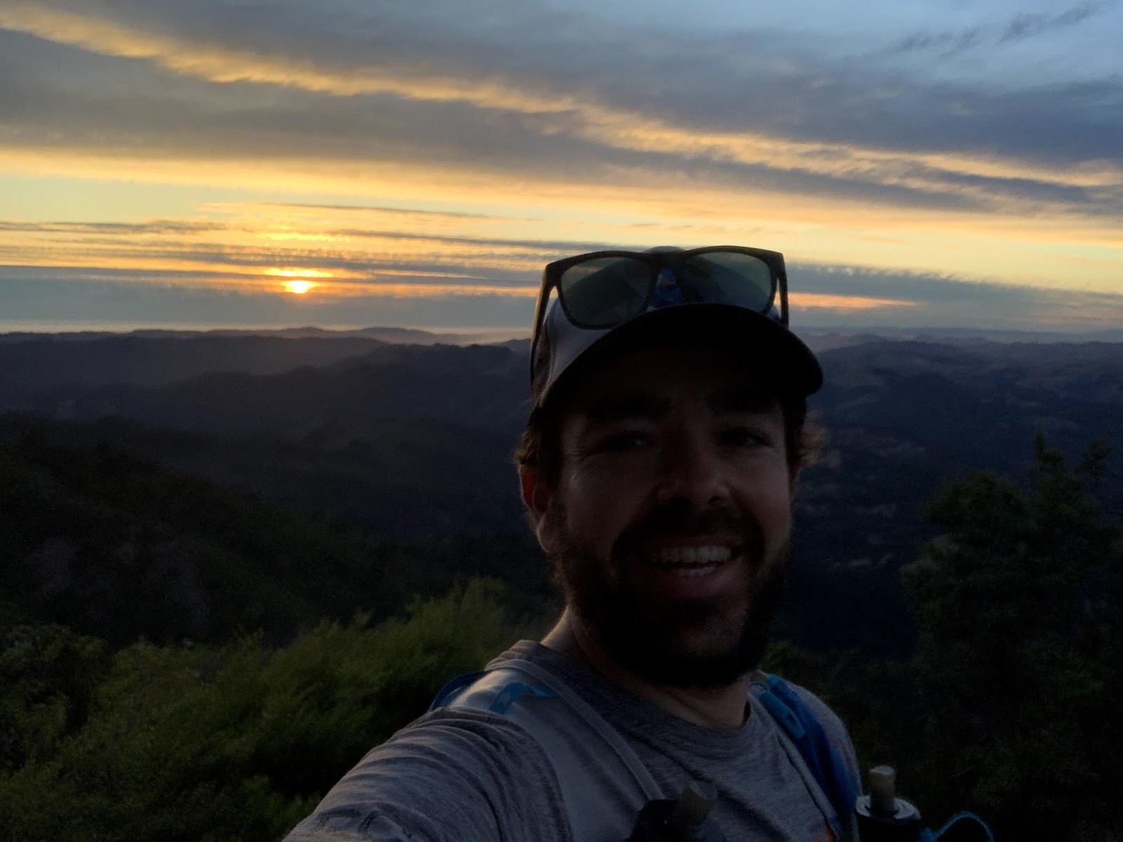
Okay, back to the “start line”. We walked to the beach and took some photos and lined up at the edge of the sand to start. My watch said 6:15 pm and we were off. Unlike a race, no fanfare besides a good luck smooch from Eddie (for Jeff that is). We started out up the famous Dipsea Trail with beautiful views of Stinson. We took the split to Steep Ravine and climbed up to Pantol Station. From there it was up to the East Peak of Tamalpais via Old Stage and the Railroad Grade. 7.5 miles and 2500 feet of climb, we submitted Tam in about 2 hours and 10 minutes. We were lucky enough with the late start to catch the sunset. It was pretty but as really spoiled trail runners we both agreed it was pretty mediocre for a Tam sunset.
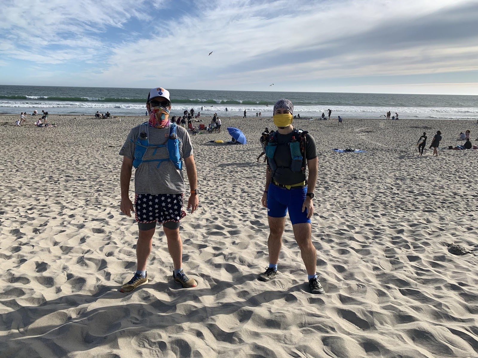
Jeff and I ready to go at Stinson
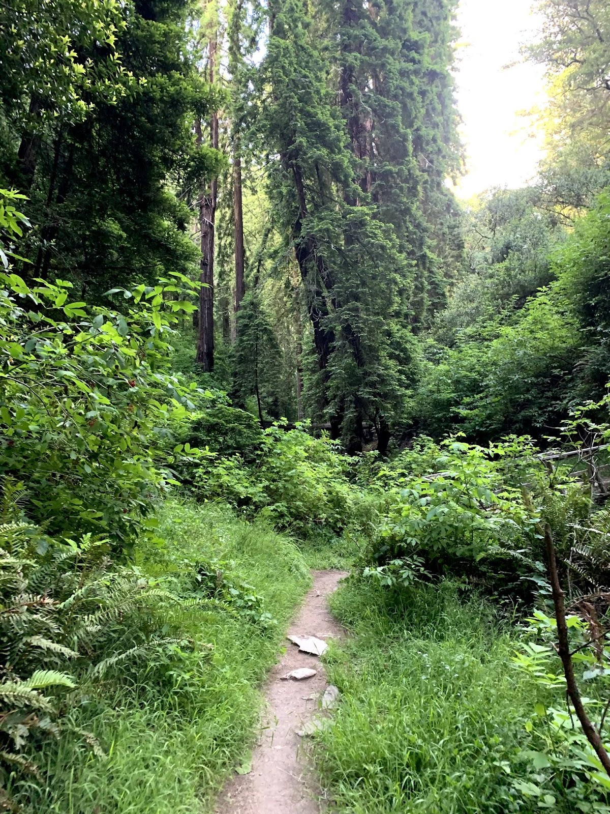

Head up Dipsea and Steep Ravine
Then it was time to head back to civilization and put in a bunch of road miles. But first to descend the 2,588 feet from the summit. The First Known Time on the route was set by David Van Stroh and his partner Victor Yee and they took the Widowmaker down. We decided to take the Eldrige Grade switchbacks as the Widowmaker is so steep and overgrown. Then we hopped onto the Indian Fire road down into Kent. Let the road begin! While pool parties of the rich were going on around us as Thursday night was in full swing, and we were getting ready for 19ish miles of road.
Sunset on Tam
Our first stop for aid was at the Chevron on Sir Francis Drake in Larkspur at about mile 15. We figured there weren’t going to be many options open once we got to Richmond so we better reload on liquids to make the push to my house. Jeff stayed outside and I got 2L of water and a pack of Doughnettes (chocolate, duh). We refilled our front bottles, and I smashed the Doughnettes as we walked towards the bridge. The next few miles felt good and easy on the flat road to the bridge.
On the Richmond side of the Richmond-San Rafael bridge, there is amazing signage and wayfinding to get yourself to the bridge. On the Marin side, not so much until you actually get to the bridge. During my Two Bridges FKT, I took the shoulder of 580 (as it is a marked bike lane) and ran to the next exit (from Sir Francis Drake) which is about .5 miles on the freeway. Then you head under the overpass and hop on the bridge bike lane. This time was a bit different at 10:45 pm. I was about 40 feet in front of Jeff when I heard cop pull over sirens and didn’t think much of it. I looked back after Jeff yelled my name and realized WE WERE GETTING PULLED OVER. The cops were very nice (totally white privilege) about it and explained it was bike only on the freeway. I told them it’s not clear and there is zero signage for pedestrians. They explained as peds you are supposed to take the other over ramp to the westbound side of the freeway and proceed to the street. Nonetheless, they said to continue on to get off the freeway and even provided an escort! That was certainly a first. Should have asked for a selfie.
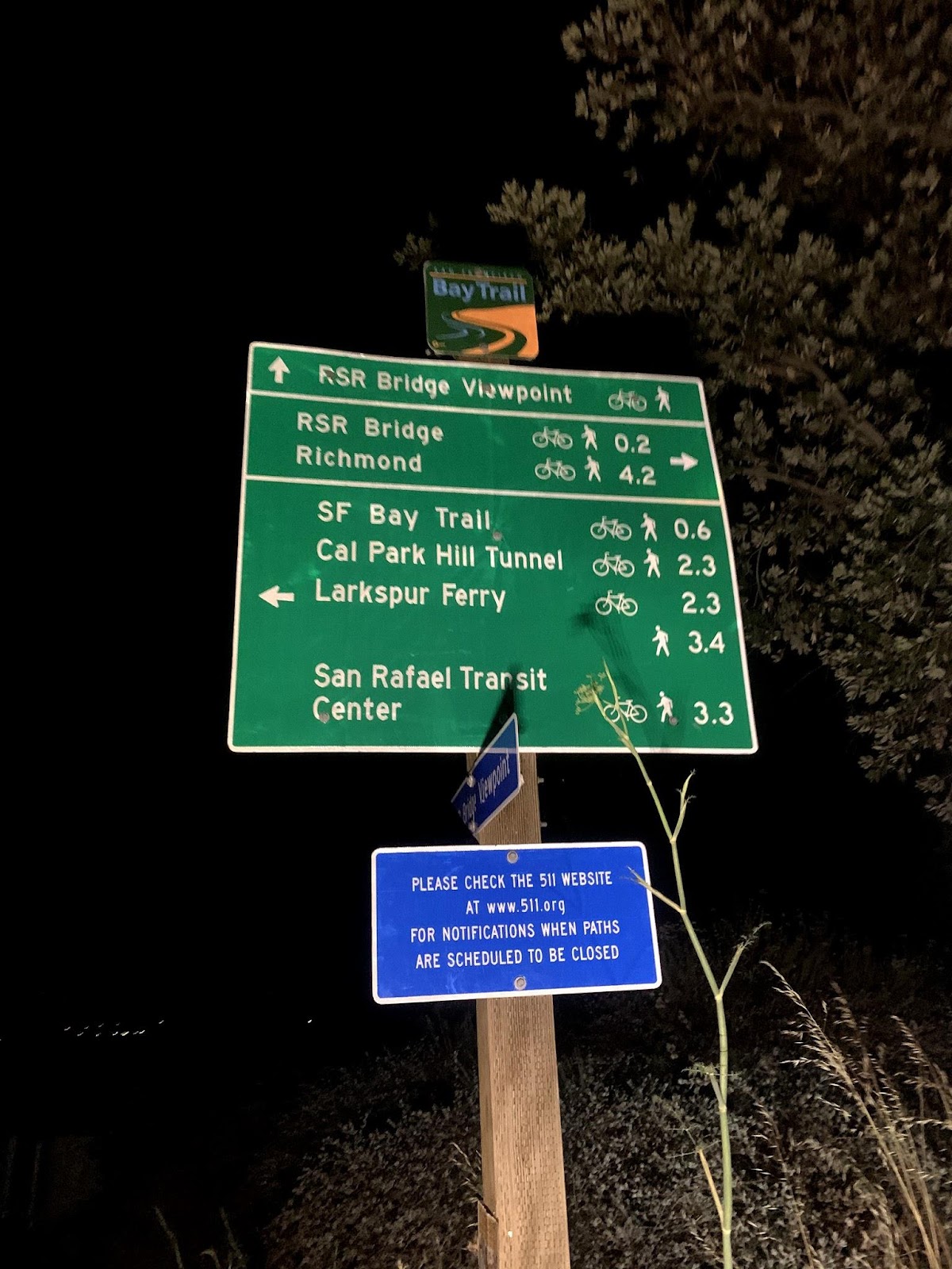
Richmond Bridge Miles
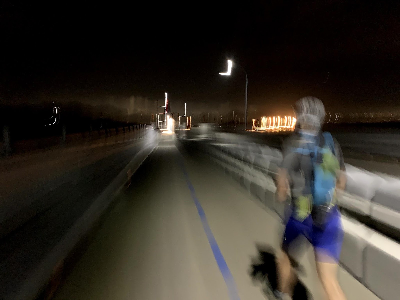
The next section was a mental grind; the Bridge and lots of straight flat desolate middle of the night road miles in Richmond. The bridge is nice, with great views and no need for a lamp at night as there was plenty of light. We were even treated to some sort of fishing vessel pass under us all light up with red and green lights. However, in the Westbound direction, you face oncoming traffic and after an hour it wears on you. Especially when semis are barreling down your direction, the wind force and the bound of the bridge is intense. There was certainly a sense of relief as we touched down into Richmond.
After a wiggle of streets to get through the cute little hamlet of Point Richmond, we hit the equivalent of a running sleep sedative; 3.5 miles flat and straight-up Cutting Blvd in the middle of the night. There was very little vehicular and pedestrian traffic at all. Jeff and I were dosing as we ran and we were really looking forward to getting to our cache at my house. This is where it became noticeable the different training blocks that Jeff and I had done for the first part of the year. I trained for a flat marathon (and PR’d the Last Annual Fuck Corona Track Marathon- yep 106 laps on a track) and spent countless hours on the road training for Vol State. Jeff on the other hand had been training for a mountain 100 (Bighorn) with a sharp focus on trail and vertical. He hadn’t run on the road for more than a 6 mile run the entire year. Needless to say, I was pushing the pace on the roads. He was dragging a bit but not bad and at 12-13 mile pace, we were moving fine. To be honest it was probably smart pacing.
Finally, we got to El Cerrito Del Norte and hopped on the Ohlone Greenway and 1.5 miles later we arrived at my garage. I had miso soup, PB&Js on Sourdough, and stockpiles of Spring gels to restock my bag. I had a coke on ice but skipped it in favor of a caffeine pill and coffee. We probably chilled out a bit longer as we were eating and refilling our water, but the 25 minutes were needed to recharge our minds for the 30 some odd miles remaining. Did I mention that we had 8,000 feet of 11,500 total left to climb on the back half?!
Like basically every run I ever take from my house, we started back up Moeser lane into the night at 1:45 AM. This was the first time I broke out the poles. I would need them constantly over the next 10 hours. Near the top of the 700-foot climb, Jeff realized he had left his phone in my garage. We debated for 2 seconds before we said, fuck it onward into Tilden! We jumped on the Olde School Trail behind Kensington and connected to Cannon road down into Tilden to Lone Oak. A quick power hike up Canyon Meadows trail to Inspiration Point and we hit the road again. We had debated during the planning phase if we wanted to connect via the San Pablo EBMUD trails to Briones Reservoir but thought it was best in the middle of the night to take Wildcat Canyon Road for ease and a faster time. The two miles down the hill to the Briones Bear Creek Trailhead Jeff showed some noticeable signs of road wear and tear. I had put on my JBL Clip 3 Bluetooth speaker and was pumping out the jams. By the time I turned around Jeff was not there. I walked and waited a bit and until he was right behind me. My body was having zero issues with the road, and besides being tired I was feeling great.
As we entered the Briones EBMUD trails, Bowie and the Spiders from Mars were cranking and we had regained a bit of positivity. 9:25 elapsed and 37 miles down. We hit the connector trail up the dam to Bear Creek Trail and rode the southside of the reservoir. The Ouran Trail rides the northside, and while it’s a nice fire road it moves in and out the fingers and is a total of 9 miles as opposed to 3.5 on Bear Creek. We moved well up the climb and down the single track back to Bear Creek Road where we ran into a locked fence. We decided to go prone and wiggle under the barbed wire with about a 15” clearance. That was certainly fun on 40-mile legs!
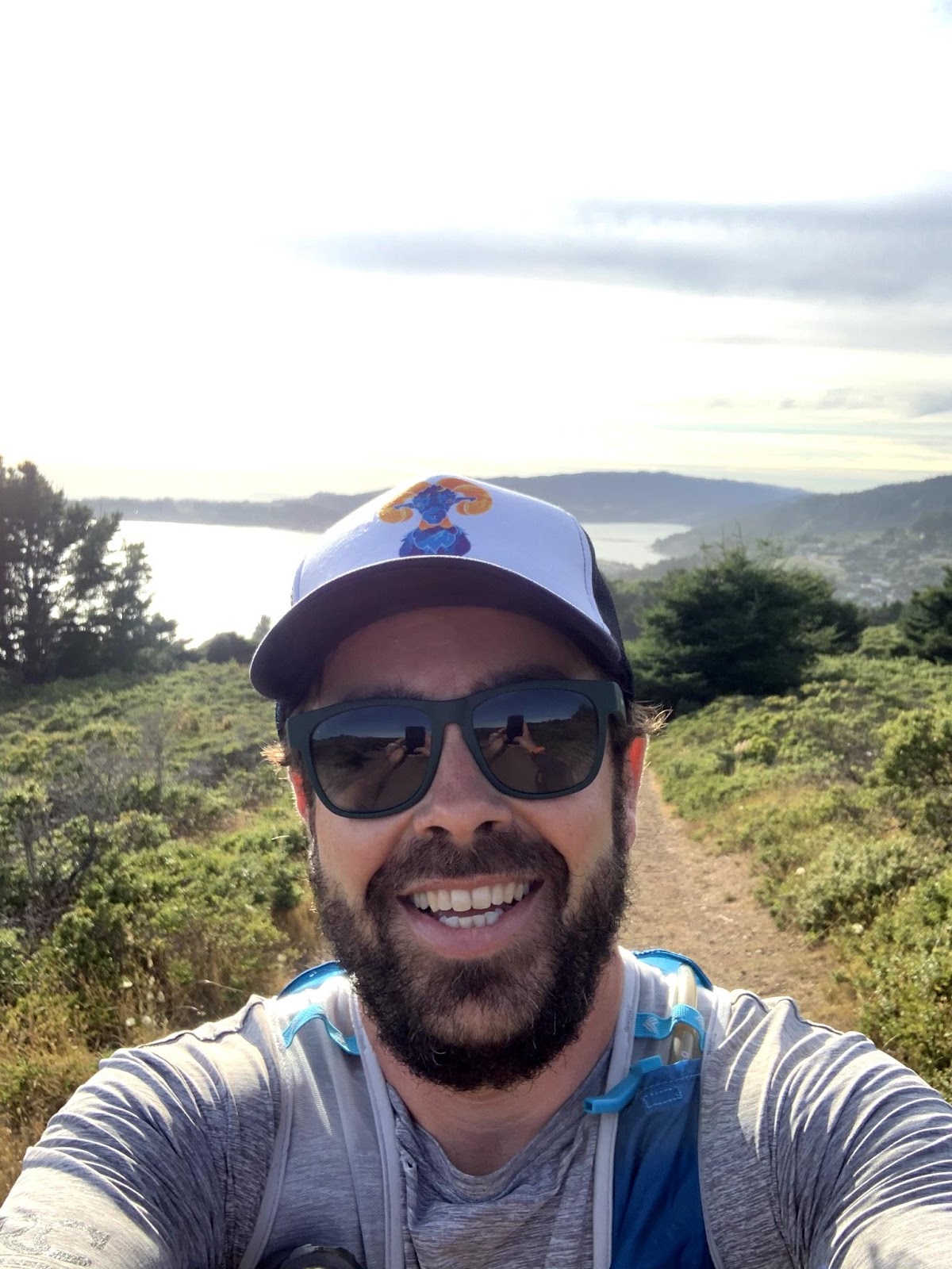
As we entered Briones Regional park off Bear Creek road at the Bear Creek Staging Area. There was a much-needed porta-potty as we entered, and additionally, we took off the lamps as civil sunrise had started. Jeff was audibly feeling the 43 miles under our belt, and much of that road. But nonetheless, we pressed on as us ultracrazies do. Sidenote, Jeff is really fucking mentally strong when he’s in a bad place. He will never stop unless someone physically removes him from a run. It’s a very admirable quality to have. We pressed on up Briones road trail to Ivan Dickson and then to the climb up Seaborg. By the time we reached the top of Seaborg’s 650-foot climb, the sun had risen and we were staring across the valley at our goal, Mt. Diablo.
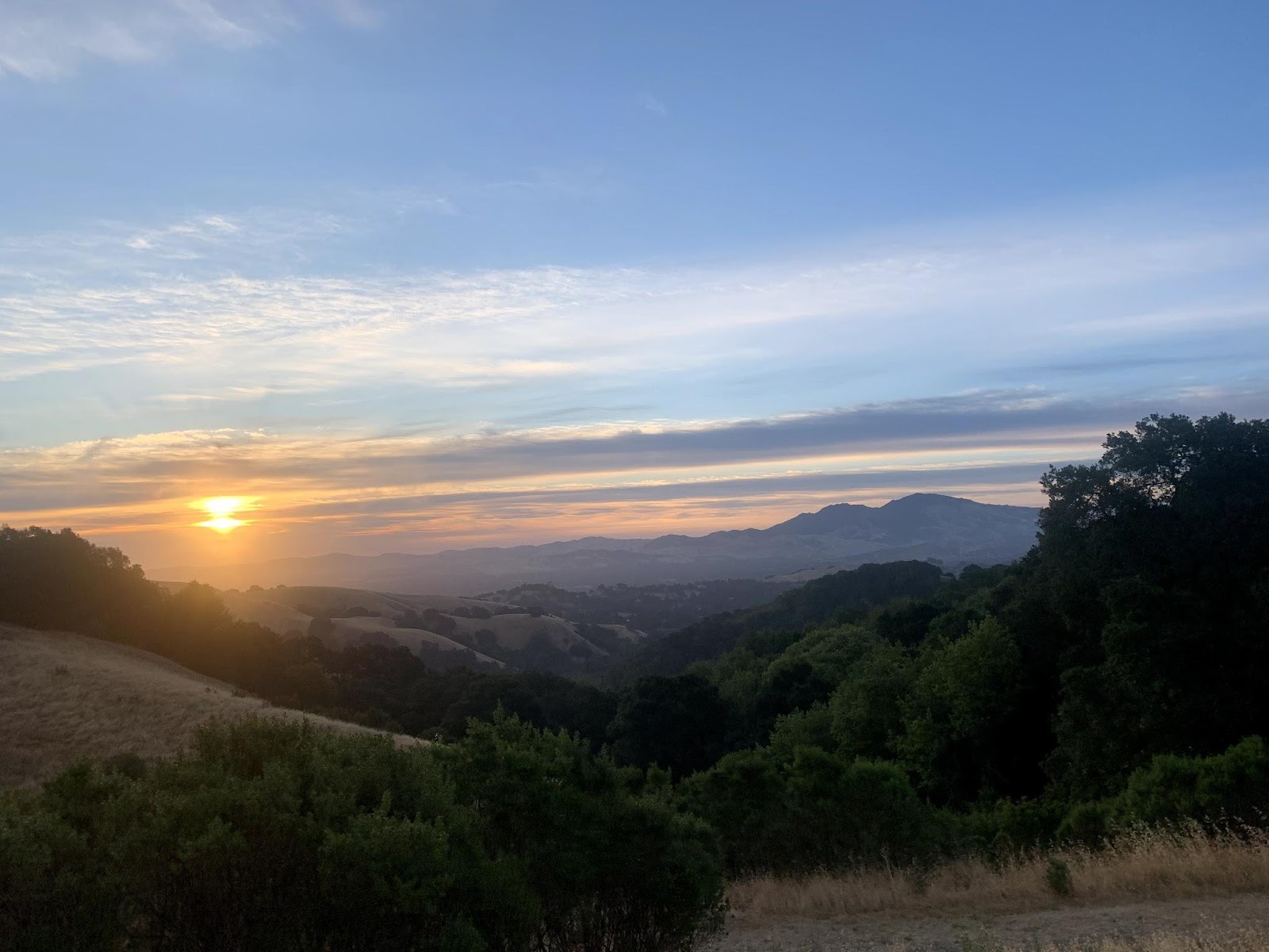
Sunrise in Briones Looking Toward Diablo
After taking in the beauty of the morning on the Briones Ridge we descended into Lafayette on the Buckeye Ranch Trail, avoiding the infamous Lafayette Ridge Trail rollers. Using the connecting Briones to Mt Diablo trail through town, it took us through the Acalanes Ridge Open Space, which I had never run. Some nice singletrack took us into Walnut Creek proper and we were back on the road for about 6-7 miles to connect to Shell Ridge Open Space. This brought us to a bit of a low spot. I had legs to move but Jeff was in death march mode. We lost probably an hour on the easy road and I was beginning to be frustrated. We had chosen to do this as a team, and I was not going to drop my teammate. As long as we were continuing to move, it was frustrating but okay. I’ve been there a million times, and I was trying to lend him my energy and pull him to Diablo.
The situation came to a head with our 3rd stop for water and supplies. We stop at a gas station in Walnut Creek, grabbed water, and a huge bag of jerky. I refilled my pack and was ready to go. Jeff needed to treat this as more of a formal stop and rearranged his bag and took some time. We discussed it briefly and made amends. Self-supported 18-hour efforts are fucking hard, and they can wear on you bad. It’s not all puppies and rainbows, but as true friends, we said our peace and moved on to achieve our goal TOGETHER. I think I said, “You ready to fucking rock this Devil?!”
14 miles to go and 4000 feet still left. We entered Homestead park and connected to Shell Ridge open space. It was a light climb with rollers and it certainly was open. I was glad the weather cooperated and it was in the low 70s with clouds. If it had been 80-90+ it would have been a totally different beast. We worked our way through Shell Ridge and Diablo Foothills and FINALLY entered Mt Diablo State Park! 7 miles to go! The goal was in sight and with 4 hours until the current FKT, it was pretty much in the bag.
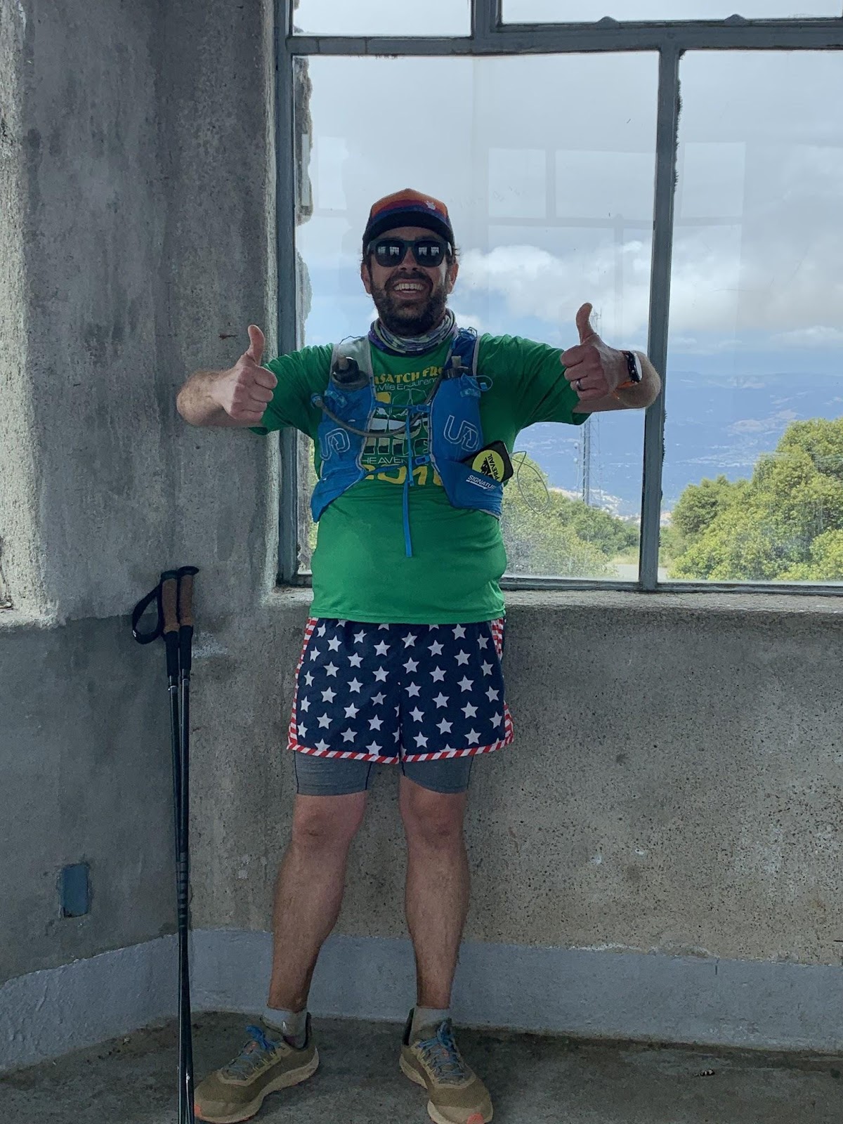
We took Wall Point Road up to Ridgeline and finally made it to the Summit trail! Only 2.5 to go! But a gigantic exposed climb too. It was a slow and steady grind. As we approached the final two segments, I heard Eddie in Jeff’s car driving up the mountain to meet us at the Summit. We were so fortunate to have Eddie drop and pick us up (THANK YOU EDDIE!). As Jeff said, if we had to hike out 10 miles down at the end I would have curled into a ball and cried. As we approached the lower Summit a big feeling of accomplishment came over me and Jeff. We were drunk with happiness and tiredness. We took a selfie at the Summit sign and made our way to the door at the summit. Boom! Done! 18:10! New FKT!
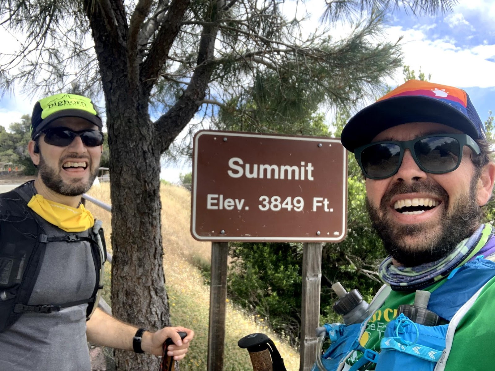
All smiles at the summit of Diablo!
We walked back down to the Lower Summit and popped a celebratory bottle of champagne to mark the occasion. We both know we are just borrowing this FKT for now as someone will most certainly lay down a solid time. Shoot, I may try it again as it’s truly a fabulous route.
.
Strava Data: https://www.strava.com/activities/3604650815/overview