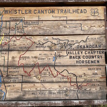
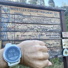
I began at the Whistler Canyon TH parking area on Hwy 97 south of Oroville to complete a solo and unsupported run to Wilcox TH and back to the starting point via Whistler Canyon Trail and Wildhorse Spring Trail. I began at 8:34 AM and reached the Wilcox TH at 11:02 AM and finished at my start point at Whistler Canyon TH at 1:16 PM. I returned the exact route I took on my way out.
I didn't get as early a start as I wanted and the heat got to nearly 90* by the time I finished. This didn't affect me but I took it into account in my effort. I wanted to make sure I could fuel and hydrate well, since I have problems with this in ultras, and I have a busy week planned so this served as a great 4+hour training effort. I've had soleus muscle tightness recently and this really inhibited my ability to run the climbs in the first 5 miles.
Of special importance about the route - The trail doesn't seem to have been maintained yet this year and is very overgrown with grass. Wildhorse spring trail is less used and is very "weedy." The trail is actually quite nice underneath and pretty clear of rocks and other debris. The first 2 miles are rather steep and runable by a strong runner but more efficiently power hiked. Miles 2-5 climb more gently and 7-13 is a very easy uphill drift with gentle rolls along the way. There is pretty good tree shade if youre not running at midday. This area is much hotter and arid than western WA. There are a few small creek crossings at around mile 5 and 11. I burned a few minutes splashing around in the creek at Mile 5 (my mile 21) just because it felt good and I'm homeless and I bathe in creeks. =D
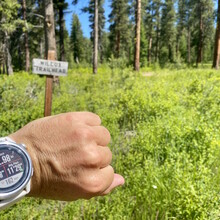
Navigation: You should copy my gpx file and program into your watch. The vital turns are hidden an easily missed. I had the route in my watch, was looking for them and still missed both. There are signs but they are covertly hidden in the trees. (See photos) My gpx shows little pigtails at each turn along Wildhorse Spring. The first turn onto Wildhorse Spring Tr was ~mi 8.6 and the second at ~mi 10.4. The Wilcox Spring TH sign is just a few meters south of where the trail empties onto the forest road. I was confused by the reference to Mt Hull in the original route description. The peak of Mt Hull lies several miles north of the PNW Scenic Trail (100) and you will not be summiting it or on trails anywhere near it.
To be honest but postive, I didn't like the trail. I become extraordinarily itchy from the tall grass, but I had a good run and I really enjoyed visiting the apple farm towns. Oroville has a brewery. And about an hour south is Chelan Lake. The town of Chelan is poppin with life and has some great shops and Stormy Mountain Brewery had some great beers. Anywhere in the area, you should try the apple cider beers. Chelan is also a great place to HQ if youre attempting the nearby Sawtooth Ridge Slam FKT.
Thank you to the creator of this route. The FKTs have allowed me to see towns, peaks, and trails I wouldn't have otherwise. This part of WA is special and shouldn't be missed.


