(The day before, on June 4, I drove out to Provincetown, parked my car there in Grace Hall lot, and biked 62 miles back to a motel in Sandwich. On the morning of June 5, I biked the 2 miles from the motel to the Sagamore bridge, and locked my bike under the bridge.)
I started running a few minutes before 5am on Sandwich Rd, right under the concrete of the Sagamore bridge. I was carrying at Nathan pack with ~85 oz water, 12 Lara bars, handwipes, headlamp, cell phone, headphones, car & bike key, credit card + license + cash, Garmin Inreach Mini, hat, rain jacket, gloves, and Squirrels Nut Butter. During mile 3, I stopped to use the bathroom in a Dunkin Donuts. I used a few other port-o-potties on the way. I ran solo the whole way. It rained on & off for the first ~50 miles, then the sun came in & out for the last ~10 miles but it was still very cold and windy on the Provincetown causeway and the Long Point beach.
For parts of the first 30 miles there was a sidewalk, but other parts were pretty hairy running along Rt 6A with no shoulder and lots of commuter traffic. During mile 31, I stopped at Cumberland Farms at 2639 Main St. in Brewster to purchase 2 quarts of gatorade. Since the weather was cool, the water I started with & gatorade I purchased was enough to get me to the end. I turned onto the Cape Cod Rail Trail (CCRT) at Nickerson Park. During mile 46, I had a little trouble finding my way off the CCRT and back to Rt 6. I was trying to follow the posted GPX file on the FKT site, but the footing was very sandy and unrunnable under the power lines, and there were "private property, no trespassing" signs. For future runners, I would suggest cutting over to Rt 6 a bit earlier, on Lecount Hollow Rd. There is a wide shoulder on Rt 6, and it felt very safe.
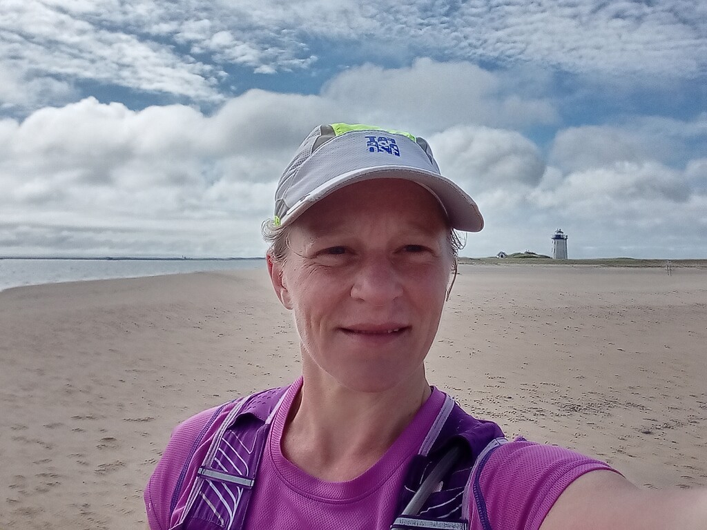
I made it to the Provincetown causeway about 2 hours after high tide (4 hours before the next low tide), and had no trouble crossing the rocks and running along the beach at that time. There were ropes up around the Long Point lighthouse with signs saying "restoration area" so I didn't go exactly to the lighthouse, but instead I ran a bit further to the actual endpoint of the beach. The final photo is from the actual endpoint, looking back westward at the lighthouse.