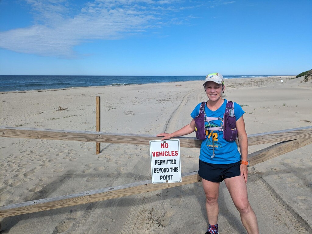
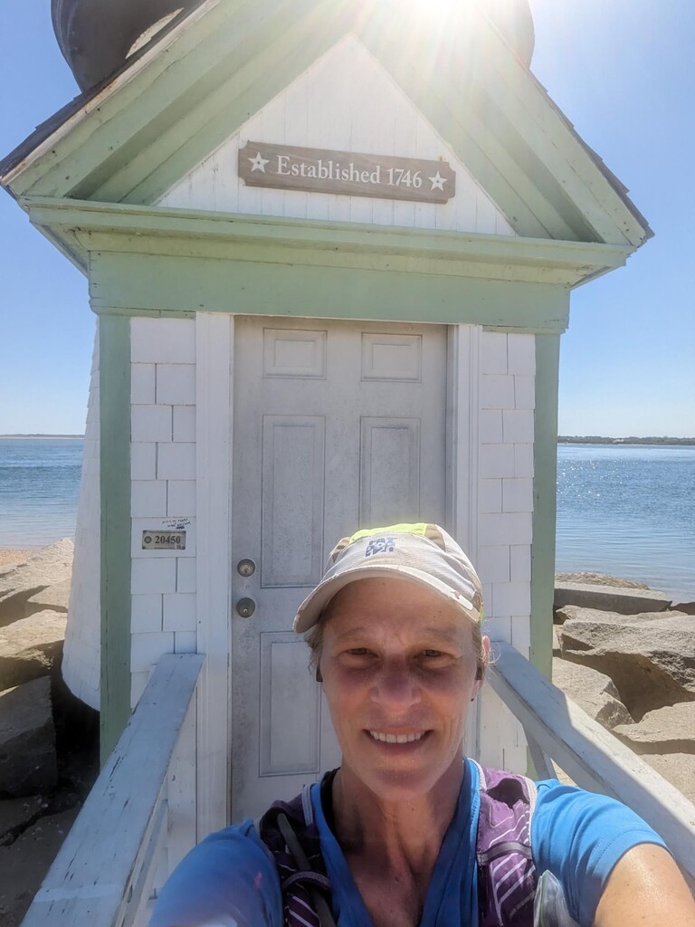
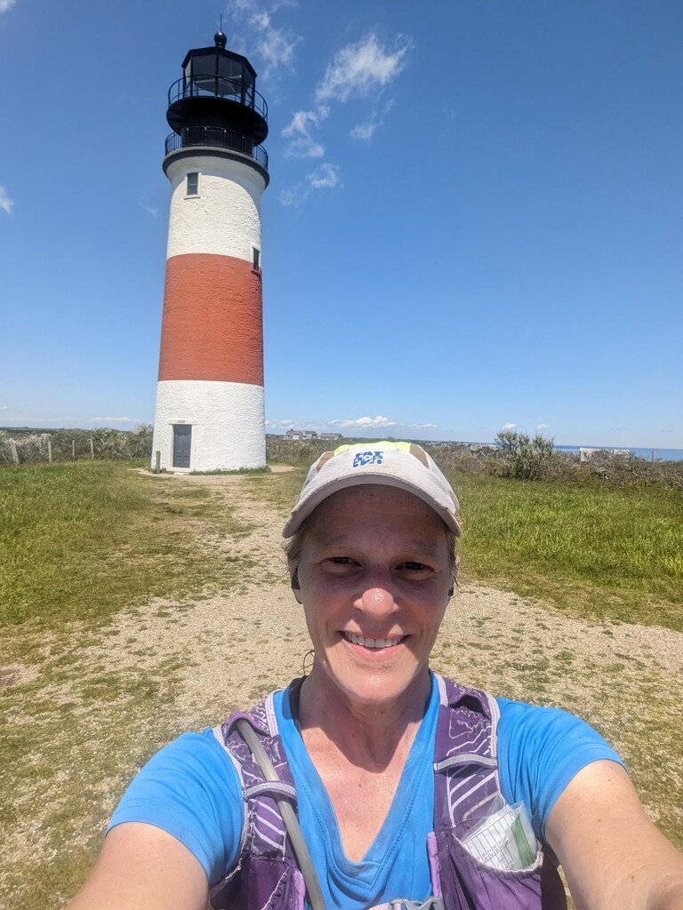
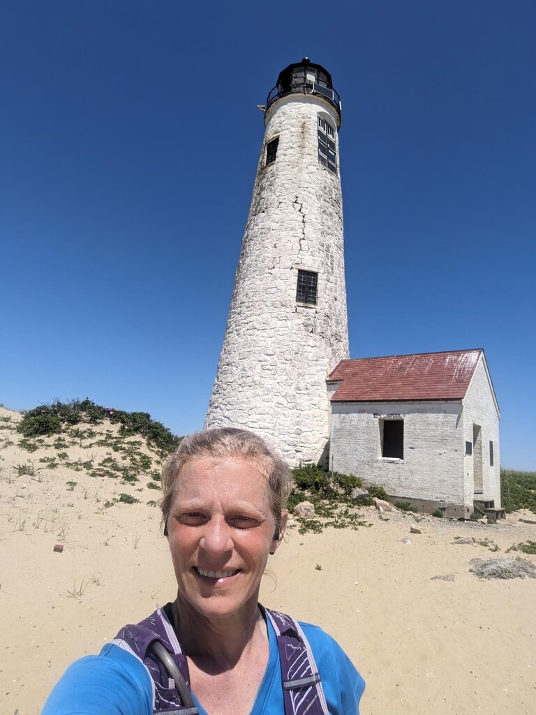
I started at the western terminus of Massachusetts Ave at Smith Point in Madaket. The first half flew by mostly on easy bike paths (with just a little confusion on Main St after the Brant Point Lighthouse #1 around mile 7). I got more confused looking for the Sconset Bluff walk around mile 15, and ended up cutting through a grassy yard on Nosegay Ln. The Bluff Walk is intended for walking, not jogging, so it was a little awkward to navigate around many people strolling slowly on the narrow single-track. After that it was easy-going to Sankaty Head Lighthouse #2 and on to Wauwinet Rd, mostly on more bike paths. But shortly after the Coskata-Coatue Wildlife Refuge Gatehouse, the "road" deteriorated to unrunnable soft sand, and then just beach. It was beautiful, with lots of cute seals lounging on the beach, but the last 5 miles through soft sand to Great Point Lighthouse #3 were a very tough slog.
I carried ~2.5 L of water and Gatorade, 6 Lara bars, my phone, and Garmin Inreach Mini live GPS tracker (in addition to my Coros watch). It was a warm day, high of 70F with not a cloud in the sky, so I was out of water by the end and it was an even tougher return slog along the 5 miles of soft sandy beach. I wanted to do this unsupported, so I didn't refill anywhere.
After noting that the cheapest hotel on Nantucket is $500/night, I decided to do this all in one day. My son & I brought our bikes on the 6:10am Hy-Line ferry from Hyannis (1hr dock to dock), then biked 7 miles to Smith Point in Madaket on the west edge of Nantucket. I locked my bike there, and did the run solo & unsupported to hit all 3 Island lighthouses. My son biked from Madaket to the Coskata-Coatue Wildlife Refuge Gatehouse and walked out to meet me on my way back from the finish, so I didn't have to retrace the painful 5 miles of soft sand alone. Then I ran the 15 miles back to my bike in Madaket, then biked 7 miles back to the ferry dock. We *barely* made the 7:05pm ferry back to Hyannis. It was a long, hard day but a lot of fun overall.
Bike from ferry to Madaket: https://www.strava.com/activities/11524219622
Unsupported Nantucket 3-lighthouse FKT: https://www.strava.com/activities/11526468903
Return walk on Coskata-Coatue Wildlife Refuge beach: https://www.strava.com/activities/11527530137
Return run to Madaket: https://www.strava.com/activities/11528351258
Return bike from Madaket to ferry: https://www.strava.com/activities/11528560112
I made a few minor wrong turns along the way, so I examined the map afterwards and updated the instructions below to clarify for whoever attempts this route next. I highly recommend it!
Dist Total Direction
0.0 0.0 W end of Massachusetts Ave, Smith Point
0.2 0.2 R on New Jersey Ave
0.05 0.3 L on Rhode Island Ave
0.1 0.4 bend R to continue on Ames Ave
0.2 0.6 L on Madaket Rd (use parallel bike path on R)
3.7 4.3 cross to L of Madaket Rd at crosswalk
0.1 4.4 45° L on Cliff Rd (use parallel bike path on L)
2.2 6.6 45° L on Easton St
0.5 7.1 180° at Brant Point Lighthouse, retrace on Easton
0.4 7.5 L on S. Beach St
0.2 7.7 R on Broad St
0.02 7.7 immediate L on S. Water St
0.1 7.8 R on Main St
0.1 7.9 L on Orange St
1.1 9.0 rotary, 45° L to Milestone Rd (use parallel Sconset Bike Path on R)
6.0 15.0 continue straight onto Main St (free water fountain on R)
0.4 15.4 straight / leftish through traffic circle, stay on Main St
0.1 15.5 L on Broadway (Main ends in T)
0.01 15.5 immediate R on Front St, which curves L (north)
0.1 15.6 R on Sconset Bluff Walk (just before Front St rejoins Broadway)
0.9 16.5 L between houses, then R (north) on Baxter Rd
0.7 17.2 180° at Sankaty Head Lighthouse, retrace on Baxter
0.6 17.8 R on Bayberry Sias Lane
0.1 17.9 R on Sankaty Rd (use parallel bike path on L)
0.4 18.3 curve L, continue on Polpis Rd (use parallel bike path on L)
2.5 20.8 R on Quidnet Rd
1.1 21.9 L on Squam Rd (unpaved)
1.7 23.6 R at triangle on Wauwinet Rd (paved)
0.1 23.7 Coskata-Coatue Wildlife Refuge Gatehouse (port-o-potties on R)
0.6 24.3 continue straight on Great Point Rd (becomes soft sand)
2.4 26.7 end of official Great Point Rd, follow beach on east edge of island
2.0 28.7 Great Point Lighthouse