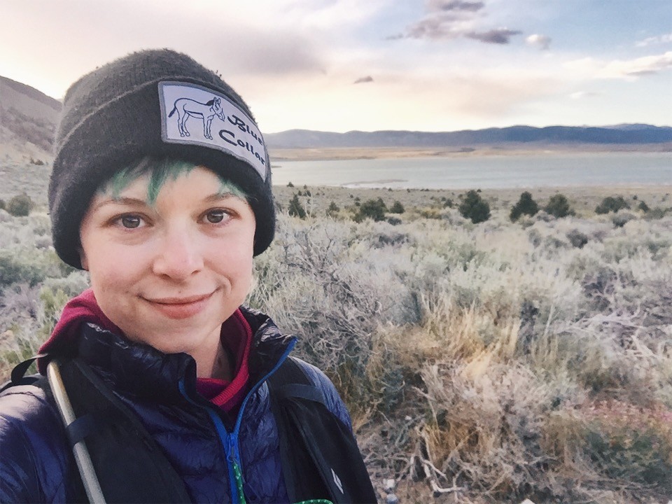
Trip report from Instagram:
Mono Lake Circumnavigation women’s fkt 13:12:10. 41.6 miles solo unsupported.
Okay y’all so lemme tell you why I’m really into this whole @fastestknowntime deal. I am by no stretch of the imagination fast, and I never will be. But being fast or doing well at races has never been my motivation, in bikes or now in running or scrambling. It’s always been about exploration, pushing myself to the limit of what is possible for me, thoroughly getting to know a chunk of land, and experiencing the life energy of the planet and nature away from all the weird structures and social systems us humans have unnecessarily built up.
I could never beat someone else’s time at p much anything, and that’s almost never my goal. The only way I get a #fastestknowntime is if I get an #onlyknowntime which is perfect for me. REALLY what I’m doing collecting these FKTs is setting a #SLOWESTknowntime, every time. The average finish time for a 50 mile ultra run in my age group and gender is 11:30. This “run” was 41 miles, and took me 13:12. Of course most ultras don’t route you through miles of loose sand and make you navigate yourself and carry all the water you need for the day from the start. But still. No one will ever do this “course” slower than me in a day. It took almost all the daylight hours for me to do it. I love this, because for me, the idea of being first far outweighs the idea of being fast. I love that I am the first woman to run around mono lake in a day, and I did everything myself. I honestly like setting a speed bar so low that another woman (or non-binary, agender, gender fluid et al person, why do they always get left out of everything) will see it and think “18 minute miles!! I can do that in my sleep!” And be stoked to get out and explore the same amazingly beautiful places that I’ve had the privilege to explore. In the past I’ve straight up not claimed FKTs I set bc I felt like they just weren’t fast enough. But I want more people to be proud of their accomplishments and not be ashamed to share or uplift themselves, so now I hope to just set that example and hopefully inspire others to get after it. ?? Route beta in comments.
?Kutzadika’a land
This route is a difficult run, but would make for a pleasant and beautiful bike ride! A plus bike would make you happiest with the combination of sand and dirt road. Normal mountain bikes would be unhappy with the sand. Download Jason Hardrath’s gpx track to follow at fastestknowntime.com - don’t follow mine bc I don’t currently run with a watch and sometimes go a little past turns before I pull out my phone map and realize it. His track is straightforward while mine is not ideal.
Mono basin gets v hot in the summer and there is v v little shade to be found. Recommend spring or fall when the temps are cooler. The lake is at 6,400 ft, some sea level dwellers may start to feel elevation at about this altitude but most people will be unaffected. The route is mostly flat with no major hills (I mostly do mountain stuff now, if you live where it’s pancake flat and don’t do hills at all you’ll notice two of them, a few hundred feet.) Coming down from and going back up to the visitor center is the only actual steep hill but it’s v short.
I did this route 100% unsupported, carrying everything I needed for the whole trip with me from the start, including food and water. I took 3 liters of water and ran out literally a hundred yards from the finish. I brought about 2000 calories and had 300 left at the end, mostly real food but some space food too. Know your own body for something like this though - Robert Rives the first person to run this route brought 4.5 L and drank it all, took him 9 hours. I knew I wouldn’t need that much from past experience, and it wasn’t a super hot day.
Speaking of water, unsupported was important for me just bc I appreciate the beauty of being self reliant as possible, but if you’re looking to go self supported and carry less from the beginning, here’s the dl on water! Mono lake is interesting bc it has many inlet streams but no outlet streams. That is why it is saline. There’s a whole controversy about water at this lake (and the Owens valley) bc LA “owns” the land and diverted the inlet streams for LA water which drastically reduced the lake level. It’s back on the rise now but yeah still LA water district. You can’t drink the water in the lake itself, but in May 2019 after a high snow year and rain, there were inlet streams flowing hard which you could collect fresh water from and filter at (traveling counter clockwise) miles 1.5, 5.5, 34.5, and 36. The county park trailhead close to 395 allegedly has water but I didn’t check it. I noticed two wells on the gaia gps map before you get to pole line road on the east side, but you’d have to look for them and I don’t know if they had water in them or were even accessible. There are two restaurants on the 395 stretch, Tioga Lodge and Mono Inn, call to check their seasonal hours. There are no stores or other resupply options on route. This route is very remote - when you’re on the east side all amenities are very far away and few people visit there at all so if something happens you’ll be real SOL so make sure you’re solid on everything you need before going past the south tufa trailhead.
I brought a puffy jacket, a fleece, and a rain shell. I didn’t end up using the rain jacket and it felt silly having a puffy when I was sweating in my t shirt with the sun coming down on me mid day, but I did put it on at the end and i usually carry one when self/unsupported anyway in case of bad injury or ailment in which I might need to unexpectedly overnight outside. I had a battery pack with one extra phone charge, a Garmin inreach mini for backup gps tracking and in case of emergency, and my first aid kit consisted of six Advil of which I took none, some blister tape that I also didn’t use, and that’s it lol. My entire pack with food and water and all gear weighed about 10 lbs.
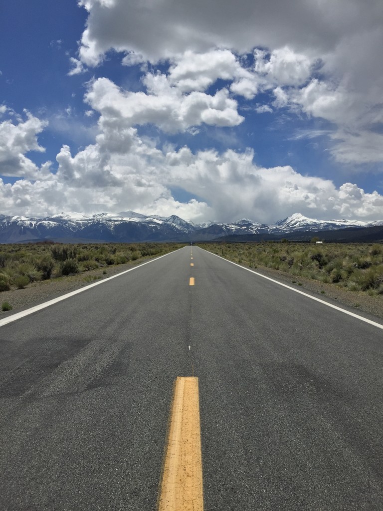
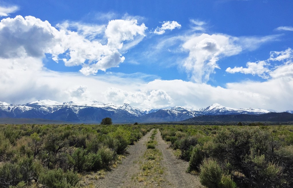
I wore road shoes and actually would recommend this. The terrain is mostly dirt road. It varies a lot in texture. I would roughly estimate 40% hard pack, 30% runnable sandy surface, 20% loose sand dune type sand, and 10% pavement. There is no single track. The short stretch of 395 highway is low shoulder and a little uncomfortable to be on, especially on foot. I took time to actually stop and climb over the guard rail when cars were coming both directions or any time a big rig truck was coming. It would be silly to survive all day in the desert and then die bc you got hit by a car so ten cuidado there.
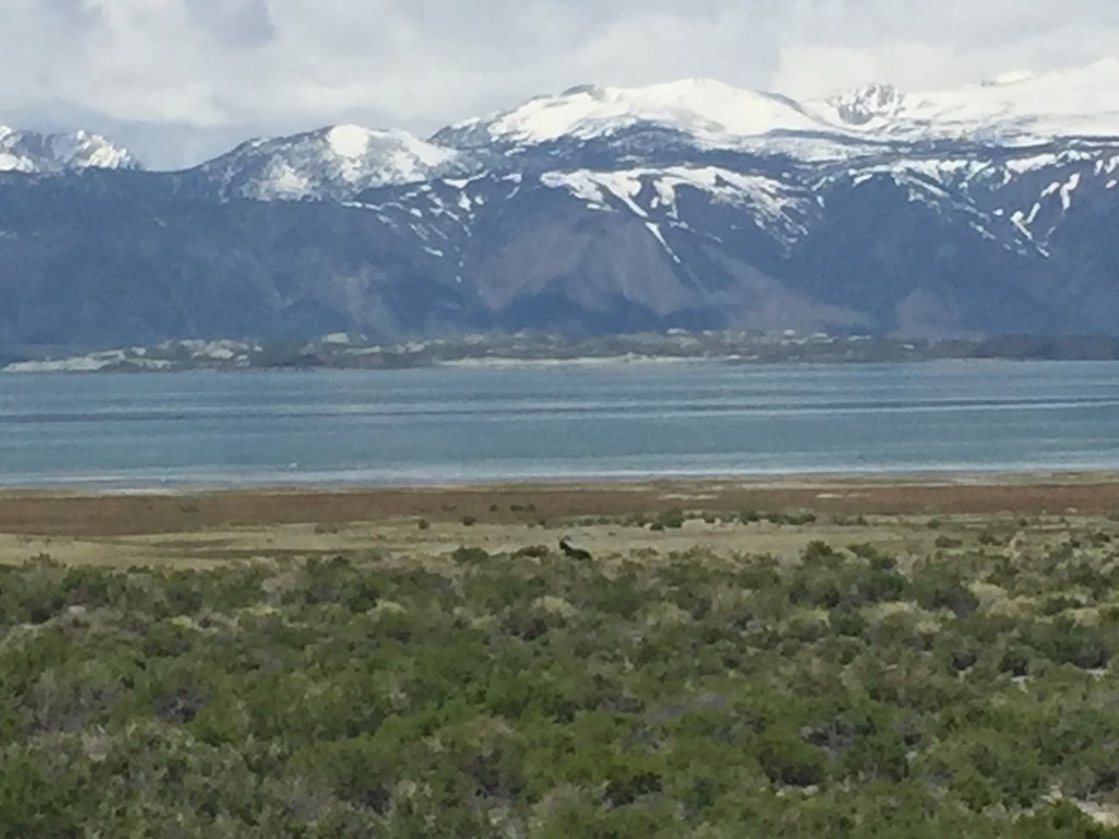
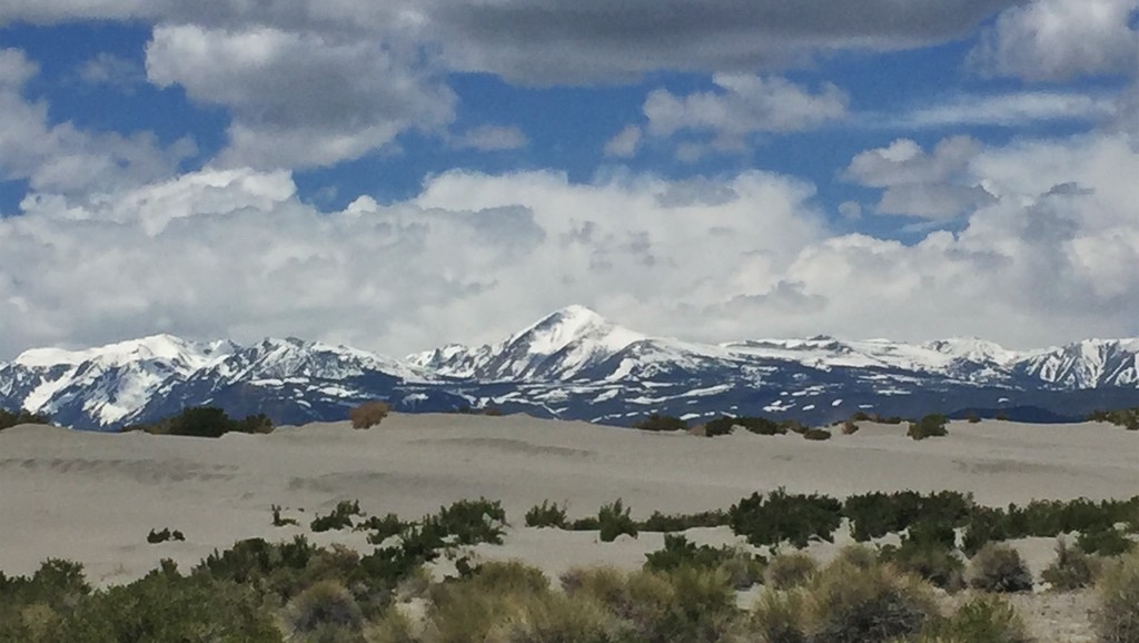
The scenery is simply amazing and outstanding the whole day. Can’t be beat. You start with views of Mono Lake and the crest of the eastern Sierra Nevada mountains. The lake is visible for the first half of the route, and again at the end. It’s indescribably cool to watch the shoreline come and go, to get level with the island the pass it then see it again on the other side. What a unique experience and way to see a whole landscape. Toward the back/east the lake hidden by sand dunes, but you can always see the mountains. This makes navigation especially easy. Plants are desert/sagebrush scrub shrubs. I saw lupine and paintbrush blooming in the spring, rabbitbrush blooms yellow in the fall. On the south east side there’s a juniper tree or two, no trees or shade at all on the east side, with pinyon pines coming up on on the north side as you get closer to the base of the mountains. Wildlife I saw included some small lizards, hawks, buzzards, small cute birds, wild horses (!), and the small alkaline flies that are famous at mono lake. The indigenous people ate the larvae of these flies and they’re high in fat and protein so I guess if you ended up in a survival situation there’s always that. They tried to land on my face in sections close to water when I stopped so it was good motivation to not linger too long and keep going.
There is a river crossing at mile 1.5. After a high snow year with rapid snowmelt starting and a solid week of rain, I was wary of what I would find. It was only knee deep, so I can safely say that you should be able to cross it at any time of year with no problems.
And that should be about all the information you could want if you wanna go around mono lake yourself!
Comments
Great running and report, Jessica! Congrats.