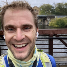
Cloudy and drizzly this morning but turned out to be a great day for a run! Thank you so much Jimmy for putting this route together, I have really enjoyed figuring out all the twists and turns, and learned some great new trails along the way (eg. had never been to Cedar Bend – very cool that you can connect the Arb to Leslie). Shout out to our dog Penny for taking several exploratory route-finding walks with me in Bluffs Nature Area.
I have attempted the full route several times but this time was my fastest.
Thank you again – I think this is a classic Ann Arbor route and I am excited to see lots more people give it a go.
Re: Start/Finish
I started and finished at the Barton Nature Area boat launch (Northwest side of the foot bridge). It’s a more convenient start for me than the Arb b/c there’s 24/7 free parking, plus I think it might be faster? You do Bird Hills/Bluff Nature Area right away while still fresh, and finish on a ~2mi downhill from Leslie.
Re: GPS
It was a very cloudy day today, which seems to have messed up my GPS track. I was wearing a Garmin watch the whole time with one continuous start-to-finish recording, but unfortunately it looks like somewhere around Plymouth Rd (heading toward Leslie) it started to drift. This makes it look as though much of the remainder of the route is translated to the Southeast, including several swims across the river and a finish point that doesn’t match the start point. The shape of the route is correct though, and I think is pretty convincing. Fortunately I also had Gaia GPS open on my phone to help with the trickier route finding sections – I know Bird Hills/Kuebler Langford quite well so didn’t turn it on until Bluffs Nature Area, but from then on you can see that I was in fact on the correct route and finished in the same place I started.

