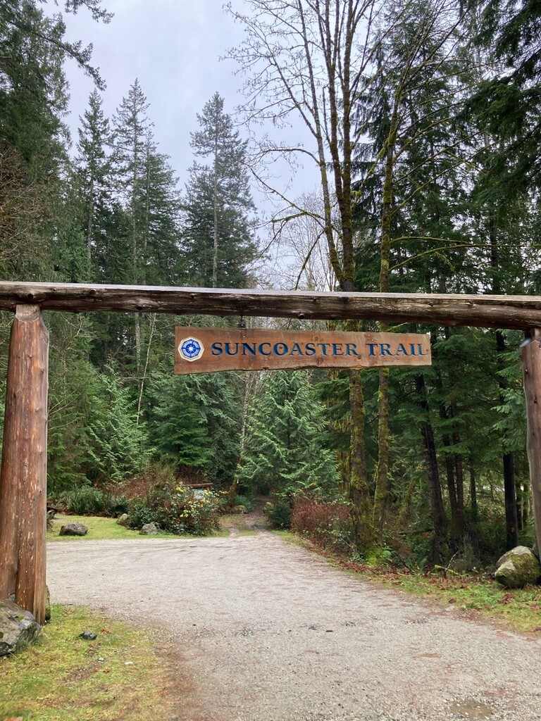
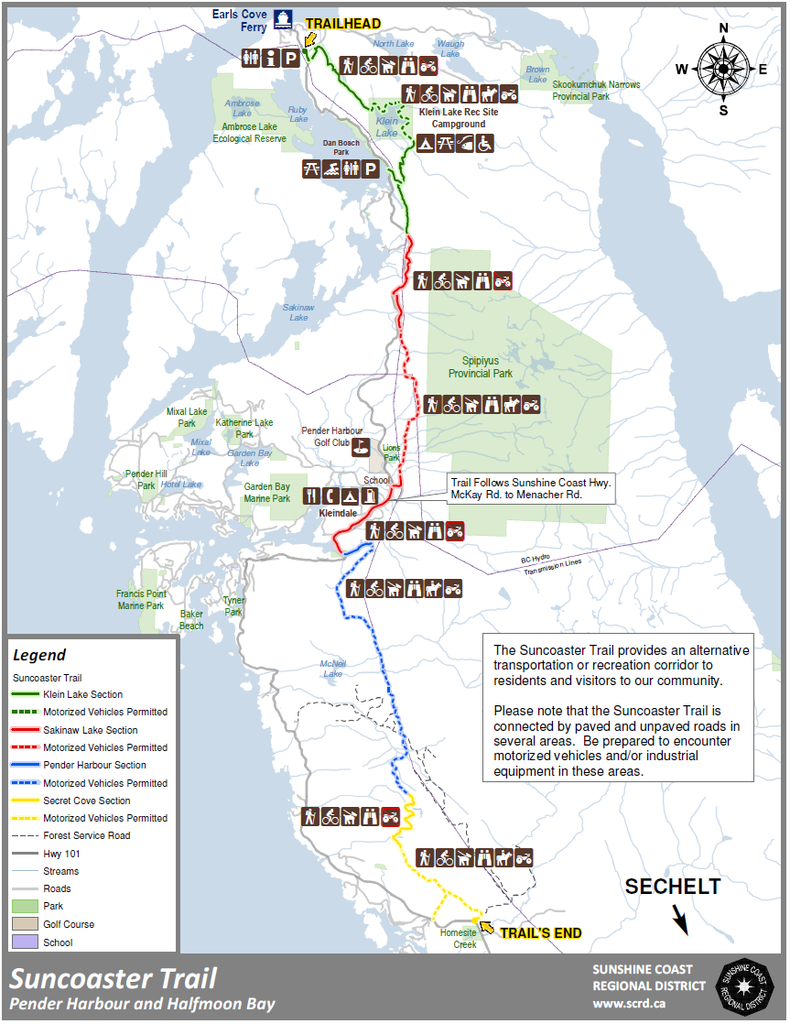
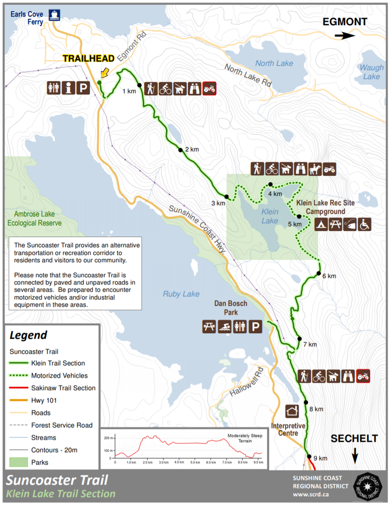
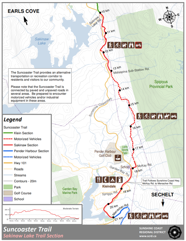
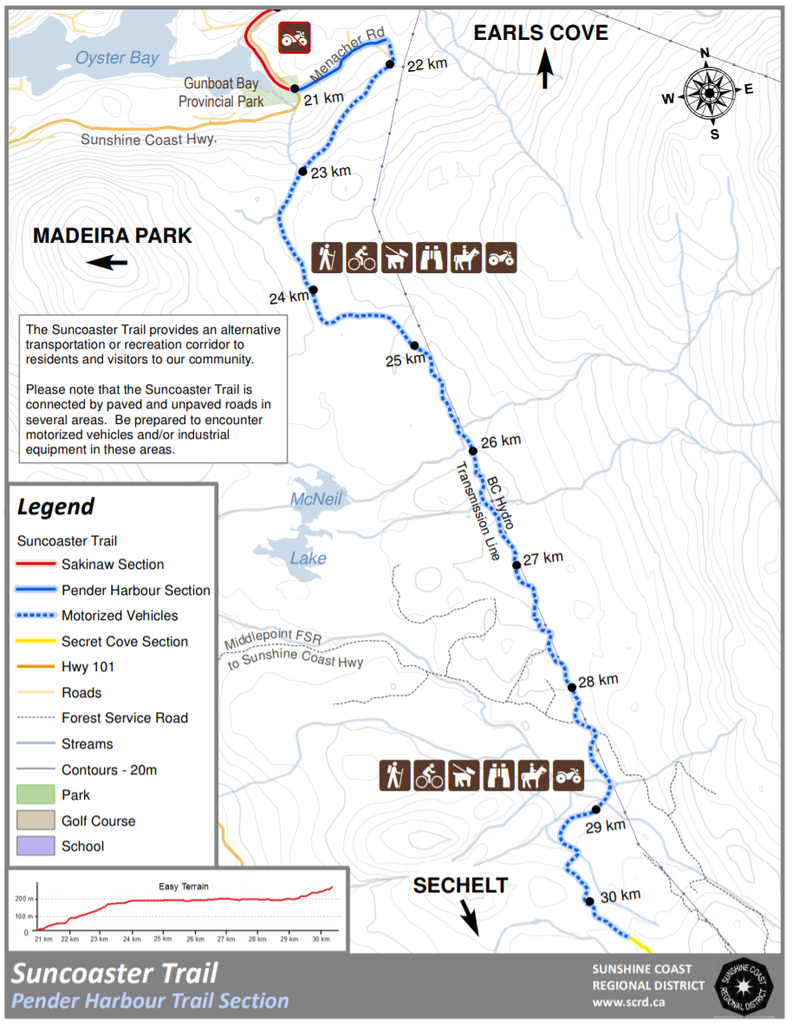
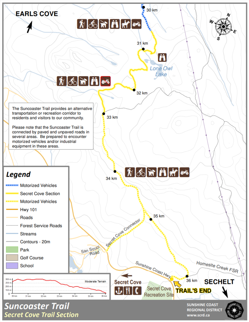
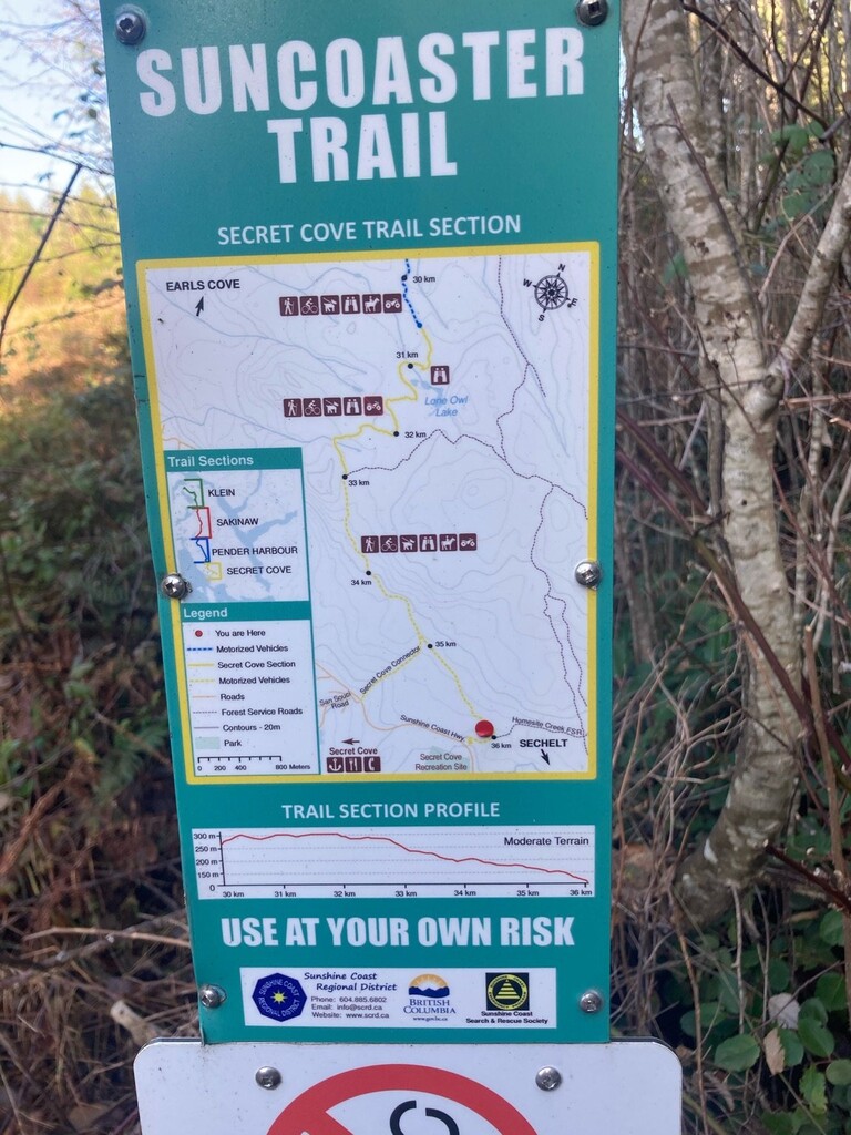
The Suncoaster Trail
The trail is one of the most popular point to point trails for hiking and mountain biking on the Sunshine Coast of British Columbia, Canada. "Phase One" of the Suncoaster Trail is a stretch of about 37 km between Earl's Cove and Halfmoon Bay. There are quite a few variations to this route. There's a parking lot at the trailhead located at the corner of Sunshine Coast Highway (Hwy 101) and Egmont Road. This trail currently terminates at the intersection of Hwy 101 and the Homesite Creek Forest Service Road near Halfmoon Bay. There are four sections: Klein Lake, Sakinaw Lake, Madeira Park and Halfmoon Bay.
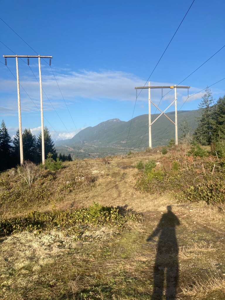
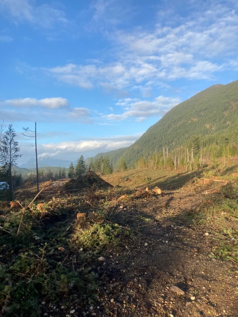
"The Suncoaster Trail moves through rural communities and wilderness settings, the condition of the trail is often a reflection of its setting. The 37 kilometres of natural trail travels through old crown land forest roadways along a series of lakes and connects trails blazed through the brush with exit points near Sunshine Coast communities (Sunshine Coast Regional District)." The route is mostly surrounded by evergreen forests with views into wetlands, high mountain peaks, ocean vistas, waterfalls and numerous creeks.
https://www.scrd.ca/Suncoaster-Trail
http://www.sunshine-coast-trails.com/suncoaster-trail.html
Fastest known time / First recorded time - unsupported South to North
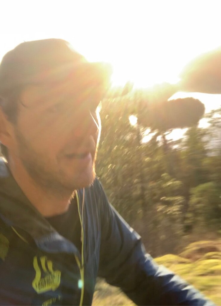
This beautiful winter day packed with a few obstacles made for a memorable FKT day. The trail can be done from North to South or South to North. I decided to go from South to North because this was practically the easiest for me. There's no recorded FKT times that I am aware off. I did find a few people on Strava and Alltrails who have done the full route. I started the run on Friday January 15, 2021, around 13:30, at the first signpost of the Suncoaster Trail. I had no support during the whole run. I brought two phones to record my data on Strava (one phone died 20 min. before the end, see other strava link).
https://www.strava.com/activities/4626868349/overview
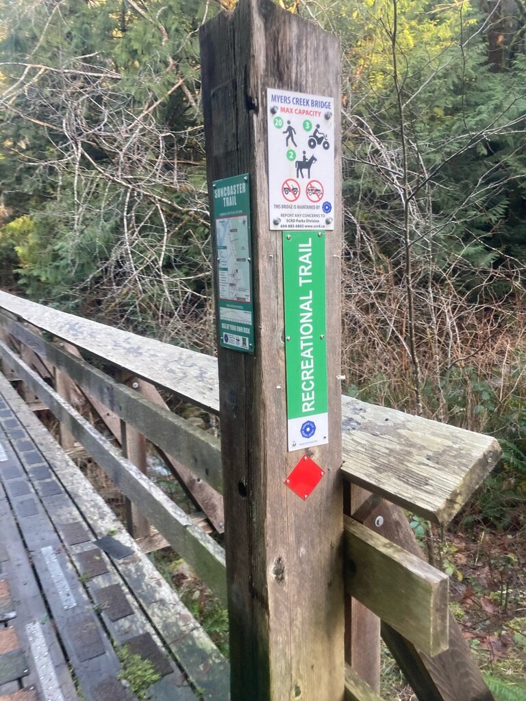
The trail is moderate to easy to run or hike, with about 900 meter (2700 feet) of vertical gain, continually rolling up and down, and some steep sections sprinkled in. Most of it is on dirt/gravel roads/trails with loose rock, sometimes following the power lines. About 1/3 is single-double track trail. There’s a 3-4 km stretch along the road where there's no connecting trail. I took the route variations that are most FKT worthy, meaning representative and scenic, while maintaining to be a fast straight forward point to point. I took no short cuts or easier logging roads (there a quite a few).The trails and bridges are well maintained (during the summer) since its very popular among mountain bikers, hikers and horse riders.
Since there’s no trail work done around this time of the year, I counted at least 50 fallen trees that needed climbing or crawling. I took a few wrong turns, but the trail is generally well marked. However, the main obstacle was a man with a machete(!) wandering around! I didn’t see him, but I got stopped by an elderly couple who seemed in a bit of a shock, so I comforted them for a few minutes. I got chased down by a few dogs and bitten by one (but nothing serious). And all that happened in the first 5k... I spotted no wildlife, though the area is known to inhabit many deer, elk, wolves and black bears.
You can find the instagram stories here: https://www.instagram.com/p/CKGF_bxlVXV/
All in all, this is a very nice trail, showcasing all that the Sunshine Coast has to offer. I hope many others will give it a try.