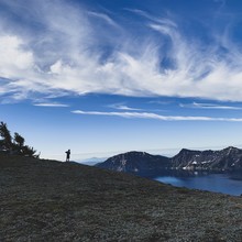
Jordan and I were swapping summer adventure ideas on a run together in spring 2019. The Crater Lake route was an idea that stuck with both of us after that day. We committed to go for it about a week in advance. Jordan had put his best mental energy into crewing at Western States a few weeks prior so I took the lead looking into the route details. The terrain is fairly diverse and so are the skills needed. In terms of distance, the route is roughly one-third road, one-third trail, and one-third route finding. Jordan noted on route that this was a classic northwest volcano circumnavigation, but it is unique in that there is no mountain in the way! You can see the entire route laid out before you all day long.
After connecting with Jason Hardrath through Instagram and spending a silly amount of hours looking at Gaia Maps as well as Jason and Winston’s GPS data, we decided to start on the opposite side of the lake (the Watchman parking lot) and travel in the opposite direction (clockwise) that Jason and Winston chose.
We started our watches at 6:10am and made our way up Hillman Pk. The sunrise views at C.L. are quite grand and we were taking lots of photos early. The cold from a night in the tent along with the crisp morning killed my battery during the first climb. The plan was to use the Gaia app on my phone for route finding when needed. I brought the free park map that they gave us at check-in as back up. It proved helpful later in the day. Our first hiccup came about a half mile into the route on our way down Hillman. We had to down-climb a steep snowfield on the north side of Hillman that proved to be spicy. Jordan had an uncontrolled glissade/fall for around fifty feet and received ice burns on both hands and shins.
It took us a minute to regroup and find our groove but once we reached the top of Lao Rock the miles began to fly by. One of the reasons we chose to start where we did and go clockwise was to hit the big road section on the east rim early in the day with fresh legs. Almost immediately after we hopped off the road to make a direct line for Cloud Cap Pk, clouds of mosquitos in numbers I’ve never before witnessed showed up to cheer us along and keep us moving.
Not having Gaia Maps for route finding took a weighty mental toll on us from Cloud Cap to the top of Garfield Pk. We were never quite sure we were choosing good lines. In hindsight we agree we couldn’t have done much better. I will say, doing your homework really helps on this route!
The soft cross-country descent down Cloud Cap was smooth going and got us away from the mosquitos. Around this point, we started scooping snow from the road and the peaks for our bottles and hats. Snow banks and a couple seasonal springs just off the road starting up Applegate Pk were the only water sources until we arrived at the lodge. The off-trail scrambly ascents up Dutton Cliffs and Applegate Pk were perfectly timed, bringing emotional and physical lows for both of us. As sea-level dwellers, Jordan and I were both feeling the elevation combined with the heat and the nagging thought that we might be off-route. Naturally, this made for a couple tough hours. We pushed on. The route was pushing back and humbling my optimistic time goals.
Once we reached the summit of Garfield Pk. we knew we’d be traveling maintained trails the rest of the way and the route finding was over. The lodge was near and our spirits lifted. After a tender-footed descent, we approached the lodge and had a nice surprise as we ran into our ladies Trisha and Karlee who were sitting outside. We had all camped together at Mazama Village and they hoped they might see us running by the lodge. The four of us walked over to the very busy gift shop where Jordan and I quickly filled up a couple 20oz Coca Cola’s at the fountain and grabbed a blue PowerAde. We had a few people in line in front of us, which made me pretty antsy. At this point our goal was to finish as close to 8:45 total time. We were pushing it as we stood in line at 7:22 total time. Jordan paid for our drinks because he’s nice like that. Then we walked over to the very well kept restrooms and filled a couple bottles. Karlee offered us a shot of whiskey just before we said our goodbyes. Despite our hesitation on whether this would affect the style of our effort we took her up on it and shared a couple swigs from a camp cup. We believe we followed the spirit of the rules regarding “Self-supported” efforts.
Once away from the lodge we dodged hikers and grunted our way through the last few rolling miles and up Watchman Pk. We sat down on the stone steps just below the summit tower and caught our breath. Our time at the summit was 8:47 and we had roughly a half-mile left. We shuffled down to the lower trail where at this point we could see our car in the distance. We put a burst into the last few hundred yards and finished strong side-by-side. After I tagged the back of my car I stopped my watch at 8:52:19. It was everything and more than I wanted! My only regret is Jordan and I didn’t get a picture together.


Comments
I’ll say it right now, I totally accept the shot of whiskey as within the spirit of the this effort too! Hahahaha!
great work out there!